Local access and transport area (LATA) is a term used in U.S. telecommunications regulation. It represents a geographical area of the United States under the terms of the Modification of Final Judgment (MFJ) entered by the United States District Court for the District of Columbia in Civil Action number 82-0192 or any other geographic area designated as a LATA in the National Exchange Carrier Association, Inc. Tariff FCC No. 4. that precipitated the breakup of the original AT&T into the "Baby Bells" or created since that time for wireline regulation.
Generally, a LATA represents an area within which a divested Regional Bell Operating Company (RBOC) is permitted to offer exchange telecommunications and exchange access services. Under the terms of the MFJ, the RBOCs are generally prohibited from providing services that originate in one LATA and terminate in another.
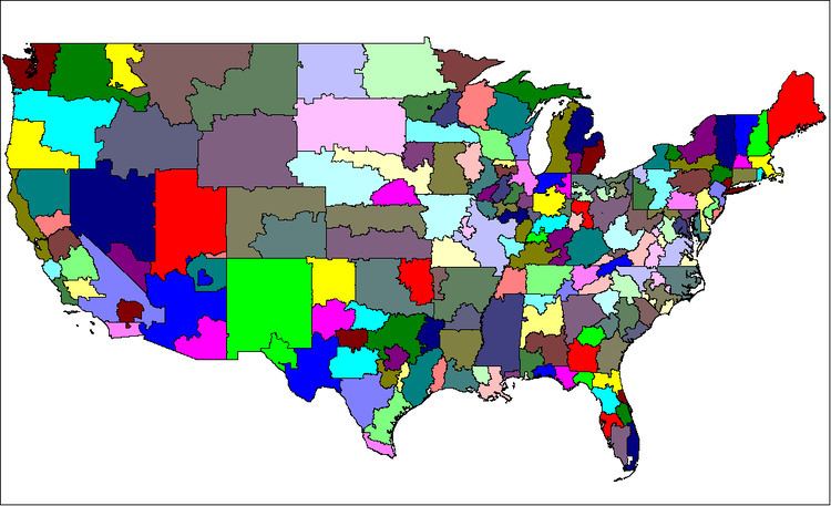
LATA boundaries tend to be drawn around markets, and not necessarily along existing state or area code borders. Some LATAs cross over state boundaries, such as those for the New York metropolitan area and Greenwich, Connecticut; Chicago, Illinois; Portland, Oregon; and areas between Maryland, Virginia, and West Virginia. Area codes and LATAs do not necessarily share boundaries; many LATAs exist in multiple area codes, and many area codes exist in multiple LATAs.
Originally, the LATAs were grouped into regions within which one particular RBOC was allowed to provide services. The LATAs in each of these regions are numbered beginning with the same digit. Generally the LATAs were associated with carriers or other indications in the following manner:
In addition to this list, two local carriers were made independent: Cincinnati Bell in the Cincinnati area, and SNET (a former unit of AT&T, sold to Frontier) in Connecticut. These were assigned LATAs in the 9xx range.
Since the breakup of the original AT&T in 1984, however, some amount of deregulation, as well as a number of phone company mergers, have blurred the significance of these regions. A number of new LATAs have been formed within these regions since their inception, most beginning with the digit 9.
LATAs contribute to an often confusing aspect of long distance telephone service. Due to the various and overlapping regulatory limitations and inter-business arrangements, phone companies typically provide differing types of “long distance” service, each with potentially different rates:
within same LATA, within same statewithin same LATA, between different statesbetween different LATAs, within same statebetween different LATAs, between different statesGiven the complexity of the legal and financial issues involved in each distinction, many long distance companies tend to not explain the details of these different rates, which can lead to billing questions from surprised customers.
Local carriers have various alternative terms for LATAs such as “Service Area” by Pacific Bell in California, or “Regional Calling Area” by Verizon in Maryland.
In order to facilitate the sharing of Telcordia telephone routing databases between countries, LATAs were later defined for the provinces of Canada, the other countries and territories of the North American Numbering Plan, and Mexico. Aside from U.S. territories, LATAs have no regulatory purpose in these areas. In 2000, the Canadian Radio-television and Telecommunications Commission eliminated all Canadian provincial LATAs in favor of a single LATA for Canada (888).
No LATAs exist with a second digit of 0 or 1, which distinguished them from traditional area codes.
The city or place name given with some LATAs is the name given to identify the LATA, not the limit of its boundary. Generally this is the most significant metropolitan area in the LATA. In some cases a LATA is named after the largest phone exchange in the LATA that was historically served by an RBOC. For example, the largest city in the Pahrump LATA in Nevada is Las Vegas. Since Las Vegas was not historically served by an RBOC, the LATA is named after the smaller town of Pahrump, which was historically served by Nevada Bell (now AT&T Inc.). Also, listing under a state does not necessarily limit the LATA's territory to that state; there may be overlaps as well as enclaves. Areas that include notable portions of other states are explained, but not all LATA state overlaps may be detailed.
LATA boundaries are not always solidly defined. Inter-carrier agreements, change proposals to the Federal Communications Commission (FCC), and new wiring developments into rural areas can and do often alter the effective borders between LATAs. Many sources on LATA boundary information conflict with each other at detailed levels. Telcordia data may provide the most up-to-date details of LATA inclusions.
476 Birmingham477 Huntsville478 MontgomeryIncludes Georgetown, Georgia480 MobileIncludes areas of Mississippi north of PascagoulaIncludes parts of northern Escambia County, Florida in the Century and Walnut Hill areas832666 PhoenixIncludes Winterhaven, CaliforniaIncludes Spirit Mountain, NevadaIncludes Glen Canyon, Utah668 TucsonIncludes Rodeo and Virden, New Mexico980 Navajo Nation (Arizona portion)Includes Shiprock, New Mexico526 Fort SmithIncludes part of Oklahoma from Pocola to MoffettIncludes section of Oklahoma from Colcord to WattsIncludes Colcord, MissouriIncludes area of Oklahoma near Maysville, ArkansasIncludes area of Oklahoma near Uniontown, Arkansas528 Little RockIncludes Blytheville, MissouriIncludes New Home, Oklahoma530 Pine BluffIncludes parts of Louisiana around Dodge City and Junction City, Arkansas722 San Francisco724 Chico726 Sacramento728 Fresno730 Los AngelesIncludes La Paz County, Arizona732 San Diego734 Bakersfield736 Monterey738 Stockton740 San Luis Obispo973 Palm Springs656 DenverExtends into Nebraska near Peetz and Julesburg, Colorado658 Colorado Springs920228 236Includes the west portion of the West Bay of Maryland, as far north as Damascus, Maryland (roughly Montgomery, Prince George's, Charles, and St. Mary's counties of Maryland)Includes the northeasternmost portion of Virginia, from Sterling to just north of Fredericksburg (roughly Northern Virginia)448 PensacolaIncludes Clear Springs, Wing and Florala, Alabama450 Panama CityIncludes a small portion of Georgia near Tallahassee452 Jacksonville454 Gainesville456 Daytona Beach458 Orlando460 Southeast Florida939 Fort Myers952 Tampa953 TallahasseeFlorida is a special case in which state regulators have also assigned 5-digit LATA codes which overlay the Federally-assigned 3-digit LATAs. See map on the right for details. Some carriers may refer to these by the 3-digit LATA, others by the 5-digit.438 AtlantaIncludes portion of Alabama from Oakland to HuguleyIncludes Phenix City, AlabamaIncludes Ranburne, Alabama440 SavannahIncludes part of southern South Carolina as far north as Hardeeville and Hilton Head Island442 AugustaIncludes Aiken County and Edgefield County, South Carolina444 Albany446 Macon834652 Southern IdahoIncludes Malheur County, Oregon, especially the Ontario areaIncludes Jackpot, Jarbidge, and Owyhee, NevadaIncludes Alta and Border, Wyoming960 Coeur d'AleneIncludes part of northwest Montana as far east as Eureka and as far south as LibbyIncludes Pullman, Washington and surrounding areaIncludes Pend Oreille County, Washington358 ChicagoIncludes Lake County and Newton County, Indiana, especially the Gary, Indiana areaIncludes Demotte, Hebron, and Lakes of the Four Seasons, IndianaExtends into Wisconsin Salem Township360 RockfordExtends into Wisconsin near Apple River, Illinois362 Cairo364 Sterling366 Forrest368 Peoria370 ChampaignMay include areas of Indiana near Danville, Illinois374 Springfield376 Quincy976 Mattoon977 Macomb978 Olney330 Evansville332 South Bend334 Auburn-Huntington336 IndianapolisExtends into Illinois near Dana, Indiana338 Bloomington937 RichmondIncludes Union City, Ohio938 Terre HauteIncludes Edgar and Clark counties of IllinoisMay include Robinson, Illinois630 Sioux CityExtends into Minnesota near incorporated areas of Iowa along its lengthIncludes the eastern portions of Dakota and Thurston counties of NebraskaIncludes North Sioux City, South Dakota, and extends into South Dakota near Akron and Hawarden, Iowa632 Des MoinesExtends into Missouri from Andover, Missouri to south of Davis City, Iowa634 DavenportIncludes portion of Illinois as far as Geneseo and AledoIncludes the Galena, Illinois area635 Cedar Rapids524 Kansas City, KS (See Missouri for details)532 Wichita534 Topeka462 LouisvilleIncludes the central southern area of Indiana around Salem464 Owensboro466 Winchester492 Baton Rouge486 Shreveport488 Lafayette490 New OrleansMaine
120Maryland
236 see Washington, D.C.; most of this LATA is actually in Maryland238 Baltimore240 HagerstownIncludes the easternmost part of West Virginia around Martinsburg as far as Route 9Includes the northwestern part of the Eastern Panhandle of West Virginia including Keyser, from Grant County to Short GapIncludes area of Pennsylvania just north of Hancock, Maryland242 Salisbury126 Western Massachusetts128 Eastern Massachusetts340 Detroit342 Upper Peninsula of MichiganIncludes portion of Wisconsin around Iron Mountain, Michigan as far as Rhinelander and Townsend, Wisconsin344 Saginaw346 Lansing348 Grand Rapids620 Rochester624 Duluth626 St. Cloud628 Minneapolis636 Brainerd, Minnesota-Fargo, North Dakota482 JacksonIncludes parts of Alabama around Columbus, Mississippi484 Biloxi520 St. LouisIncludes part of south-central Illinois southwest of Springfield.521 Westphalia (per locallingguide.com, includes Columbia MO)522 Springfield524 Kansas CityIncludes eastern portion of Kansas as far out as U.S. 73 and U.S. 59 and south as far as U.S. 54521 Central Missouri: Columbia and surrounding areas648 Great Falls650 Billings963 Kalispell (historical)note: LATA 963 appears on many LATA lists, and at least one map, but is no longer a separate LATA-equivalent area. It is now part of LATA 648.644 Omaha646 Grand Island958 Lincoln720 RenoMay include Alpine, Verdi and Coleville, California721 Pahrump122Includes part of Vermont around GrotonIncludes part of Maine around Kittery and Wilsons Mills220 Atlantic Coastal New Jersey222 Delaware Valley224 North Jersey664132 New York City and surrounding metropolitan areaIncludes Greenwich, Connecticut133 PoughkeepsieIncludes Milford, Pennsylvania and surrounding area134 AlbanyIncludes Hancock, Massachusetts136 Syracuse138 BinghamtonIncludes Sayre, Pennsylvania and surrounding area140 BuffaloIncludes Ulysses, Pennsylvania and surrounding area921 Fishers Island974 Rochester420 Asheville422 CharlotteIncludes York County and Lancaster County, South Carolina424 Greensboro-Winston-Salem area426 Raleigh428 Wilmington949 Fayetteville951 Rocky Mount636 Brainerd, Minnesota-Fargo, North Dakota 638 BismarckIncludes portions of Montana near Beach and Squaw Gap, North Dakota320 Cleveland322 Youngstown324 Columbus325 Akron326 Toledo328 Dayton922 CincinnatiIncludes Rising Sun, Indiana and surrounding areaIncludes the northern tip of Kentucky as far south as Williamstown923 Lima-Mansfield536 Oklahoma City538 Tulsa670 Eugene672 PortlandIncludes Southwestern Washington from Willapa Bay to Goldendale226 Harrisburg228 Philadelphia230 Altoona232 Northeast Pennsylvania234 Pittsburgh924 ErieRhode Island
130 Rhode Island430 GreenvilleIncludes Polk County, North Carolina432 Florence434 Columbia436 Charleston640468 MemphisIncludes part of Mississippi from south of Memphis to as far south as Hernando470 Nashville472 ChattanoogaIncludes northwestern tip of Georgia474 Knoxville956 Bristol-Johnson CountyIncludes part of Virginia from Abingdon to Wytheville540 El Paso542 Midland544 Lubbock546 AmarilloIncludes the southern half of the Oklahoma Panhandle548 Wichita Falls550 Abilene552 Dallas554 LongviewIncludes Miller County, Arkansas556 Waco558 Austin560 Houston562 Beaumont564 Corpus Christi566 San Antonio568 Brownsville570 Hearne961 San Angelo660 UtahMay include Mesquite and Partoun, NevadaMay include Fredonia and Colorado City, Arizona981 Navajo Nation (Utah portion)124 VermontIncludes West Lebanon and West Chesterfield, New Hampshire236 Arlington, Fairfax, Prince William, and Stafford counties, and enclosed cities. See Washington, D.C.244 Roanoke246 Culpeper248 Richmond250 Lynchburg252 Norfolk927 Harrisonburg928 Charlottesville929 Edinburg674 Seattle676 SpokaneIncludes parts of Oregon including Milton-Freewater and TroyIncludes a section of Idaho from Lewiston to Grangeville, up to Troy, and possibly Elk CityMay include Tensed, Idaho254 CharlestonIncludes part of Virginia east of White Sulphur Springs, West Virginia256 Clarksburg932 BluefieldIncludes a strip of Virginia from south of Bluefield to the Kentucky border350 Northeast WisconsinIncludes the southern corner of Michigan's Upper Peninsula352 Northwest Wisconsin354 Southwest Wisconsin356 Southeast Wisconsin654American Samoa - 884Guam - 871Northern Mariana Islands - 870Puerto Rico - 820U.S. Virgin Islands - 822Wake Island - 836Mexico - 838Bahamas - 824Jamaica - 826Dominican Republic - 828Other Caribbean - 830Canada - 888As LATAs exist for US regulatory purposes, where they serve as a demarcation between intra-LATA calls (handled by regional Bell operating companies) and inter-LATA calls (handled by interstate long distance carriers such as AT&T), they have no legal significance in Canada.
As of 2000, all of Canada (except for non-geographic numbers) is identified as LATA 888.
The use of this LATA set to identify individual provinces is therefore deprecated:
Alberta - 881, 884British Columbia - 886Manitoba - 888New Brunswick - 890Newfoundland - 885Nova Scotia/P.E.I. - 887, 889Ontario - 851Quebec - 850, 883Saskatchewan - 891Yukon Territory - 892Canada does define local interconnection regions (LIR's), which determine where points of interconnection (POI) must be provided by competing local exchange and mobile carriers to provide local number portability. A Canadian LIR is geographically smaller than a US LATA, typically comparable in size to a small city's flat-rate local calling area or to an entire large regional municipality. In areas where a small-city Digital Multiplex System controls a group of remote switching centres, one for each surrounding village, the local interconnect region normally includes each exchange in the city plus all downstream remotes of those exchanges. In a Toronto-sized city, the LIR will include only the city itself.
While the LIRs resemble local calling areas in geographic size, there are some key differences:
LIR's normally do not include incumbent local independent telephone company exchanges in locations not opened to competition, where the independent numbers are currently not portable.LIR's do not cross provincial boundaries. Lloydminster has an LIR for each province, as does Ottawa-Hull.LIR's closely follow network topology, which often does not match a local flat-rate calling area as local calling is defined by arbitrary regulatory constructs.One example: The tiny unincorporated village of Beebe Plain, divided by the Quebec-Vermont border, is served by +1-819-876 Rock Island, Quebec, Canada (a remote station controlled from Magog) and +1-802-873 Derby Line, Vermont, USA (a remote station controlled from St. Johnsbury). Magog and St. Johnsbury are both a long-distance call from anywhere in Beebe Plain, even though Canadian subscribers can place local calls to Sherbrooke, US subscribers can locally call Newport and an international call within the village is local. An LIR assignment which follows network topology places the Canadian remote station in Magog's LIR, not Sherbrooke's LIR.