
Country United States Area code(s) 276 Elevation 697 m Population 8,235 (2013) | Time zone EST (UTC-5) FIPS code 51-88000 Zip code 24382 | |
 | ||
Weather 7°C, Wind W at 37 km/h, 83% Humidity Points of interest Withers Park, Great Lakes to Florida Hi, Haller‑Gibboney Rock House, Thomas J Boyd Museum | ||
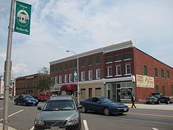
Day 327 wytheville virginia
Wytheville (/ˈwɪθvɪl/ WITH-vil) is a town in, and the county seat of, Wythe County, Virginia, United States. It is named after George Wythe, a signer of the United States Declaration of Independence, and mentor to Thomas Jefferson. Wytheville's population was 8,211 at the 2010 census. Located at the intersection of Interstate Highways 77 and 81, the town has long been a crossroads for travelers. During the American Civil War, Wytheville had a strategic importance, and was attacked in 1863 (Toland's Raid) and 1865 (Stoneman's 1865 Raid). The town is also the birthplace of Edith Bolling Wilson, wife of President Woodrow Wilson.
Contents
- Day 327 wytheville virginia
- Map of Wytheville VA 24382 USA
- Calling america day 9 wytheville virginia
- History
- Polio epidemic
- Historic District
- Geography
- Climate
- Demographics
- Places of interest
- Notable people
- References
Map of Wytheville, VA 24382, USA
Calling america day 9 wytheville virginia
History
Wythe County was created in 1789 and named for George Wythe, the "father of American Jurisprudence" and signer of the Declaration of Independence. In May 1790, Chris Simmerman donated 90 acres, along with John Davis's 10 acres, to establish a town and county seat. Robert Adams completed a town survey in November of that year, dividing the area into half-acre lots. The town didn't have an official name yet, but was generally known as Wythe Court House. Two years later, in October 1792, the town was officially named Evansham, for prominent local citizen Jesse Evans. After a disastrous fire in March 1839, the town was renamed Wytheville. At that time, it was home to about 500 residents.
Polio epidemic
What started off as a few cases of infantile paralysis during the summer of 1950 swelled into the hundreds. Out of the 5,513 inhabitants of the town, 184 people contracted the disease with 17 fatalities. From the beginning of June until the end of August, parents kept children inside and large gatherings were cancelled to diminish the chance of infection.
As the epidemic progressed, ambulances drove victims approximately 80 miles (130 km) trip to Memorial Crippled Children’s Hospital in Roanoke, Virginia. Hearses from local funeral homes were used when ambulances were unavailable. Black patients with polio were repeatedly denied admission to Roanoke’s hospital and were forced to make the approximately 300 miles (480 km) trip drive to St. Philip’s Hospital in Richmond.
The Town Council erected billboards at all five entrances to the county warning potential visitors of the epidemic and urging tourists to come again the following year. By the end of the summer, unknown assailants stole or demolished all five billboards. Though the Town Council offered a reward for information, no one came forward.
Historic District
The Crockett's Cove Presbyterian Church, Haller-Gibboney Rock House, Loretto, St. John's Episcopal Church, St. John's Lutheran Church and Cemetery, Wythe County Poorhouse Farm, and Wytheville Historic District are listed on the National Register of Historic Places.
Geography
Wytheville is located at 36°56′52″N 81°5′13″W (36.947679, −81.086955).
According to the United States Census Bureau, the town has a total area of 14.3 sq mi (37.0 km2), of which 0.04 sq mi (0.1 km2) (0.14%) is water.
Wytheville is an important point on both I-77 and I-81 and lies amidst a wrong-way concurrency of I-77 and I-81. It is located about halfway between Bristol, Tennessee/Virginia and Roanoke. On the I-77 corridor, it is located about halfway between Charleston, West Virginia and Charlotte, North Carolina. The nearby community of Fort Chiswell is the control city for the northbound traffic on I-77 coming from Charlotte, Statesville, Elkin, and Mount Airy, North Carolina. In the near future, Interstate 74 will go through Wytheville in addition to the two other interstates.
Due to the confluence of I-77, I-81 and several U.S. Highways, and its location in the foothills of the Blue Ridge Mountains, Wytheville is known as "The Hub of Southwest Virginia" and "the Crossroads of the Blue Ridge".
Climate
Due to its elevation, the climate of Wytheville is either classified as mountain temperate or humid continental (Köppen Cfb or Dfb, respectively), and the town straddles the border between USDA Plant Hardiness Zones 6B and 7A. Summers are warm and humid, although significantly cooler than low-elevation places within the state, with only 4.6 days of 90 °F (32 °C)+ highs annually, and winters are generally cool to cold with occasional intervening warm periods and 11 nights of sub-10 °F (−12 °C) lows. Monthly mean temperatures range from 30.7 °F (−0.7 °C) in January to 70.4 °F (21.3 °C) in July. Snowfall averages 20.5 inches (52 cm) per season and generally occurs from December to March.
Demographics
As of the census of 2000, there were 7,804 people, 3,504 households, and 2,112 families residing in the town. The population density was 546.8 people per square mile (211.2/km²). There were 3,776 housing units at an average density of 264.6 per square mile (102.2/km²). The racial makeup of the town was 90.76% White, 7.19% African American, 0.13% Native American, 0.70% Asian, 0.03% Pacific Islander, 0.33% from other races, and 0.86% from two or more races. Hispanic or Latino of any race were 0.82% of the population.
There were 3,504 households out of which 22.9% had children under the age of 18 living with them, 43.4% were married couples living together, 13.6% had a female householder with no husband present, and 39.7% were non-families. 36.2% of all households were made up of individuals and 16.3% had someone living alone who was 65 years of age or older. The average household size was 2.11 and the average family size was 2.72.
In the town, the population was spread out with 19.3% under the age of 18, 6.9% from 18 to 24, 25.3% from 25 to 44, 25.6% from 45 to 64, and 22.8% who were 65 years of age or older. The median age was 44 years. For every 100 females there were 78.1 males. For every 100 females age 18 and over, there were 75.2 males.
The median income for a household in the town was $28,043, and the median income for a family was $41,513. Males had a median income of $28,160 versus $21,282 for females. The per capita income for the town was $20,223. About 10.0% of families and 14.6% of the population were below the poverty line, including 21.5% of those under age 18 and 9.6% of those age 65 or over.