
Country United States County Le Flore Area code(s) 539/918 Elevation 147 m Population 4,021 (2013) | Time zone Central (CST) (UTC-6) FIPS code 40-59750 Zip code 74902 Local time Wednesday 4:06 AM | |
 | ||
Weather 16°C, Wind E at 23 km/h, 60% Humidity Area 78.99 km² (78.48 km² Land / 52 ha Water) | ||
Pocola is a town in northeastern Le Flore County, Oklahoma, United States. It is part of the Fort Smith, Arkansas-Oklahoma Metropolitan Statistical Area. The population was 4,056 at the 2010 census, a gain of 1.55 percent from 3,994 at the 2000. It is approximately 10 miles (16 km) from Fort Smith, Arkansas. Pocola is a Choctaw word meaning "ten."
Contents
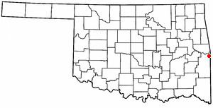
Map of Pocola, OK, USA
History
The Battle of Devil's Backbone Mountain occurred nearby on September 1, 1863. It was a victory for the Union Army.
The first post office was established in 1884. Will Hartshorne began operating a small coal mine in this area during the 1880s. By 1895, he employed six men, and sold the mine to the Fort Smith and Western Coal and Railway in the following year. The population of Pocola was estimated at 200 in 1900, but the number declined to about 75 in 1918. The post office closed in 1916.
The community did not incorporate until 1963, allowing it to gain water rights along the McClellan-Kerr Arkansas River Navigation System and to ensure that the area was not annexed by other Le Flore County communities. The town began annexing land, enlarging itself to about 30 square miles. By 1970, the population had grown to 1,840. In 1980, the census recorded 3,268 residents. A post office was reestablished in 1986.
Geography
Pocola is located at 35°15′29″N 94°28′26″W (35.257983, -94.473959).
According to the United States Census Bureau, the town has a total area of 30.5 square miles (79 km2), of which, 30.3 square miles (78 km2) of it is land and 0.2 square miles (0.52 km2) of it (0.69%) is water.
Demographics
As of the census of 2000, there were 3,994 people, 1,508 households, and 1,165 families residing in the town. The population density was 131.9 people per square mile (50.9/km²). There were 1,598 housing units at an average density of 52.8 per square mile (20.4/km²). The racial makeup of the town was 86.35% White, 3.33% African American, 5.16% Native American, 0.25% Asian, 0.03% Pacific Islander, 0.45% from other races, and 4.43% from two or more races. Hispanic or Latino of any race were 1.88% of the population.
There were 1,508 households out of which 35.7% had children under the age of 18 living with them, 59.8% were married couples living together, 12.7% had a female householder with no husband present, and 22.7% were non-families. 19.9% of all households were made up of individuals and 7.5% had someone living alone who was 65 years of age or older. The average household size was 2.61 and the average family size was 2.98.
In the town, the population was spread out with 26.5% under the age of 18, 8.8% from 18 to 24, 28.3% from 25 to 44, 24.5% from 45 to 64, and 11.9% who were 65 years of age or older. The median age was 36 years. For every 100 females there were 95.8 males. For every 100 females age 18 and over, there were 95.1 males.
The median income for a household in the town was $33,566, and the median income for a family was $37,937. Males had a median income of $30,577 versus $20,529 for females. The per capita income for the town was $14,623. About 12.6% of families and 15.4% of the population were below the poverty line, including 20.5% of those under age 18 and 22.3% of those age 65 or over.