
Area 1,308 km² Population 16,182 (2013) | Congressional district 15th Website www.clarkcountyil.org Founded 1819 | |
 | ||
Points of interest World's Largest Wind Chi, Worlds Largest Golf Tee, World's Largest Rocking, World's Largest Mailbox, Mill Creek Lake and Park | ||
Clark County is a county located in the southeastern part of U.S. state of Illinois, along the Indiana state line. As of the 2010 census, the population was 16,335. Its county seat is Marshall. The county was named for George Rogers Clark, an officer who served in the American Revolution.
Contents
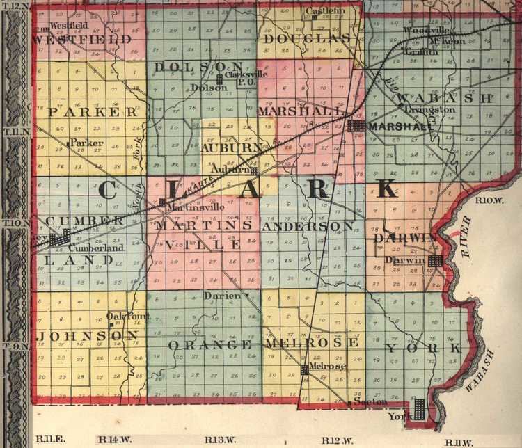
- Map of Clark County IL USA
- History
- Geography
- Adjacent counties
- Major highways
- Climate and weather
- Demographics
- Education
- Cities
- Village
- Unincorporated communities
- Townships
- References
Map of Clark County, IL, USA
History
Clark County was formed in 1819 out of Crawford County. At the time of its formation, Clark County included about a third of Illinois, and extended as far north as the present state of Wisconsin. In 1821 the northern part of Clark County became part of the newly created Pike County on January 31, and the newly created Fayette County took the western part of Clark County on February 14. Edgar County was created from the northern part of Clark County on January 3, 1823. The creation of Coles County occupied additional land from western Clark County, effective December 25, 1830. The boundaries of Clark County have been unchanged since.
Clark County was named for George Rogers Clark (older brother of William Clark of the Lewis and Clark Expedition), an officer of the army of Virginia that captured the Northwest Territory from the British during the Revolutionary War.
The county seat was located in Darwin Township in 1823. A county-wide election was held In 1839 to determine whether Auburn or Marshall would be designated as the new seat. Marshall won the election and has remained the county seat since then.
Geography
According to the U.S. Census Bureau, the county has a total area of 505 square miles (1,310 km2), of which 501 square miles (1,300 km2) is land and 3.4 square miles (8.8 km2) (0.7%) is water. Part of the county's eastern border is defined by the Wabash River. The North Fork of the Embarras River and Hurricane Creek are the main streams in western Clark County. Other than the Wabash River, Big Creek is the major stream in the eastern part of the county.
Adjacent counties
Major highways
Climate and weather
In recent years, average temperatures in the county seat of Marshall have ranged from a low of 16 °F (−9 °C) in January to a high of 86 °F (30 °C) in July, although a record low of −23 °F (−31 °C) was recorded in January 1930 and a record high of 109 °F (43 °C) was recorded in July 1936. Average monthly precipitation ranged from 2.23 inches (57 mm) in January to 4.43 inches (113 mm) in July.
Demographics
As of the 2010 United States Census, there were 16,335 people, 6,782 households, and 4,593 families residing in the county. The population density was 32.6 inhabitants per square mile (12.6/km2). There were 7,772 housing units at an average density of 15.5 per square mile (6.0/km2). The racial makeup of the county was 98.1% white, 0.3% black or African American, 0.3% Asian, 0.2% American Indian, 0.3% from other races, and 0.7% from two or more races. Those of Hispanic or Latino origin made up 1.1% of the population. In terms of ancestry, 27.4% were German, 14.2% were Irish, 14.2% were English, and 10.8% were American.
Of the 6,782 households, 30.3% had children under the age of 18 living with them, 53.5% were married couples living together, 9.7% had a female householder with no husband present, 32.3% were non-families, and 27.7% of all households were made up of individuals. The average household size was 2.38 and the average family size was 2.87. The median age was 42.3 years.
The median income for a household in the county was $43,597 and the median income for a family was $52,689. Males had a median income of $39,385 versus $27,426 for females. The per capita income for the county was $23,173. About 7.6% of families and 10.9% of the population were below the poverty line, including 15.3% of those under age 18 and 9.8% of those age 65 or over.
Education
There are three school districts in Clark County (Marshall, Martinsville and Casey-Westfield) with a total enrollment (2004) of 3,014 students. Each district has one high school (grades 9-12) and one junior high school (grades 7-8). Marshall has two elementary schools and the other districts have one each.
See List of school districts in Clark CountyCities
Village
Unincorporated communities
Townships
Clark County is divided into fifteen townships: