Country Texas Population 674,433 (2013) Area 256.3 sq mi | State Texas Founded 1680 | |
Points of interest Franklin Mountains State Park, El Paso Zoo, Wyler Aerial Tramway, Hueco Tanks State Historic Site, National Border Patrol Museum Colleges and Universities University of Texas at El Paso, El Paso Community College, Western Technical College, Southwest Career Institute, Tri-State Cosmetology Institute 1 | ||
El Paso ( from Spanish, "the pass") is the county seat of El Paso County, Texas, United States, and lies in far West Texas. As of July 1, 2013, the population estimate from the U.S. Census was 674,433, making it the 19th most populous city in the United States. Its U.S. metropolitan area covers all of El Paso and Hudspeth counties, with a population of 831,036. The El Paso MSA forms part of the larger El Paso–Las Cruces CSA, with a population of 1,044,496.
Contents
- Map of El Paso Texas
- Is el paso a good place to live a question asked by many thinking of relocating
- Spirits of el paso texas
- History
- Geography
- Economy
- Arts and culture
- El Paso in popular culture
- Annual cultural events and festivals
- Area museums
- References
Map of El Paso, Texas
El Paso stands on the Rio Grande (Rio Bravo del Norte), across the border from Juarez, Chihuahua, Mexico. The two cities, along with Las Cruces, form a combined international metropolitan area, sometimes referred as the Paso del Norte or El Paso–Juarez–Las Cruces, with over 2.7 million people. The El Paso-Juarez region is the largest bilingual, binational work force in the Western Hemisphere.
Is el paso a good place to live a question asked by many thinking of relocating
In 1659, Fray Garcia de San Francisco, established Our Lady of Guadalupe Mission of El Paso del Norte. Around this mission, the village of El Paso del Norte grew into what is now the El Paso–Juarez region. El Paso has been ranked the safest large city in the U.S. for four consecutive years and ranked in the top three since 1997. The city is the headquarters of one Fortune 500 and three publicly traded companies, as well as home to the Medical Center of the Americas, the only medical research and care provider complex in West Texas and southern New Mexico, and the University of Texas at El Paso, the citys primary university. The city hosts the annual Sun Bowl, the second oldest bowl game in the country. In 2010, El Paso received an All-America City Award.
Spirits of el paso texas
El Paso has a strong federal and military presence. William Beaumont Army Medical Center, Biggs Army Airfield and Fort Bliss call the city home. Fort Bliss is one of the largest military complexes of the United States Army and the largest training area in the United States. Also headquartered in El Paso are the DEA domestic field division 7, El Paso Intelligence Center, Joint Task Force North, U.S. Border Patrol El Paso Sector and U.S. Border Patrol Special Operations Group (SOG).
History
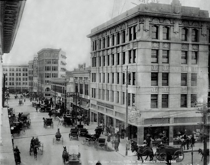
The El Paso region has had human settlement for thousands of years, as evidenced by Folsom points from hunter-gatherers found at Hueco Tanks. The earliest known cultures in the region were maize farmers. At the time of the arrival of the Spanish, the Manso, Suma, and Jumano tribes populated the area and were subsequently incorporated into the Mestizo culture, along with immigrants from central Mexico, captives from Comancheria, and genizaros of various ethnic groups. The Mescalero Apache were also present.
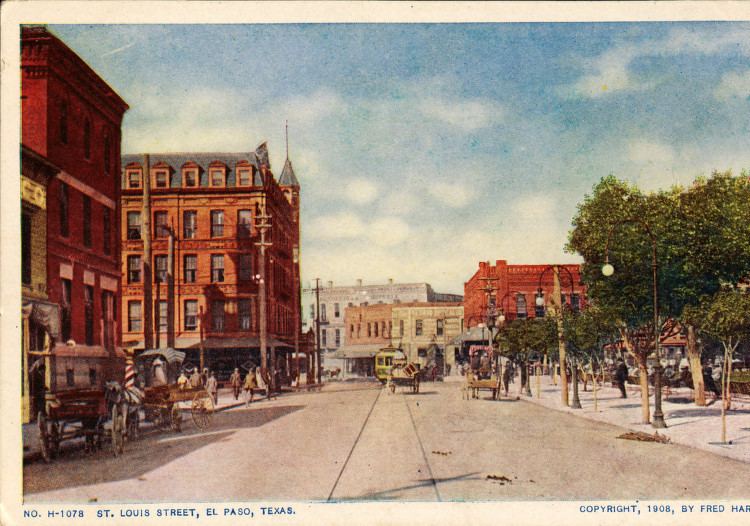
Spanish explorer Don Juan de Onate was born in 1550 in Zacatecas, Zacatecas, Mexico and was the first New Spain (Mexico) explorer known to have observed the Rio Grande near El Paso, in 1598, celebrating Thanksgiving Mass there on April 30, 1598 (several decades before the Pilgrims Thanksgiving). However, the four survivors of the Narvaez expedition, Alvar Nunez Cabeza de Vaca, Alonso del Castillo Maldonado, Andres Dorantes de Carranza, and his enslaved Moor Estevanico, are thought to have passed through the area in the mid-1530s. El Paso del Norte (the present day Juarez), was founded on the south bank of the Rio Bravo del Norte (Rio Grande), in 1659 by Fray Garcia de San Franisco. In 1680, the small village of El Paso became the temporary base for Spanish governance of the territory of New Mexico as a result of the Pueblo Revolt, until 1692 when Santa Fe was reconquered and once again became the capital. El Paso remained the largest settlement in New Mexico until its cession to the US in 1848, when Texas took possession of it with the Compromise of 1850.
The Texas Revolution (1836) was generally not felt in the region, as the American population was small; not being more than 10% of the population. However, the region was claimed by Texas as part of the treaty signed with Mexico and numerous attempts were made by Texas to bolster these claims. However, the village which consisted of El Paso and the surrounding area remained essentially a self-governed community with both representatives of the Mexican and Texan government negotiating for control until Texas irrevocably took control in 1846.
During this interregnum, 1836–1848, Americans nonetheless continued to settle the region. As early as the mid-1840s, alongside long extant Hispanic settlements such as the Rancho de Juan Maria Ponce de Leon, Anglo settlers such as Simeon Hart and Hugh Stephenson had established thriving communities of American settlers owing allegiance to Texas. Stephenson, who had married into the local Hispanic aristocracy, established the Rancho de San Jose de la Concordia, which became the nucleus of Anglo and Hispanic settlement within the limits of modern-day El Paso, in 1844. Given the reclamations of the Texas Republic that wanted a chunk of the Santa Fe trade, the Treaty of Guadalupe Hidalgo effectively made the settlements on the north bank of the river a formal American settlement, separate from Old El Paso del Norte on the Mexican side. The present Texas–New Mexico boundary placing El Paso on the Texas side was drawn in the Compromise of 1850.
El Paso County was established in March 1850, with San Elizario as the first county seat. The United States Senate fixed a boundary between Texas and New Mexico at the 32nd parallel, thus largely ignoring history and topography. A military post called "The Post opposite El Paso" (meaning opposite El Paso del Norte, across the Rio Grande) was established in 1854. Further west, a settlement on Coons Rancho called Franklin became the nucleus of the future El Paso, Texas. A year later, pioneer Anson Mills completed his plan of the town, calling it El Paso. However, the various communities never totalled more than several hundred residents with Hispanics and Americans holding an equal percentage of the population.
During the Civil War, a Confederate presence was in the area until it was captured by the Union California Column in 1862. It was then headquarters for the 5th Regiment California Volunteer Infantry until December 1864.
After the Civil Wars conclusion, the towns population began to grow as Texans continued to move into the villages and soon became the majority. El Paso itself, incorporated in 1873, encompassed the small area communities that had developed along the river. In the 1870s, a population of 23 Non-Hispanic whites and 150 Hispanics was reported. With the arrival of the Southern Pacific, Texas and Pacific and the Atchison, Topeka and Santa Fe railroads in 1881, the population boomed to 10,000 by the 1890 census, the large majority of which were Americans, principally of Texan descent as well as other Americans and a few recent Mexican newcomers ranging from businessmen and priests, to gunfighters and prostitutes. The location of El Paso as well as the arrival of these more wild newcomers caused the city to become a violent and wild boomtown known as the "Six Shooter Capital" because of its lawlessness. Indeed, prostitution and gambling flourished until World War I, when the Department of the Army pressured El Paso authorities to crack down on vice (thus benefitting vice in neighboring Ciudad Juarez). With the suppression of the vice trade and in consideration of the citys geographic position, the city continued into developing as a premier manufacturing, transportation, and retail center of the US Southwest.
In 1909, William Howard Taft and Porfirio Diaz planned a summit in El Paso, Texas, and Ciudad Juarez, Mexico, an historic first meeting between a U.S. president and a Mexican president and also the first time an American president would cross the border into Mexico But tensions rose on both sides of the border, including threats of assassination, so the Texas Rangers, 4,000 U.S. and Mexican troops, U.S. Secret Service agents, FBI agents and U.S. marshals were all called in to provide security. Frederick Russell Burnham, the celebrated scout, was put in charge of a 250 private security detail hired by John Hays Hammond, who in addition to owning large investments in Mexico was a close friend of Taft from Yale and a U.S. Vice-Presidential candidate in 1908. On October 16, the day of the summit, Burnham and Private C.R. Moore, a Texas Ranger, discovered a man holding a concealed palm pistol standing at the El Paso Chamber of Commerce building along the procession route. Burnham and Moore captured, disarmed, and arrested the assassin within only a few feet of Taft and Diaz.
By 1910, the overwhelming number of people in the city were Americans creating a settled environment. However, this period was short lived as the Mexican Revolution greatly impacted the city, bringing an influx of refugees – and capital – to the bustling boom town. Spanish-language newspapers, theaters, movie houses, and schools were established, many supported by a thriving Mexican refugee middle class. Large numbers of clerics, intellectuals, and businessmen took refuge in the city, particularly between 1913 and 1915.
Ultimately, the violence of the Mexican Revolution followed with the large Mexican diaspora which had fled into El Paso. In 1915 and again in 1916 and 1917 various Mexican revolutionary societies planned, staged, and launched violent attacks against both Texans and their political Mexican opponents in El Paso. This state of affairs eventually led to the vast Plan de San Diego and a large scale Mexican uprising against Americans which resulted in the murder of 500 white men, women, and children in forty eight hours in the city in March 1916. The subsequent reprisals by local militia soon caused an escalation of violence, raids, counter-raids, and large scale invasions by Mexican irregulars throughout El Paso city proper, the county and the Rio Grande Valley area.
Eventually, a special force of Texas Rangers ruthlessly suppressed the insurgency killing over 5,000 Mexicans by 1917. The small scale civil war had long-term impact on politics in the city as the traditional white El Paso community began excluding the Mexican population, most of whom were recent immigrants and refugees from civic life for the several decades. In turn, due to increased calls for reinforcements to secure the border the US Army took a large presence in the city expanding Fort Bliss and fortifying the border.
Simultaneously, other Texans and Americans gravitated to the city and by 1920, along with the US Army troops, the population exceeded 100,000 and whites once again were in the clear majority. Nonetheless, the city increased the segregation between Mexicans and Mexican-Americans with Americans. In reply, the Catholic Church attempted to garner the Mexican-American communitys allegiance through education and political and civic involvement organizations, including the National Catholic Welfare Fund. In 1916, the Census Bureau reported El Pasos population as 53% Hispanic and 44% non-Hispanic white.
Mining and other industries gradually developed in the area. The El Paso and Northeastern Railway was chartered in 1897, to help extract the natural resources of surrounding areas, especially in southeastern New Mexico Territory. The 1920s and 1930s saw the emergence of major business development in the city, partially enabled by Prohibition-era bootlegging,. However, the military demobilization, an agricultural economic depression which hit places like El Paso first before the larger Great Depression was felt in the big cities, hit the city hard. In turn, as in the rest of the United States, the Depression era overall hit the city hard, and El Pasos population declined through the end of World War II with most of population losses coming from the white community. Nonetheless, whites remained the majority to the 1940s.
During and following the war, military expansion in the area, as well as oil discoveries in the Permian Basin (North America), helped to engender rapid economic expansion in the mid-1900s. Copper smelting, oil refining, and the proliferation of low-wage industries (particularly garment making) led the citys growth. Additionally, the departure of regions rural population, which was mostly white, to cities like El Paso, brought a short term burst of capital and labor. However, this was balanced by additional departures of middle class Americans to other parts of the country which offered new and better paying jobs. In turn, local businesses looked south to the opportunities afforded by cheap Mexican labor. Furthermore, the period from 1942 to 1956 saw the bracero program which brought in cheap Mexican labor into the rural area to replace the losses of the native white population. In turn, seeking better-paying jobs these migrants also moved to El Paso. By 1965, Hispanics once again were a majority. Meanwhile, the post-war expansion slowed again in the 1960s, but the city continued to grow with the annexation of surrounding neighborhoods and in large part because of its significant economic relationship with Mexico.
Geography
El Paso is located at 31°47?25?N 106°25?24?W (31.790208, ?106.423242). It lies at the intersection of three states (Texas, New Mexico, and Chihuahua) and two countries (the US and Mexico). It is the only major Texas city on Mountain time. Ciudad Juarez used to be on Central Time, but both cities are now on Mountain time.

The Franklin Mountains extend into El Paso from the north and nearly divide the city into two sections; the west side forms the beginnings of the Mesilla Valley, and the east side expands into the desert and lower valley. They connect in the central business district at the south end of the mountain range.
The citys elevation is 3,800 ft (1,200 m) above sea level. North Franklin Mountain is the highest peak in the city at 7,192 ft (2,192 m) above sea level. The peak can be seen from 60 mi (100 km) in all directions. Additionally, this mountain range is home to the famous natural red-clay formation, the Thunderbird, from which the local Coronado High School gets its mascots name. According to the United States Census Bureau, the city has a total area of 256.3 square miles (663.7 km2).
The 24,000-acre (9,700 ha) Franklin Mountains State Park, the largest urban park in the United States, lies entirely in El Paso, extending from the north and dividing the city into several sections along with Fort Bliss and El Paso International Airport.
The Rio Grande Rift, which passes around the southern end of the Franklin Mountains, is where the Rio Grande flows. The river defines the border between El Paso and Ciudad Juarez to the south and west until the river turns north of the border with Mexico, separating El Paso from Dona Ana County, New Mexico. Mt. Cristo Rey, an example of a pluton, rises within the Rio Grande Rift just to the west of El Paso on the New Mexico side of the Rio Grande. Nearby volcanic features include Kilbourne Hole and Hunts Hole, which are Maar volcanic craters 30 miles (50 km) west of the Franklin Mountains.
El Paso is located within the Chihuahuan Desert, the easternmost section of the Basin and Range Region.
Economy
El Paso has a diversified economy focused primarily within international trade, military, government civil service, oil and gas, health care, tourism and service sectors. The El Paso metro area had a GDP of $29 billion in 2011. There were also $92 billion worth of trade in 2012. Over the past 15 years the city has become a significant location for American-based call centers. Cotton, fruit, vegetables, and livestock are also produced in the area. El Paso has added a significant manufacturing sector with items and goods produced that include petroleum, metals, medical devices, plastics, machinery, defense-related goods and automotive parts. The city is the second busiest international crossing point in the U.S behind San Diego.
Arts and culture
The outdoor musical extravaganza Viva! El Paso is performed in the McKelligon Canyon Amphitheatre. It is locally produced and chronicles the 400-year history and cultural evolution of the El Paso region. The show is performed each Friday and Saturday night in June, July, and August. Viva! El Paso has entertained local residents and out-of-town visitors for over 35 years.
The El Paso Symphony was established in the 1930s, it is the oldest performing arts organization in El Paso and the longest continuously running symphony orchestra in the state of Texas. It has received both national and international recognition as a result of its very successful tours of Germany in 1996 and Turkey in 2000, and continues to represent the El Paso region with pride and distinction. The El Paso Symphony Orchestra Association season is anchored by 12 classical concerts. Special events serve as outreach toward new audiences.
Broadway in El Paso at the Plaza Theater presents Broadway shows including Wicked, Jersey Boys, Rock of Ages, Mamma Mia!, and many other performances.
UTEP Diner Theater history includes 30 years and over 130 productions. Past productions include Annie, Evita, Jesus Christ Superstar, Chicago, Rocky Horror Show and many others.
EPCB is the only professional ballet company in El Paso, providing local employment for professional dancers in the field of ballet. The company performs a variety of classical and contemporary works choreographed by Artistic Director Lisa Skaf and artists from the US and Latin America. It has been active since 2005, performing yearly productions.
El Paso in popular culture
Annual cultural events and festivals
Amigo Airsho
Amigo Airsho is one of El Pasos premier events, and is ranked as one of the top ten air shows in the country. The show is filled with air entertainment and ground activities. Acts include the Franklins Flying Circus, where performers walk on the wings of an airborne plane. Ground activities include the Jet Powered School Bus. After 31 years of being held at Biggs Army Airfield, the show will move to Dona Ana Airport in 2014.
KLAQ Great River Raft Race
The KLAQ Great River Raft Race is an annual event celebrated on the second to last Saturday of June. Participants are encouraged to ride the river and float the Rio Grande with family and friends. The organizers encourage the building of unique rafts that will get you down the river with prizes and trophies awarded for the most points earned, best looking crew, and best decorated raft. The race starts at the Vinton bridge and ends three miles downstream at the Canutillo bridge.
Southwestern International PRCA Rodeo
The Southwestern International PRCA Rodeo is the 17th oldest rodeo in the nation and El Pasos longest running sporting event. Consistently ranked as one of the top 50 shows in the country by the Professional Rodeo Cowboys Association, this charitable event is a true celebration of western culture and heritage.
Fiesta de las Flores
Fiesta de las Flores is the oldest Hispanic Festival in the Southwest. The three-day Fiesta is held each year during the Labor Day weekend and emphasizes El Pasos Hispanic heritage and culture. The festival attracts 20,000 to 30,000 visitors from El Paso County, New Mexico, West Texas and the State of Chihuahua, Mexico. Activities included in the Fiesta are crowning of the Queen, a Fiesta Parade, Senior Appreciation Dance, Military Appreciation Day, and live Entertainment. The Fiesta is also well known for the authentic regional cuisine, arts and craft wares, games, and services available for the enjoyment of all segments of the attendees. Over 80 booths, sponsored by local vendors and nonprofit organizations create the Hispanic ambience and culture.
Neon Desert Music Festival
The annual Neon Desert Music Festival is a two-day event usually held on the last Saturday and Sunday of May on five stages in downtown El Paso stretching from San Jacinto Plaza to Cleveland Square. The festival brings over 30 acts from the worlds of indie rock, Latin and electronic dance music.
Texas Showdown Festival
The Texas Showdown Festival is an annual event celebrating musicians and tattoo artists under one roof. Dubbed as the worlds largest tattoo and musical festival, the event is held usually the last weekend of July at the El Paso County Coliseum.
Sun City Music Festival
The only El Paso musical festival not held downtown; instead it is held at Ascarate Park. The Sun City Music Festival is a two-day event dubbed as the largest electronic dance music festival in Texas.
Plaza Classic Film Festival
The Plaza Classic Film Festival is the worlds largest festival dedicated to classic cinema. All classic films are shown at the El Paso Plaza Theater during the first week of August.
KLAQ Balloonfest
The KLAQ Balloonfest is an annual event celebrated on Memorial Day weekend and is self described as "3 days of hot air balloons filling the El Paso skies, 3 afternoons of concerts and fun in the sun at Wet N Wild Waterworld in Anthony, Texas." Over 60 balloons take to the air annually from TFCU launch field which is adjacent to the water park. After the balloons launch, visitors have a weekend of water rides, swimming, concerts, and grilling. The concert aspect of the event features local bands, starting at noon, and different headlining artists in the afternoon. Overnight camping has been added for 2014.
El Paso Downtown Street Festival
The annual El Paso Downtown Street Festival is held during the last weekend of June in downtown El Paso near the El Paso Convention center. It is the oldest musical festival in the city and brings local, regional and nationally known acts.
Music Under the Stars
The outdoor concert series, started in 1983, is held annually at the Chamizal National Memorial and draws over 60,000 attendees. It features local and international performers with musical genres ranging from Classical, Country, Tejano, rock and others. The evening concerts are showcased every Sunday afternoon and start in early June and end in the middle of August.
Cool Canyon Nights
A free summer concert series which takes place outdoors at the McKelligon Canyon Amphitheater on Thursday nights May–July.
Alfresco Fridays
A free concert series at the downtown Convention Center Plaza featuring Jazz, Latin, Reggae, Classic Rock, Salsa, Funk, and Mariachis on Fridays May–September.
Area museums
The Centennial Museum and Chihuahuan Desert Gardens, located on the grounds of UTEP, includes a comprehensive collection of El Paso Brown, Native American pottery, as well as educational exhibits for students.
The El Paso Museum of Archaeology is located on the eastern slope of North Franklin Mountain, west of Gateway South Blvd. on TransMountain Rd. Its grounds include native plants of the American Southwest, as well samples of Native American shelters, in an unspoiled location. The museum includes dioramas for school children which illustrate the culture and geology of the American Southwest, such as Hueco Tanks in El Paso County. One diorama (see image to the right) is of the Cueva de la Olla (cave of the pot) which is located in the Sierra Madre of Chihuahua, an example of the Paquime culture.
The El Paso Museum of Art is located next to the Plaza Theater adjacent to San Jacinto Plaza, the public square downtown. It contains works of southwestern artists such as Tom Lea.
Other area museums include:
