
Largest city New Orleans Secretary of State Tom Schedler Language spoken Area 51,843 sq mi | Capital Governor Bobby JindalPopulation 4.65 million (2014) | |
Colleges and Universities Louisiana State University Destinations New Orleans, Lafayette, Baton Rouge, Houma, Avery Island Points of interest French Quarter, Mardi Gras World, The National WWII Museum, Audubon Zoo, Aquarium of the Americas | ||
Louisiana ( or French: , Louisiana Creole: Léta de la Lwizyàn) is a state located in the southern region of the United States. Louisiana is the 31st most extensive and the 25th most populous of the 50 United States. Its capital is Baton Rouge and largest city is New Orleans. Louisiana is the only state in the U.S. with political subdivisions termed parishes, which are local governments equivalent to counties. The largest parish by population is East Baton Rouge Parish, and the largest by land area is Plaquemines.
Contents
- Map of Louisiana
- Visit new orleans top 10 sites in new orleans louisiana
- Geography
- History
- Economy
- Culture
- Cajun cuisine louisianas fingerlickin staple
- References
Map of Louisiana
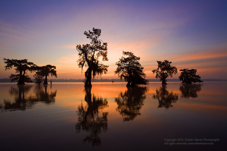
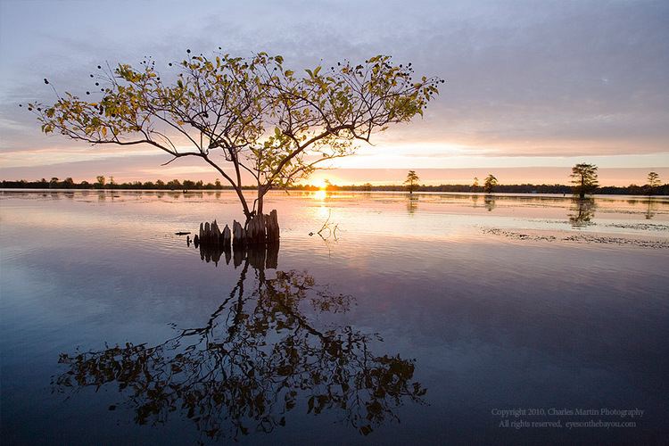
Much of the states lands were formed from sediment washed down the Mississippi River, leaving enormous deltas and vast areas of coastal marsh and swamp. The two "Deltas" are located in Monroe, the parish seat of Ouachita Parish, Shreveport, the parish seat of Caddo Parish, and Alexandria, the parish seat of Rapides Parish, for the small Delta, and Monroe, Lake Charles, and New Orleans for the large Delta. They are referred to as Deltas because they form a perfect triangle shape when the points are lined up. These contain a rich southern biota; typical examples include birds such as ibis and egrets. There are also many species of tree frogs, and fish such as sturgeon and paddlefish. In more elevated areas, fire is a natural process in the landscape, and has produced extensive areas of longleaf pine forest and wet savannas. These support an exceptionally large number of plant species, including many species of orchids and carnivorous plants.
Visit new orleans top 10 sites in new orleans louisiana
Some Louisiana urban environments have a multicultural, multilingual heritage, being so strongly influenced by a mixture of 18th-century French, Spanish, Native American, and African cultures that they are considered to be exceptional in the US. Before the American purchase of the territory in 1803, the current Louisiana State had been both a French colony and a Spanish one. In addition, colonists imported numerous African slaves as laborers in the 18th century. Many came from peoples of the same region of West Africa, thus concentrating their culture. In the post-Civil War environment, Anglo-Americans increased the pressure for Anglicization, and in 1915, English was made the only official language of the state. Louisiana has more Native American tribes than any other southern state, including four that are federally recognized, ten that are state recognized, and four that have not yet received recognition.
Geography
Louisiana is bordered to the west by Texas; to the north by Arkansas; to the east by the state of Mississippi; and to the south by the Gulf of Mexico. The surface of the state may properly be divided into two parts, the uplands of the north, and the alluvial along the coast.
The alluvial region includes low swamp lands, coastal marshlands and beaches, and barrier islands that cover about 20,000 square miles (52,000 km2). This area lies principally along the Gulf of Mexico and the Mississippi River, which traverses the state from north to south for a distance of about 600 miles (1,000 km) and empties into the Gulf of Mexico; the Red River; the Ouachita River and its branches; and other minor streams (some of which are called bayous).
The breadth of the alluvial region along the Mississippi is from 10 to 60 miles (15 to 100 km), and along the other rivers, the alluvial region averages about 10 miles (15 km) across. The Mississippi River flows along a ridge formed by its own natural deposits (known as a levee), from which the lands decline toward a river beyond at an average fall of six feet per mile (3 m/km). The alluvial lands along other streams present similar features.
The higher and contiguous hill lands of the north and northwestern part of the state have an area of more than 25,000 square miles (65,000 km2). They consist of prairie and woodlands. The elevations above sea level range from 10 feet (3 m) at the coast and swamp lands to 50 and 60 feet (15–18 m) at the prairie and alluvial lands. In the uplands and hills, the elevations rise to Driskill Mountain, the highest point in the state at only 535 feet (163 m) above sea level.
Besides the navigable waterways already named, there are the Sabine, forming the western boundary; and the Pearl, the eastern boundary; the Calcasieu (KAL-cah-shew), the Mermentau, the Vermilion, Bayou Teche, the Atchafalaya (a-CHAF-a-LI-a), the Boeuf (bEHf), Bayou Lafourche, the Courtableau River, Bayou DArbonne, the Macon River, the Tensas (TEN-saw), Amite River, the Tchefuncte (CHA-Funk-ta), the Tickfaw, the Natalbany River, and a number of other smaller streams, constituting a natural system of navigable waterways, aggregating over 4,000 miles (6,400 km) long.
The state also has political jurisdiction over the approximately 3-mile (4.8 km)-wide portion of subsea land of the inner continental shelf in the Gulf of Mexico. Through a peculiarity of the political geography of the United States, this is substantially less than the 9-mile (14 km)-wide jurisdiction of nearby states Texas and Florida, which, like Louisiana, have extensive Gulf coastlines.
The southern coast of Louisiana in the United States is among the fastest-disappearing areas in the world. This has largely resulted from human mismanagement of the coast (see Wetlands of Louisiana). At one time, the land was added to when spring floods from the Mississippi River added sediment and stimulated marsh growth; the land is now shrinking. There are multiple causes.
Artificial levees block spring flood water that would bring fresh water and sediment to marshes. Swamps have been extensively logged, leaving canals and ditches that allow saline water to move inland. Canals dug for the oil and gas industry also allow storms to move sea water inland, where it damages swamps and marshes. Rising sea waters have exacerbated the problem. Some researchers estimate that the state is losing a land mass equivalent to 30 football fields every day. There are many proposals to save coastal areas by reducing human damage, including restoring natural floods from the Mississippi. Without such restoration, coastal communities will continue to disappear. And as the communities disappear, more and more people are leaving the region. Since the coastal wetlands support an economically important coastal fishery, the loss of wetlands is adversely affecting this industry.
History
Louisiana was inhabited by Native Americans for many millennia before the arrival of Europeans in the 16th century. During the Middle Archaic period, Louisiana was the site of the earliest mound complex in North America and one of the earliest dated, complex constructions in the Americas, the Watson Brake site near present-day Monroe. An 11-mound complex, it was built about 5400 BP (3500 BCE). The Middle Archaic sites of Caney and Frenchmans Bend have also been securely dated to 5600–5000 BP, demonstrating that seasonal hunter-gatherers organized to build complex constructions in present-day northern Louisiana. The Hedgepeth Site in Lincoln Parish is more recent, dated to 5200–4500 BP.
Nearly 2,000 years later, Poverty Point, the largest and best-known Late Archaic site in the state, was built. Modern-day Epps developed near it. The Poverty Point culture may have reached its peak around 1500 BCE, making it the first complex culture, and possibly the first tribal culture in North America. It lasted until approximately 700 BCE.
The Poverty Point culture was followed by the Tchefuncte and Lake Cormorant cultures of the Tchula period, local manifestations of Early Woodland period. The Tchefuncte culture were the first people in Louisiana to make large amounts of pottery. These cultures lasted until 200 CE. The Middle Woodland period starts in Louisiana with the Marksville culture in the southern and eastern part of the state and the Fourche Maline culture in the northwestern part of the state. The Marksville culture takes its name from the Marksville Prehistoric Indian Site in Avoyelles Parish, Louisiana.
These cultures were contemporaneous with the Hopewell cultures of Ohio and Illinois, and participated in the Hopewell Exchange Network. Trade with peoples to the southwest brought the bow and arrow. The first burial mounds were built at this time. Political power begins to be consolidated as the first platform mounds at ritual centers are constructed for the developing hereditary political and religious leadership.
By 400 CE in the southern part of the state the Late Woodland period had begun with the Baytown culture. Population increased dramatically and there is strong evidence of a growing cultural and political complexity. Many Coles Creek sites were erected over earlier Woodland period mortuary mounds. Scholars have speculated that emerging elites were symbolically and physically appropriating dead ancestors to emphasize and project their own authority.
The Mississippian period in Louisiana was when Plaquemine and the Caddoan Mississippian cultures developed and extensive maize agriculture was adopted. The Plaquemine culture in the lower Mississippi River Valley in western Mississippi and eastern Louisiana began in 1200 CE and continued to about 1400 CE. Good examples of this culture are the Medora Site in West Baton Rouge Parish, Louisiana, and the Emerald Mound, Winterville and Holly Bluff sites in Mississippi.
Plaquemine culture was contemporaneous with the Middle Mississippian culture represented by the primary settlement, the Cahokia site near St. Louis, Missouri. This group is considered ancestral to the Natchez and Taensa Peoples.
By 1000 CE in the northwestern part of the state, the Fourche Maline culture had evolved into the Caddoan Mississippian culture. The Caddoan Mississippians covered a large territory, including what is now eastern Oklahoma, western Arkansas, northeast Texas, and northwest Louisiana. Archeological evidence has demonstrated that the cultural continuity is unbroken from prehistory to the present. The Caddo and related Caddo language speakers in prehistoric times and at first European contact were the direct ancestors of the modern Caddo Nation of Oklahoma of today.
Many current place names in the state, including Atchafalaya, Natchitouches (now spelled Natchitoches), Caddo, Houma, Tangipahoa, and Avoyel (as Avoyelles), are transliterations of those used in various Native American languages.
Economy
The total gross state product in 2010 for Louisiana was US$213.6 billion, placing it 24th in the nation. Its per capita personal income is $30,952, ranking 41st in the United States.
Culture
Louisiana is home to many, especially notable are the distinct culture of the Creoles.