
 | ||
The Pan-American Highway (French: Route / Autoroute Panaméricaine / Transaméricaine, Portuguese: Rodovia / Auto-estrada Pan-americana, Spanish: Autopista / Carretera / Ruta Panamericana) is a network of roads measuring about 30,000 kilometres (19,000 mi) in total length. Except for a rainforest break of approximately 160 km (100 mi), called the Darién Gap, the road links almost all of the mainland countries of the Americas in a connected highway system. According to Guinness World Records, the Pan-American Highway is the world's longest "motorable road". However, because of the Darién Gap, it is not possible to cross between South America and Central America.
Contents
- Map of Pan American Hwy Panama
- Development and construction
- Countries served
- Hemispheric overview
- Alaska Canada and the contiguous 48 states
- Mexico
- Central America
- Darin Gap
- Colombia and Venezuela
- Ecuador Peru Chile Argentina and Paraguay
- Brazil and Uruguay
- Guyana Suriname and French Guyana
- West Indies section
- Art and culture
- References
Map of Pan-American Hwy, Panama
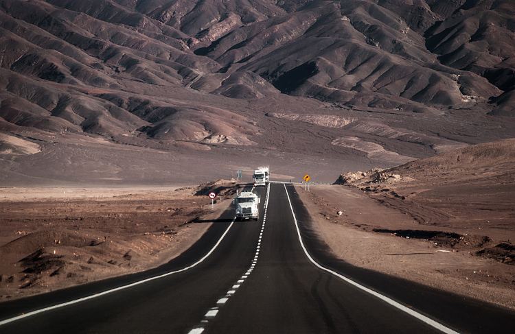
The Pan-American Highway passes through many diverse climates and ecological types, from dense jungles, to arid deserts, some of which are passable only during the dry season, and in many regions driving is occasionally hazardous.
Jake Silverstein, writing in 2006, described the Pan-American Highway as "a system so vast, so incomplete, and so incomprehensible it is not so much a road as it is the idea of Pan-Americanism itself".
Development and construction
The concept of an overland route from one tip of the Americas to the other was originally proposed at the First Pan-American Conference in 1889 as a railroad; however, this proposal was never realized. The idea of building a highway emerged at the Fifth International Conference of American States in 1923. The first conference regarding construction of the highway occurred on October 5, 1925. Finally, on July 29, 1937, Bolivia, Chile, Colombia, Costa Rica, El Salvador, Guatemala, Honduras, Mexico, Nicaragua, Panama, Peru, Canada, and the United States signed the Convention on the Pan-American Highway, whereby they agreed to speedy construction, by all adequate means. In 1950, Mexico became the first Latin American country to complete its portion of the highway.
Countries served
The Northern Pan-American Highway travels through 9 countries:
The Southern Pan-American Highway travels through 8 countries:
Important spurs also lead into 4 countries:
Hemispheric overview
The Pan-American Highway system is physically mostly complete and extends in de facto terms from Prudhoe Bay, Alaska, in North America to the lower reaches of South America. Several southern highway termini are claimed to exist, including the cities of Puerto Montt and Quellón in Chile and Ushuaia in Argentina. West and north of the Darien Gap, it is also known as the Inter-American Highway through Central America and Mexico where it splits into several spurs leading to the Mexico–US border.
The entire Interstate Highway System in the United States has been officially designated part of the Pan American system by the Federal Highway Administration, although this has never been reflected in any of the official interstate signage. Of the many freeways that make up this very comprehensive system, there are several that stand out because of their mainly north-south orientation and their links to the main Mexican route and its spurs. These include the following:
Alaska, Canada and the contiguous 48 states
In Canada, no particular road has been officially or unofficially designated as the Pan-American Highway (the Trans-Canada Highway, which runs mostly east-west, is the country's only official interprovincial highway system). However, some unofficial claims have been made based on routes that are a natural extension of several key American highways that reach the Canada–US border. British Columbia Highway 97 and Highway 2 to Alberta both pick up where the southern end of the Alaska highway leaves off. Highway 97 becomes U.S. Route 97 at the Canada–US border and eventually ends at Interstate 5 in northern California. British Columbia Highway 99 provides an alternate route from Highway 97 just north of Cache Creek that runs through Whistler and Vancouver before ending at the Canada–US border at the north end of Interstate 5 in Washington State, the beginning of the official Pan-American route south of British Columbia. Meanwhile, Alberta Highway 2 runs south and east to Alberta Highway 3 leading into Lethbridge, then south on Alberta Highway 4 to the Canada–US border where it becomes Interstate 15 in Montana, the first official stretch of the Pan-American Highway south of the Alberta route. I-15 runs south all the way to San Diego where it converges with Interstate 5 then heads east as Interstate 8. This links indirectly via a short stretch of Interstate 10 to Interstate 19 that becomes a spur of the Pan-American highway through Mexico at the Nogales border crossing.
In 1966, the Federal Highway Administration designated the entire Interstate Highway System part of the Pan-American Highway System. However comprehensive this designation, there are certain interstates and other smaller highways that attract particular attention because of special names that have been officially or unofficially attached or identity claims that have been made.
The section of Interstate 35 in San Antonio, Texas is referred to as the Pan Am Expressway by locals. I-35 is a northerly continuation of Mexico Highway 85, the original official Mexican route, ending in Duluth, Minnesota, where Minnesota State Highway 61 continues to the Canada–US border near Thunder Bay, Ontario. As a result, the Trans-Canada Highway from Alberta to Thunder Bay has been considered as a possible route for the Pan-American Highway.
Interstate 25 in Albuquerque, New Mexico, was named the Pan-American Freeway, as an extension of highway 45, the Mexican spur linking El Paso to the original route along highway 85 north of Mexico City. This portion of I-25 largely follows the historic Camino Real, and thus serves a culturally significant portion of the Pan American system. Like I-35, the complete route of Interstate 25 is an official northerly continuation towards Alberta, where Highway 2 provides a direct (but unofficial) link to the Alaska Highway.
The Pan American Highway Association claims U.S. Route 81 from its main point of separation from I-35 south of McPherson, Kansas, to Watertown, South Dakota, where it merges with I-29 running north to the Canada–US border near Winnipeg. There it links with the Thunder Bay-Alberta section of the Trans-Canada. Unlike the interstate highways through San Antonio and Albuquerque, the claim for Highway 81 remains unofficial.
Beyond Alberta, the Alaska Highway through Alaska, Yukon and British Columbia is also claimed as a de facto part of the Pan-American Highway, as well as the Dalton Highway in Alaska, which is the only year-round road in North America to reach the Arctic Ocean. The ice road from Inuvik, Canada also reaches the Arctic Ocean but is not claimed as part of the Pan-American system.
Several intra-North American routes have names that make no direct reference to the Pan-American Highway:
Mexico
The official route of the Pan-American Highway through Mexico (where it is known as the Inter-American Highway) starts at Nuevo Laredo, Tamaulipas (opposite Laredo, Texas) and goes south to Mexico City along Mexican Federal Highway 85. Later branches were built to the border as follows:
From Mexico City to the border with Guatemala, the highway follows Mexican Federal Highway 190.
Central America
The Pan-American (or Inter-American) highway passes through the Central American countries with the highway designation of CA-1 (Central American Highway 1). In Guatemala, it passes through 10 departments, including The Department Of Guatemala, where it passes through Guatemala City. In El Salvador, it passes through the cities of Santa Ana, Santa Tecla, Antiguo Cuscatlán, San Salvador, San Martín, San Miguel, and crosses the border into Honduras at Amatillo. From Honduras, it passes into Nicaragua, passing though the Nicaraguan cities of Chinandega, Estelí, Sebaco Matagalpa, León, and Managua, before entering Costa Rica at Peñas Blancas. In Costa Rica, it passes through Liberia, San José, Cartago, Pérez Zeledón, Palmares, Neily, before crossing into Panama at Paso Canoas. In Panama, it crosses the Panama Canal via the Centennial Bridge, and ends at Yaviza, at the edge of the Darién Gap. The road had formerly ended at Cañita, Panama, 110 miles (180 km) north of its current end. United States government funding was particularly significant to complete the high-level Bridge of the Americas over the Panama Canal, during the years when the canal was administered by the United States.
Belize was supposedly included in the route at one time, after it switched to driving on the right. Prior to independence, as British Honduras, it was the only Central American country to drive on the left side of the road.
Darién Gap
The Pan-American Highway is interrupted between Panama and Colombia by a 100 km (60 mi) stretch of marshland known as the Darién Gap. On the South American side, the highway terminates at Turbo, Colombia, while on the Panamanian side, the road terminus is the town of Yaviza. Because of swamps, marshes, and rivers, construction would be very expensive.
Efforts have been made for decades to eliminate the gap in the Pan-American highway, but have been controversial. Planning began in 1971 with the help of United States funding, but this was halted in 1974 after concerns raised by environmentalists. Another effort to build the road began in 1992, but by 1994 a United Nations agency reported that the road, and the subsequent development, would cause extensive environmental damage. There is evidence that the Darién Gap has prevented the spread of diseased cattle into Central and Northern America, which have not seen foot-and-mouth disease since 1954, and since at least the 1970s this has been a substantial factor in preventing a road link through the Darién Gap. The Embera-Wounaan and Kuna have also expressed concern that the road would bring about the potential erosion of their cultures.
One proposed option to bridge the gap is a short ferry link from Colombia to a new ferry port in Panama, with an extension of the existing Panama highway that would complete the highway without violating these environmental concerns.
Colombia and Venezuela
The southern part of the highway begins in northwestern Colombia, from where it follows Colombia Highway 62 to Medellín. At Medellín, Colombia Highway 54 leads to Bogotá, but Colombia Highway 25 turns south for a more direct route. Colombia Highway 72 is routed southwest from Bogotá to join Highway 25 at Murillo. Highway 25 continues all the way to the border with Ecuador.
Another route, known as the Simón Bolívar Highway, runs from Bogotá (Colombia) to Guiria (Venezuela). It begins by using Colombia Highway 71 all the way to the border with Venezuela. From there it uses Venezuela Highway 1 to Caracas and Venezuela Highway 9 to its end at Guiria.
Ecuador, Peru, Chile, Argentina and Paraguay
Ecuador Highway 35 runs the whole length of that country. Peru Highway 1 carries the Pan-American Highway all the way through Peru to the border with Chile.
In Chile, the highway follows Chile Route 5 south to a point north of Santiago (Llaillay), where the highway splits into two parts, one of which goes through Chilean territory to Puerto Montt, where it splits again, to Quellón on Chiloé Island, and to its continuation as the Carretera Austral. The other part goes east along Chile Route 60, which becomes Argentina National Route 7 at the Argentinian border and continues to Buenos Aires, the end of the main highway. The highway network also continues south of Buenos Aires along Argentina National Route 3 towards the city of Ushuaia in Tierra del Fuego. Another branch, from Buenos Aires to Asunción in Paraguay, heads out of Buenos Aires on Argentina National Route 9. It switches to Argentina National Route 11 at Rosario, which crosses the border with Paraguay right at Asunción. Other branches probably exist across the center of South America.
Brazil and Uruguay
A continuation of the Pan-American Highway to the Brazilian cities of São Paulo and Rio de Janeiro uses a ferry from Buenos Aires to Colonia in Uruguay and Uruguay Highway 1 to Montevideo. Uruguay Highway 9 and Brazil Highway 471 route to near Pelotas, from where Brazil Highway 116 leads to Brazilian main cities.
Guyana, Suriname and French Guyana
The highway does not have official segments to Belize, Guyana, Suriname and French Guiana, nor to any of the island nations in the Americas. However, highways from Venezuela link to Brazilian Trans-Amazonian highway that provides a southwest entrance to Guyana, route to the coast, and follow a coastal route through Suriname to French Guiana.
West Indies section
Plans have been discussed for including the West Indies in the Pan American Highway system. According to these, a system of ferries would be established to connect terminal points of the highway. Travelers would then be able to ferry from Key West to Havana, drive to the eastern tip of Cuba, ferry to Haiti, drive through Haiti and the Dominican Republic, and ferry again to Puerto Rico. Included in this system would also be a ferry from the western tip of Cuba to the Yucatán Peninsula. Mexico has already surveyed a route which will run across the Yucatán, Campeche, and Chiapas to San Cristobal de Las Casas, on the Pan American Highway. ("The Pan American Highway System" by Travel Division Pan American Union, Washington D.C. October 1947)
Art and culture
Travel writer Tim Cahill wrote a book, Road Fever, about his record-setting 24-day drive from Ushuaia in the Argentine province of Tierra del Fuego to Prudhoe Bay in the U.S. state of Alaska with professional long-distance driver Garry Sowerby, much of their route following the Pan-American Highway.
In the British motoring show Top Gear, the presenters drove on a section of the road in their off-road vehicles in the Bolivian Special.
In 2003, Kevin Sanders, a long-distance rider, broke the Guinness World Record for the fastest traversal of the highway by motorcycle in 34 days.