
Existed: 1991 – present Length 239.5 km | South end: I-35 at Duluth Constructed 1991 | |
 | ||
Tourist
routes: Lake Superior Circle Tour
North Shore Scenic Drive North end: Highway 61 near Grand Portage Major cities Duluth, Grand Marais, Two Harbors, Silver Bay Counties St. Louis County, Minnesota, Lake County, Minnesota, Cook County, Minnesota | ||
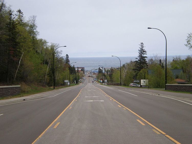
Minnesota State Highway 61 (MN 61) is a highway in northeast Minnesota, which runs from a junction with Interstate 35 (I-35) in Duluth at 26th Avenue East, and continues northeast to its northern terminus at the Canadian border near Grand Portage. The roadway becomes Ontario Highway 61 upon entering Canada at the Pigeon River Bridge, and terminates at the Trans-Canada Highway in Thunder Bay. MN 61 is 149 miles (240 km) in length.
Contents
Map of MN-61, Minnesota, USA
The route is a scenic highway, following the North Shore of Lake Superior, and is part of the Lake Superior Circle Tour designation that runs through Minnesota, Ontario, Michigan, and Wisconsin.
This roadway was designated U.S. Highway 61 until 1991. This highway, then US 61, is the road that musician Bob Dylan referred to in the album and song Highway 61 Revisited.
The North Shore Scenic Drive is an All-American Road scenic byway that follows Saint Louis County Road 61 / Lake County Road 61 / MN 61, formerly US 61, from the city of Duluth, Minnesota, to the Canadian border near Grand Portage. The route stays close to the rocky North Shore, offering spectacular vistas of the lake to the southeast as it skirts along the foothills of the Sawtooth Range to the northwest.
Route description
MN 61 serves as a northeast–southwest route in northeast Minnesota between Duluth, Two Harbors, Silver Bay, Grand Marais, and the Canadian border.
21 miles (34 km) of MN 61 from Duluth to Two Harbors is a four-lane expressway officially designated the Arthur Rohweder Memorial Highway. There are no markers on the highway showing this designation, but there is a plaque at a wayside.
The roadway is located close to and in many places next to Lake Superior. Sights include forests, wildlife, cliffs, state parks, and a national monument.
Highway 61 passes through the Superior National Forest and the Grand Portage State Forest in Cook County.
The following state parks are located on Highway 61:
The Grand Portage National Monument is located adjacent to the community of Grand Portage on Highway 61.
The southern terminus for MN 61 is its junction with I-35 in Duluth in northeast Minnesota. The national northern terminus for I-35 is also located at this same junction with 26th Avenue East.
The northern terminus for MN 61 is at the Canadian border, near Grand Portage, where it becomes Ontario Highway 61 upon entering Canada at the Pigeon River Bridge. The roadway continues to Thunder Bay.
History
Minnesota Highway 61 was designated and signed in 1991. The roadway was originally part of US 61 from 1926 to 1991.
After construction of I-35 in the 1960s, US 61 was co-signed with I-35 until 1991. During that year, US 61 was decommissioned from the Canadian border south to its present-day junction with I-35 at the city of Wyoming near Forest Lake. The section of US 61 north of Duluth was redesignated MN 61 that same year.
MN 61 is one of three state marked highways to carry the same number as an existing U.S. Highway within the state, the others are MN 65 and MN 169.
Early history
MN 61, between Duluth and the Canadian border, was commissioned as part of US 61 in 1926, ready for use by 1929, and paved by 1940.
The section of MN 61 from Hovland to the Pigeon River formerly ran inland, bypassing the community of Grand Portage. The new highway alignment and border crossing were constructed in the early 1960s.
The MN 61 expressway between Duluth and Two Harbors was constructed inland in the 1960s. The state then turned over maintenance of the original US 61 between Duluth and Two Harbors to Saint Louis and Lake counties. The two counties then redesignated this section as CR 61 or Scenic 61.