
Country Mexico Foundation October 6, 1750 Time zone CST (UTC−6) Population 278,455 (2007) | Elevation 316 m (1,040 ft ft) Area 188 km² | |
 | ||
Weather 19°C, Wind S at 0 km/h, 83% Humidity Colleges and Universities Autonomous University of Tamaul, Instituto Tecnológico de Ciuda, Universidad La Salle Victoria | ||
Hampton inn by hilton ciudad victoria ciudad victoria tamaulipas mexico
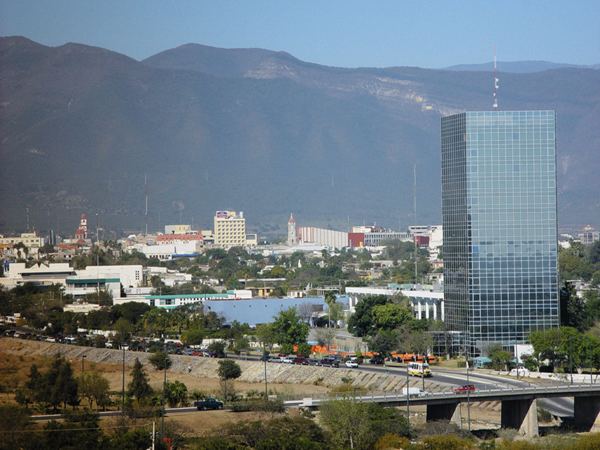
Ciudad Victoria ([sjuˈðad bikˈtoɾja]), is the capital city of the Mexican state of Tamaulipas. It is located in the western-central region of the state. Ciudad Victoria is also the municipal seat of the surrounding Victoria Municipality, which covers an area of 1,638 km² (632.4 sq mi). According to the 2010 INEGI population count, the city had 305,155 inhabitants, and the Victoria Municipality had a population of 321,953. The city and the municipality both rank fourth in population size in the state, behind Reynosa, Matamoros, and Nuevo Laredo.
Contents
- Hampton inn by hilton ciudad victoria ciudad victoria tamaulipas mexico
- Map of Ciudad Victoria Tamaulipas Mexico
- History
- Air travel
- Education
- Notable residents
- Geography
- Climate
- References
Map of Ciudad Victoria, Tamaulipas, Mexico
Hampton inn by hilton ciudad victoria ciudad victoria tamaulipas mexico
History
Ciudad Victoria was founded on October 6, 1750 with the name Villa de Santa María de Aguayo by José de Escandón y Helguera. On April 20, 1825, the town was elevated to the status of city, and was given its current name in honor of the first president of Mexico, Guadalupe Victoria. Toward the end of the 19th century and the beginning of the 20th century, the city began undergoing a number of modernizing changes. In 1890, a railroad was completed that passed through Ciudad Victoria on its route between Monterrey and Tampico. Several major highways were also completed during the 20th century.
Several monuments and structures were built during the 19th and early 20th century, including a bronze statue of Benito Juárez on July 18, 1897, the Juárez Theater in 1899, and on September 15, 1910, a monument to the heroes of the independence of Mexico. In 1896, the first children's garden/playground (kindergarten) in Latin America was established in the city by Estefanía Castañeda Núñez de Cáceres.
Air travel
The city is served by General Pedro J. Méndez International Airport, located 18 kilometers (11 mi) from the city center.
Education
List of universities in Ciudad Victoria:
Notable residents
Geography
Victoria is located 316 metres (1,037 ft) above sea level and at coordinates 23°44′N 99°8′W just north of the Tropic of Cancer. The city is in a valley between two mountain ranges: the Sierra Madre Oriental to the west and the Sierra de Tamaulipas to the east.
Climate
Victoria has short mild winters and long hot summers. Temperatures rarely drop below 0 °C (32 °F) — the lowest recorded temperature was −6 °C (21 °F) and the hottest was 48.5 °C (119.3 °F), one of the highest temperatures ever recorded in Mexico. The average annual precipitation is 700 millimeters (28 in). Half of this amount falls between May and September, although there is a drying trend in July. Its Köppen climate classification is Cwa or humid subtropical, its moderate elevation adds to overall precipitation pattern. Exceptionally heavy rains brought by occasional North Atlantic tropical cyclones also influence the overall climate and precipitation amounts.