
 | ||
Major cities | ||
Top 10 places to visit along the carretera austral chile
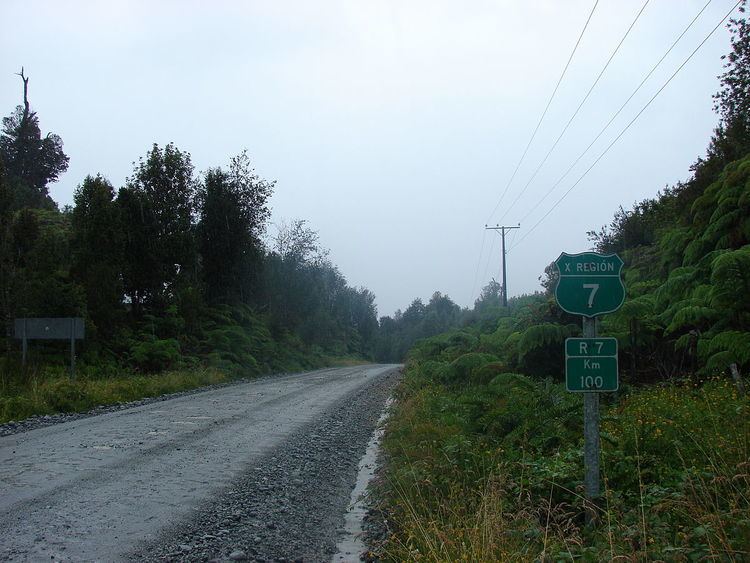
The Carretera Austral (CH-7) is the name given to Chile's Route 7. The highway runs about 1,240 kilometers (770 mi) from Puerto Montt to Villa O'Higgins through rural Patagonia.
Contents
- Top 10 places to visit along the carretera austral chile
- Map of Ruta 7 Chile
- Carretera austral ruta 7 in chile patagonia documentary
- History
- Places along the highway
- Ferry crossings
- Current activity
- References
Map of Ruta 7, Chile
Carretera Austral provides road access to Chile's Aysén del General Carlos Ibáñez del Campo Region and southern part of Los Lagos Region. These areas are sparsely populated and despite its length, Carretera Austral provides access to only about 100,000 people. South of the highway's start in Puerto Montt, Coyhaique (population 44,850) is the largest city along it.
Carretera austral ruta 7 in chile patagonia documentary
History
Construction of the highway was commenced in 1976 under the dictatorship of Augusto Pinochet in order to connect a number of remote communities. Before that, in the 1950s and 1970s, there had been unsuccessful attempts to build access roads in the region. It is among the most ambitious infrastructure projects developed in Chile during the 20th century.
During the military dictatorship the belief that the Carretera Austral bears the name of Augusto Pinochet arises, which has been denied by the authorities, since no official document supports this assumption. Also, there have been propaganda elements such as posters and maps with the unofficial name "Carretera Longitudinal Austral Presidente Pinochet".
Carretera Austral has a strategic meaning due to the difficult access by land to a significant portion of Chile's southern territory. This area is characterized by thick forests, fjords, glaciers, canals and steep mountains. Access by sea and air is also a complex task due to extreme winter weather conditions. For decades, most of the land transportation had to cross the border to Argentina in order to reach again Chile's Patagonia. These difficulties were deepened during the 1970s due to the Beagle Conflict crisis. In order to strengthen the Chilean presence in these isolated territories and ensure the land connection to the rest of the country, the government planned the construction of this road, which was executed by the Chilean Army's Engineering Command. More than 10,000 soldiers worked in its construction. Many of them lost their lives during this effort.
The highway opened to traffic in 1988, and by 1996 was completed to Puerto Yungay. The last 100 kilometers (62 mi) to Villa O'Higgins were opened in 2000. In 2003, a branch road to Caleta Tortel was finished.
Places along the highway
Ferry crossings
Traveling the entire route requires the use of three ferries:
- a 30-minute crossing about 45 kilometers (28 mi) south of the start of the highway in Puerto Montt
- a 5-hour crossing from Hornopiren (110 kilometers (68 miles) south of Puerto Montt) to Caleta Gonzalo
- a 50-minute crossing from Puerto Yungay to Rio Bravo, connecting to the final 100 kilometers (62 mi) of the highway.
Current activity
The highway began as almost entirely unpaved, but more sections are becoming paved each year. As of January 2017, the paved road ends at Villa Cerro Castillo, with roadworks going on just south of there.
There is also a plan to extend the road to Magallanes Region, which still lacks domestic road connection to the rest of Chile. This means constructing a 935-kilometre (581 mi) branch Rio Bravo-Ventisquero Montt-Puerto Natales, with 9 ferry crossings planned. By January 2007, the construction on the Rio Bravo-Ventisquero Montt section had begun, with the branch off point from the main Rio Bravo-Villa O'Higgins road being at 48.00°S 73.13°W / -48.00; -73.13.