
Type Sea Max. length 1,175 km (730 mi) Max. depth 2,212 m (7,257 ft) Elevation 0 cm | Primary outflows Bosphorus Average depth 1,253 m (4,111 ft) Area 436,402 km² Bridges Asparuhov most | |
 | ||
Surface area 436,402 km (168,500 sq mi) | ||
Beautiful black sea coast of bulgaria balkan road trip 01
The Black Sea is a body of water between Eastern Europe and Western Asia, bounded by Bulgaria, Georgia, Romania, Russia, Turkey, and Ukraine. It is supplied by a number of major rivers, such as the Danube, Dnieper, Rioni, Southern Bug, and Dniester. The Black Sea has an area of 436,400 km2 (168,500 sq mi) (not including the Sea of Azov), a maximum depth of 2,212 m (7,257 ft), and a volume of 547,000 km3 (131,000 cu mi). It is constrained by the Pontic Mountains to the south and by the Caucasus Mountains to the east, and features a wide shelf to the northwest. The longest east-west extent is about 1,175 km (730 mi).
Contents
- Beautiful black sea coast of bulgaria balkan road trip 01
- Map of Black Sea
- Visit batumi black sea resort in georgia
- Extent
- Modern names
- Historical names
- Geology and bathymetry
- Hydrology
- Hydrochemistry
- Marine
- Phytoplankton
- Endemic animal species
- Ecological effects of pollution
- Terrestrial
- Climate
- Mediterranean connection during the Holocene
- Deluge hypothesis
- Recorded history
- Archaeology
- Commercial and civic use
- Navigation
- Fishing
- Hydrocarbons exploration
- Holiday resorts and spas
- International and military use of the Straits
- References
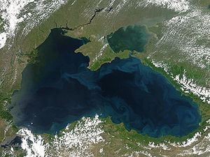
Map of Black Sea
Important cities along the coast include Batumi, Burgas, Constanța, Giresun, Istanbul, Kerch, Novorossiysk, Odessa, Ordu, Poti, Rize, Samsun, Sevastopol, Sochi, Sukhumi, Trabzon, Varna, Yalta, and Zonguldak.
The Black Sea has a positive water balance; that is, a net outflow of water 300 km3 (72 cu mi) per year through the Bosphorus and the Dardanelles into the Aegean Sea. Mediterranean water flows into the Black Sea as part of a two-way hydrological exchange. The Black Sea outflow is cooler and less saline, and floats over the warm, more saline Mediterranean inflow – as a result of differences in density caused by differences in salinity – leading to a significant anoxic layer well below the surface waters. The Black Sea drains into the Mediterranean Sea and then the Atlantic Ocean, via the Aegean Sea and various straits. The Bosphorus Strait connects it to the Sea of Marmara, and the Strait of the Dardanelles connects that sea to the Aegean Sea region of the Mediterranean. These waters separate Eastern Europe and Western Asia. The Black Sea is also connected to the Sea of Azov by the Strait of Kerch.
The water level has varied significantly. Due to these variations in the water level in the basin, the surrounding shelf and associated aprons have sometimes been land. At certain critical water levels it is possible for connections with surrounding water bodies to become established. It is through the most active of these connective routes, the Turkish Straits, that the Black Sea joins the world ocean. When this hydrological link is not present, the Black Sea is an endorheic basin, operating independently of the global ocean system, like the Caspian Sea for example. Currently the Black Sea water level is relatively high, thus water is being exchanged with the Mediterranean. The Turkish Straits connect the Black Sea with the Aegean Sea, and comprise the Bosphorus, the Sea of Marmara and the Dardanelles.
Visit batumi black sea resort in georgia
Extent
The International Hydrographic Organization defines the limits of the Black Sea as follows:
Modern names
Current names of the sea are usually equivalents of the English name "Black Sea", including these given in the countries bordering the sea:
Such names have not yet been shown conclusively to predate the 12th century, but there are indications that they may be considerably older.
In Greece, the historical name "Euxine Sea", which holds a different meaning (see below), is still widely used:
The Black Sea is one of four seas named in English after common colour terms—the others being the Red Sea, the White Sea and the Yellow Sea.
Historical names
Strabo's Geographica (1.2.10) reports that in antiquity, the Black Sea was often just called "the Sea" (ὁ πόντος ho pontos). For the most part, Graeco-Roman tradition refers to the Black Sea as the "Hospitable sea", Εὔξεινος Πόντος Eúxeinos Póntos. This is a euphemism replacing an earlier "Inhospitable Sea", Πόντος Ἄξεινος Póntos Áxeinos, first attested in Pindar (c. 475 BC).
Strabo (7.3.6) thinks that the Black Sea was called "inhospitable" before Greek colonization because it was difficult to navigate, and because its shores were inhabited by savage tribes. The name was changed to "hospitable" after the Milesians had colonized the southern shoreline, the Pontus, making it part of Greek civilization.
It is also possible that the epithet Áxeinos arose by popular etymology from a Scythian word axšaina- "unlit", "dark"; the designation "Black Sea" may thus date from antiquity.
A map of Asia dating to 1570, entitled "Asiae Nova Descriptio", from Abraham Ortelius's Theatrum Orbis Terrarum, labels the sea Mar Maggior ("Great Sea", cf. Latin mare major).
English-language writers of the 18th century often used the name "Euxine Sea" (/ˈjuːksᵻn/ or /ˈjuːkˌsaɪn/) to refer to the Black Sea. Edward Gibbon, for instance, calls the sea by this name throughout The History of the Decline and Fall of the Roman Empire. During the Ottoman Empire period, the Black Sea was called either Bahr-e Siyah or Karadeniz, both meaning "the Black Sea" in the Ottoman Turkish.
It is worthy to note, that in the tenth-century geography book Hudud al-'Alam, written in the Persian language by an unknown author, the Black Sea is called "Georgian Sea", "Sea of Georgians" ("daryä-yi Gurziyan").
Old Georgian sources of 9th-14th centuries ("The Georgian Chronicles") were using the name "Speris Zğua" (სპერის ზღუა), which means "The Sea of Speri", after the name of Kartvelian tribe Speris or Saspers, now in Turkey.
Geology and bathymetry
The geological origins of the basin can be traced back to two distinct relict back-arc basins which were initiated by the splitting of an Albian volcanic arc and the subduction of both the Paleo- and Neo-Tethys Oceans, but the timings of these events remain controversial. Since its initiation, compressional tectonic environments led to subsidence in the basin, interspersed with extensional phases resulting in large-scale volcanism and numerous orogenies, causing the uplift of the Greater Caucasus, Pontides, Southern Crimean Peninsula and Balkanides mountain ranges.
The ongoing collision between the Eurasian and African plates and westward escape of the Anatolian block along the North Anatolian Fault and East Anatolian Faults dictates the current tectonic regime, which features enhanced subsidence in the Black Sea basin and significant volcanic activity in the Anatolian region. It is these geological mechanisms which, in the long term, have caused the periodic isolations of the Black Sea from the rest of the global ocean system.
The modern basin is divided into two sub-basins by a convexity extending south from the Crimean Peninsula. The large shelf to the north of the basin is up to 190 km (120 mi) wide, and features a shallow apron with gradients between 1:40 and 1:1000. The southern edge around Turkey and the eastern edge around Georgia, however, are typified by a narrow shelf that rarely exceeds 20 km (12 mi) in width and a steep apron that is typically 1:40 gradient with numerous submarine canyons and channel extensions. The Euxine abyssal plain in the centre of the Black Sea reaches a maximum depth of 2,212 metres (7,257.22 feet) just south of Yalta on the Crimean Peninsula.
The littoral zone of the Black Sea is often referred to as the Pontic littoral or Pontic zone.
The area surrounding the Black Sea is commonly referred to as the Black Sea Region. Its northern part lies within the Chernozem belt (black soil belt) which goes from eastern Croatia (Slavonia), along the Danube (northern Serbia, northern Bulgaria (Danubian Plain) and southern Romania (Wallachian Plain)) to northeast Ukraine and further across the Central Black Earth Region and southern Russia into Siberia.
Hydrology
The Black Sea is a marginal sea and is the world's largest body of water with a meromictic basin. The deep waters do not mix with the upper layers of water that receive oxygen from the atmosphere. As a result, over 90% of the deeper Black Sea volume is anoxic water. The Black Sea's circulation patterns are primarily controlled by basin topography and fluvial inputs, which result in a strongly stratified vertical structure. Because of the extreme stratification, it is classified as a salt wedge estuary.
The Black Sea only experiences water transfer with the Mediterranean Sea, so all inflow and outflow occurs in the Bosphorus and Dardanelles. Inflow from the Mediterranean has a higher salinity and density than the outflow, creating the classical estuarine circulation. This means that inflow of dense water from Mediterranean occurs at the bottom of the basin while outflow of fresher Black Sea surface-water into the Marmara Sea occurs near the surface. Fresher surface water is the product of the fluvial inputs, and this makes the Black Sea a positive sea. The net input of freshwater creates an outflow volume about twice that of the inflow. Evaporation and precipitation are roughly equal at about 300 cubic kilometres per year (72 cu mi/a).
Because of the narrowness and shallowness of the Bosphorus and Dardanelles (their respective depths are only 33 and 70 meters), inflow and outflow current speeds are high and there is significant vertical shear. This allows for turbulent mixing of the two layers. Surface water leaves the Black Sea with a salinity of 17 psu and reaches the Mediterranean with a salinity of 34 psu. Likewise, inflow of the Mediterranean with salinity 38.5 psu experiences a decrease to about 34 psu.
Mean surface circulation is cyclonic and waters around the perimeter of the Black Sea circulate in a basin-wide shelfbreak gyre known as the Rim Current. The Rim Current has a maximum velocity of about 50–100 cm/s. Within this feature, two smaller cyclonic gyres operate, occupying the eastern and western sectors of the basin. The Eastern and Western Gyres are well-organized systems in the winter but dissipate into a series of interconnected eddies in the summer and autumn. Mesoscale activity in the peripheral flow becomes more pronounced during these warmer seasons and is subject to interannual variability.
Outside of the Rim Current, numerous quasi-permanent coastal eddies are formed as a result of upwelling around the coastal apron and "wind curl" mechanisms. The intra-annual strength of these features is controlled by seasonal atmospheric and fluvial variations. During the spring, the Batumi eddy forms in the southeastern corner of the sea.
Beneath the surface waters—from about 50–100 meters—there exists a halocline that stops at the Cold Intermediate Layer (CIL). This layer is composed of cool, salty surface waters, which are the result of localized atmospheric cooling and decreased fluvial input during the winter months. It is the remnant of the winter surface mixed layer. The base of the CIL is marked by a major pycnocline at about 100–200 metres (330–660 ft) and this density disparity is the major mechanism for isolation of the deep water.
Below the pycnocline is the Deep Water mass, where salinity increases to 22.3 psu and temperatures rise to around 8.9 °C. The hydrochemical environment shifts from oxygenated to anoxic, as bacterial decomposition of sunken biomass utilizes all of the free oxygen. Weak geothermal heating and long residence time create a very thick convective bottom layer.
Hydrochemistry
Because of the anoxic water at depth, organic matter, including anthropogenic artifacts such as boat hulls, are well preserved. During periods of high surface productivity, short-lived algal blooms form organic rich layers known as sapropels. Scientists have reported an annual phytoplankton bloom that can be seen in many NASA images of the region. As a result of these characteristics the Black Sea has gained interest from the field of marine archaeology as ancient shipwrecks in excellent states of preservation have been discovered, such as the Byzantine wreck Sinop D, located in the anoxic layer off the coast of Sinop, Turkey.
Modelling shows the release of the hydrogen sulphide clouds in the event of an asteroid impact into the Black Sea would pose a threat to health—or even life—for people living on the Black Sea coast.
There have been isolated reports of flares on the Black Sea occurring during thunderstorms, possibly caused by lighting igniting combustible gas seeping up from the sea depths.
Marine
The Black Sea supports an active and dynamic marine ecosystem, dominated by species suited to the brackish, nutrient-rich, conditions. As with all marine food webs, the Black Sea features a range of trophic groups, with autotrophic algae, including diatoms and dinoflagellates, acting as primary producers. The fluvial systems draining Eurasia and central Europe introduce large volumes of sediment and dissolved nutrients into the Black Sea, but distribution of these nutrients is controlled by the degree of physiochemical stratification, which is, in turn, dictated by seasonal physiographic development.
During winter, strong wind promotes convective overturning and upwelling of nutrients, while high summer temperatures result in a marked vertical stratification and a warm, shallow mixed layer. Day length and insolation intensity also controls the extent of the photic zone. Subsurface productivity is limited by nutrient availability, as the anoxic bottom waters act as a sink for reduced nitrate, in the form of ammonia. The benthic zone also plays an important role in Black Sea nutrient cycling, as chemosynthetic organisms and anoxic geochemical pathways recycle nutrients which can be upwelled to the photic zone, enhancing productivity.
Phytoplankton
The main phytoplankton groups present in the Black Sea are dinoflagellates, diatoms, coccolithophores and cyanobacteria. Generally, the annual cycle of phytoplankton development comprises significant diatom and dinoflagellate-dominated spring production, followed by a weaker mixed assemblage of community development below the seasonal thermocline during summer months and a surface-intensified autumn production. This pattern of productivity is also augmented by an Emiliania huxleyi bloom during the late spring and summer months.
Endemic animal species
Ecological effects of pollution
Since the 1960s, rapid industrial expansion along the Black Sea coast line and the construction of a major dam has significantly increased annual variability in the N:P:Si ratio in the basin. In coastal areas, the biological effect of these changes has been an increase in the frequency of monospecific phytoplankton blooms, with diatom bloom frequency increasing by a factor of 2.5 and non-diatom bloom frequency increasing by a factor of 6. The non-diatoms, such as the prymnesiophytes Emiliania huxleyi (coccolithophore), Chromulina sp., and the Euglenophyte Eutreptia lanowii are able to out-compete diatom species because of the limited availability of Si, a necessary constituent of diatom frustules. As a consequence of these blooms, benthic macrophyte populations were deprived of light, while anoxia caused mass mortality in marine animals.
The decline in macrophytes was further compounded by overfishing during the 1970s, while the invasive ctenophore Mnemiopsis reduced the biomass of copepods and other zooplankton in the late 1980s. Additionally, an alien species—the warty comb jelly (Mnemiopsis leidyi)—was able to establish itself in the basin, exploding from a few individuals to an estimated biomass of one billion metric tons. The change in species composition in Black Sea waters also has consequences for hydrochemistry, as Ca-producing coccolithophores influence salinity and pH, although these ramifications have yet to be fully quantified. In central Black Sea waters, Si levels were also significantly reduced, due to a decrease in the flux of Si associated with advection across isopycnal surfaces. This phenomenon demonstrates the potential for localised alterations in Black Sea nutrient input to have basin-wide effects.
Pollution reduction and regulation efforts have led to a partial recovery of the Black Sea ecosystem during the 1990s, and an EU monitoring exercise, 'EROS21', revealed decreased N and P values, relative to the 1989 peak. Recently, scientists have noted signs of ecological recovery, in part due to the construction of new sewage treatment plants in Slovakia, Hungary, Romania, and Bulgaria in connection with membership in the European Union. Mnemiopsis leidyi populations have been checked with the arrival of another alien species which feeds on them.
Terrestrial
In the past, the range of the Asiatic lion extended from South Asia to the Balkans, possibly up to the Danube. Places like Turkey and the Trans-Caucasus were in this range. Caspian tigers occurred in eastern Turkey and the Caucasus, at least. The lyuti zver (Old Russian for "fierce animal") that was encountered by Vladimir II Monomakh, Velikiy Kniaz of Kievan Rus' (which ranged to the Black Sea in the south), may have been a tiger or leopard, rather than a wolf or lynx, due to the way it behaved towards him and his horse.
Climate
Short-term climatic variation in the Black Sea region is significantly influenced by the operation of the North Atlantic Oscillation, the climatic mechanisms resulting from the interaction between the north Atlantic and mid-latitude air masses. While the exact mechanisms causing the North Atlantic Oscillation remain unclear, it is thought the climate conditions established in western Europe mediate the heat and precipitation fluxes reaching Central Europe and Eurasia, regulating the formation of winter cyclones, which are largely responsible for regional precipitation inputs and influence Mediterranean Sea Surface Temperatures (SST's).
The relative strength of these systems also limits the amount of cold air arriving from northern regions during winter. Other influencing factors include the regional topography, as depressions and storms systems arriving from the Mediterranean are funneled through the low land around the Bosphorus, Pontic and Caucasus mountain ranges acting as wave guides, limiting the speed and paths of cyclones passing through the region.
Mediterranean connection during the Holocene
The Black Sea is connected to the World Ocean by a chain of two shallow straits, the Dardanelles and the Bosphorus. The Dardanelles is 55 m (180 ft) deep and the Bosphorus is as shallow as 36 m (118 ft). By comparison, at the height of the last ice age, sea levels were more than 100 m (330 ft) lower than they are now.
There is also evidence that water levels in the Black Sea were considerably lower at some point during the post-glacial period. Some researchers theorize that the Black Sea had been a landlocked freshwater lake (at least in upper layers) during the last glaciation and for some time after.
In the aftermath of the last glacial period, water levels in the Black Sea and the Aegean Sea rose independently until they were high enough to exchange water. The exact timeline of this development is still subject to debate. One possibility is that the Black Sea filled first, with excess fresh water flowing over the Bosphorus sill and eventually into the Mediterranean Sea. There are also catastrophic scenarios, such as the "Black Sea deluge theory" put forward by William Ryan, Walter Pitman and Petko Dimitrov.
Deluge hypothesis
The Black Sea deluge is a hypothesized catastrophic rise in the level of the Black Sea circa 5600 BC due to waters from the Mediterranean Sea breaching a sill in the Bosporus Strait. The hypothesis was headlined when The New York Times published it in December 1996, shortly before it was published in an academic journal. While it is agreed that the sequence of events described did occur, there is debate over the suddenness, dating and magnitude of the events. Relevant to the hypothesis is that its description has led some to connect this catastrophe with prehistoric flood myths.
Recorded history
The Black Sea was a busy waterway on the crossroads of the ancient world: the Balkans to the west, the Eurasian steppes to the north, Caucasus and Central Asia to the east, Asia Minor and Mesopotamia to the south, and Greece to the south-west.
The oldest processed gold in the world was found in Varna, and the Black Sea was supposedly sailed by the Argonauts. The land at the eastern end of the Black Sea, Colchis, (now Georgia), marked for the Greeks the edge of the known world.
The steppes to the north of the Black Sea have been suggested as the original homeland (Urheimat) of the speakers of the Proto-Indo-European language, (PIE) the progenitor of the Indo-European language family, by some scholars such as Marija Gimbutas; others move the heartland further east towards the Caspian Sea, yet others to Anatolia.
The Black Sea became an Ottoman Navy lake within five years of Genoa losing the Crimea in 1479, after which the only Western merchant vessels to sail its waters were those of Venice's old rival Ragusa. This restriction was gradually changed by the Russian Navy from 1783 until the relaxation of export controls in 1789 because of the French Revolution.
The Black Sea was a significant naval theatre of World War I and saw both naval and land battles during World War II.
Archaeology
Ancient trade routes in the region are currently being extensively studied by scientists, as the Black Sea was sailed by Hittites, Carians, Colchians Thracians, Greeks, Persians, Cimmerians, Scythians, Romans, Byzantines, Goths, Huns, Avars, Bulgars, Slavs, Varangians, Crusaders, Venetians, Genoese, Lithuanians, Georgians, Poles, Tatars, Ottomans, and Russians.
Perhaps the most promising areas in deepwater archaeology are the quest for submerged prehistoric settlements in the continental shelf and for ancient shipwrecks in the anoxic zone, which are expected to be exceptionally well preserved due to the absence of oxygen. This concentration of historical powers, combined with the preservative qualities of the deep anoxic waters of the Black Sea, has attracted increased interest from marine archaeologists who have begun to discover a large number of ancient ships and organic remains in a high state of preservation.
Commercial and civic use
According to NATO, the Black sea is a strategic corridor that provides smuggling channels for moving legal and illegal goods including drugs, radioactive materials, and counterfeit goods that can be used to finance terrorism.
Navigation
Ports and ferry terminals
According to the International Transport Workers' Federation 2013 study, there were at least 30 operating merchant seaports in the Black Sea (including at least 12 in Ukraine).
Merchant fleet and traffic
According to the International Transport Workers' Federation 2013 study, there were around 2,400 commercial vessels operating in the Black Sea.
Fishing
Anchovy: the Turkish commercial fishing fleet catches around 300,000 tons per year on average, and fishery carried out mainly in winter and the highest portion of the stock is caught between November and December.
Hydrocarbons exploration
Since the 1980s, the Soviet Union started offshore drilling for petroleum in the sea's western portion (adjoining Ukraine's coast). The independent Ukraine continued and intensified that effort within its exclusive economic zone, inviting major international oil companies for exploration. Discovery of the new, massive oilfields in the area stimulated an influx of foreign investments. It also provoked a short-term peaceful territorial dispute with Romania which was resolved in 2011 by an international court redefining the exclusive economic zones between the two countries.
Holiday resorts and spas
In the years following the end of the Cold War, the popularity of the Black Sea as a tourist destination steadily increased. Tourism at Black Sea resorts became one of the region's growth industries. The following is a list of notable Black Sea resort towns:
International and military use of the Straits
The 1936 Montreux Convention provides for a free passage of civilian ships between the international waters of the Black and the Mediterranean Seas. However, a single country (Turkey) has a complete control over the straits connecting the two seas. The 1982 amendments to the Montreux Convention allow Turkey to close the Straits at its discretion in both wartime and peacetime.
The 1936 Montreux Convention governs the passage of vessels between the Black and the Mediterranean Seas and the presence of military vessels belonging to non-littoral states in the Black Sea waters.