
Location Eastern Europe Highest elevation 1,545 m (5,069 ft) Adjacent bodies of water Black Sea, Sea of Azov | Largest city Sevastopol Area 27,000 km² | |
 | ||
Status Controlled by Russia (except Ukrainian-controlled part of Arabat Spit), internationally recognised as part of Ukraine Regions Autonomous Republic of CrimeaSevastopolKherson Oblast (northern part of Arabat Spit, Henichesk Raion) Federal district Southern Federal District Similar Donbass, Transnistria, Ukraine | ||
4k the crimean peninsula eastern europe 2016
The Crimean Peninsula (Crimean Tatar: Къырым ярымадасы, Qırım yarımadası; Ukrainian: Кри́мський піво́стрів, Kryms'kıy pivostriv; Russian: Кры́мский полуо́стров, Krymskiy poluostrov;), also known simply as Crimea (/kraɪˈmiːə/; Crimean Tatar: Къырым, Qırım; Ukrainian: Крим, Krym; Russian: Крым, Krym, Greek: Κριμαία), is a major land mass on the northern coast of the Black Sea that is almost completely surrounded by both the Black Sea and the smaller Sea of Azov to the northeast. The peninsula is located south of the Ukrainian region of Kherson and west of the Russian region of Kuban. It is connected to Kherson Oblast by the Isthmus of Perekop and is separated from Kuban by the Strait of Kerch. The Arabat Spit is located to the northeast, a narrow strip of land that separates a system of lagoons named Sivash from the Sea of Azov.
Contents
- 4k the crimean peninsula eastern europe 2016
- Map of Crimean Peninsula
- Yalta crimea russia ukraine hd travel
- Name
- Ancient history
- Medieval history
- Crimean Khanate 14411783
- Russian Empire 17831917
- Russian Civil War 19171921
- Soviet Union 19211991
- Russian Soviet Federative Socialist Republic 19211954
- Ukrainian Soviet Socialist Republic 19541991
- Autonomous Republic within Ukraine 19912014
- 2014 Russian annexation
- Russian administration since 2014
- Geography
- Coastline
- Crimean Mountains
- Hydrography
- Steppe
- Crimean Riviera
- Climate
- Strategic value
- Economy
- Energy
- Infrastructure
- Tourism
- Sanctions
- Demographics
- Culture
- Sport
- References
Map of Crimean Peninsula
Crimea (or the Tauric Peninsula, as it was called from antiquity until the early modern period) has historically been at the boundary between the classical world and the Pontic–Caspian steppe. Its southern fringe was colonised by the ancient Greeks, the Persians, the Romans, the Byzantine Empire, the Crimean Goths, the Genoese and the Ottoman Empire, while at the same time its interior was occupied by a changing cast of invading steppe nomads and empires, such as the Cimmerians, Scythians, Sarmatians, Goths, Alans, Bulgars, Huns, Khazars, Kipchaks, Mongols and the Golden Horde. Crimea and adjacent territories were united in the Crimean Khanate during the 15th to 18th century.
In 1783, Crimea was annexed by the Russian Empire. Following the Russian Revolution of 1917, Crimea became an autonomous republic within the Russian Soviet Federative Socialist Republic in the USSR, though later, during World War II, it was downgraded to the Crimean Oblast.
In 1954, the Crimean Oblast was transferred to the Ukrainian Soviet Socialist Republic by Nikita Khrushchev in order to bolster the "unity of Russians and Ukrainians" and the "great and indissoluble friendship" between the two peoples. It became the Autonomous Republic of Crimea within newly independent Ukraine in 1991, with Sevastopol having its own administration, within Ukraine but outside of the Autonomous Republic.
Since 1997, after the Peace and Friendship Treaty signed by Russia and Ukraine, Crimea hosts the Russian Black Sea Fleet naval base in Sevastopol. The ex-Soviet Black Sea Fleet and its facilities were divided between Russia's Black Sea Fleet and the Ukrainian Naval Forces. The two navies shared some of the city's harbours and piers, while others were demilitarised or used by either country. Sevastopol remained the location of the Russian Black Sea Fleet headquarters with the Ukrainian Naval Forces Headquarters also based in the city. On April 27, 2010, Russia and Ukraine ratified the Russian Ukrainian Naval Base for Gas treaty, extending the Russian Navy's lease of Crimean facilities for 25 years after 2017 (through 2042) with an option to prolong the lease in 5-year extensions.
In March 2014, following the ousting of pro-Russian president Viktor Yanukovych in the 2014 Ukrainian revolution, armed Russian special forces backed by pro-Russian separatists invaded major Ukrainian government buildings, military bases and telecommunication facilities of the peninsula and forced local authorities to hold an illegal referendum on "reunification with Russia". Most of the international community (except Zimbabwe, Venezuela, Syria, Nicaragua, Sudan, Belarus, Armenia, North Korea and Bolivia) do not recognize the annexation and consider Crimea to be Ukrainian territory. Russia currently administers the peninsula as two federal subjects: the Republic of Crimea and the federal city of Sevastopol. Ukraine continues to assert its right over the peninsula.
Yalta crimea russia ukraine hd travel
Name
The classical name Tauris or Taurica is from the Greek Ταυρική, after the peninsula's Scytho-Cimmerian inhabitants, the Tauri.
Strabo (Geography vii 4.3, xi.2.5), Polybius, (Histories 4.39.4), and Ptolemy refer to the Strait of Kerch as the Κιμμερικὸς Βόσπορος (romanized spellings, Kimmerikos Bosporos, Bosporus Cimmerius), and to Cimmerium as the capital of the Taurida, whence the peninsula, and so also its easternmost part was named Promontorium Cimmerium (Κιμμέριον Ἄκρον).
In English usage since the early modern period the Crimean Khanate is referred to as Crim Tartary. The Italian form Crimea (and "Crimean peninsula") also becomes current during the 18th century, gradually replacing the classical name of Tauric Peninsula in the course of the 19th century. The omission of the definite article in English ("Crimea" rather than "the Crimea") became common during the later 20th century.
The name "Crimea" derives (via Italian) from the Crimean Tatar name for the city Qırım (today's Stary Krym) which served as a capital of the Crimean province of the Golden Horde. The name of the capital was extended to the entire peninsula at some point during Ottoman suzerainty. The origin of the word Qırım is uncertain. Suggested derivations include:
- a corruption of Cimmerium (Greek, Kimmerikon, Κιμμερικόν).
- a derivation from the Greek Cremnoi (Κρημνοί, in post-classical Koiné Greek pronunciation, Crimni, i.e., "the Cliffs", a port on Lake Maeotis (Sea of Azov) cited by Herodotus in The Histories 4.20.1 and 4.110.2); he identifies the port as being on the west coast of the Sea of Azov.
- a derivation from the Turkic term qirum ("fosse, trench"), from qori- ("to fence, protect").; related to the Mongolian appellation kerm "wall"
The classical name was revived in 1802 in the name of the Russian Taurida Governorate. While it was abandoned in the Soviet Union, and has had no official status since 1921, it is still used by some institutions in Crimea, such as the Taurida National University, or the Tavriya Simferopol football club.
Ancient history
In the 8th century BCE the Cimmerians migrated to the region and subsequently the Scythians as well it being the site of Greek colonies. The most important city was Chersonesos at the edge of today's Sevastopol. The Persian Achaemenid Empire expanded to Crimea.
Later occupiers included the Romans, Goths, Huns, Bulgars, the Byzantine Empire, Khazars, the Kipchaks, the Golden Horde, and the state of Kievan Rus'.
Consideration of the succeeding residents of the peninsula by their linguistic grouping is also of relevance. Three linguist groups are prominent: the Indo-Iranian group comprising the Taurians, Cimmerians, and Scythians; the Indo-European group comprising the Greeks, Romans, Goths, Venetians, Genoese, and Slavs; and the Ural-Altaic group comprising the Alans, Huns, Kazhars, Tatars, and Ottomans.
Medieval history
In the 9th century CE, Byzantium established the Cherson theme to fend against incursions by the Rus' Khaganate, and the Crimean peninsula from this time was contested between Byzantium, Rus' and Khazaria. The area remained the site of overlapping interests and contact between the early medieval Slavic, Turkic and Greek spheres, and became a center of slave trade, Slavs were sold to Byzantium and other places in Anatolia and the Middle-East during this period.
Trapezuntine Perateia had already been subjected to pressure from the Genoese and Kipchaks by the time Alexios I of Trebizond died in 1222 before the Mongol invasions swept through in 1223. With them, the peninsula's status quo changed in the 1230s as all but the Perateia of Crimea was incorporated into the territory of the Golden Horde throughout the 14th century CE. In the course of the 13th century CE, portions were controlled by the Republic of Venice and by the Republic of Genoa, the Perateia soon became the Principality of Theodoro and Genoese Gazaria, respectively.
Crimean Khanate (1441–1783)
The Crimean Khanate, a vassal state of the Ottoman Empire, succeeded the Golden Horde and lasted from 1449 to 1779 In 1571, the Crimean Tatars attacked and sacked Moscow, burning everything but the Kremlin. Until the late 18th century, Crimean Tatars maintained a massive slave trade with the Ottoman Empire, exporting about 2 million slaves from Russia and Ukraine over the period 1500–1700.
Russian Empire (1783–1917)
In 1774, the Khanate was proclaimed independent under the Treaty of Küçük Kaynarca, and was then annexed by Russia in 1783.
The Taurida Oblast was created by a decree of Catherine the Great on 2 February 1784. The center of the oblast was first in Karasubazar but was moved to Simferopol later in 1784. The establishment decree divided the oblast into 7 uyezds. However, by a decree of Paul I on 12 December 1796, the oblast was abolished and the territory, divided into 2 uyezds (Akmechetsky [Акмечетский] and Perekopsky [Перекопский]) was attached to the second incarnation of the Novorossiysk Governorate.
From 1853 to 1856, the peninsula was the site of the principal engagements of the Crimean War, a conflict fought between the Russian Empire and an alliance of France, Britain, the Ottoman Empire and Sardinia.
Russian Civil War (1917–1921)
Following the Russian Revolution of 1917, the military and political situation in Crimea was chaotic like that in much of Russia. During the ensuing Russian Civil War, Crimea changed hands numerous times and was for a time a stronghold of the anti-Bolshevik White Army. The White Army controlled Crimea before remnants were finally driven out by the Red Army in November 1920. It was in Crimea that the White Russians led by General Wrangel made their last stand against Nestor Makhno and the Red Army. When resistance was crushed, many of the anti-Communist fighters and civilians escaped by ship to Istanbul. Between 56 000 and 150 000 of the Whites were murdered as part of the Red Terror.
Soviet Union (1921–1991)
Crimea became part of the Russian Soviet Federative Socialist Republic in 1921 as the Crimean Autonomous Soviet Socialist Republic, which became part of the Soviet Union in 1922.
Russian Soviet Federative Socialist Republic (1921–1954)
Artek youth camp was created in 1925. During the Second World War the peninsula was invaded by Nazi Germany and Romanian troops in summer 1941 across the Isthmus of Perekop. Following the capture of Sevastopol on 4 July 1942, the Crimea was occupied until German and Romanian forces were expelled in an offensive by Soviet forces ending in May 1944. On 25 June 1946, it was downgraded to the Crimean Oblast, and the Crimean Tatars were deported for alleged collaboration with the Nazi forces. A total of more than 230,000 people – about a fifth of the total population of the Crimean Peninsula at that time – were deported, mainly to Uzbekistan. 12,075 Bulgarians, 14,300 Greeks and about 10,000 Armenians were also expelled.
Ukrainian Soviet Socialist Republic (1954–1991)
On 19 February 1954, the Presidium of the Supreme Soviet of the USSR issued a decree on the transfer of the Crimean region of the RSFSR to the Ukrainian SSR. This Supreme Soviet Decree states that this transfer was motivated by "the commonality of the economy, the proximity, and close economic and cultural relations between the Crimean region and the Ukrainian SSR".
In post-war years, Crimea thrived as a tourist destination, with new attractions and sanatoriums for tourists. Tourists came from all around the Soviet Union and neighbouring countries, particularly from the German Democratic Republic. In time the peninsula also became a major tourist destination for cruises originating in Greece and Turkey. Crimea's infrastructure and manufacturing also developed, particularly around the sea ports at Kerch and Sevastopol and in the oblast's landlocked capital, Simferopol. Populations of Ukrainians and Russians alike doubled, with more than 1.6 million Russians and 626,000 Ukrainians living on the peninsula by 1989.
Autonomous Republic within Ukraine (1991–2014)
In January 1991, a referendum was held in the Crimean Oblast, and voters approved restoring the Crimean Autonomous Soviet Socialist Republic. However, after the dissolution of the Soviet Union less than a year later, the Autonomous Republic of Crimea was formed as a constituent entity of independent Ukraine, with a slight majority of Crimean voters approving Ukrainian independence in a December referendum. On 5 May 1992, the Crimean legislature declared conditional independence, but a referendum to confirm the decision was never held amid opposition from Kiev. The Verkhovna Rada voted to grant Crimea "extensive home rule" during the dispute.
2014 Russian annexation
After the 2014 Ukrainian revolution and flight of the Ukrainian President Viktor Yanukovych from Kiev on 21 February 2014, the Kremlin was interested in appropriating Crimea for Russia. Within days, unmarked Russian forces with local militias took over the Autonomous Republic of Crimea and Sevastopol, as well as occupying several localities in Kherson Oblast on the Arabat Spit, which is geographically a part of Crimea. Following a controversial referendum, the Russian results of which showed majority support for joining Russia, Russian President Vladimir Putin signed a treaty of accession with the self-declared Republic of Crimea, incorporating it into the Russian Federation as two federal subjects: the Republic of Crimea and the federal city of Sevastopol. The United Nations General Assembly adopted a non-binding resolution calling upon states not to recognise changes to the integrity of Ukraine. Russia withdrew its forces from southern Kherson in December 2014.
Russian administration (since 2014)
Since Russian control over Crimea was established in 2014, the peninsula has been administered as part of the Russian Federation except for the northern areas of the Arabat Spit and the Syvash which are still controlled by Ukraine. Within days of the signing of the accession treaty, the process of integrating Crimea into the Russian federation began: in March the Russian ruble went into official circulation and clocks were moved forward to Moscow time, in April a new revision of the Russian Constitution was officially released with the Republic of Crimea and the federal city of Sevastopol included in the list of federal subjects of the Russian Federation, and in June the Russian ruble became the only form of legal tender. In July 2015, Russian Prime Minister Dmitry Medvedev stated that Crimea had been fully integrated into Russia.
Though Russia has control over the peninsula, its sovereignty remains disputed as Ukraine and the majority of the international community consider the annexation illegal. A range of international sanctions remain in place against Russia and a number of named individuals as a result of the events of 2014.
Geography
Covering an area of 27,000 km2 (10,425 sq mi), Crimea is located on the northern coast of the Black Sea and on the western coast of the Sea of Azov, the only land border is shared with Ukraine's Kherson Oblast from the north.
The natural border between the Crimean Peninsula and the Ukrainian mainland is formed by the Sivash or "Rotten Sea", a large system of shallow lagoons. The peninsula is connected to the Kherson Oblast's Henichesk Raion, and thus the European mainland, via the Isthmus of Perekop, a strip of land about 5–7 kilometres (3.1–4.3 mi) wide, as well as by bridges over the narrow Chongar and Henichesk straits. The northern part of Arabat Spit is administratively part of Henichesk Raion in Kherson Oblast, including its two rural communities of Shchaslyvtseve and Strilkove. The eastern tip of the peninsula is the Kerch Peninsula, separated from Taman Peninsula on the Russian mainland by the Kerch Strait, which connects the Black Sea with the Sea of Azov, at a width of between 3–13 kilometres (1.9–8.1 mi).
Geographically, the peninsula is generally divided into three zones: steppe, mountains and southern coast.
Coastline
The Crimean peninsula comprises many smaller peninsulas, such as the mentioned Kerch peninsula, Heracles Peninsula, Tarkhankut Peninsula and many others. Crimea also possesses lots of headlands such as Cape Priboiny, Cape Tarkhankut, Sarych, Cape Fonar, Kazantyp, Cape Akburun, and many others.
The Crimean coastline is broken by several bays and harbors. These harbors lie west of the Isthmus of Perekop by the Bay of Karkinit; on the southwest by the open Bay of Kalamita between the port cities of Eupatoria and Sevastopol.
The Kerch Peninsula is attached to the Crimean mainland by Isthmus of Yenikale, delimited by the Bay of Arabat to the north (interrputed by the incoming Arabat Spit), and the Bay of Caffa to the south (arching eastward from the port of Feodosiya).
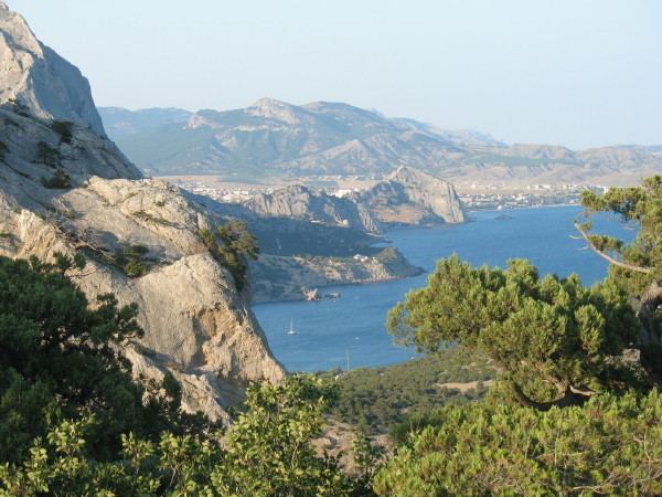
Crimean Mountains
The southeast coast is flanked at a distance of 8–12 kilometres (5.0–7.5 mi) from the sea by a parallel range of mountains, the Crimean Mountains. These mountains are backed by secondary parallel ranges.
The main range of these mountains shoots up with extraordinary abruptness from the deep floor of the Black Sea to an altitude of 600–1,545 metres (1,969–5,069 ft), beginning at the southwest point of the peninsula, called Cape Fiolente. It was believed that this cape was supposedly crowned with the temple of Artemis, where Iphigeneia is said to have officiated as priestess. Uchan-su, on the south slope of the mountains, is the highest waterfall in Crimea.
Hydrography
There are 257 rivers and major streams on the Crimean peninsula which are primarily fed by rainwater, with snowmelt playing a very minor role. This means there is significant annual fluctuation in water flow with many streams drying up completely during the summer. The largest rivers are the Salhir (Salğır, Салгир), the Kacha (Кача), the Alma (Альма), and the Belbek (Бельбек). Also important are the Kokozka (Kökköz or Коккозка), the Indole (Indol or Индо́л), the Chorna (Çorğun, Chernaya or Чёрная), the Derekoika (Dereköy or Дерекойка), the Karasu-Bashi (Biyuk-Karasu or Биюк-Карасу) (tributary of Salhir river), the Burulcha (Бурульча) (tributary of Salhir river), the Uchan-su, and the Ulu-Uzen'. The longest river of Crimea is the Salhir at 204 km. The Belbek has the greatest average discharge at 2.16 cubic metres per second (76 cu ft/s). The Alma and the Kacha are the second and third longest rivers.
There are more than fifty salt lakes and salt pans on the peninsula, the largest of them is Lake Sasyk (Сасык) on the southwest coast, but others include Aqtas, Koyashskoye, Kiyatskoe, Kirleutskoe, Kizil-Yar, Bakalskoe, and Donuzlav. The general trend is for the former lakes to become salt pans. Lake Syvash (Sıvaş or Сива́ш) is a system of interconnected shallow lagoons on the northern coast, which covers an area of around 2,560 km2. There are a number of dams that have created reservoirs, among the largest are the Simferopolskoye, Alminskoye, the Taygansky and the Belogorsky just south of Bilohirsk in Bilohirsk Raion. The North Crimea Canal, which transports water from the Dnieper, is the largest of the man-made irrigation channels on the peninsula.
Steppe
Seventy-five percent of the remaining area of Crimea consists of semiarid prairie lands, a southward continuation of the Pontic-Caspian steppe, which slope gently to the northwest from the foot of the Crimean Mountains. Numerous kurgans, or burial mounds, of the ancient Scythians are scattered across the Crimean steppes.
Crimean Riviera
The terrain that lies beyond the sheltering Crimean Mountain range is of an altogether different character. Here, the narrow strip of coast and the slopes of the mountains are smothered with greenery. This "riviera" stretches along the southeast coast from capes Fiolente and Aya, in the south, to Feodosiya, and is studded with summer sea-bathing resorts such as Alupka, Yalta, Gurzuf, Alushta, Sudak, and Feodosiya. During the years of Soviet rule, the resorts and dachas of this coast served as the prime perquisites of the politically loyal.why here? and ref? In addition, vineyards and fruit orchards are located in the region. Fishing, mining, and the production of essential oils are also important. Numerous Crimean Tatar villages, mosques, monasteries, and palaces of the Russian imperial family and nobles are found here, as well as picturesque ancient Greek and medieval castles.
The Crimean Mountains and the southern coast are part of the Crimean Submediterranean forest complex ecoregion. The natural vegetation consists of scrublands, woodlands, and forests, with a climate and vegetation similar to the Mediterranean Basin.
Climate
Crimea is located between the temperate and subtropical climate belts and is characterized by warm and sunny weather. It is characterized by the diversity and presence of microclimates. The northern parts of Crimea have a moderate continental climate with short, mild winters and moderately hot dry summers. In the central and mountainous areas, the climate is transitional between the continental climate to the north and the Mediterranean climate to the south. Winters are mild at lower altitudes (in the foothills) and colder at higher altitdues. Summers are hot at lower altitudes and warm in the mountains. A subtropical, Mediterranean climate is found in the southern coastal regions, and is characterized by mild winters and moderately hot, dry summers.
The climate of Crimea is influenced by its geographic location, relief, and influences from the Black sea. The Crimean coast is shielded from cold air masses coming from north and as a result has milder winters. Maritime influences from the Black Sea are restricted to coastal areas; inside the peninsula, the influence is weak and does not play an important role. Because a high pressure system is located north of Crimea in both summer and winter, winds predominantly come from the north and northeast year-round. In winter, these winds bring in cold, dry continental air while in summer, it brings in dry and hot weather. Winds from the northwest bring warm and wet air from the Atlantic Ocean and are responsible for bringing precipitation during spring and summer. As well, winds from the southwest bring very warm and wet air from the subtropical latitudes of the Atlantic Ocean and the Mediterranean sea and are responsible for bringing precipitation during fall and winter.
Mean annual temperatures range from 10 °C (50.0 °F) in the far north (Armiansk) to 13 °C (55.4 °F) in the far south (Yalta). In the mountains, the mean annual temperature is around 5.7 °C (42.3 °F). For every 100 m (330 ft) increase in altitude, temperatures decrease by 0.65 °C (1.17 °F) while precipitation increases. In January, mean temperatures range from −3 °C (26.6 °F) in Armiansl to 4.4 °C (39.9 °F) in Myskhor. Cool season temperatures average around 7 °C (44.6 °F) and it is rare for the weather to drop below freezing except in the mountains, where there is usually snow. In July, mean temperatures range from 15.4 °C (59.7 °F) in Ai-Petri to 23.4 °C (74.1 °F) in the central parts of Crimea to 24.4 °C (75.9 °F) in Myskhor. The frost free period ranges from 160–200 days in the steppe and mountains regions to 240–260 days on the south coast.
Precipitation in Crimea varies significantly based on location; it ranges from 310 millimetres (12.2 in) in Chornomorske to 1,220 millimetres (48.0 in) at the highest altitudes in the Crimean mountains. The Crimean mountains greatly influence the amount of precipitation present in the peninsula. However, most of Crimea (88.5%) receives 300 to 500 millimetres (11.8 to 19.7 in) of precipitation per year. The plains usually receive 300 to 400 millimetres (11.8 to 15.7 in) of precipitation per year, increasing to 560 millimetres (22.0 in) in the southern coast at sea level. The western parts of the Crimean mountains receive more than 1,000 millimetres (39.4 in) of precipitation per year. Snowfall is predominant in the mountains during winter.
Most of the peninsula receives more than 2,000 sunshine hours per year; it reaches up to 2,505 sunshine hours in Karabi–Yayla in the Crimean mountains. As a result, the climate is favorable for recreation and tourism. Because of its climate and subsidized travel packages from Russian state-run companies, the southern Crimean coast has remained a popular resort for Russian tourists.
Strategic value
The Black Sea ports of Crimea provide quick access to the Eastern Mediterranean, Balkans and Middle East. Historically, possession of the southern coast of Crimea was sought after by most empires of the greater region since antiquity (Roman, Byzantine, Ottoman, Russian, British and French, Nazi German, Soviet).
The Dnieper River is a major waterway and transportation route that crosses the European continent from north to south and ultimately links the Black Sea with the Baltic Sea, of strategic importance since the historical trade route from the Varangians to the Greeks. The Black Sea serves as an economic thoroughfare connecting the Caucasus region and the Caspian Sea to central and Eastern Europe.
According to the International Transport Workers' Federation, in 2013 there were at least 12 operating merchant seaports in Crimea.
Economy
The main branches of the modern Crimean economy are tourism and agriculture. Industrial plants are situated for the most part in the northern regions of the republic. Important industrial cities include Dzhankoy, housing a major railway connection, Krasnoperekopsk and Armyansk, among others. Since the Russian annexation of Crimea in early 2014 and subsequent sanctions targeting Crimea, the tourist industry has suffered major losses. The flow of holidaymakers dropped 35 percent in the first half of 2015 over the same period of 2014.
The most important industries in Crimea include food production, chemical fields, mechanical engineering and metal working, and fuel production industries. Sixty percent of the industry market belongs to food production. There are a total of 291 large industrial enterprises and 1002 small business enterprises.
Agriculture in the region includes cereals, vegetable-growing, gardening, and wine-making, particularly in the Yalta and Massandra regions. Livestock production includes cattle breeding, poultry keeping, and sheep breeding. Other products produced on the Crimean Peninsula include salt, porphyry, limestone, and ironstone (found around Kerch) since ancient times.
In 2014, the republic's annual GDP was $4.3 billion (500 times smaller than the size of Russia's economy). The average salary was $290 per month. The budget deficit was $1 billion.
Energy
Crimea also possesses several natural gas fields both onshore and offshore, which were starting to be drilled by western oil and gas companies before annexation. The inland fields are located in Chornomorske and Dzhankoy, while offshore fields are located in the western coast in the Black Sea and in the northeastern coast in the Azov Sea:
The republic also possesses two oil fields: one onshore, the Serebryankse oil field in Rozdolne, and one offshore, the Subbotina oil field in the Black Sea.
Crimea has 540 MW of its own electricity generation capacity including Simferopol Thermal Power Plant (100 MW), Sevastopol Thermal Power Plant (22 MW) and Kamish-Burunskaya Thermal Polwer Plant (19 MW).
Infrastructure
In May 2015, work began on a multibillion-dollar road-rail bridge across the Kerch Strait, sometimes referred to as 'Putin's Bridge'. It is projected to be fully completed and operational by 2019.
Almost every settlement in Crimea is connected with another settlement by bus lines. Crimea contains the longest (96 km or 59 mi) trolleybus route in the world, stretching from Simferopol to Yalta. The trolleybus line starts near Simferopol's Railway Station (at Soviet age start near Simferopol International Airport) through the mountains to Alushta and on to Yalta. The length of line is about 90 km. It was founded in 1959.
Railroad lines running through Crimea include Armyansk—Kerch (with a link to Feodosiya), and Melitopol—Sevastopol (with a link to Yevpatoria), connecting Crimea to the Ukrainian mainland.
The cities of Yalta, Feodosiya, Kerch, Sevastopol, Chornomorske and Yevpatoria are connected to one another by sea routes. In the cities of Yevpatoria and nearby townlet Molochnoye are tram systems.
Tourism
The development of Crimea as a holiday destination began in the second half of the 19th century. The development of the transport networks brought masses of tourists from central parts of the Russian Empire. At the beginning of the 20th century, a major development of palaces, villas, and dachas began—most of which remain. These are some of the main attractions of Crimea as a tourist destination. There are many Crimean legends about famous touristic places, which attract the attention of tourists.
A new phase of tourist development began when the Soviet government realised the potential of the healing quality of the local air, lakes and therapeutic muds. It became a "health" destination for Soviet workers, and hundreds of thousands of Soviet tourists visited Crimea.
Artek is a former Young Pioneer camp on the Black Sea in the town of Hurzuf, near Ayu-Dag, established in 1925. In 1969 it had an area of 3.2 km². The camp consisted of 150 buildings Unlike most of the young pioneer camps, Artek was an all-year camp, due to the warm climate. Artek was considered to be a privilege for Soviet children during its existence, as well as for children from other communist countries. During its heyday, 27,000 children a year vacationed at Artek. Between 1925 and 1969 the camp hosted 300,000 children. After the breaking up of the Young Pioneers in 1991 its prestige declined, though it remained a popular vacation destination.
In the 1990s, Crimea became more of a get-away destination than a "health-improvement" destination. The most visited areas are the south shore of Crimea with cities of Yalta and Alushta, the western shore – Eupatoria and Saki, and the south-eastern shore – Feodosia and Sudak. According to National Geographic, Crimea was among the top 20 travel destinations in 2013.
Places of interest include
Sanctions
Following Russia's unrecognized annexation of Crimea, the European Union, the United States, Canada, Australia, Japan, and several other countries (including Ukraine) imposed economic sanctions against Russia, including some specifically targeting Crimea. Many of these sanctions were directed at individuals—both Russian and Crimean. In general they prohibit the sale, supply, transfer, or export of goods and technology in several sectors, including services directly related to tourism and infrastructure. They list seven ports where cruise ships cannot dock. Sanctions against individuals include travel bans and asset freezes. In December 2014, Visa and MasterCard have stopped service in Crimea.
Demographics
As of 2007, the estimate of the total population of the Autonomous Republic of Crimea and Sevastopol was at 2.352 million people, just slightly down from the count of the 2001 Ukrainian Census at 2.413 million.
According to the 2014 Russian census, 84% of Crimean inhabitants named Russian as their native language; 7.9% – Crimean Tatar; 3.7% – Tatar; and 3.3% – Ukrainian. It was the first official Russian census in Crimea since Ukrainian that held in 2001.
According to the 2001 census, 77% of Crimean inhabitants named Russian as their native language; 11.4% – Crimean Tatar; and 10.1% – Ukrainian. In 2013, however, the Crimean Tatar language was estimated to be on the brink of extinction, being taught in Crimea only in around 15 schools at that point. Turkey provided the greatest support to Tatars in Ukraine, which had been unable to resolve the problem of education in their mother tongue in Crimea, by bringing the schools to a modern state.
Ethnic composition of Crimea's population has changed dramatically since the early 20th century. The 1897 Russian Empire Census for the Taurida Governorate reported: 196,854 (13.06%) Crimean Tatars, 404,463 (27.94%) Russians and 611,121 (42.21%) Ukrainians. But these numbers included Berdyansky, Dneprovsky and Melitopolsky uyezds which were on mainland, not in Crimea. The population number excluding these uyezds is given in the table below.
Crimean Tatars, a predominantly Muslim ethnic minority who in 2001 made up 12.1% of the population, formed in Crimea in the late Middle Ages, after the Crimean Khanate had come into existence. The Crimean Tatars were forcibly expelled to Central Asia by Joseph Stalin's government as a form of collective punishment, on the grounds that they had formed pro-German Tatar Legions. After the fall of the Soviet Union, Crimean Tatars began to return to the region. According to the 2001 Ukrainian population census 58% of the population of Crimea are ethnic Russians and 24% are ethnic Ukrainians.
Jews in Crimea were historically Krymchaks and Karaites (the latter a small group centered at Yevpatoria). The 1879 census for the Taurida Governorate reported a Jewish population of 4.20%, not including a Karaite population of 0.43%. The Krymchaks (but not the Karaites) were targeted for annihilation during Nazi occupation.
The number of Crimea Germans was 60,000 in 1939. During WWII, they were forcibly deported on the orders of Stalin, as they were regarded as a potential "fifth column". This was part of the 800,000 Germans in Russia who were relocated within the Soviet Union during Stalinist times. The 2001 Ukrainian census reports just 2,500 ethnic Germans (0.1% of population) in Crimea.
Besides the Crimean Germans, Stalin in 1944 also deported 70,000 Greeks, 14,000 Bulgarians and 3,000 Italians.
Culture
Almost 100 broadcasters and around 1,200 publications are registered in Crimea, although no more than a few dozen operate or publish regularly. Of them most use the Russian language only. Crimea's first Tatar-owned, Tatar-language TV launched in 2006.
Alexander Pushkin visited Bakhchysarai in 1820 and later wrote the poem The Fountain of Bakhchisaray. Crimea was the background for Adam Mickiewicz's seminal work, The Crimean Sonnets inspired by his 1825 travel. A series of 18 sonnets constitute an artistic telling of a journey to and through the Crimea, they feature romantic descriptions of the oriental nature and culture of the East which show the despair of an exile longing for the homeland, driven from his home by a violent enemy.
Ivan Aivazovsky, the 19th-century marine painter of Armenian origin, who is considered one of the major artists of his era was born in Feodosia and lived there for the most part of his life. Many of his paintings depict the Black Sea. He also created battle paintings during the Crimean War.
Vasily Aksyonov published The Island of Crimea in 1979, in which he predicted the annexation.
Crimean Tatar singer Jamala won the Eurovision Song Contest 2016 with her song 1944, about the historic deportation of Crimean Tatars in that year by Soviet authorities.
Sport
Following Crimea's vote to join Russia and subsequent annexation in March 2014, the top football clubs withdrew from the Ukrainian leagues. Some clubs registered to join the Russian leagues but the Football Federation of Ukraine objected. UEFA ruled that Crimean clubs could not join the Russian leagues but should instead be part of a Crimean league system. The Crimean Premier League is now the top professional football league in Crimea.
A number of Crimean born athletes have been given permission to compete for Russia instead of Ukraine at future competitions, including Vera Rebrik, the European javelin champion.