
- elevation 0 m (0 ft) Basin area 516,300 km² | - elevation 220 m (722 ft) Length 2,201 km | |
 | ||
- average 1,670 m/s (58,975 cu ft/s) Bridges Moskovskyi Bridge, Paton Bridge, Pivdennyi Bridge | ||
Ukraine river cruise travel video dnieper river tour in europe
The Dnieper River ( /ˈdniːpə/, /ˈniːpər/) (also known as: Dnepr (/ˈdnjɛpə/, Dnyapro or Dnipro (/dniːˈprəʊ/) is one of the major rivers of Europe (fourth by length), rising near Smolensk, Russia and flowing through Russia, Belarus and Ukraine to the Black Sea. It is the longest river of Ukraine and Belarus and the fourth longest river in Europe. The total length ranges between 2,145 km (1,333 mi) and 2,201 km (1,368 mi) with a drainage basin of 504,000 square kilometres (195,000 sq mi). The river is noted for its dams and hydroelectric stations. The Dnieper is an important navigable waterway for the economy of Ukraine and is connected via the Dnieper–Bug Canal to other waterways in Europe.
Contents
- Ukraine river cruise travel video dnieper river tour in europe
- Map of Dnieper river
- Istanbul kiev from the black sea to the dnieper documentary discovery history
- Etymology
- Geography
- Tributaries of the Dnieper
- Rapids
- Channel
- Fauna
- Reservoirs and hydroelectric power
- Regions
- Cities
- Navigation
- Literature
- Visual arts
- Popular culture
- Ecology
- References
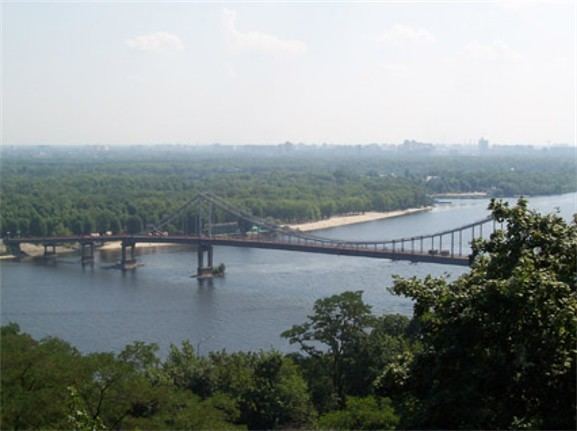
Map of Dnieper river
In antiquity, the river was known to the Greeks as the Borysthenes and was part of the Amber Road. Arheimar, a capital of the Goths, was located on the Dnieper, according to the Hervarar saga.
Istanbul kiev from the black sea to the dnieper documentary discovery history
Etymology
The name Dnieper is derived from Sarmatian Dānu apara "the river on the far side". (By contrast, the Dniester derives from "the close river".) According to V. Abaev (expert on Scytho-Sarmatian languages) the name Dnieper derives from Scythian Dānu apr (Dānapr) "deep river", while the name Dniester is combination of Scythian Dānu (river) and Thracian Ister, the old name of Dniester.
In the three countries through which it flows it has essentially the same name, albeit pronounced differently:
The river is mentioned by the Ancient Greek historian Herodotus in the 5th century BC as Borysthenes (Βορυσθένης), as well as by Strabo; this name is Scythian (cf. Iranian *varu-stāna) and translates as "wide land", referring most likely to the Ukrainian steppe. The late Greek and Roman authors called it Δάναπρις - Danapris and Danaper respectively - (dana in Old Persian meant "river"); this form is derived from Sarmatian Dānu apara "the river on the far side". Its Old East Slavic name used at the time of Kievan Rus' was Slavuta or Slavutych, the Huns called it Var, and Bulgars - Buri-Chai. The name in Crimean Tatar: Özü.
Geography
The total length of the river is 2,145 kilometres (1,333 mi), of which 485 km (301 mi) are within Russia, 700 km (430 mi) are within Belarus, and 1,095 km (680 mi) are within Ukraine. Its basin covers 504,000 square kilometres (195,000 sq mi), of which 289,000 km2 (112,000 sq mi) are within Ukraine, 118,360 km2 (45,700 sq mi) are within Belarus.
The source of the Dnieper is the sedge bogs (Akseninsky Mokh) of the Valdai Hills in central Russia, at an elevation of 220 m (720 ft). For 115 km (71 mi) of its length, it serves as the border between Belarus and Ukraine. Its estuary, or liman, used to be defended by the strong fortress of Ochakiv.
On the Dnepr River to the south of Komarin urban-type settlement, Braghin District, Gomel Region the southern extreme point of Belarus is situated.
Tributaries of the Dnieper
The Dnieper has many tributaries (up to 32,000) with 89 being rivers of 100+ km. The main ones, in orographic sequence, are:
Many small direct tributaries also exist, such as, in the Kiev area, the Syrets (right bank) in the north of the city, the historically significant Lybid (right bank) passing west of the centre, and the Borshahivka (right bank) to the south.
The water resources of the Dnieper basin compose around 80% out of all Ukraine.
Rapids
Dnieper rapids were part of trade route from the Varangians to the Greeks, first mentioned in the Kiev Chronicle. The route was probably established in the late eighth and early ninth centuries and gained significant importance from the tenth until the first third of the eleventh century. On the Dnieper the Varangians had to portage their ships round seven rapids, where they had to be on guard for Pecheneg nomads.
Along this middle flow of the Dnieper, there were nine major rapids (although some sources cite a fewer number of them), obstructing almost the whole width of the river, about 30–40 smaller rapids, obstructing only part of the river, and about 60 islands and islets.
After Dnieper Hydroelectric Station was built in 1932, they were inundated by Dnieper Reservoir.
Channel
There are a number of channels:
– The Dnieper–Donbas Canal;
– The Dnieper–Kryvyi Rih Canal;
– The Kakhovka Canal (south-east of the Kherson region);
– The Krasnoznamianka Irrigation System in the south-west of the Kherson region;
– The North Crimean Canal—will largely solve the water problem of the peninsula, especially in the arid northern and eastern Crimea;
– The Inhulets Irrigation System.
Fauna
The river is part of the quagga mussel's native range. The mussel has been accidentally introduced around the world where it has become an invasive species.
Reservoirs and hydroelectric power
From the Mouth of the Prypiat River to the Kakhovka Hydroelectric Station, there are six sets of dams and hydroelectric stations, which produce 10% of Ukraine's electricity.
The first constructed was the Dnieper Hydroelectric Station (or DniproHES) near Zaporizhia, built in 1927–1932 with an output of 558 MW. It was destroyed during World War II, but was rebuilt in 1948 with an output of 750 MW.
Regions
Cities
Major cities, over 100,000 in population, are in bold script. Cities and towns located on the Dnieper are listed in order from the river's source (in Russia) to its mouth (in Ukraine):
Arheimar, a capital of the Goths, was located on the Dnieper, according to the Hervarar saga.
Navigation
Almost 2,000 km (1,200 mi) of the river is navigational (to the city of Dorogobuzh). The Dnieper is important for the transport and economy of Ukraine: its reservoirs have large ship locks, allowing vessels of up to 270 by 18 metres (886 ft × 59 ft) to access as far as the port of Kiev and thus create an important transport corridor. The river is used by passenger vessels as well. Inland cruises on the rivers Danube and Dnieper have been a growing market in recent decades.
Upstream from Kiev, the Dnieper receives the water of the Pripyat River. This navigable river connects to the Dnieper-Bug canal, the link with the Bug River. Historically, a connection with the Western European waterways was possible, but a weir without a ship lock near the town of Brest has interrupted this international waterway. Poor political relations between Western Europe and Belarus mean there is little likelihood of re-opening this waterway in the near future.
Navigation is interrupted each year by freezing in winter, and severe winter storms.
Literature
The River Dnieper has been a subject of chapter X of a story by Nikolai Gogol A Terrible Vengeance (1831, published in 1832 as a part of the Evenings on a Farm Near Dikanka short stories collection). It is considered as a classical example of description of the nature in Russian literature. The river was also described in the works of Taras Shevchenko.
Visual arts
The River Dnieper has been a subject for artists, great and minor, over the centuries. Major artists with works based on the Dnieper are Arkhip Kuindzhi and Ivan Aivazovsky.
Popular culture
Ecology
The Dnieper River is close to the Prydniprovsky Chemical Plant radioactive dumps (near Kamianske), and susceptible to leakages of radioactive waste. The river is also close to the Chernobyl Nuclear Power Station (Chernobyl Exclusion Zone) that is located next to the mouth of the Prypiat River.