
Basin area 63,700 km² Country Ukraine | Length 806 km Discharge 108 m³/s | |
 | ||
Similar Donets, Multimedia Fountain Roshen, Bulvar Flots'kiy, Werwolf, Mykolaev Zoo | ||
The Southern Bug, also called Southern Buh (Ukrainian: Південний Буг, Pivdennyi Buh; Russian: Южный Буг, Yuzhny Bug), and sometimes Boh River, is a river located in Ukraine. It is the second-longest river in Ukraine.
Contents
- Map of Pivdennyi Buh River Ukraine
- Nomenclature etymology and history
- Bridges and ferries
- Navigation
- References
Map of Pivdennyi Buh River, Ukraine
The source of the river is in the west of Ukraine, in the Volyn-Podillia Upland, about 145 kilometres (90 mi) from the Polish border, from where it flows southeasterly into the Bug Estuary (Black Sea basin) through the southern steppes. It is 806 kilometres (501 mi) long and drains 63,700 square kilometres (24,600 sq mi).
Major cities on the Southern Bug are Khmelnytskyi, Vinnytsia, Pervomaisk, Mykolaiv (listed downstream, i.e. southwards).
Between 1941 and 1944 during World War II the Southern Bug formed the border between the German-occupied Ukraine and the Romanian-occupied part of Ukraine, called Transnistria.
Nomenclature, etymology and history
(Ukrainian: Південний Буг, Pivdennyi Buh; Ukrainian: Бог; Polish: Boh; Russian: Южный Буг, Yuzhny Bug, Ottoman Turkish: Aksu)
Herodotus (c. 484–425 BCE) refers to the river using its ancient Greek name: Hypanis. During the Migration Period of the 5th to the 8th centuries CE the Southern Bug represented a major obstacle to all the migrating peoples in the area.
The long-standing local Slavic name of the river, Boh (Cyrillic: Бог), may derive from a root meaning "rich" (Ukrainian: бaгата, bahata). The famous 17th-century French military engineer and geographer Guillaume Le Vasseur de Beauplan (Ukrainian: Ґійом Левассер де Боплан ) recorded the name of the river as Boh Ruthenian (Ukrainian: Бог Руський, Boh Ruskyi).
From the 16th to the 18th centuries most of the Southern Ukraine formed part of the Crimean Khanate and/or of the Ottoman Empire; the river had the Turkic name Aq-su, meaning the "White river".
"Bug", a Russian name, became established during the colonial period in Ukraine and known internationally. It was a misnomer given by a Russian geologist Vladimir Laskaryev at the beginning of 20th century.
On March 6, 1918 the Central Council of Ukraine (Tsentralna Rada of the Ukrainian People's Republic) adopted the law "For the administrative-territorial division of Ukraine", dividing Ukraine into numerous lands. One of those lands in the upper stream of the river was named "Boh land" (Ukrainian: Побожжя, Pobozhia). Previously in the 18th century there had existed the Bohogard phalanx (Ukrainian: Бoгоґардівська паланка, Bohogardivska palanka) as part of the Zaporizhian Sich centered in the city of Gard (today – a tract near Yuzhnoukrainsk).
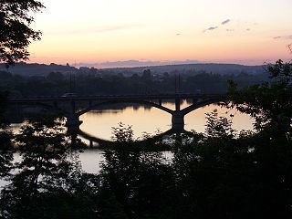
Bridges and ferries
The Varvarivskyi Bridge over Southern Bug in Mykolayiv is a swing bridge (facilitating ship building) with Europe's largest span (134 m). It is also the southernmost bridge over the river.
Navigation
The river is technically navigable for dozens of kilometers up from its mouth; several riverports (such as Voznesensk) exist.
In 2011, plans are announced to revitalize commercial freight navigation on the Southern Bug as part of the increasing grain export from Ukraine. They were cancelled because of the economic crisis following the 2014 Ukrainian revolution.