
Country Region Kanto Governor Masaru Hashimoto | Area 6,095.58 km2 Capital | |
Colleges and Universities University of Tsukuba Points of interest Destinations | ||
Population 2.96 million (Mar 31, 2012) | ||
Map of Ibaraki Prefecture
Ibaraki Prefecture (茨城県, Ibaraki-ken) is a prefecture of Japan, located in the Kantō region on the main island of Honshu. The capital is Mito.
Contents
- Map of Ibaraki Prefecture
- Trip to japan daigomachi ibaraki prefecture
- Tsunami in hitachinaka ibaraki prefecture japan
- History
- Geography
- Cities
- Towns and villages
- Economy
- Demographics
- Culture
- University
- Sports
- Football soccer
- Volleyball
- Rugby
- Baseball
- Puroresu
- Tourism
- Railways
- Cable cars
- Expressways
- National highways
- Ports
- Airports
- Pronunciation
- References
Trip to japan daigomachi ibaraki prefecture
Tsunami in hitachinaka ibaraki prefecture japan
History
Ibaraki Prefecture was previously known as Hitachi Province. In 1871, the name of the province became Ibaraki.
Geography
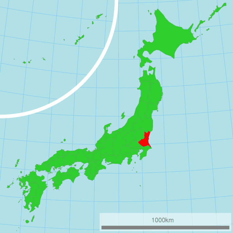
Ibaraki Prefecture is the northeastern part of the Kantō region, stretching between Tochigi Prefecture and the Pacific Ocean and bounded on the north and south by Fukushima Prefecture and Chiba Prefecture. It also has a border on the southwest with Saitama Prefecture. The northernmost part of the prefecture is mountainous, but most of the prefecture is a flat plain with many lakes.
As of 1 April 2012, 15% of the total land area of the prefecture was designated as Natural Parks, namely Suigo-Tsukuba Quasi-National Park and nine Prefectural Natural Parks.
Cities
Thirty-two (32) cities are located in Ibaraki Prefecture:
Towns and villages
These are the towns and villages in each district:
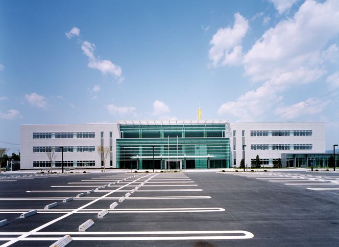
Economy
Ibaraki's industries include energy, particularly nuclear energy, production, as well as chemical and precision machining industries. The Hitachi company was founded in the Ibaraki city of the same name.
As of March 2011, the prefecture produced 25% of Japan's bell peppers and Chinese cabbage.
Demographics
Ibaraki's population is increasing modestly as the Greater Tokyo region spreads out.
Culture
Ibaraki is known for nattō, or fermented soybeans, in Mito, watermelons in Kyōwa (recently merged into Chikusei), and chestnuts in the Nishiibaraki region.
Ibaraki is famous for the martial art of Aikido founded by Ueshiba Morihei, also known as Osensei. Ueshiba spent the latter part of his life in the town of Iwama, now part of Kasama, and the Aiki Shrine and dojo he created still remain.
There are castle ruins in many cities, including Mito, Kasama, and Yūki.
Kasama is famous for Shinto, art culture and pottery.
The capital Mito is home to Kairakuen, one of Japan's three most celebrated gardens, and famous for its over 3,000 Japanese plum trees of over 100 varieties.
University
Sports
The sports teams listed below are based in Ibaraki.
Football (soccer)
Volleyball
Rugby
Baseball
Puroresu
Tourism
Railways
Cable cars
Expressways
National highways
Ports
Airports
Pronunciation
The prefecture is often mispronounced "Ibaragi". However, the correct pronunciation is "Ibaraki". According to the author of "Not Ibaragi, Ibaraki", this is most likely due to a mishearing of the softening of the "k" sound in Ibaraki dialect.