
District HIgashiibaraki Population 19,955 (Sep 2015) | Region Kantō Area 161.8 km² Local time Sunday 6:10 AM | |
 | ||
Weather 4°C, Wind NW at 14 km/h, 74% Humidity Points of interest Gozenyama, Keisokusan, Iwasawajirikannon Hot Spring, Akazawafuji, Hanakazukisan | ||
Shirosato (城里町, Shirosato-machi) is a town located in Higashiibaraki District, Ibaraki Prefecture, in the northern Kantō region of Japan. As of September 2015, the town had an estimated population of 19,955 and a population density of 123 persons per km². Its total area was 161.80 km².
Contents
- Map of Shirosato Higashiibaraki District Ibaraki Prefecture Japan
- Geography
- Surrounding municipalities
- History
- Education
- Train
- Highway
- Noted people from Shirosato
- References
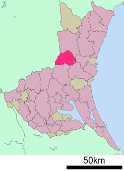
Map of Shirosato, Higashiibaraki District, Ibaraki Prefecture, Japan
Geography
Located in central-west Ibaraki Prefecture, Shinsato is bordered by Tochigi Prefecture to the west. The Naka River passes through the town.
Surrounding municipalities
History
Shirosato was formed on February 1, 2005, from the merger of the town of Jōhoku, the village of Katsura, both from Higashiibaraki District, and the village of Nanakai, from Nishiibaraki District.
Education
Train
Highway
Noted people from Shirosato
References
Shirosato, Ibaraki Wikipedia(Text) CC BY-SA