
Area 69.94 km² Local time Monday 4:36 PM | Region Kantō Population 109,651 (2010) | |
 | ||
Weather 12°C, Wind S at 18 km/h, 67% Humidity University | ||
Toride (取手市, Toride-shi) is a city located in Ibaraki Prefecture, in the northern Kantō region of Japan. As of September 2015, the city had an estimated population of 106,691 and a population density of 1530 persons per km². Its total area was 69.94 km².
Contents
- Map of Toride Ibaraki Prefecture Japan
- Geography
- Surrounding municipalities
- History
- Economy
- Education
- Train
- Highway
- Sister city relations
- References
Map of Toride, Ibaraki Prefecture, Japan
Geography
Located in southern Ibaraki Prefecture, Toride is bordered by Chiba Prefecture to the south. The Tone River passes along the southern border of Toride, which also marks the Ibaraki/Chiba border. It is approximately 40 kilometers from central Tokyo.
Surrounding municipalities
History
Toride developed in the Edo period as a post town on the Mito Kaido highway connecting Edo with Mito. Toride town was created with the establishment of the municipalities system on April 1, 1889. It was elevated to city status on October 1, 1970. On March 28, 2005, the neighboring town of Fujishiro (from Kitasōma District) was merged into Toride, nearly doubling its size.
Economy
Due to its proximity to Tokyo, Toride is increasingly a bedroom community for the Tokyo metropolis.
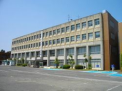
Education
Takahagi has ten public and one private elementary schools, six public and two private middle schools and five public and two private high schools. In addition, the Tokyo University of the Arts maintains a campus at Toride.