
- Flower Golden-rayed lily Population 15,911 (Sep 2015) Number of airports 1 | Region Kantō - Tree Wild cherry tree Area 66.61 km² Local time Wednesday 11:27 AM | |
 | ||
Weather 12°C, Wind NW at 32 km/h, 48% Humidity | ||
Miho (美浦村, Miho-mura) is a town located in Inashiki District, Ibaraki Prefecture, in the northern Kantō region of Japan. As of September 2015, the village had an estimated population of 15,977 and a population density of 240 persons per km². Its total area was 66.61 km².
Contents
- Map of Miho Inashiki District Ibaraki Prefecture Japan
- Geography
- Surrounding municipalities
- History
- Economy
- Education
- Railway
- Highway
- Local attractions
- International relations
- Noted people from Miho
- References
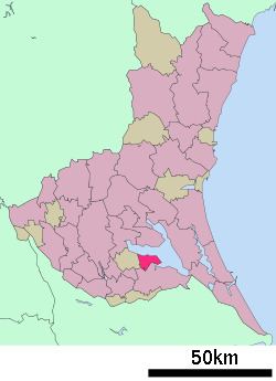
Map of Miho, Inashiki District, Ibaraki Prefecture, Japan
Geography
Located in southern Ibaraki Prefecture, Miho is bordered by Lake Kasumigaura to the north and east.
Surrounding municipalities
History
The villages of Kihara and Anju were created with the establishment of the municipalities system on April 1, 1889. The two villages were merged to form the village of Miho on April 1, 1955.
Economy
The economy of Miho is primarily agricultural, including aquaculture on Lake Kasumigaura.
Education
Railway
Highway
Local attractions
International relations
Noted people from Miho
References
Miho, Ibaraki Wikipedia(Text) CC BY-SA