
Governing body U.S. Forest Service Phone +1 208-373-4100 | Visitors 1,180,000 (in 2009) Area 8,918 km² Established 1908 | |
 | ||
Hours Closed today SundayClosedMonday8AM–4:30PMTuesday8AM–4:30PMWednesday8AM–4:30PMThursday8AM–4:30PMFriday8AM–4:30PMSaturdayClosed Profiles | ||
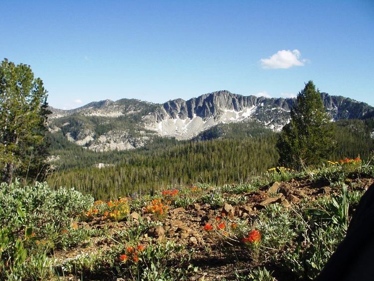
Middle fork payette river on the boise national forest in idaho
Boise National Forest is a federally protected area covering 2,203,703 acres (8,918.07 km2) of the U.S. state of Idaho as part of the national forest system. Created on July 1, 1908 from part of Sawtooth National Forest, it is managed by the U.S. Forest Service as five units: the Cascade, Emmett, Idaho City, Lowman, and Mountain Home ranger districts.
Contents
- Middle fork payette river on the boise national forest in idaho
- Boise national forest job opportunities
- History
- US Forest Service
- Management
- Geography and geology
- Waterways
- Climate
- Recreation
- Winter activities
- Scenic roads
- References
The Idaho Batholith underlays most of Boise National Forest, forming the forest's Boise, Salmon River, and West mountain ranges; the forest reaches a maximum elevation of 9,730 feet (2,970 m) on Steel Mountain. Common land cover includes sagebrush steppe and spruce-fir forests; there are 9,600 miles (15,400 km) of streams and rivers and 15,400 acres (62 km2) of lakes and reservoirs. Boise National Forest contains 75 percent of the known populations of Sacajawea's bitterroot, a flowering plant endemic to Idaho.
The Shoshone people occupied the forest before European settlers arrived in the early 1800s. Many of the early settlers were trappers and prospectors before gold was discovered in 1862. After the 1860s Boise Basin gold rush ended, mining of tungsten, silver, antimony, and gold continued in the forest until the mid-twentieth century. Recreation opportunities and facilities include over 70 campgrounds, whitewater and flatwater boating, cabin rentals, and 1,300 miles (2,100 km) of trails for hiking, biking, horseback riding, and motorized off-road vehicle use. The Forest Service has an objective to maintain timber, range, water, recreation, and wildlife for multiple use and sustained yield of its resources.
Boise national forest job opportunities
History
Archaeological evidence indicates that human habitation in Idaho began towards the end of the last ice age: bone fragments about 10,000 years old have been found in Wilson Butte Cave, an inflationary cave on the Snake River Plain believed to have been occupied by indigenous people until as recently as the 17th century. A change of climate around 7000 years ago dried up much of the Great Basin, forcing the Shoshone people northward into the mountainous areas of central Idaho. Most of what is now Boise National Forest was sparsely inhabited by Native Americans, and several archaeological sites, including campsites, rock shelters, burial grounds, and pictographs have been found along rivers in the area. Trappers and fur traders of European descent first arrived in the area in the early 1800s, starting with John Jacob Astor's Pacific Fur Company in October 1811. Donald Mackenzie and Francois Payette trapped in the area of Boise National Forest in 1819. By 1840 the fur trade was coming to an end, but the westward migration on the Oregon Trail, which passed south of the forest, was beginning. The first settlers moved into the mountains in the 1860s after gold was discovered in Idaho, which forced many of the Shoshone out and led to conflicts throughout the state, including the Bannock War in southern Idaho.
Prospectors George Grimes and Moses Splawn were the first to discover gold in the forest at the eponymous Grimes Creek on August 2, 1862. Subsequent gold discoveries at Rocky Bar in 1863 and Atlanta in 1864 increased the rush of people to Idaho, and in 1863 Idaho City, with a population of 6,267, surpassed Portland, Oregon as the largest city in the Pacific Northwest. The Idaho gold rush was largely over by 1870, and the population of the Boise Basin fell from 16,000 to 3,500. In 1898 the forest's first gold dredge was built in Placerville and followed by several others. By 1951 when the last dredges shut down, at least 2.3 million ounces (65.2 million grams) of gold had been produced from the Boise Basin area. Silver was mined along the Crooked River from 1882 until 1921, but a silver mine at Silver Mountain proved unsuccessful. Following a shortage of mercury during World War II, mines in the Stibnite area became the country's largest producer of tungsten and second largest source of mercury. The most important known placer deposit of niobium and tantalum in the United States is located in Bear Valley. From 1953 until 1959 dredges there produced $12.5 million ($103 million today) in niobium, tantalum, and uranium. Other minerals mined in the forest include antimony and molybdenum.
U.S. Forest Service
Boise National Forest was created on July 1, 1908 from part of Sawtooth National Forest, and originally covered 1,147,360 acres (4,643.2 km2). By the Forest Reserve Act of 1891, the U.S. Congress granted the U.S. President the authority to establish forest reserves out of Public Domain Lands that were subject to disposal (homesteads, sales, etc.) administered by the General Land Office, which had been placed under the authority of the U.S. Department of the Interior in 1849. With the passage of the Transfer Act of 1905, forest reserves were transferred to the U.S. Department of Agriculture in the newly created U.S. Forest Service. Present-day Boise National Forest was first protected as part of two forest reserves by proclamations issued by President Theodore Roosevelt: Sawtooth Forest Reserve (created on May 29, 1905 and expanded on November 6, 1906) and Payette Forest Reserve (created on June 3, 1905). After forest reserves were renamed national forests in 1908, Boise National Forest was split from Sawtooth National Forest into an independent national forest. On April 1, 1944 the entirety of what was then Payette National Forest was transferred to Boise National Forest, and simultaneously Weiser and Idaho national forests were combined to reestablish the present-day Payette National Forest, which is to the north of Boise National Forest. In 1933 the Boise Basin Experimental Forest was created on 8,740 acres (35.4 km2) of the forest near Idaho City to study the management of ponderosa pine. The Lucky Peak Nursery was established in 1959 to produce trees for planting on burned or logged lands on the national forests of the Intermountain region.
After the creation of the Civilian Conservation Corps (CCC) in 1933, nine camps and eight subcamps were set up in Boise National Forest, but the number of camps was reduced from 1934 until the program was closed in 1942. Work conducted by the CCC included fire suppression, fish habitat improvement, and construction of guard houses, fire lookouts, campgrounds, roads, and trails, among other facilities.
Management
Boise National Forest is managed by the U.S. Forest Service, an agency within the Department of Agriculture, as five units called ranger districts. The ranger districts are Cascade (400,000 acres or 1,600 square kilometers), Emmett (350,000 acres or 1,400 square kilometers), Idaho City (400,000 acres), Lowman (400,000 acres), and Mountain Home (650,000 acres or 2,600 square kilometers); each has an office in their respective cities and is managed by a district ranger, while forest headquarters are located in the city of Boise. Congress proclaimed 2,648,273 acres (10,717.18 km2) of Idaho part of Boise National Forest, but the forest manages only 2,203,703 acres (8,918.07 km2). The proclaimed boundary is set and can only be changed by Congress whereas the administered boundary can be shifted among adjacent national forests without congressional approval. For management (and from the visitor's perspective) the forest's boundaries are its administered area.
Geography and geology
Elevations in the forest range from 2,800 feet (850 m) in the North Fork Payette River Canyon to 9,730 feet (2,970 m) at the top of Steel Mountain, a gain of 6,930 feet (2,110 m). The forest contains several subranges of the Rocky Mountains, including the Boise, Salmon River, and West mountain ranges. Much of the forest is underlain by the Idaho Batholith, and the forest is dominated by granitic rock, but intrusions of basalt can be found to the west and other volcanic rocks to the south.
North of the South Fork Payette River and east of the North Fork Payette River, the forest is part of the Salmon River Mountains, which extend north and east outside the forest's boundaries. The South Fork Salmon River Range and the North Fork Range are subranges of the Salmon River Mountains within Boise National Forest. The Boise Mountains cover much of the southern portion of the forest and contain the forest's highest point, Steel Mountain, but the range's highest point, Two Point Mountain, lies outside of the forest's boundary. The Trinity Mountains are a subrange in southeastern part of the Boise Mountains that reach their peak at 9,451 feet (2,881 m) on Trinity Mountain. The westernmost portion of the forest south and west of Lake Cascade are part of the West Mountains, which reach their highest point at 8,320 feet (2,540 m) on Snowbank Mountain. The Danskin Mountains are a smaller range on the forest's southern border that run northwest to southeast.
Waterways
There are an estimated 9,600 miles (15,400 km) of perennial and intermittent streams and 15,400 acres (62 km2) of lakes and reservoirs in the forest. The Forest Service provides access to and recreation opportunities at the seven reservoirs it borders, although it does not own or manage them. There are numerous natural lakes in the forest, most of which are tarns created by alpine glaciers during the Pleistocene. The largest, Warm Lake, is 26 miles (42 km) east of Cascade in Valley County; many of the smaller lakes are in the Trinity and West mountains. Annual water yield on the forest is estimated at 4.1 million acre-feet (5.1 × 10⁹ m3). The southern portion of the forest is drained by the Boise River, the central and western portions by the Payette River, northeastern portion by the Salmon River, and far western portions of the Emmett Ranger District by the Weiser River. All four rivers are tributaries of the Snake River, which itself is a tributary of the Columbia River in the Pacific basin.
Climate
Daily high temperatures range from 9 to 29 °F (−13 to −2 °C) in winter to 80 to 90 °F (27 to 32 °C) in summer, while lower elevations can experience conditions over 100 °F (38 °C). Idaho's mountain ranges can block Arctic air in the winter, but when cold air masses do enter the area, they sometimes stagnate in the Snake and Salmon river valleys, causing very cold temperatures to persist. Summer and fall are generally dry, while intense short-duration thunderstorms can occur in late spring and early summer as atmospheric moisture interacts with warm temperatures and steep topography via orographic lifting. During winter, warm, moist air from the Pacific Ocean often brings rain at lower elevations in addition to snowfall throughout the forest. The influence of these Pacific maritime air masses increases as latitude increases in the forest. Average annual snowfall ranges from 55 inches (140 cm) in drier areas and at lower elevations to 70 inches (180 cm) in wetter locations and higher elevations. The growing season within the forest ranges from over 150 days in lower elevations to less than 30 days in alpine areas.
Recreation
There are over 70 campgrounds in Boise National Forest and groups of more developed recreation facilities at the Trinity Mountains, Warm Lake, and Deadwood and Sage Hen reservoirs. As in most national forests, the majority of the land in Boise National Forest is open to dispersed camping (outside of developed campgrounds). One of the forest's fire lookouts, Deadwood Lookout, is now available as a cabin for the public to rent, among other sites. Bicycles are allowed on forest roads and on more than 1,300 miles (2,100 km) of multiple-use trails, whereas over 1,200 miles (1,900 km) of trails are open to motorized recreation. The Danskin Mountains Off-Highway Vehicle Trail System contains 150 miles (240 km) of motorcycle and ATV trails on 60,000 acres (24,000 ha) of land that is generally open from April through November. The forest's Trinity Mountain Recreation Area includes the highest drivable (4-wheel drive recommended) road in Idaho, which ascends to the Trinity Mountain Lookout at an elevation of over 9,400 feet (2,900 m). In 2013 revenues from recreation and special use fees amounted to $454,635, while expenses totaled US$352,550; the difference is allocated to the following season's startup costs.
Waterways
Rivers in Boise National Forest offer the opportunity for rafting and kayaking through rapids up to class four, with the most difficult sections on the South Fork and main stems of the Payette River. Numerous developed boat launch sites provide access to rivers for whitewater enthusiasts, and Dagger Falls is the primary launching site for visitors to the Middle Fork of the Salmon River and Frank Church River of No Return Wilderness. Motorized boating is permitted on Anderson Ranch Reservoir, Deadwood Reservoir, and Warm Lake.
Winter activities
During winter, visitors to the forest can participate in activities including snowmobiling, snowshoeing, and downhill and cross-country skiing. The Bogus Basin ski area is located within the forest north of Boise and has 7 chairlifts and 53 runs on 2,600 acres (11 km2) of skiable terrain. There are 137 miles (220 km) of groomed snowmobile trails in the Garden Valley system in the Emmett Ranger District and several Mongolian-style yurts available for rental in winter.
Scenic roads
Boise National Forest is home to three of Idaho's scenic byways, all of which are paved highways accessible to roadworthy vehicles. The Payette River Scenic Byway is an 80-mile (130 km) route between Eagle and McCall on Idaho State Highway 55. The route follows the Payette River between McCall and Horseshoe Bend, but the majority of the highway does not pass through Boise National Forest; only a small portion north of Horseshoe Bend is in the Emmett Ranger District. Over half of the 35-mile (56 km) Wildlife Canyon Scenic Byway, which travels between highway 55 and Lowman, passes through the forest, parallels the South Fork of the Payette River, and is signed as the Banks-Lowman Road. The Ponderosa Pine Scenic Byway is a 130-mile (210 km) road between Stanley and Boise following Idaho State Highway 21. This route passes over Arrowrock Reservoir and through Idaho City and Lowman, where it connects with the Wildlife Canyon Byway. North and east of Lowman the byway partially follows the South Fork of the Payette River before ascending to the 7,037-foot (2,145 m) Banner Creek Summit at the forest's boundary with Salmon-Challis National Forest.