
Purpose Water storage Opening date 1948 Surface area 121.7 km² Total capacity 854.9 million m³ | Construction began 1942, 1946 Type of dam Zoned earthfill Catchment area 1,606 km² | |
 | ||
Owner United States Bureau of Reclamation | ||
2016 lake cascade ice fishing trip
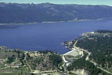
Lake Cascade (formerly "Cascade Reservoir", also formerly known as Payette Lake "The Mile High Playground" ) is a reservoir in the western United States, on the North Fork of the Payette River in Valley County, Idaho. Located in the Boise National Forest, it has a surface area of 47 square miles (122 km2), and is the fourth largest lake or reservoir in the state. The closest cities are Cascade, Donnelly, and McCall, all in the Long Valley of Valley County.
Contents
- 2016 lake cascade ice fishing trip
- Map of Lake Cascade Idaho USA
- RecreationEdit
- Sport fish restorationEdit
- Water qualityEdit
- Tamarack ResortEdit
- References
Map of Lake Cascade, Idaho, USA
Following a delay due to World War II, the earthen dam was built by the Bureau of Reclamation, and completed in 1948. The term "Lake Cascade" came into common use in the 1990s, with the federal name change made in 1999.
RecreationEdit
The lake contains perch, trout, smallmouth bass, Kokanee salmon, and Coho salmon for anglers and there is a beautiful winter ice fishing season. Lake Cascade State Park has several units around the lake.
Sport fish restorationEdit
In 2003 the Idaho Department of Fish and Game (IDFG) proposed draining Lake Cascade to facilitate the removal of pikeminnow and the addition of sport fish, such as perch. Pikeminnows are a problem in Lake Cascade because they are predators that live up to 15 years and compete for food stocks. Issues involved in mitigating damage during the lowering of the lake level include maintaining an adequate supply for irrigation, providing a steady stream for power, maintaining salmon flow augmentation, and other water rights. The U.S. Bureau of Reclamation manages the reservoir and estimated the draining could take place over the course of a year at a cost of $100,000 to $300,000. The U. S. Bureau of Reclamation withdrew its application for an Environmental Impact Statement studying the drawdown citing "that the draining of Lake Cascade is not a viable option for sport fish restoration."
Water qualityEdit
The lake experienced a bloom of blue-green algae in 1993 caused by low water, high phosphorus content, and hot weather. Studies of water quality found phosphorus to be present in high levels which contributed to the algal bloom. Beginning in 1995, the water quality was monitored and an improvement plan was implemented to lower the phosphorus by 37 percent. By 2003 the lake had 57 percent less phosphorus than the initial monitoring in 1995 due to the best management practices adopted in the drainage basin of the lake.
Tamarack ResortEdit
Tamarack Resort is located on the west shore of the reservoir, southwest of Donnelly.