
- elevation 6,083 ft (1,854 m) - elevation 2,825 ft (861 m) Length 182 km Source Cloochman Creek | - average 1,299 cu ft/s (37 m/s) Discharge 36.78 m³/s | |
 | ||
Bridges North Fork Payette River Bridge | ||
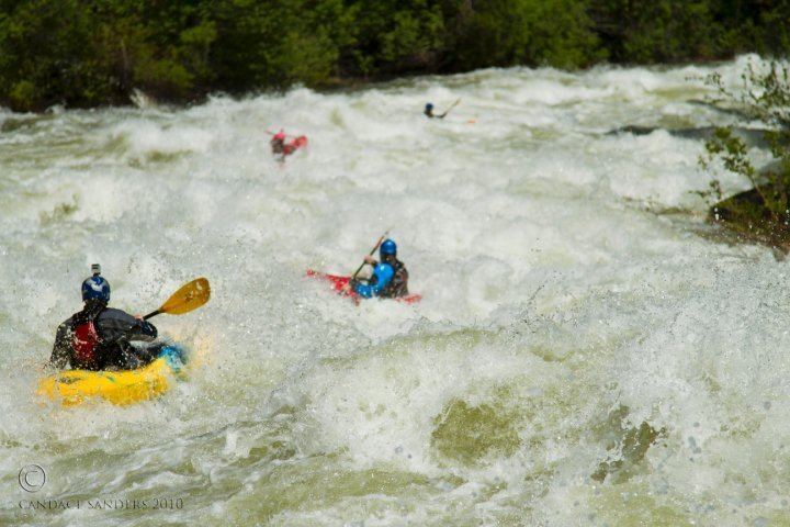
North fork payette river jacobs ladder v
The North Fork Payette River is a river in western Idaho in the United States. It stretches over 113 miles (182 km) from north to south, flowing from the Salmon River Mountains to near Banks, where it joins with the South Fork Payette River to form the Payette River, a tributary of the Snake River. Its watershed comprises more than 900 square miles (2,300 km2) of forested mountains and sprawling lakes and wetlands.
Contents
- North fork payette river jacobs ladder v
- Map of North Fork Payette River Idaho USA
- Gopro kayaking north fork payette river
- CourseEdit
- References
Map of North Fork Payette River, Idaho, USA
Gopro kayaking north fork payette river
CourseEdit
It rises at the confluence of two small streams, Trail Creek and Cloochman Creek, in a meadow deep within the Payette National Forest. The river flows south into Upper Payette Lake then further in that direction through a deep valley into Payette Lake, which lies at the northern end of Long Valley. The river exits from the southern end of the lake near McCall and flows southwards through the broad valley into Lake Cascade, a huge reservoir formed by Cascade Dam. While part of the lake, the North Fork Payette River receives the Lake Fork, its largest tributary, which descends from the mountains to the northeast.
The river leaves the Cascade Dam at Cascade and 5 mi (8.0 km) later enters a gorge, leaving the Long Valley. Idaho State Highway 55 follows the river as it courses south-southwest through the canyon. The gorge starts out as a valley only about 700 feet (210 m) deep, but as the river nears the mouth, it attains its maximum depth below the rim at nearly 3,000 feet (910 m). The North Fork joins with the South Fork near the village of Banks, at an elevation of 2,825 feet (861 m). From there, the river is known as the main stem of the Payette and flows 62 miles (100 km) further west to its confluence with the Snake River near Ontario, Oregon.