
Country United States FIPS code 16-13150 Elevation 1,451 m Population 904 (2013) Area code 208 | Time zone Mountain (MST) (UTC-7) GNIS feature ID 0396241 Zip code 83611 Local time Sunday 5:38 PM | |
 | ||
Weather -1°C, Wind SW at 14 km/h, 59% Humidity Area 12.59 km² (10.8 km² Land / 179 ha Water) | ||
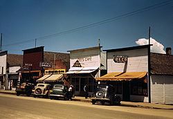
Idaho tourism summer in cascade idaho
Cascade is a rural city in and the county seat of Valley County, Idaho, United States, in the west central part of the state. The population was 939 at the 2010 census, down from 997 in 2000.
Contents
- Idaho tourism summer in cascade idaho
- Map of Cascade ID 83611 USA
- Cascade idaho summer 2016
- Geography
- Highways
- 2010 census
- 2000 census
- Climate
- Notable people
- References
Map of Cascade, ID 83611, USA
Cascade is located on the southeast shore of Lake Cascade, formerly known as "Cascade Reservoir." With the introduction of the Tamarack Resort in 2004, the name was officially changed to sidestep the negative marketing connotations of "reservoir." It was formed by the completion of Cascade Dam, on the north side of the city. Construction by the Bureau of Reclamation began in 1942, was halted during World War II, and completed in 1948.
Cascade was the home of a sizable Boise Cascade sawmill, which closed in May 2001.
The recreational city of McCall is 29 mi (47 km) north, and the village of Donnelly is a little over midway, via Highway 55. The Tamarack Resort is across the reservoir to the northwest.
Cascade idaho summer 2016
Geography
Cascade is located at 44°30′56″N 116°2′37″W (44.515575, -116.043681). at an elevation of 4,760 feet (1,451 m) above sea level.
According to the United States Census Bureau, the city has a total area of 4.86 square miles (12.59 km2), of which, 4.17 square miles (10.80 km2) is land and 0.69 square miles (1.79 km2) is water.
Highways
Cascade is approximately 70 miles (110 km) north of Boise, accessed via State Highway 55, the Payette River Scenic Byway, a designated national scenic byway. It heads north from Eagle in Ada County to Horseshoe Bend in Boise County, and climbs the whitewater of the Payette River to Cascade. SH-55 continues north to McCall, where it turns west at Payette Lake and continues to New Meadows in Adams County, ending at the junction with US-95.
2010 census
As of the census of 2010, there were 939 people, 416 households, and 256 families residing in the city. The population density was 225.2 inhabitants per square mile (87.0/km2). There were 847 housing units at an average density of 203.1 per square mile (78.4/km2). The racial makeup of the city was 96.5% White, 0.2% African American, 0.9% Native American, 0.2% Asian, 0.6% from other races, and 1.6% from two or more races. Hispanic or Latino of any race were 2.7% of the population.
There were 416 households of which 24.5% had children under the age of 18 living with them, 48.6% were married couples living together, 9.6% had a female householder with no husband present, 3.4% had a male householder with no wife present, and 38.5% were non-families. 32.0% of all households were made up of individuals and 12.5% had someone living alone who was 65 years of age or older. The average household size was 2.20 and the average family size was 2.77.
The median age in the city was 46.4 years. 19.6% of residents were under the age of 18; 8.7% were between the ages of 18 and 24; 19.9% were from 25 to 44; 33.9% were from 45 to 64; and 18% were 65 years of age or older. The gender makeup of the city was 50.7% male and 49.3% female.
2000 census
As of the census of 2000, there were 997 people, 421 households, and 282 families residing in the city. The population density was 275.8 people per square mile (106.6/km²). There were 562 housing units at an average density of 155.5 per square mile (60.1/km²). The racial makeup of the city was 95.59% White, 0.10% African American, 0.40% Native American, 0.30% Asian, 0.10% Pacific Islander, 1.60% from other races, and 1.91% from two or more races. Hispanic or Latino of any race were 2.21% of the population. 22.6% were of German, 12.7% English, 11.4% Irish, 8.7% American and 5.8% French ancestry according to Census 2000.
There were 421 households out of which 30.4% had children under the age of 18 living with them, 51.1% were married couples living together, 10.2% had a female householder with no husband present, and 33.0% were non-families. 29.2% of all households were made up of individuals and 10.5% had someone living alone who was 65 years of age or older. The average household size was 2.32 and the average family size was 2.83.
In the city, the population was spread out with 27.0% under the age of 18, 4.3% from 18 to 24, 25.3% from 25 to 44, 26.5% from 45 to 64, and 17.0% who were 65 years of age or older. The median age was 40 years. For every 100 females there were 102.2 males. For every 100 females age 18 and over, there were 99.5 males.
The median income for a household in the city was $32,411, and the median income for a family was $37,813. Males had a median income of $36,250 versus $20,139 for females. The per capita income for the city was $17,330. About 9.3% of families and 12.1% of the population were below the poverty line, including 20.1% of those under age 18 and 9.0% of those age 65 or over.
Climate
Cascade experiences a humid continental climate (Köppen abbreviation Dsb) with long, cold, snowy winters and short, warm, dry summers.