
Founded October 1, 1812 Website www.stlouisco.com Unemployment rate 5.3% (Apr 2015) | Area 1,355 km² Population 1.001 million (2013) | |
 | ||
Destinations Colleges and Universities Washington University in St Louis, University of Missouri, Webster University, Maryville University, Missouri Baptist University | ||
St. Louis County is a county located in the far eastern portion of Missouri. It is bounded by the Mississippi River, the Missouri River, the Meramec River, and the state of Illinois. As of the 2015 Census Bureau population estimate, the population was 1,003,362, making it the most populous county in Missouri. Its county seat is Clayton.
Contents
- Map of St Louis County MO USA
- Colonial settlement and early government
- Prewar growth and early education
- Government changes and early courthouses
- Separation of St Louis and St Louis County
- Post separation political issues
- Growth of education and municipalities
- Post World War II era
- Geography
- Natural boundaries
- Topography
- Geology
- Flora and fauna
- Climate
- Other geography
- Demographics
- Economy
- Arts and culture
- West County
- Mid County
- North County
- South County
- Parks and recreation
- Government
- Crime and Public Safety
- Politics
- Education
- Health care
- Communities
- Other
- References
Map of St Louis County, MO, USA
St. Louis County borders, but does not include, the city of St. Louis, which is an independent city. It is included in the St. Louis, MO-IL Metropolitan Statistical Area.
Colonial settlement and early government
During the 18th century, several settlements were established in the area that would become St. Louis County. The earliest of these, St. Louis, was begun by Pierre Laclede and Auguste Chouteau on February 14, 1764. Founded in about 1767 was Carondelet, which was at the southern end of what is now St. Louis (annexation of Carondelet took place in 1871). Florissant, then known as St. Ferdinand, was established in 1785 about twelve miles northwest of St. Louis on a tributary of the Missouri River. During the 1790s, very small settlements known as Creve Coeur and Point Labadie were built north and west of St. Louis.
Upon the transfer of French Louisiana to the United States on October 1, 1804, President Thomas Jefferson suggested that the territory retain the districts drawn by Spanish officials during their rule of the territory. During this time, the first governing body of St. Louis County (aside from earlier, Spanish governors of the district) was established. This government, called the Court of Quarter Sessions, was composed of Charles Gratiot, Auguste Chouteau, Jacques Clamorgan, and David Delauney; the court held judicial, executive, and legislative power. On October 1, 1812, the District of St. Louis was renamed St. Louis County (exactly eight years after its establishment) during a reorganization of the territory's status.
Prewar growth and early education
After the transfer of Louisiana to the United States, the authority to grant incorporation to municipalities became territorial and, later, state power. The first to gain municipal status in St. Louis County was St. Louis, which incorporated on November 9, 1809 under the territorial legislature, and gained city status on December 9, 1822. Only a handful of other municipal incorporations took place prior to the separation of the county and city: St. Ferdinand was granted incorporation in 1829 (and reincorporated as Florissant in 1843), while Bridgeton, a settlement along the Missouri River near Florissant, gained incorporation in 1843.
Two towns grew substantially and incorporated as a result of the building of the Pacific Railroad (later the Missouri Pacific Railroad) in the 1850s: Pacific and Kirkwood. Pacific, known before the railroad line connection as Franklin, straddles St. Louis County and Franklin County; it incorporated as Pacific in 1859. Kirkwood was settled in 1853 after Hiram Leffingwell and Richard Elliott platted and auctioned land along the railroad line; they named their settlement after James P. Kirkwood, who planned the route of the railroad through the area. Leffingwell organized the town as a planned suburb (the first west of the Mississippi), and Kirkwood was granted incorporation by the state in 1865.
Other areas of the county began to be settled during this period but did not incorporate as towns. Among these were Chesterfield and Gumbo, both settled in the 1820s in west St. Louis County, and Gravois and Affton which were settled in south St. Louis County in the 1850s and 1860s.
Aside from the first St. Louis Public Schools that were established in the 1830s, some of the settlements of St. Louis County began providing public education in the 1840s and 1850s. In 1854, the [Maplewood] Richmond Heights High School|School District of Maplewood]] was established, which included all of today's Maplewood district, part of what became Webster Groves along the south and southwest, a large part of St. Louis in the east, and to the north up to Clayton Road. The first school, originally called the Washington Institute and later renamed Maplewood High School, opened as a one-room stone building at the crossing of Manchester Road over the Missouri Pacific Railroad tracks. Another antebellum school district was Rock Hill, which provided a one-room school across from the Rock Hill Presbyterian Church until about 1870.
The first school in Florissant opened in 1819 under the direction of the Religious of the Sacred Heart, a Roman Catholic religious congregation. The instructor, Rose Philippine Duchesne, was a French immigrant who has been described as "one of the foremost educators in the state of Missouri." A second school, initially an Indian school known as the St. Regis Academy, operated for young boys from 1823 to 1829; the school also included a Jesuit seminary known as St. Stanislaus Seminary, which continued to operate until 1971. The earliest public school in Florissant was the St. Ferdinand School, which was authorized by the General Assembly in 1845 and operated until 1871, when the Florissant School District was formed.
Government changes and early courthouses
From 1813 to 1830, the county underwent several changes to its government. By an act of the territorial legislature, the Court of Quarter Sessions was succeeded by a panel of three judges of common pleas in 1813. Two years later, this panel was succeeded by a newly created county court composed of justices of the peace from the county elected to three month terms. In 1816, after only one year of the previous system, the St. Louis County Circuit Court (itself established in 1815 as the judicial branch of the county) was given authority over the executive and legislative affairs of the county. In 1821, a hybrid County and Probate Court was established and given executive and legislative control, and in 1830, its probate functions ceased. This County Court operated as the government of St. Louis County until public scandals encouraged the state legislature to abolish it and replace it in 1859 with a Board of Commissioners.
Sessions of the County Court and other county governing bodies were held in a variety of locations during this early period. The Court of Quarter Sessions held its first meeting in 1804 at a tavern in St. Louis, then regularly at a building at Third and Plum until 1817. The county seat moved that year to a newly built one-story log cabin on Third Street between Elm and Spruce, followed by a move to the brick Baptist Church at Third and Market in 1820. The County Court established a commission in 1822 to study a permanent courthouse (previous facilities were rented), and in 1823, Auguste Chouteau and John Baptiste Charles Lucas donated two tracts of land that formed a vacant square bounded by Broadway, Fourth, Chestnut, and Market.
Between the summer of 1826 and 1833, on this vacant tract was built a low-roofed two-story brick structure fronting Fourth Street that was the first permanent courthouse for St. Louis County. Within a few years, however, the building's size was inadequate for the county government's needs; the original building was left in place during construction on the new building, which began in 1839. This new courthouse, now known as the Old Courthouse, included a finished rotunda, dome, and west wing by 1843; the 1833 courthouse was demolished in 1851, and by 1856, the east wing was complete.
Separation of St. Louis and St. Louis County
It was during the antebellum period that the first attempts were made at separating the city of St. Louis, then the county's largest municipality, from the county. In 1843, a group of St. Louis city residents petitioned the state legislature to separate the two entities; however, the General Assembly only passed a resolution calling for a referendum on the subject among county voters outside the city. This vote, held on August 7, 1844, showed a majority of county voters opposed separation.
Despite the vote, controversy continued and tension mounted between the county government and the city government during the 1840s and 1850s. Much of the dispute involved the double taxation of city residents and their proportionally lesser representation in county government. The reform of 1859, in which the County Court was abolished by the state government and replaced by a Board of Commissioners, was in large part a reaction to city outcry over mismanagement of tax money. More than a name change, the reform expanded the size of the county government council to seven members, with four seats set aside for city representation (the city, however, had roughly ten times the population of the county at that time). The reform temporarily ameliorated the tensions, and in 1863, the General Assembly restored the name of the county government to its former name of County Court.
As with the 1844 vote that opposed separation, despite reforms, controversy returned and grew during the 1860s. This was in much part because although representation on the County Court had improved for city residents, the county continued to tax city residents for the same services that the city provided and for which the city taxed them. Several plans began to circulate during the late 1860s that would relieve this burden, including home rule status for St. Louis, further reorganization of the County Court to ensure greater representation, city-county government consolidation, and separation of the two entities. The General Assembly considered several plans during this period, and in March 1871, it passed a further reorganization of the County Court; the new Court would have an at-large presiding judge, four seats reserved for city residents, and two seats for county residents. This reform, however, pleased virtually no one pushing for reform and made little practical difference in the operation of the county government.
Thus a consolidation plan proceeded in the General Assembly in 1871, backed by city political leaders Anthony Ittner and Roderick E. Rombauer. The Missouri Republican newspaper strongly backed the approach, while the Missouri Democrat argued it would lead city leaders into corruption. The latter pressed for a separation plan, support for which was led by David H. Armstrong. The separation plan gained greater support when it became clear that the mistrust between city and county residents precluded consolidation. A citizen group known as the Taxpayers League formed in 1872 to advance the separation cause, and city leaders looked to Baltimore, which had separated from Baltimore County in 1853, as an example.
The mechanism by which separation took place began in 1875 at the state constitutional convention. At the convention, a committee examined the issues of St. Louis government, and it summarized the two options facing the region as consolidation and separation. The full convention voted to include a provision in the constitution allowing for separation by a vote of 53 in favor, 4 opposed, 11 absent. Only one member of the St. Louis delegation opposed separation:
I am in favor of total consolidation of St. Louis County, but I am not in favor of dividing it, splitting and hacking it in this manner...I vote no.
In 1877, the City of St. Louis separated itself from the county, creating an independent city. The city in August 1876 narrowly approved the separation while county residents overwhelmingly opposed the separation. City residents had argued they wanted to be "rid of county taxes and state influence over county government." At the time the city had 350,000 residents while the rural county had 30,000. The rural county also had only 150 miles of gravel roads. The election was challenged in the courts and they were formally separated in March 1877.
Post-separation political issues
The first meeting of the new County Court took place on January 22, 1877 at the home of James C. Sutton, in what is now Maplewood, and the three judges appointed a new county clerk, sheriff, and treasurer. They also announced at that meeting that the new Court was functional (obviating the legal standing of the previous County Court, which continued to meet albeit without legal function until July 1877) and the transfer of all county buildings and property in the city of St. Louis to the city government. Thus the county's courthouse in St. Louis became city property. The Court also requested that the city of St. Louis continue to provide police protection to some areas of the county until the county could provide these services.
On January 29, 1877, the Court considered a report that recommended Kirkwood as the new county seat, but did not decide the issue at that time. The Court continued to meet at the Sutton House in Maplewood until February 1877, when it convened at the Des Peres Grange Hall; it agreed then to rent space at the Mount Olive Hotel, in what is now University City, until deciding on a new location for the courthouse. The Court continued to meet at the Mount Olive Hotel from March 1877 to 1879. Throughout 1877, the Court debated the question of the county seat; after rejecting several sites, including Kirkwood and Florissant, in September 1877 the Court accepted the donation of 100 acres of land on Hanley Road by a farmer named Ralph Clayton. In addition to the benefit of donated land, the site was chosen because it was on the route of the Hodiamont streetcar line, which connected from St. Louis to Florissant. An additional four acres were given by M.F. Hanley, and in May 1878, the cornerstone was laid for a new county courthouse. In October 1878 the courthouse donation and streets were platted in what would become the town of Clayton. The new courthouse and jail opened in December 1878, at a cost of $38,000. Two additions were made to the courthouse in 1912 and in 1926.
Growth of education and municipalities
In the years from the Civil War to World War I, relatively few new towns incorporated in St. Louis County; the first to incorporate after the war, Fenton, was incorporated in 1874 in southwest St. Louis County. Webster Groves incorporated in 1896, prompted by residents' demands for a police department after the murder of Bertram Atwater, a commercial artist from Chicago. Webster had earlier been settled in 1853 as a stop on the Missouri Pacific line.
Other incorporations before World War I included University City in 1906 near Washington University in St. Louis; Maplewood in 1908, also along the Missouri Pacific railroad line; Wellston in 1908 in north county near Florissant; Shrewsbury in 1913 north of Webster Groves; Clayton in 1913 south of University City; and Richmond Heights in 1913 south of Clayton. State law required only that 50% of residents agree to incorporation via a petition for a legal incorporation to take place; the county government had no ability to restrict the incorporation if the 50% threshold were met. Significant suburban growth in the early 20th century set off a rapid increase in the number of incorporations after 1935.
After the Civil War, dozens of school districts opened in St. Louis County to provide basic primary education. In Eureka, along the Missouri Pacific line to Pacific, a one-room log school opened in the town in 1870, which was expanded to two stories and four rooms in about 1900. In the towns of Old Orchard and Webster Groves along the Missouri Pacific line, a school opened in 1867 and 1868, respectively. In Kirkwood, private schools began operating within a few years of the first settlers purchasing lots in 1853; in the early 1860s, these included the Kirkwood Seminary (which closed in 1889), the Kirkwood Military Academy, St. Peter Catholic School, and Concordia Lutheran School. The first public schools in Kirkwood opened in 1866 as part of the newly formed Kirkwood School District; the district provided two years of high school in 1873 and opened a four-year Kirkwood High School in 1896.
In some areas, formerly private schools became part of new public districts. In Florissant, the St. Ferdinand School (opened in 1845) became part of the Florissant School District in 1871, although it continued to be staffed by nuns; the first school in the newly formed district opened in 1876 near St. Ferdinand and Washington Streets. In Ballwin, a school opened in 1855 by German Methodists was bought by a newly formed Ballwin School District in 1869; the one-room schoolhouse operated until 1900, when a two-room building opened as a replacement.
Post-World War II era
A new courthouse was built in 1945 (it is today's County Police headquarters). The original 1878 courthouse was torn down in 1971 to be replaced by county government plaza and modern six-story courthouse.
Several changes took place in St. Louis County education after World War II. The Florissant School District and the Ferguson School District merged in October 1951 to form the Ferguson-Florissant School District. As part of a court-ordered desegregation plan, the Ferguson-Florissant district annexed the Kinloch School District and the Berkeley School District in 1975.
In 1955, St. Louis County established the St. Louis County Police Department, with jurisdiction throughout the county. In 1977, St. Louis County was terrorized by three car bombings, which killed two people. The bomber was never caught.
The county became larger than the city in the 1970 U.S. Census when it had 951,353 compared to the city's 622,236 . With the city dropping to its lowest population since the 19th century in the 2010 U.S. Census and the county also dropping in population for the first time in its history there has been talk of the two entities reuniting.
Geography
According to the U.S. Census Bureau, the county has a total area of 523 square miles (1,350 km2), of which 508 square miles (1,320 km2) is land and 15 square miles (39 km2) (2.9%) is water.
Natural boundaries
The Missouri River forms the northern border with St. Charles County, exclusive of a few areas where the river has changed its course. The Meramec River forms most of its southern border with Jefferson County. To the east is the City of St. Louis and the Mississippi River. The western boundary with Franklin County is the north-south line where the distance between the Meramec and Missouri Rivers is the shortest, bisecting the City of Pacific roughly 2 blocks east of Hwy OO/F (First street).
Topography
The foothills of the Ozark Mountains begin in southwestern St. Louis County, with most of the rest of the county being a fairly level plateau. This western part of the county is the least developed, due to rugged topography. Bluffs along the Mississippi in the south of the county rise about 200–300 feet above the river. A major floodplain area is the Chesterfield Valley, in the western part of the county, along the Missouri River, formerly called "Gumbo Flats" after its rich, dark soil; it was submerged by at least ten feet of water during the Great Flood of 1993, but recent development there is protected by a higher levee. The Columbia Bottom is a floodplain in the northeast of the county at the confluence of the Mississippi and Missouri Rivers; this is a conservation area open to the public. The Missouri Bottom area between the two other floodplains is largely agricultural, but is being increasingly developed. The River des Peres drains the interior of county before flowing underground into the City of St. Louis and then resurfacing to form the boundary between southern portions of St. Louis City and St. Louis County. Other streams include Coldwater Creek, Bonhomme Creek, and Creve Coeur Creek, flowing into the Missouri River; Keifer Creek, Fishpot Creek, and Grand Glaize Creek, flowing into the Meramec River; Deer Creek and Gravois Creek, flowing into the River des Peres; and Maline Creek, flowing into the Mississippi River. The highest elevation is 904 feet/275 meters.
Geology
The bedrock is mainly limestone and dolomite, and much of the county near the rivers is Karst terrain, with numerous caves, sinkholes, and springs. No igneous or metamorphic rock is exposed on the surface. A major outcropping of the St. Peter Sandstone formation, a fine white sandstone used for making clear glass, is mined in the southwest corner of the county in Pacific. Brick clay mining was once a major industry in the county. The Charbonier Bluff along the Missouri River is an outcropping of coal, and was used a fueling station for steamboats. The "St. Louis Anticline", an underground formation, has small petroleum deposits in north part of the county.
Flora and fauna
Before European settlement, the area was prairie and open parklike forest, maintained by Native Americans via burning. Trees are mainly oak, maple, and hickory, similar to the forests of the Ozarks; common understory trees include Eastern redbud, serviceberry, and flowering dogwood. Riparian areas are heavily forested with mainly American sycamore. By the 1920s most of the timber in the county was harvested; since that time, large parks and undeveloped areas in the western and southern parts of the county have grown dense forest cover. Old pastures are usually colonized with Eastern red cedar. Most of the residential area of the county is planted with large native shade trees. In Autumn, the changing color of the trees is notable. St. Louis County has the most recorded native species of plants in the state, but this is probably due to the intensive botanical research done in the area. Most species here are typical of the Eastern Woodland; but some southern species are found in swampland, and typical northern species survive in sheltered hollows. Invasive species, most notably Japanese Honeysuckle, are common in some homesteads converted to parks; these are actively removed.
Large mammals include growing populations of whitetail deer and coyotes, which are becoming increasingly urbanized. Eastern gray squirrel, cottontail rabbit, and other rodents are abundant, as well as opossum, beaver, muskrat, raccoon, and skunk. Large bird species include wild turkey, Canada goose, mallard duck, various raptors like the turkey vulture and red-tailed Hawk, as well as shorebirds, including the great egret and great blue heron. Winter populations of bald eagles are found by the Mississippi River around the Chain of Rocks Bridge. The county is on the Mississippi Flyway, used by migrating birds, and has a large variety of small bird species, common to the eastern U.S. The Eurasian tree sparrow, an introduced species, is limited in North America to the counties surrounding St. Louis.
Frogs are commonly found in the springtime, especially after extensive wet periods. Common species include American toad and species of chorus frogs, commonly called "spring peepers" that are found in nearly every pond. Some years have outbreaks of cicadas or ladybugs. Mosquitos and houseflies are common insect nuisances; because of this, windows are nearly universally fitted with screens, and "screened-in" porches are common in homes of the area. Populations of honeybees have sharply declined in recent years, and numerous species of pollinator insects have filled their ecological niche.
Climate
St. Louis County has a continental climate, and has neither large mountains nor large bodies of water to moderate its temperature. The area is affected by both cold Canadian Arctic air, and also hot, humid air from the Gulf of Mexico. The county has four distinct seasons. Spring is the wettest season and produces erratic severe weather ranging from tornadoes to winter storms. Summers are hot, and the humidity can make the heat index rise to temperatures above 100 °F (38 °C). Fall is mild with lower humidity and can produce intermittent bouts of heavy rainfall with the first snow flurries usually forming in late November. Winters are cool to cold with periodic snow and temperatures often below freezing. Winter storm systems, such as Alberta clippers, can bring days of heavy freezing rain, ice pellets, and snowfall.
The average annual temperature for the years 1971–2000, recorded at Lambert–St. Louis International Airport, is 56.3 °F (13.5 °C), and average precipitation is 36 inches (914 mm). The average high temperature in July is 88.4 °F (32 °C), and the average low temperature in January is 22.6 °F (−6 °C), although these values are often exceeded. Temperatures of 0 °F (−18 °C) or below occur 3 days per year on average. The highest temperature ever recorded in St. Louis was 115 °F (46 °C), on July 14, 1954, while the lowest temperature on record is −23 °F (−31 °C), on January 29, 1873
Winter is the driest season, averaging about 6 inches of total precipitation. Springtime (March through May), is typically the wettest season, with just under 10.5 inches. Dry spells of one or two weeks duration are common during the growing seasons.
Thunderstorms can be expected on 40 to 50 days per year. A few of them will be severe with locally destructive winds and large hail, and occasionally accompanied by tornadoes. A period of unseasonably warm weather late in Autumn known as Indian summer is common – roses will still be in bloom as late as November or early December in some years.
Other geography
The largest natural lake in the state is Creve Coeur Lake, which was originally an oxbow of the nearby Missouri River and is now the centerpiece of a popular county park.
Manchester Road (Route 100) follows an ancient path westward out of St. Louis, following the boundary between the Missouri and Meramec watersheds, and is one of only two ways to leave the county without crossing any rivers (the other being State Highway T). (Although, since the city of St. Louis is not a part of the county, any highway between the city and county would also be leaving the county without crossing a river.)
The Sinks is a karst area in the far northern part of the county, with numerous sinkholes.
Demographics
As of the census of 2010, there were 998,954 people. There were 404,765 households with 263,423 family households. The population density was 1,966 people per square mile (773/km²). There were 423,749 housing units at an average density of 834 per square mile (322/km²). The racial makeup of the county was 70.3% White (68.9% Non-Hispanic White), 23.3% African American, 0.2% Native American, 3.5% Asian, 0.03% Pacific Islander, 0.9% from other races, and 1.9% from two or more races. Hispanic or Latino of any race were 2.5% of the population.
There were 404,765 households out of which 31.0% had children under the age of 18 living with them, 51.00% were married couples living together, 12.70% had a female householder with no husband present, and 33.00% were non-families. 28.00% of all households were made up of individuals and 10.10% had someone living alone who was 65 years of age or older. The average household size was 2.47 and the average family size was 3.05.
In the county, the age distribution of the population shows 25.20% under the age of 18, 8.30% from 18 to 24, 29.00% from 25 to 44, 23.50% from 45 to 64, and 14.10% who were 65 years of age or older. The median age was 38 years. For every 100 females there were 90.00 males. For every 100 females age 18 and over, there were 85.70 males.
The median income for a household in the county was $50,532, and the median income for a family was $61,680. Males had a median income of $45,714 versus $30,278 for females. The per capita income for the county was $27,595. About 5.00% of families and 6.90% of the population were below the poverty line, including 9.30% of those under age 18 and 5.30% of those age 65 or over. St. Louis County is the most affluent county in Missouri.
Economy
As of 2009, the largest employment sectors in St. Louis County are education and health (25.2%), trade and transportation (19.6%), and professional business services (12.7%). The county also has the highest per capita income in Missouri ($49,727), and nearly one-fourth of the state workforce is employed in St. Louis County, but it accounts for 27% of the state's wages. It is home to the eighth-strongest market for technology hiring, and the world's largest concentration of plant science Ph.D.'s. The St. Louis County Economic Council is the economic development agency of St. Louis County, and it is operated under the authority of the St. Louis County government. Among the largest employers in the county are Boeing (16,000 employees), Washington University in St. Louis (13,200 employees), and SSM Healthcare (12,400 employees). As of 2013, Express Scripts has approximately 4,500 employees, with a planned expansion of 1,500 jobs to be added over the next five years.
Unemployment in St. Louis County is well below the national rate of 7.7% (November 2012) at 6.5% (October); for monthly unemployment numbers since June 2012, see below:
Arts and culture
Culturally, St. Louis County is often divided into Mid, North, West and South sections. North County lies north of Interstate 70, West County lies west of Interstate 270, South County lies south of Interstate 44 and Mid County lies in the middle of the three main bordering highways (I-70, I-270 & I-44) and the St. Louis county-city line.
West County
Some sections of West County are inhabited by pro athletes, professionals and new wealth, creating a large area of high-income residents. Communities include Ballwin, Chesterfield, Clarkson Valley, Des Peres, Ellisville, Eureka, Manchester, Town and Country, Twin Oaks, Valley Park, Creve Coeur and Wildwood. West County is home to two major shopping centers: Chesterfield Mall and West County Center. Local school districts include the Parkway School District, Valley Park School District, and the Rockwood School District along with numerous private schools. Leisure spots in West County include Bellerive Country Club and Faust Park, which is home to the Butterfly House.
Mid County
Mid County is made up of the central and eastern portion of St. Louis County. The bulk of Mid County lies just west of the City of St. Louis. Municipalities include Clayton, Maplewood, Brentwood, Webster Groves, Richmond Heights, Frontenac, Warson Woods, Ladue, Kirkwood, Rock Hill, Olivette, University City, St. Ann, and Overland. With access to Interstate 70 and Interstate 44 to the north and south of Mid County, access to Interstate 270 and Interstate 170 on the west and east and Interstate 64 running through the middle of Mid County, the area is never far from highway transportation. The closest major mall to Downtown St. Louis is the St. Louis Galleria located in Richmond Heights. Other popular areas are The Loop on Delmar Blvd. in University City and Westport Plaza in Maryland Heights. Clayton is also known for its wide variety of local shops, boutiques and original restaurants.
North County
North County is home to Boeing's Defense, Space & Security unit, Lambert-St. Louis International Airport, and Emerson Electric Company. The population is one of the most diverse in St. Louis County. Public transportation has been beneficial to North County and was the first area of Metro St. Louis served by the metropolitan rail system, MetroLink. Cities of North County also include Bellefontaine Neighbors, Bridgeton, Ferguson, Florissant, Jennings and Spanish Lake. Residents of some communities, such as Bridgeton and Hazelwood, often distinguish themselves from locations further north by labeling their area as "Northwest County." North St. Louis County is not only diverse in racial makeup but also by socioeconomic means. There are numerous black and mixed raced villages located in North-Central county along the Natural Bridge Corridor east of Interstate 170 including Glen Echo Park, Bellerive, Bel-Ridge, Bel-Nor, and Pasadena Hills, second to Olympia Fields, Illinois as the most affluent majority black community north of the Mason-Dixon line. Some of the inner-ring suburbs located between Interstate 70 and Interstate 270 along the city-county line show past and current signs of white flight.
South County
While largely populated, much of South County is unincorporated. It is the most homogeneous area within St. Louis county and major communities include Fenton, Lemay, Mehlville, Oakville, Affton, and Sunset Hills. The start of the Ozark Mountains and Ozark plateau begin in South St. Louis county and neighboring Jefferson County. Many communities have an abundance of gently rolling hills.
Parks and recreation
St. Louis County owns and maintains more than forty parks as part of its county park system, including playgrounds and nature preserves. It also operates several recreation centers, the Museum of Transportation, and the Affton Community Center. In addition to parks owned by St. Louis County, the county is home to three Missouri state parks: Babler, Castlewood, and Route 66 State Park, and part of the Big Muddy National Fish and Wildlife Refuge and the Ulysses S. Grant National Historic Site. Several municipalities in the county also own and maintain their own park systems.
Government
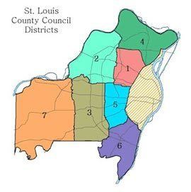
St. Louis County government is divided between executive power vested in the County Executive of St. Louis County and legislative power vested in the St. Louis County Council. The current county executive is Steve Stenger, who was elected November 5, 2014. The county executive's term is four years without term limits, and the position is elected by the population of the entire county. The council consists of seven members elected from separate districts within the county, with four year terms beginning on January 1 following elections. In 1950, St. Louis County became the first Missouri county to adopt a home-rule charter under the Missouri Constitution, and the current charter was adopted by voters on November 6, 1979.
Crime and Public Safety
The St. Louis County Police Department operates under the authority of the St. Louis County government and is the largest law enforcement agency in St. Louis County. Although it is directly responsible for law enforcement in unincorporated areas of the county, several municipalities contract with the county police for public safety services. Municipalities that maintain service agreements with the county police are Black Jack, Clarkson Valley, Dellwood, Fenton, Ferguson, Grantwood Village, Green Park, Hanley Hills, Jennings, Marlborough, Norwood Court, Pasadena Hills, Twin Oaks, Valley Park, Vinita Terrace, Wilbur Park, Wildwood, and Winchester. A total of 58 of the 90 municipalities in the county maintain their own police departments. Eighty-one of the local towns run their own courts.
St. Louis County Fire Department services are provided by 20 municipal fire departments and 23 fire protection districts. The fire protection districts exist as independent, taxing governments that are unrelated to the St. Louis County government, while the municipal fire departments are funded through municipal taxes and are administered by their respective cities. Municipal fire departments include Berkeley, Brentwood, Clayton, Crestwood, Des Peres, Ferguson, Frontenac, Glendale, Hazelwood, Jennings, Kinloch, Kirkwood, Ladue, Maplewood, Olivette, Pacific, Richmond Heights, Rock Hill, Shrewsbury, University City, and Webster Groves. Independent fire districts include Affton, Black Jack, Community, Creve Coeur, Eureka, Fenton, Florissant Valley, Kinloch, Lemay, Maryland Heights, Mehlville, Metro West, Mid-County, Moline, Monarch, Normandy, Pattonville Bridgeton Terrace, Riverview, Robertson, Spanish Lake, Valley Park, West County EMS and West Overland.
Politics
As of March 2016, there were 648,073 registered voters in St. Louis County, down from 708,283 registered voters in April 2013. Since 1992, the county has favored Democratic candidates in the presidential elections, although the western part of the county tends to support the Republican Party. It was one of only three counties in Missouri that Democrats won in the 2004 presidential election and one of only four to do so in 2012. In the 2008 presidential primaries, 41% of Republicans in St. Louis County voted for John McCain with 37% voting for Mitt Romney. For Democrats in St. Louis County, 63% voted for Barack Obama while 36% voted for Hillary Clinton. In total 187,234 votes were cast for Democratic Party candidates and 95,437 votes were cast for the Republican Party candidates. In the 2012 presidential primaries, out of 36,463 votes cast in the Republican race, Rick Santorum came in first with 53.45%, Mitt Romney came in second with 29.82%, and Ron Paul came in third with 10.56%. Only 14,517 votes were cast in the Democratic primary, and incumbent President Obama won 93.31%. In the 2016 presidential primaries, with 134,284 votes cast in the Republican race, Donald Trump narrowly won with 35.73% to Ted Cruz's 35.54%. John Kasich had 17.53% of the vote and Marco Rubio had 9.15%. In the Democratic race, with 161,950 votes cast, Hillary Clinton won with 55.30% to Bernie Sanders's 44.01%. As of the 2014 elections, of the five senators (who have residences in St. Louis County) elected to the Missouri Senate, four are Democrats and one is a Republican. Of the 28 representatives elected to the Missouri House of Representatives, 19 are Democrats and 9 are Republicans. All of North County elects Democrats to the Missouri General Assembly, most of Mid County and South County also elect Democrats, while all of West County elects Republicans.
Education
Education in St. Louis County is provided by 24 school districts, private schools, both a unified public library system and several municipal libraries, and several colleges and universities.
School districts operating within St. Louis County include Affton, Bayless, Brentwood, Clayton, Ferguson-Florissant, Hancock Place, Hazelwood, Kirkwood, Jennings, Ladue, Lindbergh, Maplewood-Richmond Heights, Mehlville, Normandy, Parkway, Pattonville, Ritenour, Riverview Gardens, Rockwood, Special School District, University City, Valley Park, and Webster Groves. Several of the school districts in the county also maintain a voluntary student transfer agreement with the St. Louis Public Schools that allows county residents to attend magnet schools in the city of St. Louis. In addition to public school districts, several private schools operate in the county. These include independent secular and religious schools, and Catholic parochial schools operated by the Archdiocese of St. Louis.
St. Louis County libraries include the unified St. Louis County Library and several municipal library systems. Public and non-profit private colleges and universities in St. Louis County include Concordia Seminary, Eden Theological Seminary, Fontbonne University, Kenrick–Glennon Seminary, Logan College of Chiropractic, Maryville University, Missouri Baptist University, University of Missouri-St. Louis, St. Louis Christian College, three campuses of the St. Louis Community College, Washington University in St. Louis, and Webster University.
Health care
In 1927, a $1 million bond was issued allocating funds for the construction of the first St. Louis County Hospital. Construction of the 200-bed, non-segregated hospital began in 1929 in the city of Clayton. The hospital opened in July 1931 and ran until June 1986.
Current list of hospitals in St. Louis County:
Communities
One-third of the county population lives in unincorporated areas, for which the county government provides services such as zoning, code enforcement, refuse disposal, and police protection. In addition to the county-level government, there are 90 municipal governments in St. Louis County that also provide services. These vary widely in population and area. The smallest towns in population are Champ with a 2010 population of 13, Country Life Acres (population 74) and Mackenzie (population 134); 14 county municipalities have a 2010 population under 500, and fewer than a third exceed 10,000. In area, the smallest town is Mackenzie (12.8 acres (5.2 ha)) while 14 other towns are 0.1 square miles (0.26 km2) or less. At the other end of the scale, Florissant has a population over 50,000 and Wildwood at the far west of the county is 66 square miles (170 km2).
St. Louis County municipalities include: