St. Charles County is a county in the eastern part of the U.S. state of Missouri. As of the 2010 census, the population was 360,485, making it Missouri's third-most populous county. Its county seat is St. Charles. The county was organized October 1, 1812 and named for Saint Charles Borromeo, an Italian cardinal. The county executive is Steve Ehlmann, since January 2007.
St. Charles County is part of the St. Louis, MO-IL Metropolitan Statistical Area and contains many of the city's northern suburbs.
The wealthiest county in Missouri, St. Charles County is one of the nation's fastest-growing counties. The county is also recognized as very conservative, ranking in the top 100 nationally, and many residents support a gun culture.
St. Charles County includes an area of vineyards and wineries whose distinction has been nationally recognized. On its rural outer edge along the south-facing bluffs above the Missouri River is an area of numerous wineries, so that Missouri Route 94 is sometimes called the Missouri Weinstrasse. The area includes the Augusta AVA, designated in 1980 as the first American Viticultural Area by the federal government.
The County of St. Charles was originally called the District of St. Charles and had no definite limits until 1816 to 1818 when neighboring counties were formed. The borders of St. Charles are the same today as they were in 1818.
According to the U.S. Census Bureau, the county has a total area of 593 square miles (1,540 km2), of which 560 square miles (1,500 km2) is land and 32 square miles (83 km2) (5.4%) is water.
The highest elevation is 901 feet (275 m) northwest of Augusta near Femme Osage Creek headwaters.
Lincoln County (northwest)Calhoun County, Illinois (north)Jersey County, Illinois (northeast)Madison County, Illinois (east)St. Louis County (southeast)Franklin County (south)Warren County (west) I-64 – Major freeway in the western portion of the county. Originally U.S. Route 40, the highway was upgraded to Interstate standards in the late 2000s. The highway was resigned as Interstate 64 from the Daniel Boone Bridge to Interstate 70 in Wentzville in 2009. I-70 – The major east-west thoroughfare in the county. It is mostly a six-lane freeway throughout most of the county but there are sections in St. Charles and St. Peters where the Interstate widens to 11 lanes of traffic. US-40 US-61 US-67 Rte-79 Rte-94 Rte-364 – A freeway in the southern and central portions of the county that begins at Interstate 270 in western St. Louis County and ends at Interstate 64 in Lake St. Louis. Rte-370 – A six-lane freeway that connects Interstate 70 in St. Charles County and Interstate 270 in St. Louis County.Two Rivers National Wildlife Refuge (part)As of 2010, there were 360,485 people, 132,906 households, and 77,060 families residing in the county. The population density was 643 people per square mile (1665/km²). There were 142,766 housing units at an average density of 73 persons/km² (188 persons/sq mi). The racial makeup of the county was 91.3% White, 4.4% African American, 0.3% Native American, 2.3% Asian, 0.1% Pacific Islander, and 1.6% from two or more races. Hispanic or Latino of any race were 2.9% of the population.
There were 101,663 households out of which 40.50% had children under the age of 18 living with them, 63.20% were married couples living together, 9.20% have a woman whose husband does not live with her, and 24.20% were non-families. 19.40% of all households were made up of individuals and 5.90% had someone living alone who was 65 years of age or older. The average household size was 2.76 and the average family size was 3.18.
In the county, the population was spread out with 29.00% under the age of 18, 8.20% from 18 to 24, 32.60% from 25 to 44, 21.60% from 45 to 64, and 8.80% who were 65 years of age or older. The median age was 34 years. For every 100 females there were 97.10 males. For every 100 females age 18 and over, there were 94.10 males.
The median income for a household in the county was $71,458, and the median income for a family was $64,415. Males had a median income of $44,528 versus $29,405 for females. The per capita income for the county was $23,592. 4.00% of the population and 2.80% of families were below the poverty line. Out of the total people living in poverty, 4.90% are under the age of 18 and 5.10% are 65 or older.
St. Charles County, with an estimated population of 373,495, has been one of the fastest-growing counties in the country for decades, with 55% growth in the 1970s, 48% in the 1980s, 33% in the 1990s, and another 27% in the 2000s. The county features a cross-section of industry, as well as extensive retail and some agriculture. With the Missouri River on the south and east and the Mississippi River on the north, the county is bisected east to west by Interstate 70. St. Charles County has two small airports, St. Charles County Smartt Airport and St. Charles Airport, and two ferries that cross the Mississippi River.
Fort Zumwalt R-II School District – O'FallonJoseph L. Mudd Elementary School – (K-02) – O'FallonSt. Peters Elementary School – (K-02) – St. PetersDardenne Elementary School – (K-05) – O'FallonEmge Elementary School – (K-05) – O'FallonHawthorn Elementary School – (K-05) – St. PetersMid Rivers Elementary School – (K-05) – St. PetersMount Hope Elementary School – (K-05) – O'FallonOstmann Elementary School – (K-05) – O'FallonPheasant Point Elementary School – (K-05) – O'FallonProgress South Elementary School – (K-05) – St. PetersRock Creek Elementary School – (K-05) – O'FallonTwin Chimneys Elementary School – (K-05) – O'FallonWesthoff Elementary School – (K-05) – O'FallonForest Park Elementary School – (03-05) – O'FallonLewis & Clark Elementary School – (03-05) – St. PetersDr. Bernard J. DuBray Middle School – (06-08) – St. PetersFt. Zumwalt North Middle School – (06-08) – O'FallonFt. Zumwalt South Middle School – (06-08) – St. PetersFt. Zumwalt West Middle School – (06-08) – O'FallonFt. Zumwalt East High School – (09-12) – St. PetersFt. Zumwalt North High School – (09-12) – O'FallonFt. Zumwalt South High School – (09-12) – St. PetersFt. Zumwalt West High School – (09-12) – O'FallonFrancis Howell R-III School District – St. PetersEarly Childhood Family Education Center – (PK) – St. PetersEarly Childhood Family Education Center – (PK) – St. PetersEarly Childhood Family Education Center – (PK) – Weldon SpringBecky-David Elementary School – (K-05) – St. PetersCastlio Elementary School – (K-05) – St. PetersCentral Elementary School – (K-05) – St. PetersDaniel Boone Elementary School – (K-05) – New MelleFairmount Elementary School – (K-05) – St. PetersHarvest Ridge Elementary School – (K-05) – St. CharlesHenderson Elementary School – (K-05) – St. PetersIndependence Elementary School – (K-05) – Weldon SpringJohn Weldon Elementary School – (K-05) – Dardenne PrairieWarren Elementary School – (K-05) – CottlevilleBarnwell Middle School – (06-08) – St. PetersBryan Middle School – (06-08) – Weldon SpringFrancis Howell Middle School – (06-08) – Weldon SpringHollenbeck Middle School – (06-08) – St. PetersSaeger Middle School – (06-08) – CottlevilleFrancis Howell Central High School – (09-12) – CottlevilleFrancis Howell North High School – (09-12) – St. PetersFrancis Howell High School – (09-12) – Weldon Spring HeightsOrchard Farm R-V School District – St. CharlesDiscovery Elementary School – (PK-02) – St. CharlesOrchard Farm Elementary School – (K-05) – St. CharlesOrchard Farm Middle School – (06-08) – St. CharlesOrchard Farm High School – (09-12) – St. CharlesSt. Charles R-VI School District – St. CharlesCoverdell Elementary School – (K-04) – St. CharlesGeorge M. Null Elementary School – (K-04) – St. CharlesHarris Elementary School – (K-04) – St. CharlesMonroe Elementary School – (K-04) – St. CharlesLincoln Elementary School – (K-04) – St. CharlesJefferson Intermediate School – (05-06) – St. CharlesHardin Middle School – (07-08) – St. CharlesSt. Charles High School – (09-12) – St. CharlesSt. Charles West High School – (09-12) – St. CharlesWentzville R-IV School District – WentzvilleEarly Childhood Center – (PK) – WentzvilleHeritage Primary School – (K-02) – WentzvilleBoone Trail Elementary School – (K-05) – WentzvilleCrossroads Elementary School – (K-05) – O'FallonDuello Elementary School – (K-05) – Lake St. LouisDiscovery Ridge Elementary School – (K-05) – Lake St. LouisGreen Tree Elementary School – (K-05) – Lake St. LouisPeine Ridge Elementary School – (K-05) – WentzvillePrairie View Elementary School – (K-05) – O'FallonHeritage Intermediate School – (03-05) – WentzvilleFrontier Middle School – (06-08)– O'FallonWentzville Middle School – (06-08) – WentzvilleWentzville South Middle School – (06-08) – WentzvilleLiberty High School – (09-12) – Lake St. LouisEmil E. Holt High School – (09-12) – WentzvilleTimberland High School – (09-12) – WentzvilleAcademy of the Sacred Heart – St. Charles – (PK-08) – Roman CatholicAll Saints School – St. Peters – (K-08) – Roman CatholicAssumption Catholic Grade School – O'Fallon – (K-08) – Roman CatholicCampbell Montessori School – St. Charles – (NS-06) – NonsectarianFirst Baptist Christian Academy – O'Fallon – (PK-07) – Nondenominational ChristianForistell Baptist Academy – Foristell – (K-09) – BaptistHope Montessori Academy – Lake St. Louis – (PK-K) – NonsectarianImmaculate Conception Catholic School – Dardenne Prairie – (K-08) – Roman CatholicImmanuel Lutheran School – St. Charles – (PK-08) – LutheranImmanuel Lutheran School – Wentzville – (PK-08) – LutheranLiving Word Christian School District – O'Fallon and St. Peters– (PK-12) – Nondenominational ChristianMessiah Lutheran School – Weldon Spring – (PK-08) – LutheranMid Rivers Seventh-day Adventist School – St. Peters – (03-08) – Seventh-day AdventistSt. Charles Borromeo – St. Charles – (K-08) – Roman CatholicSt. Cletus School – St. Charles – (K-08) – Roman CatholicSt. Elizabeth St. Robert Regional School – St. Charles – (PK-08) – Roman CatholicSt. Joseph School – Cottleville – (K-08) – Roman CatholicSt. Joseph School – Wentzville – (PK-08) – Roman CatholicSt. Patrick Elementary School – Wentzville – (K-08) – Roman CatholicSt. Paul Elementary School – St. Paul – (PK-08) – Roman CatholicSt. Peter Catholic School – St. Charles – (PK-08) – Roman CatholicSt. Theodore School – Wentzville – (K-08) – Roman CatholicSts. Joachim & Ann School – St. Charles – (PK-08) – Roman CatholicTrinity Lutheran School – St. Charles – (01-08) – LutheranWillott Road Christian Academy – St. Peters – (NS-09) – BaptistZion Lutheran School – St. Charles – (PK-08) – LutheranLiving Word Christian School – O'Fallon – (06-08) – Nondenominational ChristianLiberty Classical School – O'Fallon – (07-12) – Nondenominational ChristianLiving Word Christian High School – O'Fallon– (09-12) – Nondenominational ChristianDuchesne High School– St. Charles– (09-12)– Roman CatholicLutheran High School of St. Charles County – St. Peters – (09-12) – LutheranSt. Dominic High School – O'Fallon – (09-12) – Roman CatholicBoonslick State School – St. Peters – Special EducationFort Zumwalt Hope High School – O'Fallon – Other/Alternative School – (09-12)Francis Howell Union High School – St. Charles – Other/Alternative School – (09-12)Heritage Landing – St. Peters – Other/Alternative School – (06-12)Lewis & Clark Career Center – St. Charles – Vocational/Technical School – (09-12)Quest Day Treatment Center – St. Charles – Other/Alternative School – (06-12)Lindenwood University – St. CharlesSt. Charles Community College – CottlevilleLaw and government
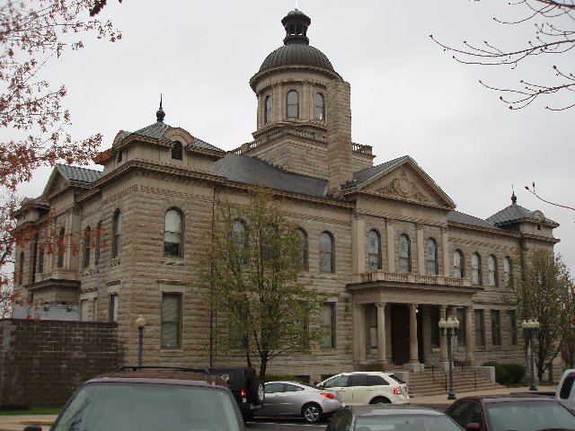
St. Charles County is governed by a county executive and a county council. The county council consists of seven members, each elected from various districts in the county. The county executive is elected by the entire county. The current executive is Steve Ehlmann. He was preceded by Joe Ortwerth, who was preceded by Gene Schwendemann, the first county executive of St. Charles County under the new form of government. The executive under the old form of county government was termed a "judge." The county had 258,525 registered voters as of March, 2016.
The St. Charles County Police Department operates under the authority of the St. Charles County government and is the largest law enforcement agency in St. Charles County.St. Charles County Police Department (SCCPD)
St. Charles County Ambulance District (SCCAD) is the largest district in Missouri, serving all of St. Charles County and its population of nearly 370,000.St. Charles County Ambulance District (SCCAD)
The Republican Party predominantly controls politics at the local level in St. Charles County. Republicans hold all the elected positions in the county.
St. Charles County is divided into twelve legislative districts in the Missouri House of Representatives, all of which are held by Republicans.
District 42 – Bart Korman (R-High Hill). Consists of Augusta, Defiance and part of New Melle.District 63 – Bryan Spencer (R-Wentzville). Consists of Wentzville, Foristell, and part of New Melle.District 64 - Robert Cornejo (R-St. Peters). Consists of Flint Hill, Josephville, St. Paul, and parts of O'Fallon and St. Peters.District 65 - Tom Hannegan (R-St. Charles). Consists of West Alton, Portage Des Sioux, and part of St. Charles.District 70 - Mark Matthiesen (R-Maryland Heights). Consists of parts of St. Charles and Weldon Spring.District 102 - Kurt Bahr (R-O'Fallon). Consists of Weldon Springs Heights, and parts of O'Fallon, Dardenne Prairie, New Melle, and Weldon Spring.District 103 - John Wiemann (R-O'Fallon). Consists of Cottleville and parts of O'Fallon, St. Peters, and Weldon Spring.District 104 – Kathie Conway (R-St. Charles). Consists of part of St. Peters.District 105 - Phil Christofanelli (R-St. Charles). Consists of parts of St. Charles and St. Peters.District 106 – Chrissy Sommer (R-St. Charles). Consists of parts of St. Charles and St. Peters.District 107 – Nick Schroer (R-O'Fallon). Consists of parts of Lake St. Louis, O’Fallon, and St. Peters.District 108 – Justin Hill (R-Lake St. Louis). Consists of parts of Lake St. Louis and Dardenne Prairie.St. Charles County is divided into two districts in the Missouri Senate, both of which have elected Republicans.
District 2 – Bob Onder (R-Lake St. Louis). Consists of the communities of Augusta, Dardenne Prairie, Flint Hill, Foristell, Josephville, Lake St. Louis, New Melle, O'Fallon, St. Paul, Weldon Spring Heights, and Wentzville.District 23 – Bill Eigel (R-Weldon Spring). Consists of Portage Des Sioux, St. Charles, St. Peters, Weldon Spring, and West Alton.Part of St. Charles County is included in Missouri’s 2nd Congressional District and is currently represented by Ann Wagner in the U.S. House of Representatives.
Most of St. Charles County is included in Missouri’s 3rd Congressional District and is currently represented by Blaine Luetkemeyer (R-St. Elizabeth) in the U.S. House of Representatives.
RepublicanDonald Trump won the most votes in St. Charles County, with 41.50 percent. U.S. Senator Ted Cruz (R-Texas) came in second with 38.87 percent, Governor John Kasich (R-Ohio) came in third with 10.70 percent, and U.S. Senator Marco Rubio (R-Florida) came in fourth with 7.10 percent.
DemocraticU.S. Senator Bernie Sanders (I-Vermont) won the primary with 54.32 percent to former Secretary of State Hillary Clinton's 44.80 percent.
RepublicanFormer U.S. Senator Rick Santorum (R-Pennsylvania) won the most votes in St. Charles County, with 56.29 percent. Former Governor Mitt Romney (R-Massachusetts) came in second with 25.43 percent, and former U.S. Representative Ron Paul (R-Texas) came in third with 12.69 percent.
DemocraticWith incumbent President Barack Obama facing no serious opposition, few St. Charles County voters voted in the Democratic primary; Obama won 87.83 percent.
RepublicanFormer Governor Mitt Romney (R-Massachusetts) won the most votes in St. Charles County, with 37.72 percent. U.S. Senator John McCain (R-Arizona) came in second with 34.95 percent, former Governor Mike Huckabee (R-Arkansas) came in third with 21.83 percent, and U.S. Representative Ron Paul (R-Texas) came in fourth with 3.83 percent.
DemocraticFormer U.S. Senator Hillary Clinton (D-New York) received more votes, a total of 23,611, than any candidate from either party in St. Charles County during the 2008 presidential primary.
JosephvilleWeldon Spring HeightsDefianceGilmoreHamburgHarvesterMatsonNonaOrchard Farm