
Country United States FIPS code 29-61706 Elevation 161 m Zip code 63117 Area code 314 | Time zone Central (CST) (UTC-6) GNIS feature ID 0756579 Area 5.96 km² Population 8,508 (2013) Local time Wednesday 8:00 PM | |
 | ||
Weather 18°C, Wind E at 21 km/h, 67% Humidity | ||
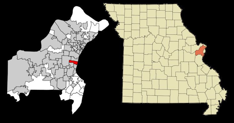
Richmond Heights, a city in St. Louis County, is an inner-ring suburb of St. Louis, Missouri. The population was 8,603 at the 2010 census. According to Robert L. Ramsay, the name was suggested by Robert E. Lee, who thought the topography of the area resembled Richmond, Virginia. As of 2006, a joint study to consider the advantages and disadvantages of merging with the adjoining city of Clayton is underway.
Contents
Map of Richmond Heights, MO, USA
Geography
Richmond Heights is located at 38°37′42″N 90°19′43″W (38.628402, -90.328614). According to the United States Census Bureau, the city has a total area of 2.30 square miles (5.96 km2), all of it land.
Highways
Richmond Heights has several major highways within its boundaries: Interstate 170, Interstate 64 and U.S. Route 40.
2010 census
As of the census of 2010, there were 8,603 people, 4,244 households, and 2,012 families residing in the city. The population density was 3,740.4 inhabitants per square mile (1,444.2/km2). There were 4,680 housing units at an average density of 2,034.8 per square mile (785.6/km2). The racial makeup of the city was 81.7% White, 11.6% African American, 0.2% Native American, 4.2% Asian, 0.5% from other races, and 1.8% from two or more races. Hispanic or Latino of any race were 2.3% of the population.
There were 4,244 households of which 20.9% had children under the age of 18 living with them, 35.8% were married couples living together, 8.4% had a female householder with no husband present, 3.3% had a male householder with no wife present, and 52.6% were non-families. 42.4% of all households were made up of individuals and 10.4% had someone living alone who was 65 years of age or older. The average household size was 2.01 and the average family size was 2.84.
The median age in the city was 38.6 years. 18.2% of residents were under the age of 18; 7.9% were between the ages of 18 and 24; 32.8% were from 25 to 44; 27.7% were from 45 to 64; and 13.5% were 65 years of age or older. The gender makeup of the city was 46.8% male and 53.2% female.
2000 census
As of the census of 2000, there were 9,602 people, 4,647 households, and 2,202 families residing in the city. The population density was 4,191.5 people per square mile (1,618.9/km²). There were 4,931 housing units at an average density of 2,152.5 per square mile (831.4/km²). The racial makeup of the city was 81.54% White, 13.32% African American, 0.25% Native American, 3.20% Asian, 0.01% Pacific Islander, 0.34% from other races, and 1.34% from two or more races. Hispanic or Latino of any race were 1.74% of the population.
In the city the population was spread out with 19.2% under the age of 18, 9.0% from 18 to 24, 36.0% from 25 to 44, 21.0% from 45 to 64, and 14.7% who were 65 years of age or older. The median age was 36 years. For every 100 females there were 85.6 males. For every 100 females age 18 and over, there were 80.1 males.
The median income for a household in the city was $50,557, and the median income for a family was $69,681. Males had a median income of $47,536 versus $35,407 for females. The per capita income for the city was $37,217. About 4.4% of families and 7.3% of the population were below the poverty line, including 8.3% of those under age 18 and 11.7% of those age 65 or over.
Economy
Panera Bread used to be headquartered in Richmond Heights with a St. Louis Bread Co. bakery-cafe (as they are locally known) located across the street. The Sisters of Saint Mary hospital, a movie theater, various notable small businesses, specialty shops, and franchised business locations. The Saint Louis Galleria is a prominent shopping mall in the area, and a large source of municipal revenue. The Parkmoor restaurant was a local institution in neighboring Clayton that used to face Oak Knoll Park, also in Clayton right across from Richmond Heights on the north side of Clayton Road. It was demolished as part of a Walgreens drugstore expansion. The Clayton store has a Richmond Heights zip code.