
Existed: 1956 – present Constructed 1956 | Length 402.4 km | |
 | ||
Major cities | ||
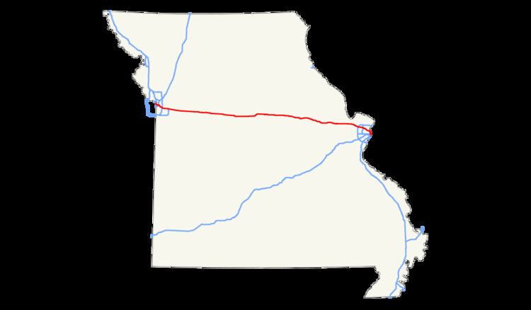
In the U.S. state of Missouri, Interstate 70 (I-70) is generally parallel to the Missouri River. This section of the transcontinental Interstate begins at the Kansas state line on the Lewis and Clark Viaduct, concurrent with U.S. Routes 24, 40, and 169, and the east end is on the Stan Musial Veterans Memorial Bridge in St. Louis.
Contents
Kansas City
While passing through Kansas City, I-70 is known as the "George Brett Super Highway", named after the former third baseman of the Kansas City Royals who is a member of the Baseball Hall of Fame. The Truman Sports Complex, which houses the Royals' and Chiefs' stadiums, is located along I-70 at I-435.
Beginning on the Lewis and Clark Viaduct, I-70 immediately encounters the Alphabet Loop, a small but complex loop of freeways with all of its exits having a number of 2 and a letter suffix that uses the entire alphabet (except I, O, and Z).[1] I-35 becomes concurrent with I-70 as soon as the highway gets into the Loop, and maintain the concurrency until the northeastern corner of the Loop. Back at the northwest corner, US 169 splits off to the north, leaving four routes concurrent with each other. There is a large interchange with Route 9 as the Loop reaches the northeastern corner. When it does reach the corner, US 24 splits to the east, I-29 ends, and US 71 joins.
After that, the freeway turns south, with interchanges to more roads. At the southeastern end, I-70/US 40/US 71 exit the Loop, where I-70/US 40 split off to the east and US 71 continues south. I-670 ends where I-70/US 40 usurp the alignment. Soon after usurpation, I-70/US 40 turn southeast, and at exit 7A, US 40 departs from I-70. Soon after that, I-70 interchanges with I-435, the beltway around Kansas City.
Independence to Wentzville
East of I-435, I-70 continues east through Independence, passing a busy cloverleaf interchange at I-470. The highway then continues with six lanes to the rapidly growing suburb of Blue Springs, where the roadway narrows to four lanes (two each direction) at Route 7. I-70 remains at this width until just west of the intersection with I-64/US 40/US 61 in Wentzville, over 170 miles (270 km) away.
East of Blue Springs, I-70 takes on a rural highway as it leaves Jackson County. The highway remains this way for the next 100 miles (160 km), going through gently rolling terrain while it meets US 65 at a cloverleaf interchange and finally crossing the Missouri River at Rocheport just west of where it reaches the mid-sized college town of Columbia in the center of the state. Through Columbia, the highway is lined with restaurants and hotels and can get congested during University of Missouri sporting events. The highway leaves Columbia after an exit with St. Charles Road on the east end of town. East of Columbia, I-70 has an interchange with US 54 at Kingdom City, Route 19 at New Florence, and Route 47 at Warrenton. Then, it continues through more gently rolling terrain until it reaches Wentzville, where it meets I-64/US 61. Here, US 40 departs from I-70. It then expands to three lanes each direction to St. Louis.
St. Louis
East of Wentzville, I-70 passes through the bedroom community of Lake St. Louis, then the growing towns of O'Fallon and St. Peters, and finally the historic city of St. Charles.
It crosses over the Missouri River one last time on the Blanchette Memorial Bridge, which is actually made up of two bridges: the westbound span built in the late-1950s and refurbished in 2013 and the eastbound one completed in the late-1970s.
Traffic volume increases as I-70 enters St. Louis County, requiring more lanes. There are as many as 13 lanes at one point. The section of I-70 from Fifth Street in St. Charles to I-270 is among the busiest section of highway in the state, with AADT counts approaching 165,000 in 2005.[2]
I-270 draws much of the traffic, so I-70 continues east through Bridgeton with only six lanes. After interchanges with Route 180 (St. Charles Rock Road) and US 67 (Lindbergh Boulevard), it passes on the southern edge of Lambert–St. Louis International Airport and through several bedroom communities – including Edmunson, Berkeley, Ferguson, and Jennings – and crossing I-170 in the process.
As it finally enters the city of St. Louis, motorists encounter what are signed as the "Express Lanes", known by MoDOT as the "reversible lanes". Two lanes in the middle of the freeway are separated from the eastbound and westbound lanes by Jersey barriers. Due to traffic pattern changes caused by the I-64 reconstruction, the lanes travel eastbound all day. MoDOT regularly monitors traffic patterns of this stretch of I-70 and will adjust the express lane traffic patterns accordingly. These lanes have no entrance or exit ramps, except at the ends. They extend approximately 8 miles (13 km) from near Union Boulevard to just north of downtown.
Just before the it enters downtown St. Louis, I-70 turns to the east to cross the Stan Musial Veterans Memorial Bridge, which redirects the highway's traffic away from the congested Poplar Street Bridge two miles (3.2 km) to the south. The former stretch of I-70 now continues as I-44.
History
I-70 had been criticized for cutting off downtown St. Louis from the Mississippi River waterfront particularly at the Gateway Arch. St. Louis is considering a $90 million project to cover the highway (now I-44) by the Arch.
This was not the first controversy involving I-70 and the Arch. In 1959, builders of the Poplar Street Bridge asked for the National Park Service to give 25 acres (10 ha) of the park for the bridge. The request generated enormous controversy and ultimately 2.5 acres (1.0 ha) was turned over to use for the bridge.
The New Mississippi River Bridge was finished and opened to traffic on Sunday, February 9, 2014. It reroutes and redirects I-70 traffic off the congested Poplar Street Bridge. The bridge was named in honor of St. Louis Cardinals baseball legend Stan Musial.
Future
I-70 across central Missouri is one of the oldest stretches of Interstate Highway in the system, as some sections date back as far as the late 1950s. As a result, the exits often have short, substandard acceleration and deceleration ramps, and the median is relatively narrow. Certain spots of both directions of traffic are separated by no more than a Jersey barrier. Also, a number of overpasses have low clearance, especially railway overpasses. Long-term plans have been identified to expand the highway to between six and eight lanes across the middle of the state. Tolling the Interstate has become a possible alternative, although the public does not support this idea. According to the improveI70.com website, tolling would not start until all 189 miles (304 km) of I-70 is reconstructed.
A March 2010 study of I-70 from the Kansas state line to the I-470 interchange identified several possible improvements, including expansion of the freeway from four to eight lanes, adding HOV or HOT lanes, reconstructing the Truman Road interchange and improving the curves at Jackson Avenue and Truman Road. Some novel ideas included a new alignment of I-70 as a tunnel from the southeast corner of the downtown loop to 22nd/23rd streets, covering the southern portion of the downtown loop (I-670) or making the downtown loop into a uni-directional freeway around downtown, essentially becoming a large roundabout.