
Founded October 3, 1695 ZIP code(s) 20607–20774 Area 1,292 km² Population 890,081 (2013) | Area code(s) 240, 301 Unemployment rate 4.8% (Apr 2015) | |
 | ||
Demonym(s) Prince Georgian, P.G. Countyan Colleges and Universities University of Maryland, Prince George's Communi, University of Maryland, Bowie State University, Capitol Technology University Destinations | ||
Prince george s county maryland happy
Prince George’s County, also known as P.G. County, is a county in the U.S. state of Maryland, bordering the eastern portion of Washington, D.C. As of the 2010 U.S. Census, the population was 863,420, making it the second-most populous county in Maryland, behind only Montgomery County. Its county seat is Upper Marlboro.
Contents
- Prince george s county maryland happy
- Map of Prince Georges County MD USA
- Etymology
- History
- 17th century
- 18th century
- 19th century
- 20th century
- 21st century
- Geography
- Regions
- North County
- Central County
- Rural Tier
- Inner Beltway
- South County
- Adjacent counties and independent cities
- National protected areas
- Government
- Other officials
- Law enforcement
- Emergency services
- Demographics
- 2000
- 2010 census
- Education
- Religion
- Top employers
- Crime
- Colleges and universities
- Public schools
- Transportation
- Major highways
- Enterprises and recreation
- Media
- Recreation
- Communities
- Towns
- Census designated places
- Ghost town
- Sister cities
- Notable people
- Namesakes
- References
Map of Prince George's County, MD, USA
Prince George’s County is included in the Washington-Arlington-Alexandria, DC-VA-MD-WV Metropolitan Statistical Area. Due to its proximity to Washington, D.C. the county also hosts many U.S. governmental facilities, such as Joint Base Andrews, a U.S. military airbase, as well as the headquarters of the United States Census Bureau.
Etymology
The official name of the county, as specified in the county's charter, is "Prince George’s County, Maryland". The county is named after Prince George of Denmark (1653–1708), the husband of Anne, Queen of Great Britain, and the brother of King Christian V of Denmark and Norway. The county's demonym is Prince Georgian and its motto is Semper Eadem (English: "Ever the Same"), a phrase used by Queen Anne. Prince George's County is frequently referred to as "P.G." or "P.G. County", an abbreviation viewed as pejorative by some residents.
History
The Cretaceous Era brought dinosaurs to the area which left a number of fossils, now preserved in a 7.5-acre (3.0 ha) park in Laurel. The site, which among other finds has yielded fossilized teeth from Astrodon and Priconodon species, has been called the most prolific in the eastern United States.
In the mid to late Holocene era, the area was occupied by Paleo-Native Americans and then later, Native Americans. When the first European settlers arrived, what is now Prince George's County was inhabited by people of the Piscataway Indian Nation. Three branches of the tribe are still living today, two of which are headquartered in Prince George's County.
17th century
Prince George's County was created by the English Council of Maryland in the Province of Maryland in 1696 from portions of Charles and Calvert counties. The county was divided into six districts referred to as "Hundreds": Mattapany, Petuxant, Collington, Mount Calvert, Piscattoway and New Scotland.
18th century
A portion was detached in 1748 to form Frederick County. Because Frederick County was subsequently divided to form the present Allegany, Garrett, Montgomery, and Washington counties, all of these counties in addition were derived from what had up to 1748 been Prince George's County.
In 1791, portions of Prince George's County were ceded to form the new District of Columbia, along with portions of Montgomery County, Maryland, as well as the parts of Northern Virginia; that were later returned to Virginia.
19th century
During the War of 1812, the British marched through the county by way of Bladensburg to burn the White House. On their return, they kidnapped a prominent doctor, William Beanes. Lawyer Francis Scott Key was asked to negotiate for his release, which resulted in his writing "The Star-Spangled Banner".
Since much of the southern part of the county was tobacco farms that were worked by enslaved Africans, there was a high population of African Americans in the region. After the Civil War, many African Americans attempted to become part of Maryland politics, but were met with violent repression after the fall of Reconstruction.
In April 1865, John Wilkes Booth made his escape through Prince George's County after shooting President Abraham Lincoln. He was on his way to Virginia.
20th century
The population of African Americans declined during the first half of the 20th century, but was renewed to over 50% in the early 1990s when the county again became majority African American. The first African American County Executive was Wayne K. Curry, elected in 1994.
On July 1, 1997, the Prince George's County section of the city of Takoma Park, Maryland, which straddled the boundary between Prince George's and Montgomery counties, was transferred to Montgomery County. This was done after city residents voted to be under the sole jurisdiction of Montgomery County, and subsequent approval by both counties and the Maryland General Assembly. This was the first change in Prince George's County's boundaries since 1968, when the City of Laurel was unified in Prince George's County.
21st century
The county has a number of properties on the National Register of Historic Places.
Geography
According to the U.S. Census Bureau, the county has a total area of 499 square miles (1,290 km2), of which 483 square miles (1,250 km2) is land and 16 square miles (41 km2) (3.2%) is water.
Prince George's County lies in the Atlantic coastal plain, and its landscape is characterized by gently rolling hills and valleys. Along its western border with Montgomery County, Adelphi, Calverton and West Laurel rise into the piedmont, exceeding 300 feet (91 m) in elevation.
The Patuxent River forms the county's eastern border with Howard, Anne Arundel, and Calvert counties.
Regions
County terrain, culture and demographics differ significantly by location within the county. There are five key regions to Prince George's County: North County, Central County, the Rural Tier, the Inner Beltway, and South County.
North County
Northern Prince George's County includes Laurel, Beltsville, Adelphi, College Park and Greenbelt. This area of the county is anchored by the Capital Beltway and the Baltimore–Washington Parkway. Laurel is experiencing a population boom with the construction of the Inter-County Connector. The key employers in this region are the University of Maryland, Beltsville Agricultural Research Center, and NASA-Goddard Space Flight Center. Areas of geographic distinction include Greenbelt Park, a wooded reserve adjacent to the planned environmental community of Greenbelt, and University Park, a collection of historic homes adjacent to the University of Maryland. Riversdale Mansion, along with the historic homes of Berwyn Heights, Mt. Rainier and Hyattsville, along with Langley Park are also located in this area. The hidden Lake Artemesia, a park constructed during the completion of the Washington Metro Green Line, incorporates a stocked fishing lake and serves as the trail-head for an extensive Anacostia Tributary Trails system that runs along the Anacostia River and its tributaries. The south and central tracts of the Patuxent Wildlife Research Center also lie in this part of the county; the north tract lies north of the Patuxent River in Anne Arundel County.
Central County
Central County, located on the eastern outskirts of the Capital Beltway, consists of Mitchellville, Woodmore, Greater Upper Marlboro, Springdale, and Bowie. According to the 2010 census, it has generally been the fastest growing region of the county. Mitchellville is named for a wealthy African American family, the Mitchells, who owned a large portion of land in this area of the county. Central Avenue, a major exit off the I-95 beltway, running east to west, is one of two main roads in this portion of the county. The other major roadway is Old Crain Highway, which runs north to south along the eastern portion of the county. The Newton White Mansion on the grounds is a popular site for weddings and political events.
Bowie is best known as a planned Levittown. William Levitt built traditional homes, as well as California contemporaries along U.S. Route 50, the key highway to the eastern shore and the state capital of Annapolis. Bowie has currently grown to be the largest city in Prince George's County, with more than 50,000 people. It also has a large Caucasian population, compared to much of the county (48% of the population). Housing styles vary from the most contemporary to century old homes in Bowie's antique district (formerly known as Huntingtown), where the town of Bowie began as a haven for thoroughbred horse racing. Areas of geographic distinction include the Ogden Bowie Mansion, Allen Pond, key segments of the Washington, Baltimore and Annapolis Trail, as well as planned parks, lakes and walking trails.
Rural Tier
Prince George's rural tier was designated "in the 2002 General Plan as an area where residential growth would be minimal"; it may be found in the area well beyond the Beltway to the east and south of central county, bounded on the north by U.S. Route 50, the west by the communities Accokeek and Fort Washington, and the east by the Patuxent River. Prince George's origins are in this part of the county. Most of this area contains the unincorporated parishes, villages and lost towns of Prince George's County. Largely under postal designations of "Upper Marlboro" or "Brandywine", in truth the town of Upper Marlboro is more central county in character, though it is the post office location for various rural settlements. (The names of these unincorporated areas are listed below in the towns section of this article). Since 1721 Upper Marlboro has been the county seat of government, with families that trace their lineage back to Prince George's initial land grants and earliest governing officials. Names like Clagett, Sasscer, King James and Queen Anne pepper the streets.
The rural tier has been the focus of orchestrated efforts by residents and county government to preserve its rural character and environmental integrity. Under the Maryland-National Capital Park and Planning Commission (M-NCPPC), Patuxent River Park is the largest natural preserve and provides public access for birdwatching and viewing the rural tier's natural waterfront vistas. In season, the park's Jug Bay Natural Area and the Patuxent Riverkeeper in Queen Anne both offer canoeing and kayaking rentals on the Patuxent. The county's largest collection of tobacco planter mansions and preserved homes are in the rural tier, some managed by the M-NCPPC. Many rural tier roads have scenic highway preservation status; a fall drive yields exceptional beauty along the Patuxent valley's Leeland Road, Croom Road, Clagett's Landing Rd., Mill Branch Rd., Queen Anne Rd., and Brandywine Rd. Walking access along roads in this area is very limited, because most property along the roads remains in private ownership. However, walking is much more accessible in the widespread M-NCPPC lands and trails and state holdings in the Patuxent valley, such as Merkle Wildlife Sanctuary and Rosaryville State Park, both popular among hikers and mountain bikers.
Inner Beltway
The inner beltway communities of Capitol Heights, District Heights, Forestville, Suitland and Seat Pleasant border the neighboring District of Columbia's northeastern and southeastern quadrants. This region is the most densely populated area of the county, although many communities here saw a decrease in population from 2000 to 2010. A high percentage of its residents are African American.
South County
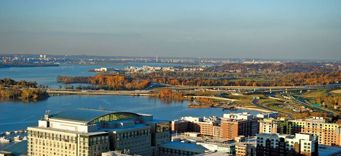
South county is a blend of the greenery of the rural tier and the new development of central county. The communities of Clinton, Oxon Hill, Temple Hills and Fort Washington are the largest areas of south county. It is the only portion of Prince George's County to enjoy the Potomac River waterfront, and that geographic distinction has yielded the rise of the National Harbor project: a town center and riverside shopping and living development on the Potomac. The National Harbor has become a major tourist and convention attraction, with significant hotel accommodations, eateries and shopping. Ferry rides allow trips across the Potomac into Alexandria. Several historic sites, including Mt. Vernon, can be viewed from the harbor front. River Road in Fort Washington also yields great views of the Potomac. Fort Washington Park was a major battery and gives access to the public for tours of the fort, scenic access to the river and other picnic grounds. Oxon Hill Manor offers a working farm and plantation mansion for touring; His Lordship's Kindness is another major historic home. Also, Fort Foote is an old American Civil War fort and tourist destination.
Adjacent counties and independent cities
Prince George's and Montgomery Counties share a bi-county planning and parks agency in the M-NCPPC and a public bi-county water and sewer utility in the Washington Suburban Sanitary Commission
National protected areas
Government
Since 1792, the county seat has been Upper Marlboro. Prior to 1792, the county seat was located at Mount Calvert, a 76-acre (308,000 m²) estate along the Patuxent River on the edge of what is now in the unincorporated community of Croom.
Prince George's County was granted a charter form of government in 1970 with the county executive elected as the head of the executive branch and the county council members as the leadership of the legislative branch. Prince George's County is part of the Seventh Judicial Circuit of the state of Maryland and holds 23 of the 32 total circuit court judges in the circuit (which includes Calvert, Charles, Prince George's, and St. Mary's counties).
Fitch Ratings assigned a 'AAA' bond rating to Prince George's County on August 25, 2011, re-affirming the county's stable financial outlook. Earlier in 2011, the County received 'AAA' status from Standard & Poor's and Moody's. 'AAA' bond ratings are the highest possible bond ratings a jurisdiction can receive.
Other officials
Law enforcement
Prince George's County is serviced by multiple law enforcement agencies. The Prince George's County Police Department is the primary police service for county residents residing in unincorporated areas of the county. In addition, the Prince George's County Sheriff's Office acts as the enforcement arm of the county court, and also shares some patrol responsibility with the county police. County parks are serviced by the Prince George's County Division of the Maryland-National Capital Park Police. Besides the county-level services, all but one of the 27 local municipalities maintain police departments that share jurisdiction with the county police services. Furthermore, the Maryland State Police enforces the law on state highways which pass through the county and the Maryland Department of Natural Resources Police patrol the state parks and navigable waterways located within the county.
Along with the state and local law enforcement agencies, the federal government also maintains several departments that service citizens of the county such as the US Park Police, US Postal Police, Andrews Air Force Base Security Police, and other federal police located on various federal property located within the county.
In addition, nearly all of the incorporated cities and towns in the county have their own municipal police force. Notable exceptions include the city of College Park.
Emergency services
Prince George's County hospitals include Bowie Health Center, Doctors Community Hospital in Lanham, Gladys Spellman Specialty Hospital & Nursing Center in Cheverly, Hospice of the Chesapeake in Landover, Laurel Regional Hospital in Laurel, Prince George's Hospital Center in Cheverly, Southern Maryland Hospital Center in Clinton, and Fort Washington Medical Center.
The Prince George's County Volunteer Firemen's Association was formed in 1922 with several of the first companies organized in the county. The first members of the association were Hyattsville, Cottage City, Mount Rainier, and Brentwood.
In March 1966, the Prince George's County Government employed the firefighters who had been hired by individual volunteer stations and an organized career department was begun. The career firefighters and paramedics are represented by IAFF 1619.
Prince George's County became the first jurisdiction in Maryland to implement the 9-1-1 Emergency Reporting System in 1973. Advanced life support services began for citizens of the county in 1977. Firefighters were certified as Cardiac Rescue Technicians and deployed in what was called at the time Mobile Intensive Care Units to fire stations in Brentwood, Silver Hill, and Laurel.
As of 2007, the Prince George's County Fire/EMS Department operates a combination system staffed by over 800 career firefighters and paramedics, and nearly 1,100 active volunteers.
Demographics
Prince George's County is the wealthiest African American-majority county in the United States.
2000
The racial makeup of the county was as of 2000:
By the 2008 estimates there were 298,439 households out of which 65.1% are family households and 34.9% were non-family households. 36.4% of households had children under the age of 18 living with them, 44.00% were married couples living together, 19.60% had a female householder with no husband present. 24.10% of all households were made up of individuals and 4.90% had someone living alone who was 65 years of age or older. The average household size was 2.74 persons and the average family size was 3.25 persons.
In the county, the population was spread out with 26.80% under the age of 18, 10.40% from 18 to 24, 33.00% from 25 to 44, 22.10% from 45 to 64, and 7.70% who were 65 years of age or older. The median age was 33 years. For every 100 females there were 91.50 males. For every 100 females age 18 and over, there were 87.20 males.
The median income for a household in the county in 2008 was $71,696, and the median income for a family was $81,908. The 2008 mean income for a family in the county was $94,360. As of 2000, males had a median income of $38,904 versus $35,718 for females. The 2008 per capita income for the county was $23,360. About 4.70% of families and 7.40% of the population were below the poverty line, including 9.2% of those under age 18 and 7.1% of those age 65 or over. Prince George's County is the 70th most affluent county in the United States by median income for families and the most affluent county in the United States with an African-American majority. Almost 38.8% of all households in Prince George's County, earned over $100,000 in 2008.
2010 census
As of the 2010 United States Census, there were 863,420 people, 304,042 households, and 203,520 families residing in the county. The population density was 1,788.8 inhabitants per square mile (690.7/km2). There were 328,182 housing units at an average density of 679.9 per square mile (262.5/km2). The racial makeup of the county was 64.5% black or African American, 19.2% white, 4.1% Asian, 0.5% American Indian, 0.1% Pacific islander, 8.5% from other races, and 3.2% from two or more races. Those of Hispanic or Latino origin made up 14.9% of the population. In terms of ancestry, 6.5% were Subsaharan African, and 2.0% were American.
Of the 304,042 households, 36.8% had children under the age of 18 living with them, 40.1% were married couples living together, 20.4% had a female householder with no husband present, 33.1% were non-families, and 26.1% of all households were made up of individuals. The average household size was 2.78 and the average family size was 3.31. The median age was 34.9 years.
The median income for a household in the county was $71,260 and the median income for a family was $82,580. Males had a median income of $49,471 versus $49,478 for females. The per capita income for the county was $31,215. About 5.0% of families and 7.9% of the population were below the poverty line, including 9.6% of those under age 18 and 6.7% of those age 65 or over.
Education
30.1% of all residents over the age of 25 had graduated from college and obtained a bachelor's degree (17.8%) or professional degree (12.2%). 86.2% of all residents over the age of 25 were high school graduates or higher.
Religion
Prince George's County is home to more than 800 churches, including 12 megachurches, as well as a number of mosques, synagogues, and Hindu and Buddhist temples. Property belonging to religious entities makes up 3,450 acres (14.0 km2) of land in the county, or 1.8% of the total area of the county.
Top employers
According to the county's comprehensive annual financial report, the top private-sector employers in the county are the following. "NA" indicates not in the top ten for the year given.
The top public-sector employers in the county are:
Crime
Prince George's County accounted for 20% of murders in the State of Maryland from 1985 to 2006. A twenty-year crime index trends study, performed by Prince George's County Police Department Information Resource Management, showed the county had a 23.1% increase in total crime for the years of 2000 to 2004. Between the years of 1984 to 2004, Prince George's had a 62.8% increase in total crime.
However, as of 2009, crime had generally declined in the county and the number of homicides declined from 151 in 2005 to 99 in 2009.
Violence continued into 2013 initially. The Washington Post reported that, as of February 20, Prince George's County already had 15 homicides in 2013, up from 10 on the same date in 2012. However, as of the end of 2013, the County had experienced a record drop in crime, especially record lows in violent crimes.
Colleges and universities
The University of Maryland System headquarters are in the unincorporated area of Adelphi.
Public schools
The county's schools are managed by the Prince George's County Public Schools system.
Transportation
The County contains a large portion of the Capital Beltway. After a decades-long debate, construction began in late 2007 on an east-west toll freeway, the Intercounty Connector ("ICC"), which extends Interstate 370 in Montgomery County in order to connect I-270 with Interstate 95 and U.S. 1 in Laurel. The ICC was completed in 2012.
The Washington Metropolitan Area Transit Authority operates Metrobus fixed-route bus service and Metrorail heavy-rail passenger service in and out of the County as well as the regional MetroAccess paratransit system for the handicapped. The Prince George’s County Department of Public Works and Transportation also operates TheBus, a County-wide fixed-route bus system, and the Call-A-Bus service for passengers who do not have access to or have difficulty using fixed-route bus service. Call-A-Bus is a demand-response service which generally requires 14-days advance reservations. The county also offers a subsidized taxicab service for elderly and disabled residents called Call-A-Cab in which eligible customers who sign up for the service purchase coupons giving them a 50 percent discount with participating taxicab companies in Prince George’s and Montgomery Counties.
Fifteen stations of the Washington Metro subway system are located in Prince George’s County, with four of them as terminus stations: Greenbelt, New Carrollton, Largo, and Branch Avenue. There has been much debate on the construction of the Purple Line, which would link highly developed areas of both Montgomery and Prince George’s Counties. Also worth noting is the potential expansion of the Green Line northward to Laurel and beyond.
The MARC Train (Maryland Area Rail Commuter) train service has two lines that traverse Prince George's County. The Camden Line runs between Baltimore Camden Station and Washington Union Station and has six stops in the county in Riverdale Park, College Park, Greenbelt, Muirkirk, Laurel, and Laurel Racetrack. The Penn Line runs on the AMTRAK route between Baltimore Penn Station and Washington Union Station. It has three stops in the county: Bowie State, Seabrook, and New Carrollton.
The College Park Airport (est. 1909) is the world’s oldest continuously operated airport and is home to the adjacent College Park Aviation Museum.
Residents may use Ronald Reagan Washington National Airport in Arlington County, Virginia, Baltimore–Washington International Thurgood Marshall Airport near Baltimore, and Dulles International Airport in Dulles, Virginia.
Major highways
Enterprises and recreation
Prince George’s County is home to the United States Department of Agriculture's Henry A. Wallace Beltsville Agricultural Research Center, NASA’s Goddard Space Flight Center, the United States Census Bureau, Andrews Air Force Base, the National Archives and Records Administration's College Park facility, the University of Maryland’s flagship College Park campus, Six Flags America and Six Flags Hurricane Harbor, FedEx Field (home of the Washington Redskins), and the National Harbor, which its developers, Peterson Companies and Gaylord Entertainment Company, bill as the largest single mixed-use project and combined convention center–hotel complex on the East Coast.
Media
Recreation
Although Prince George’s County is not often credited for the Washington Redskins, the Redskins stadium is in Landover. No other major-league professional sports teams are in the county, though Bowie hosts the Bowie Baysox, a minor league baseball team. The county is known for its very successful youth. In basketball, ESPN published an article declaring Prince George's County the new "Hoops Hot Bed" and ranked it as the number one basketball talent pool in the country. A number of basketball prospects, including Ty Lawson, Kevin Durant, Jeff Green, Roy Hibbert and Michael Beasley from AAU basketball teams such as the PG Jaguars, DC Assault, and DC Blue Devils. Besides AAU, basketball has skyrocketed from local high schools such as DeMatha Catholic High School and Bishop McNamara High School, both of which have found some great success locally and nationally.
Communities
This county contains the following incorporated municipalities:
Towns
Part of the city of Takoma Park was formerly in Prince George’s County, but since 1997 the city has been entirely in Montgomery County. The part of Takoma Park that changed counties comprises two residential neighborhoods, Carole Highlands (an unincorporated portion of this neighborhood is still in Prince George’s County) and New Hampshire Gardens.
Census-designated places
Unincorporated areas are also considered as towns by many people and listed in many collections of towns, but they lack local government. Various organizations, such as the United States Census Bureau, the United States Postal Service, and local chambers of commerce, define the communities they wish to recognize differently, and since they are not incorporated, their boundaries have no official status outside the organizations in question. The Census Bureau recognizes the following census-designated places in the county:
Ghost town
Sister cities
Prince George's County has three sister cities, as designated by Sister Cities International: