
State Maryland Settled 1695 Local time Sunday 1:48 PM Area code 301 | County Prince George's Area 111 ha Population 794 (2013) | |
 | ||
Country United States of America Replatted 1744 (as Upper Marlborough) Weather 16°C, Wind NW at 13 km/h, 35% Humidity | ||
New homes at beechtree in upper marlboro maryland
Upper Marlboro, officially the Town of Upper Marlboro, is the seat of Prince George's County, Maryland in the United States. The population within the town limits was 631 at the 2010 U.S. Census, although Greater Upper Marlboro is many times larger.
Contents
- New homes at beechtree in upper marlboro maryland
- Map of Upper Marlboro MD 20772 USA
- Etymology
- History
- Prince Georges County courthouse
- Proposed move to Largo
- Geography
- Climate
- 2010 census
- 2000 census
- Economy
- Government
- Education
- Sports
- Notable people
- References
Map of Upper Marlboro, MD 20772, USA
Etymology
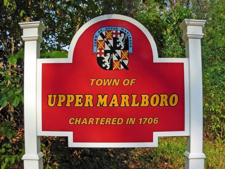
Upper Marlboro was established in 1706 as "Marlborough Town", after John Churchill, 1st Duke of Marlborough, an ancestor of Winston Churchill. In 1744, the town was renamed to "Upper Marlborough". In the late 19th century, the town's name changed from Upper Marlborough to Upper Marlboro. The name change is linked to a postal clerk who felt that the last three letters, "ugh", did not properly fit on the rubber stamps being used at the time. By 1893, postal guides were referring to the town as Upper Marlboro and the name stuck, despite a proposed ballot to have it changed back in 1968.
History
The area of Upper Marlboro was first settled around 1695. It was named after John Churchill, 1st Duke of Marlborough, an ancestor of Winston Churchill. The land, which was to become the town, was part of several estates known as Grove Landing, Meadows, and Darnall's Chance, owned by the Brooke, Beall, and Darnall families, respectively.
Darnall's Chance, also known as the Buck House, was built between 1694 and 1712. The house can still be found across from the present-day County Administration Building on Gov. Oden Bowie Drive. It was owned by the Darnall and Carroll families. The home may have been the birthplace of Daniel Carroll, a signer of the U.S. Constitution, and his brother, John Carroll, the first archbishop of Baltimore, as well as the first Roman Catholic prelate in what would become the United States.
In 1706, Marlborough Town was established as a port town by the Act for the Advancement of Trade and Erecting Ports and Towns. It was declared that the town would be constructed, "at the upper landing on the Western Branch, commonly called Colonel Belt's landing." County surveyor Thomas Truman Greenfield conducted a survey of 100 acres (0.40 km2) of the three estates from which the town would be formed. Streets, alleys, a meetinghouse, lots for small businesses, and 100 lots to be used for homes were laid out. Earliest plans showed the town being laid out in a grid pattern with an L shape.
Residents of the area were not happy with Greenfield's initial layout and petitioned the General Assembly to have the town replatted. In 1744, the new survey was approved and the town was given a new name, Upper Marlborough. Upper was added to distinguish the town from the community of Marlboro (now known as Lower Marlboro) in Calvert County.
Early in its life, when the western branch of the Patuxent River was still navigable, the town served as a port town for tobacco ships. The town blossomed into an agricultural, social, and political hot spot. Farms, many of which raised tobacco, dominated the surrounding areas.
In 1721, a courthouse was constructed in the town. The county seat was then moved from Charles Town, on the banks of the Patuxent, to Upper Marlborough. The courthouse was built with money from a 12-pound tobacco tax imposed on county inhabitants. One of the first laws passed at the courthouse was the Public School Act, which established a public school system.
During the late 18th and early 19th centuries, many prominent merchants, lawyers, and politicians lived and worked in the area. Horse racing came to the town around the mid-18th century and attracted many people from the surrounding areas. The Maryland Jockey Club sponsored spring and summer races at the race track south of town, and racing continued there until 1972, when they were moved to the Bowie Race Track. The race track is now part of the Equestrian Center owned by Prince George's County.
In 1870, the town was incorporated by the Maryland General Assembly. A volunteer fire department was organized in 1886, and the Marlborough Fire Association was incorporated the following year.
In 1878 Michael Green, an African-American man accused of assaulting a white woman, was taken from the country jail and hanged from a tree outside of town. An "iron bridge just between the town and the railroad depot" was the site of two more lynchings. Joseph Vermillion was killed there in 1889 and Stephen Williams met the same fate in 1894.
Since its initial conception the town has changed quite a bit. It initially boomed as a port town for tobacco trade, but the clearing and cultivation of land for farming would lead to erosion in the area. Over the years this erosion caused sedimentation, leading the Western Branch to become unnavigable. The fields of tobacco that once dominated the area have been converted over to residential developments, with the number of farms dwindling each year.
The town is the county seat of Prince George's County. Located within the town are the Prince George's County Courthouse, County Administration Building, the Board of Education, and the headquarters of the Prince George's County Sheriff's Office. The town's atmosphere is remarkably different, depending on the time of day.
Prince George's County courthouse
The courthouse has been a critical part of the town since it became the county seat in 1721. Since then, the courthouse in Upper Marlboro has seen many changes. Between 1798 and 1801, a new courthouse was constructed on the site of the old one. The courthouse was again rebuilt in the 1880s.
In 1939, the courthouse was substantially expanded and rebuilt. During this time, the building gained its famous stone Ionic columns. According to county historian Susan Pearl, "They wanted the neo-classic Georgian university campus building, and that's what they got." The total cost of the revision was $178,000.
Small additions were made in 1947 and 1969.
In the early 1990s a new courthouse was erected behind the existing courthouse. The new courthouse, composed of the Marbury and Bourne wing, was completed in 1991. The new building occupies 360,000 square feet (33,000 m2) of space and cost $80 million. The old courthouse was then designated as the Duvall Wing and was attached to the new section by walkways.
In May 2003, the old courthouse was closed for a $25 million renovation. On November 3, 2004, two months before the building was scheduled to reopen, a fire broke out and destroyed much of the 151,000-square-foot (14,000 m2) building. The fire left only a charred skeleton of the cupola, which had overlooked Main Street for 64 years.
In January 2007, the courthouse briefly caught fire again when sparks from a construction worker's welding tool ignited building materials on the roof. Firefighters quickly contained the blaze, and the renovations continued.
On March 12, 2009, the Duvall Wing of the Prince George's County Courthouse reopened after being closed in 2001 for renovations.
Proposed move to Largo
Since the 1990s, the Prince George's County government has been purchasing land in Largo, Maryland due to its convenient location near the Washington Metro and interstate highways. In 2015, County Executive Rushern Baker recommended the move of the county's seat from Upper Marlboro to Largo so that residents could be better served.
Geography
Upper Marlboro is located at 38°48′59″N 76°45′12″W (38.816488, −76.753454).
According to the United States Census Bureau, the town has a total area of 0.43 square miles (1.11 km2), of which, 0.40 square miles (1.04 km2) is land and 0.03 square miles (0.08 km2) is water.
Upper Marlboro is the county seat of Prince George's County, a large urban and suburban area of some 850,000 people adjacent to Washington, D.C. U.S. Route 301 and Maryland Route 4 intersect at the edge of town. The northern terminus of the Stephanie Roper Highway (Maryland Route 4) is in Upper Marlboro at the intersection of Pennsylvania Avenue and Water Street. Major features of the town include the courthouse, jail, county office building, board of education, and a lake with walking path. Just to the south of town is the Prince George's Equestrian Center which is the location of the annual county fair, a major annual antiques show and The Show Place Arena on the former Marlboro racetrack grounds. This arena is used for events such as hockey games, circuses, rodeos, conventions, trade shows, and graduation ceremonies of many regional high schools, as well as daily overflow parking for county governmental employees, jurors, and visitors.
Although the surrounding area has many rural, pastoral features, including horse farms, housing developments are increasingly prevalent. However, except for supermarkets, an Amish market, car dealers, and a Home Depot, all outside the town limits, the town and surrounding area have only minimal shopping; therefore, residents must travel to Bowie, Clinton, Brandywine, Waldorf, or Forestville to find department stores. Upper Marlboro is convenient to employees commuting to locations along Maryland Route 4 or US Route 301, such as Joint Base Andrews and the U.S. Census Bureau.
The Town of Upper Marlboro is often mistaken for the surrounding unincorporated area of Greater Upper Marlboro, with a population of nearly 20,000 in an area of 77 square miles (200 km2) (as designated by the post office).
Climate
The climate in this area is characterized by hot, humid summers and generally mild to cool winters. According to the Köppen Climate Classification system, Upper Marlboro has a humid subtropical climate, abbreviated "Cfa" on climate maps.
2010 census
As of the census of 2010, there were 631 people, 290 households, and 157 families residing in the town. The population density was 1,577.5 inhabitants per square mile (609.1/km2). There were 310 housing units at an average density of 775.0 per square mile (299.2/km2). The racial makeup of the town was 33.8% White, 57.8% African American, 0.2% Native American, 1.1% Asian, 2.9% from other races, and 4.3% from two or more races. Hispanic or Latino of any race were 4.1% of the population.
There were 290 households of which 29.0% had children under the age of 18 living with them, 34.1% were married couples living together, 17.6% had a female householder with no husband present, 2.4% had a male householder with no wife present, and 45.9% were non-families. 36.9% of all households were made up of individuals and 11% had someone living alone who was 65 years of age or older. The average household size was 2.18 and the average family size was 2.88.
The median age in the town was 39.5 years. 21.1% of residents were under the age of 18; 7.1% were between the ages of 18 and 24; 32.1% were from 25 to 44; 30% were from 45 to 64; and 9.7% were 65 years of age or older. The gender makeup of the town was 47.4% male and 52.6% female.
2000 census
As of the census of 2000, there were 648 people, 292 households, and 165 families residing in the town. The population density was 1,586.7 people per square mile (610.2/km²). There were 309 housing units at an average density of 756.6 per square mile (291.0/km²). The racial makeup of the town was 51.54% White, 45.06% African American, 0.46% Native American, 1.08% Asian, 0.15% from other races, and 1.70% from two or more races. Hispanic or Latino of any race were 1.54% of the population.
There were 292 households out of which 31.8% had children under the age of 18 living with them, 29.5% were married couples living together, 22.9% had a female householder with no husband present, and 43.2% were non-families. 34.2% of all households were made up of individuals and 8.6% had someone living alone who was 65 years of age or older. The average household size was 2.21 and the average family size was 2.86.
In the town, the population was spread out with 23.9% under the age of 18, 6.9% from 18 to 24, 36.3% from 25 to 44, 23.1% from 45 to 64, and 9.7% who were 65 years of age or older. The median age was 37 years. For every 100 females there were 72.8 males. For every 100 females age 18 and over, there were 75.4 males.
The median income for a household in the town was $52,813, and the median income for a family was $58,542. Males had a median income of $42,639 versus $39,000 for females. The per capita income for the town was $28,892. About 1.3% of families and 1.4% of the population were below the poverty line, including none of those under age 18 and 4.0% of those age 65 or over.
Economy
The courthouse draws a small amount of business to the area in the form of various bail bond offices and law firms.
Government
The town has three departments:
Education
Residents are zoned to schools in the Prince George's County Public Schools system.
Residents are zoned to: PUBLIC SCHOOLS PRIVATE SCHOOLS
Numerous other events occur at the nearby Show Place Arena.
Sports
The Chesapeake Icebreakers of the East Coast Hockey League played two seasons in Upper Marlboro from 1997 to 1999 at The Show Place Arena, just outside town, before moving to Jackson, Mississippi.
The Chesapeake Tide of the Continental Indoor Football League started play at The Show Place Arena, just outside town, in 2007. Beginning in 2009, they will be known as the Maryland Maniacs and play in the Indoor Football League.