
Founded May 13, 1838 Area 655.3 km² | Website www.howardcountymd.gov Population 304,580 (2013) | |
 | ||
Points of interest Savage Mill, Lake Kittamaqundi, Lake Centennial, Lake Elkhorn, Rockburn Branch Park Colleges and Universities Howard Community College, Maryland University of Integrat, Lincoln Technical Institute, University of Phoenix | ||
Howard County is a county located in the central part of the U.S. state of Maryland. As of the 2010 census, the population was 287,085. Its county seat is Ellicott City.
Contents
- Map of Howard County MD USA
- Etymology
- History
- Geography
- Adjacent counties
- Climate
- 2000 census
- 2010 census
- Education
- Library
- Politics and government
- County Council
- Economy
- Awards
- Culture and attractions
- Airports
- Public transportation
- Roads
- Communities
- Census designated places
- Unincorporated communities
- References
Map of Howard County, MD, USA
Howard County is included in the Baltimore-Columbia-Towson, MD Metropolitan Statistical Area, which is also included in the Washington-Baltimore-Arlington, DC-MD-VA-WV-PA Combined Statistical Area. However, recent development in the south of the county has led to some realignment towards the Washington, D.C. media and employment markets. The county is home to Columbia, a major planned community of approximately 100,000 founded by developer James Rouse in 1967.
Howard County is frequently cited for its affluence, quality of life, and excellent schools. With an estimated median household income of $108,844 in 2012, Howard County had the third-highest median household income of any U.S. county in 2013. Many of the most affluent communities in the Baltimore-Washington Metropolitan Area, such as Clarksville, Dayton, Glenelg, Glenwood, and West Friendship, are located along the Route 32 corridor in Howard County. The main population center of Columbia/Ellicott City was named second among Money magazine's 2010 survey of "America's Best Places to Live." Howard County's schools frequently rank first in Maryland as measured by standardized test scores and graduation rates.
In 2010, the center of population of Maryland was located in the Howard County town of Jessup.
Etymology
The name of the county honors Colonel John Eager Howard, an officer in the "Maryland Line" of the Continental Army in the American Revolutionary War, commander notably at the Battle of Cowpens in South Carolina in 1781, among others. He was the fifth governor of Maryland from 1788 to 1791. His home was the mansion "Belvedere", located at the present-day intersection of East Chase and North Calvert streets, north of Baltimore Town in an area also called "Howard's Woods", where Baltimore's Washington Monument was later erected and the neighborhood of Mount Vernon was developed in the 1820s.
History
The lands of prehistoric Howard County were populated by Native Americans. The Maryland Historical Trust has documented sites along the Patapsco, Patuxent, Middle and Little Patuxent River valleys. In 1652, the Susquehannock tribes signed a peace treaty with Maryland, giving up their provenance over the territory that is now Howard County. In 1800, the mean center of U.S. population as calculated by the US Census Bureau was found in what is now Howard County.
In 1838, Dr. William Watkins of Richland Manor proposed the "Howard District" of Anne Arundel County. After several adjournments, the area of western Anne Arundel County was designated the Howard District in 1839. The district had the same status as a county except that it was not separately represented in the Maryland General Assembly. In 1841, the county built its first courthouse in Ellicott City. At the January 1851 constitutional convention, Thomas Beale Dorsey submitted a petition led by James Sykes. A committee was formed with Dorsey, Bowie, Smith, Harbine and Ricaud. After several postponements, the district was erected officially as Howard County on March 7, 1851.
The plantations of modern Howard County used slave labor as early as 1690. At the time of the Underground Railroad, some Howard County residents assisted slaves who were escaping to freedom. This was particularly risky, as many prominent plantation families were Confederate sympathizers during the Civil War, contributing militiamen to the South to protect local interests. Maryland was exempt from the Emancipation Proclamation, later abolishing slavery in the update of the Maryland Constitution in November 1864.
On May 1, 1883 Howard County joined Anne Arundel and Hardford County in liquor prohibition.
By 1899, Howard County contained 400 miles (640 km) of dirt and 48 miles (77 km) of stone roads, including three paid turnpikes maintained by 118 men. Most traffic consisted of loads delivered to rail crossings. In 1909, County Commissioners Hess, Werner and O'Neil were charged with malfeasance regarding contract bids.
In 1918, a deadly flu pandemic swept the county starting with an early outbreak in Camp Meade in adjacent Anne Arundel County. The 1930s saw a shift from one-room schoolhouses to centralized schools with bus service. By 1939 wheat harvesting fell to just 18,800 acres (7,600 ha). In 1940, local newspaper owner Paul Griffith Stromberg led a five-county commission to study a superhighway between Baltimore and Washington through Howard County. The Federal Aid Highway Act of 1956 eventually led to the construction of Interstate 70 across northern Howard County and Interstate 95 across the eastern part of the county. The sparsely populated county hosted population centers in Ellicott City, Elkridge, Savage, North Laurel and Lisbon with W.R. Grace and Johns Hopkins Applied Physics Lab as the largest new employers. Residents elected officials that campaigned to keep the county rural while planners prepared public works to support a quarter million residents by the year 2000. Race relations and desegregation became major issues of the time.
From 1963 to 1966 the Rouse Company bought 14,000 acres (5,700 ha) of land and rezoned it for the Columbia Development. In 1972, the Marriott company proposed to build a regional theme park on Rouse-owned land but was denied zoning.
The county has a number of properties on the National Register of Historic Places.
Geography
According to the U.S. Census Bureau, the county has a total area of 253 square miles (660 km2), of which 251 square miles (650 km2) is land and 2.7 square miles (7.0 km2) (1.0%) is water. It is the second-smallest county in Maryland by land area and smallest by total area.
Howard County is located in the Piedmont Plateau region of Maryland, with rolling hills making up most of the landscape. It is bounded on the north and northeast by the Patapsco River, on the southwest by the Patuxent River, and on the southeast by a land border with Anne Arundel County. Both the Patapsco and Patuxent run largely through publicly accessible parkland along the county borders. The Patuxent border includes the Triadelphia and Rocky Gorge reservoirs.
Adjacent counties
Climate
Howard County lies in the humid subtropical climate zone. As one travels west in the county away from the Baltimore area, the winter temperatures get lower and winter snow is more common. Annual rainfall is about 45 inches (1,100 mm) throughout the county. Over a 50-year period from 1950 to 2010, there were 394 National Climatic Data Center reportable events causing 617 injuries, and 99 fatalities. There were 9 reported tornadoes, reaching a maximum of F2, with no recorded fatalities.
2000 census
As of the census of 2000, there were 247,842 people, 90,043 households, and 65,821 families residing in the county. The population density was 983 people per square mile (380/km²). There were 92,818 housing units at an average density of 368 per square mile (142/km²). The racial makeup of the county was 74.33% White, 14.42% Black, 0.24% Native American, 7.68% Asian, 0.04% Pacific Islander, 1.11% from other races, and 2.19% from two or more races. 3.02% of the population were Hispanic or Latino of any race. 15.1% were of German, 11.0% Irish, 9.3% English, 6.6% Italian and 5.7% American ancestry.
There were 90,043 households out of which 40.00% had children under the age of 18 living with them, 60.50% were married couples living together, 9.50% had a female householder with no husband present, and 26.90% were non-families. 20.80% of all households were made up of individuals and 4.60% had someone living alone who was 65 years of age or older. The average household size was 2.71 and the average family size was 3.18.
In the county, the population was spread out with 28.10% under the age of 18, 6.30% from 18 to 24, 34.40% from 25 to 44, 23.80% from 45 to 64, and 7.50% who were 65 years of age or older. The median age was 36 years. For every 100 females there were 96.60 males. For every 100 females age 18 and over, there were 92.90 males.
The median income for a household in the county was $101,003, and the median income for a family was $117,186 in 2009. The per capita income was $44,120. About 2.70% of families and 4.00% of the population were below the poverty line.
2010 census
As of the 2010 United States Census, there were 287,085 people, 104,749 households, and 76,333 families residing in the county. The population density was 1,144.9 inhabitants per square mile (442.0/km2). There were 109,282 housing units at an average density of 435.8 per square mile (168.3/km2). The racial makeup of the county was 62.2% white, 17.5% black or African American, 14.4% Asian, 0.3% American Indian, 2.0% from other races, and 3.6% from two or more races. Those of Hispanic or Latino origin made up 5.8% of the population. In terms of ancestry, 17.7% were German, 13.9% were Irish, 10.6% were English, 7.0% were Italian, and 4.6% were American.
Of the 104,749 households, 39.3% had children under the age of 18 living with them, 58.9% were married couples living together, 10.5% had a female householder with no husband present, 27.1% were non-families, and 21.9% of all households were made up of individuals. The average household size was 2.72 and the average family size was 3.20. The median age was 38.4 years.
The median income for a household in the county was $103,273 and the median income for a family was $119,810. Males had a median income of $82,307 versus $59,128 for females. The per capita income for the county was $45,294. About 2.8% of families and 4.2% of the population were below the poverty line, including 4.6% of those under age 18 and 5.5% of those age 65 or over.
Education
The Howard County Public School System manages 71 schools and serves approximately 49,000 students. The graduation rate from this school district was 90.4% in 2009, and the county's schools are ranked among the best in the state. Student test scores consistently top the list for all Maryland school districts. Howard High School is currently the largest school in the county with over 1,700 students.
Library
In 2013 Howard County Library System was selected as the Library of the Year by Library Journal and cited by editor-at-large, John N. Berry, as "a 21st-century library model, with a position, doctrine, purpose, and curriculum worthy of study and consideration by every library in America, if not the world." In 2015 the Howard County Library System was designated the top Star Library in its class.
Under the library's sponsorship, a campaign called "Choose Civility" started in Howard County in 2006. According to its website, "Choose Civility is an ongoing community-wide initiative, led by Howard County Library, to position Howard County as a model of civility. The project intends to enhance respect, empathy, consideration and tolerance in Howard County." The campaign's distinctive green bumper stickers are often seen in Howard County and neighboring areas.
Politics and government
Howard County last supported a Republican candidate for President in 1988. It usually supports Democrats at the state and federal level, though it voted for Republican Bob Ehrlich in the 2002 gubernatorial election over Democrat Kathleen Kennedy Townsend and Larry Hogan over Democrat Anthony G. Brown in the 2014 gubernatorial election.
At the state level, Howard County is represented by six Democrats and three Republicans in the Maryland House of Delegates. It is represented by two Democrats and one Republican in the Maryland Senate. Generally, the southern portion of the county is more Democratic, while the northern portion leans Republican. The one Republican state senator from the county represents a district that spills into heavily Republican Carroll County to the north, as do two of the three state delegates.
From 1914 to 1968, Howard County was governed by a system of three elected commissioners with four-year terms. Prior to 1962, the only polling location in the county was located in Ellicott City. In May 1962, voters were offered a second location to vote, also in Ellicott City at the National Armory on Montgomery Road. Senator James Clark proposed a five-person County Council and a County Executive in 1965. In 1968, the county implemented a charter form of government. In 1984 a councilmanic referendum was approved, switching council from at-large representation to district representation. The County Council serves as the county's legislative branch; members also provide constituent service and sit as members of the Zoning Board and Liquor Board. The current Howard County Executive is Republican Allan H. Kittleman, who was elected in November 2014 and took office in December 2014. Most of the county is in Maryland's 7th congressional district, represented by Democrat Elijah Cummings. A small portion is in Maryland's 3rd congressional district, represented by Democrat John Sarbanes.
County Council
The County Council adopts ordinances and resolutions, and has all of the County's legislative powers. There are five council districts throughout the county. The current County Council as of January 2017 includes 4 Democrats and 1 Republican.
Economy
Statistics for July 2014 indicate that Howard County's unemployment rate is at 5.2 percent (7,527 persons).
Howard County Public School System employs 8,136 of which 4,670 are teachers. The County Government employs 3,323 outside of the school system with 672 police, 482 public works, and 472 fire and rescue employees. The top ten private sector employers in Howard County are as follows:
Awards
Awards and recognitions achieved by Howard County or locations within it include the following:
Culture and attractions
Airports
Howard County does not have any public or commercial airport facilities. A 1967 Airport Study Commission recommended a facility for 150-250 aircraft to provide economic development, but was not initiated. With the closure of Haysfield Airport, there is one privately owned airstrip, Glenair Airport in Glenelg. Commercial air service is provided by Baltimore–Washington International Thurgood Marshall Airport, Ronald Reagan Washington National Airport, and Washington Dulles International Airport.
Public transportation
Bus routes that operate in Howard County are managed by the Regional Transportation Agency of Central Maryland and the Maryland Transit Administration.
Roads
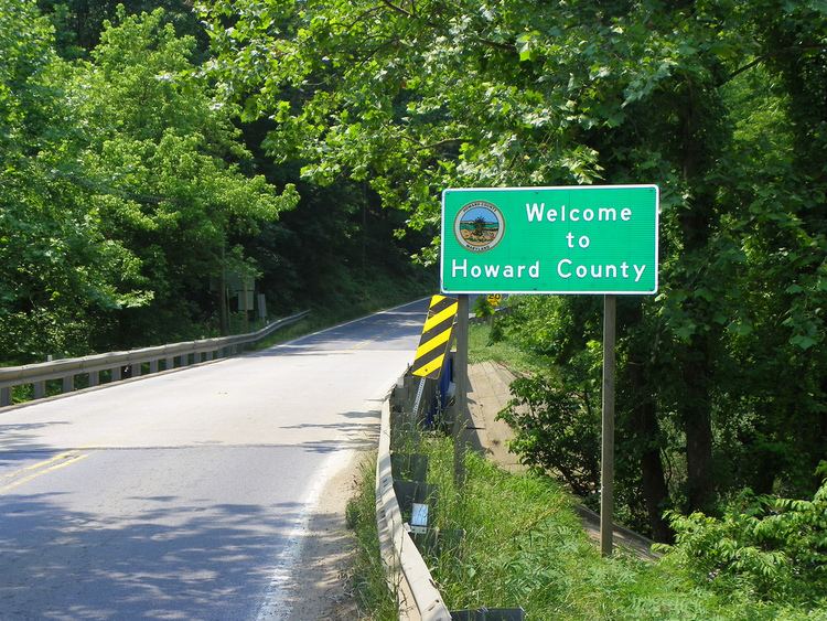
Howard County contains two primary Interstate highways: Interstate 70 which runs east-west across the northern portion of the county and Interstate 95 which enters the county in Elkridge and runs north-south to North Laurel, then crossing into Prince George's County.
Other major routes include U.S. Route 29, which runs from its northern terminus at MD 99 in Ellicott City into Montgomery County, Maryland Route 100 which provides quick access to BWI Airport from Ellicott City and Columbia, and Maryland Route 32 which links the northwest suburbs of West Friendship, Glenelg, and Clarksville with Columbia and Fort Meade.
Communities
Howard County has no incorporated municipalities.
Census-designated places
The Census Bureau recognizes the following Census-designated places in the county:
Unincorporated communities
Unincorporated places not listed as Census-designated places but known in the area include: