
State Maryland Incorporated April 18, 1931 ZIP codes 20781, 20784, 20785 Elevation 291 m Population 6,354 (2013) | County Prince George's Time zone EST (UTC-5) Area 3.5 km² Local time Saturday 8:59 AM Area code 301 | |
 | ||
Country United States of America Weather 1°C, Wind W at 13 km/h, 44% Humidity | ||
Cheverly is a town in Prince George's County, Maryland, just outside Washington, D.C., United States. The town was founded in 1918, and it was incorporated in 1931. Cheverly had 6,173 residents as of the 2010 Census.
Contents
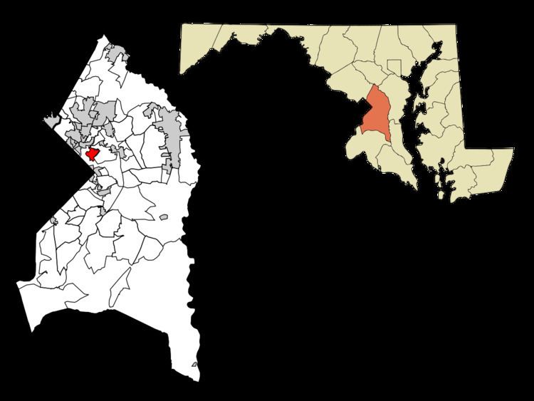
- Map of Cheverly MD USA
- History
- Historic sites
- Geography
- Bordering areas
- 2010 census
- 2000 census
- Education
- Parks and recreation
- Notable people
- References
Map of Cheverly, MD, USA
There is a Washington Metro station in the southern part of Cheverly, on Columbia Park Road. This station is on the Orange Line.
The Cheverly area is home to the Prince George's Hospital Center and the Publick Playhouse for the Performing Arts (neither of which are located within the corporate town limits). Cheverly's ZIP codes are 20784 and 20785.
History
Cheverly was begun as a planned suburb in the early 1900s. The Cheverly area was first platted in 1904 for a 93-acre (380,000 m2) community called Cheverly Gardens. The land was subsequently purchased in 1918 by Robert Marshall, president of the Washington Suburban Realty Company. The Cheverly subdivision platted by Marshall was developed around the 1839 Magruder family homestead known as Mount Hope. Marshall became the first resident of Cheverly by taking up residence in the restored homestead in 1919. In 1923, the first road, now known as Cheverly Avenue, was completed and paved to connect the Pennsylvania Railroad line to Landover Road. 34 developer-built houses were constructed between 1921 and 1925. Most of the early houses were mail-order homes from Sears & Roebuck and the McClure Homes Company. Marshall lost control of the Washington Suburban Realty Company in 1927. Harry Wardman assumed the position until the company’s bankruptcy in 1929 due to the stock market crash.
Incorporation was granted in 1931 to address concerns for better roads and services. During the 1930s and 1940s, the streets were improved and lighting enhanced, and the number of residences increased from 135 to 650. Residential construction continued through the 1960s, creating a varied housing stock of early Cape Cod houses, with later ranch and split-level types. Two garden-style apartment complexes (Cheverly Terrace and Hanson Arms) were constructed in the early 1960s along Landover Road near the U.S. Route 50 interchange. The community center, town hall, and park facility was built in 1978. Industrial property was established in 1958 on the west side of town and adjacent to Route 50.
On April 29, 2006, the community held a 75th anniversary celebration at the town community center. The historic home Mount Hope has been the town's official symbol since 1931.
Historic sites
The following is a list of historic sites in Cheverly identified by the Maryland-National Capital Park and Planning Commission:
Geography
Cheverly is located at 38°55′28″N 76°54′49″W (38.924478, -76.913488).
According to the United States Census Bureau, the town has a total area of 1.35 square miles (3.50 km2), all of it land.
Bordering areas
2010 census
As of the census of 2010, there were 6,173 people, 2,287 households, and 1,568 families residing in the town. The population density was 4,572.6 inhabitants per square mile (1,765.5/km2). There were 2,395 housing units at an average density of 1,774.1 per square mile (685.0/km2). The racial makeup of the town was 32.4% White, 57.1% African American, 0.1% Native American, 1.7% Asian, 5.3% from other races, and 3.4% from two or more races. Hispanic or Latino of any race were 10.5% of the population.
There were 2,287 households of which 36.3% had children under the age of 18 living with them, 44.3% were married couples living together, 17.6% had a female householder with no husband present, 6.6% had a male householder with no wife present, and 31.4% were non-families. 23.6% of all households were made up of individuals and 4.5% had someone living alone who was 65 years of age or older. The average household size was 2.69 and the average family size was 3.17.
The median age in the town was 37.8 years. 23.6% of residents were under the age of 18; 8.5% were between the ages of 18 and 24; 28.7% were from 25 to 44; 30.6% were from 45 to 64; and 8.5% were 65 years of age or older. The gender makeup of the town was 50.6% male and 49.4% female.
As of the American Community Survey of 2013, the median income for a household in the town was $95,274, and the median income for a family was $112,353. The median income for married-couple families was $123,218, and the median income for non-family households was $54,079.
2000 census
As of the census of 2000, there were 6,433 people, 2,258 households, and 1,637 families residing in the town. The population density was 4,769.9 people per square mile (1,839.8/km²). There were 2,348 housing units at an average density of 1,741.0 per square mile (671.5/km²). The racial makeup of the town was 33.86% White, 56.79% African American, 0.17% Native American, 2.50% Asian, 0.03% Pacific Islander, 3.22% from other races, and 3.44% from two or more races. Hispanic or Latino of any race were 6.76% of the population.
There were 2,258 households out of which 39.8% had children under the age of 18 living with them, 48.8% were married couples living together, 17.1% had a female householder with no husband present, and 27.5% were non-families. 20.4% of all households were made up of individuals and 4.7% had someone living alone who was 65 years of age or older. The average household size was 2.85 and the average family size was 3.30.
In the town, the population was spread out with 28.5% under the age of 18, 7.6% from 18 to 24, 31.7% from 25 to 44, 24.2% from 45 to 64, and 8.0% who were 65 years of age or older. The median age was 36 years. For every 100 females there were 94.9 males. For every 100 females age 18 and over, there were 89.3 males.
The median income for a household in the town was $65,431, and the median income for a family was $67,540. Males had a median income of $39,237 versus $36,757 for females. The per capita income for the town was $24,096. About 4.9% of families and 6.8% of the population were below the poverty line, including 9.7% of those under age 18 and 4.1% of those age 65 or over.
Education
Cheverly is served by the Prince George's County Public Schools system.
Public schools in Cheverly include:
Public schools attended by Cheverly residents:
Private schools: