
Area 1,699 km² Population 29,889 (2013) | Congressional district 6th Website www.garrettcounty.org Founded 1872 | |
 | ||
Points of interest Deep Creek Lake, Deep Creek Lake State Park, Herrington Manor State Park, New Germany State Park, Casselman Bridge Destinations | ||
Garrett County (gərɛt) is the westernmost county of the U.S. state of Maryland. As of the 2010 census, the population was 30,097, making it the third-least populous county in Maryland. Its county seat is Oakland. The county was named for John Work Garrett (1820–1884), president of the Baltimore and Ohio Railroad. Created from Allegany County, Maryland in 1872, it was the last Maryland county to be formed.
Contents
- Map of Garrett County MD USA
- History
- Government
- County seal
- County flag
- Law enforcement
- Geography
- The Glades
- Loess Dunes
- Forests rivers caves
- State parks
- County parks
- Municipal parks
- Adjacent counties
- 2000 census
- 2010 census
- Economy
- Airport
- Media
- Events
- Census designated places
- Unincorporated communities
- Education
- References
Map of Garrett County, MD, USA
Garrett County has long been part of the media market of Pittsburgh, Pennsylvania. It is considered to be a part of Western Maryland.
The Commonwealth of Pennsylvania is to the north. The Maryland–Pennsylvania boundary was surveyed and marked between April 1765 and October 1767 by astronomer Charles Mason and surveyor Jeremiah Dixon. This boundary is commonly known as the Mason–Dixon line. The eastern border with Allegany County was defined by the Bauer Report, submitted to Governor Lloyd Lowndes, Jr. on November 9, 1898. The Potomac River and State of West Virginia lie to the south and west.
Garrett County lies in the Allegheny Mountains, which here form the western flank of the Appalachian Mountain Range. Hoye-Crest, a summit along Backbone Mountain, is the highest point in Maryland.
The Eastern Continental Divide runs along portions of Backbone Mountain. The western part of the county, drained by the Youghiogheny River, is the only part of Maryland within the Mississippi River drainage basin. All other parts of the county are in the Chesapeake Bay basin.
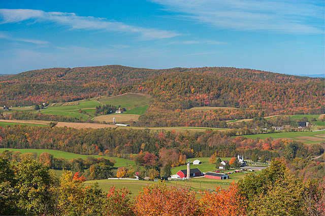
Garrett County contains over 76,000 acres (310 km2) of parks, lakes, and publicly accessible forestland. Popular activities in the county include camping, hiking, backpacking, rock climbing, alpine and cross county skiing, snowmobiling, hunting, ice fishing, fly fishing, whitewater canoeing, kayaking, rafting, boating, swimming, sailing, horseback riding, and water skiing.
The National Register of Historic Places listings in Garrett County, Maryland has 20 National Register of Historic Places properties and districts, including Casselman Bridge, National Road a National Historic Landmark. Garrett County is part of Maryland's 6th congressional district. The extreme south of the county lies within the United States National Radio Quiet Zone.
History
In the early 20th century, the railroad and tourism started to decline. Coal mining and timber production continued at a much slower pace. Today, tourism has made a dramatic rebound in the county with logging and farming making up the greatest part of the economic base. Due to a cold climate and lack of any large city, Garrett County has remained a sparsely populated rural area.
Government
The County is governed by an elected Board of County Commissioners (the "Board"), whose three members serve four-year terms and must live in the District they represent. The Board is the traditional form of county government in Maryland and may exercise only such powers as are conferred by the General Assembly of Maryland.
The County is administered under a line organizational method, with the County Administrator responsible for the general administration of County Government. The administration of the County is centralized with the County Administrator responsible for overseeing the financial planning, annual budget process, personnel management, and direction and management of operations within the organization.
The county is part of Maryland's 6th congressional district and is the most Republican in the state. The Republican candidate for President has won in each of the last thirteen elections. In 2008, John McCain carried Garrett County by a 40.2% margin over Barack Obama, with Obama carrying Maryland by a 25.5% margin over McCain.
County seal
On December 15, 1977, the seal of Garrett County went into effect by virtue of Resolution #7. The seal is elliptical, with the name "Garrett County" inscribed above the upper fourth of the ellipse, and "Maryland 1872" inscribed below the lower fourth of the ellipse. The date “1872" depicts the year of the formation of Garrett County. The seal illustrates a large snowflake to depict winter; water to represent sailing; and oaks and conifer to represent the county’s mountains. The colors are peacock blue for the sky and water. The blue and white background is divided by kelly green.
County flag
The official flag for Garrett County is elliptical. The flag illustrates a large snowflake to depict winter; water to represent sailing; and oaks and conifer to represent the county’s mountains. The colors are peacock blue for the sky and water. The blue and white background is divided by kelly green.
Law enforcement
The county is policed by the Garrett County Sheriff's Office and the Maryland State Police.
The state parks are police by the Department of Natural Resources Police.
Geography
According to the U.S. Census Bureau, the county has a total area of 656 square miles (1,700 km2), of which 647 square miles (1,680 km2) is land and 8.6 square miles (22 km2) (1.3%) is water. It is the second-largest county in Maryland by land area.
Garrett County is Maryland's westernmost county, bordered to the north by the Mason–Dixon line with Pennsylvania, to the south by the Potomac River and West Virginia, to the west by a land border with West Virginia, and to the east by a land border with Allegany County, Maryland. The county's northwesternmost point is approximately 60 miles (97 km) southeast of Pittsburgh, Pennsylvania, and its southeasternmost point is approximately 160 miles (260 km) northwest of Baltimore, Maryland.
Garrett County is located entirely within the highland zone of the Appalachian Mountains known variously as the Allegheny Mountains, the Allegheny Plateau, and the Appalachian Plateau. The county's highest elevations are located along four flat-topped ridges and range to a height of 3,360 feet (1,020 m) at Hoye-Crest along Backbone Mountain, the highest point in the state of Maryland. As is typical in the Allegheny region, broad flats generally lie below the ridge crests at elevations of approximately 500 feet (150 m). River valleys are generally narrow and deep, with ravines typically 1,000 to 1,800 feet (550 m) below surrounding peaks.
The county contains over 76,000 acres (310 km2) of parks, lakes, and publicly accessible forestland. It is drained by two river systems, the Potomac and the Youghiogheny. The Savage River, a tributary of the Potomac, drains about a third of the county. The Casselman River, a tributary of the Youghiogheny, flows north from the county’s central section into Pennsylvania. The Youghiogheny itself drains the westernmost area of the county and flows north into Pennsylvania, where it empties into the Monongahela River at McKeesport, just south of Pittsburgh.
The Glades
The Glades' 601 acres (2.43 km2) is of great scientific interest because it is an ombrotrophic system (fed solely by rainwater) with peat layers up to 9 feet (2.7 m) thick, and is one of the oldest examples of mountain peatland in the Appalachians.
On the western edge of the Savage River State Forest along Maryland Route 495 lies Bittinger, Maryland. Named after Henry Bittinger who first settled in the area, other German settlers moved in and took up the fertile farm land. On the eastern edge of Bittinger is one of the largest glades area of Garrett County. Geographically, this is an area which seems to have been affected by the last great ice sheet of North America. Two miles southeast of Bittinger, there is a large deposit of peat moss.
Loess Dunes
In the Casselman River valley, 1-mile (1.6 km) south of Grantsville, Maryland and beside Maryland Route 495, one can see remains of geological evidence about the last great ice sheet over North America. A series of low mounds can be seen in the fields on the west side of Maryland Route 495 that are "loess" (wind-blown) material. Apparently, these are the only ones still visible in the northern part of Garrett County.
The mounds were formed when a glacier lake existed in the Casselman valley, and the ice around the edges of the frozen lake melted. Wind blew fine grains of earth into the water around the edges where it sank to the bottom, and the mounds were the result of the deposit of this wind-blown material.
Forests, rivers, caves
See these articles for information on the forests, rivers and caves of Garrett County:
State parks
There are six state parks in Garrett County. All offer picnic and fishing areas; all but Casselman River State Park have hiking paths. Mountain bike paths, swimming areas, and boat launches and rentals are available at Deep Creek, Herrington Manor, and New Germany state parks. Rental cabins are available at Herrington Manor and New Germany state parks. Big Run, Deep Creek, Herrington Manor and New Germany state parks all offer canoeing, while campsites may be found at Big Run, Deep Creek, New Germany, and Swallow Falls state parks.
County parks
Garrett County owns four park sites and fifteen recreation facilities. The parks are maintained in cooperation with local associations and civic groups. The recreation areas are attached to public schools and colleges and maintained by the Garrett County Board of Education.
Municipal parks
The municipal parks of Garrett County provide sport facilities, hiking, bike and walk paths, playgrounds, picnic areas, boat ramps, and fishing.
Adjacent counties
2000 census
As of the census of 2000, there were 29,846 people, 11,476 households, and 8,354 families residing in the county. The population density was 18/km² (46/sq mi). There were 16,761 housing units at an average density of 10/km² (26/sq mi). The racial makeup of the county was 98.83% White, 0.43% Black or African American, 0.07% Native American, 0.19% Asian, 0.02% Pacific Islander, 0.09% from other races, and 0.37% from two or more races. 0.44% of the population were Hispanic or Latino of any race. 36.1% were of German, 22.9% American, 9.6% English and 8.8% Irish ancestry.
There were 11,476 households out of which 32.60% had children under the age of 18 living with them, 60.70% were married couples living together, 8.40% had a female householder with no husband present, and 27.20% were non-families. 23.50% of all households were made up of individuals and 10.60% had someone living alone who was 65 years of age or older. The average household size was 2.55 and the average family size was 3.00.
In the county, the population was spread out with 25.10% under the age of 18, 7.80% from 18 to 24, 27.60% from 25 to 44, 24.60% from 45 to 64, and 14.90% who were 65 years of age or older. The median age was 38 years. For every 100 females there were 97.20 males. For every 100 females age 18 and over, there were 93.80 males.
The median income for a household in the county was $32,238, and the median income for a family was $37,811. Males had a median income of $29,469 versus $20,673 for females. The per capita income for the county was $16,219. 13.30% of the population and 9.80% of families were below the poverty line. Out of the total people living in poverty, 16.60% are under the age of 18 and 13.90% are 65 or older.
2010 census
As of the 2010 United States Census, there were 30,097 people, 12,057 households, and 8,437 families residing in the county. The population density was 46.5 inhabitants per square mile (18.0/km2). There were 18,854 housing units at an average density of 29.1 per square mile (11.2/km2). The racial makeup of the county was 97.8% white, 1.0% black or African American, 0.3% Asian, 0.1% American Indian, 0.1% from other races, and 0.7% from two or more races. Those of Hispanic or Latino origin made up 0.7% of the population. In terms of ancestry, 35.4% were German, 13.6% were American, 11.3% were Irish, and 11.3% were English.
Of the 12,057 households, 30.0% had children under the age of 18 living with them, 56.4% were married couples living together, 9.3% had a female householder with no husband present, 30.0% were non-families, and 25.5% of all households were made up of individuals. The average household size was 2.45 and the average family size was 2.92. The median age was 42.7 years.
The median income for a household in the county was $45,760 and the median income for a family was $56,545. Males had a median income of $40,035 versus $27,325 for females. The per capita income for the county was $23,888. About 8.9% of families and 12.5% of the population were below the poverty line, including 19.2% of those under age 18 and 12.1% of those age 65 or over.
Economy
Garrett County produces natural gas, the only county in the state to do so. Much of the economic activity in the area centers around the outdoors. In the winter, the Wisp ski resort in Oakland and New Germany State Park's cross county skiing trail are frequent destinations, and Deep Creek Lake sees much activity in the summer. The state parks in the county are frequented year-round.
Airport
Garrett County Airport (2G4) is a general aviation airport surrounded by the mountains of Western Maryland. The airport enhances the region's tourist industry and provides emergency air service evacuation and landing facilities for general aviation.
Media
Garrett County is part of the Pittsburgh DMA, a regional media market centered in neighboring Pennsylvania.
Events
Annual events include the Autumn Glory Festival, the Scottish Highland Festival, and the Garrett County Fair.
Census-designated places
The United States Census Bureau recognizes seven census-designated places (CDPs) in Garrett County.
Unincorporated communities
The following communities are classified as populated places or locales by the Geographic Names Information System.
Education
Garrett County Public Schools operates public schools.