
Population 320,103 (2013) | Formed September 25, 1786 Founded 25 September 1786 Unemployment rate 5.9% (Apr 2015) | |
 | ||
Country United States of America Colleges and Universities Luzerne County Communi, Wilkes University, Misericordia University, King's College, Penn State Hazleton Points of interest Mohegan Sun Pocono, Eckley Miners' Village, Frances Slocum State Park, Pocono Mountains, Seven Tubs Recreatio | ||
Pa route 437 luzerne county pennsylvania
Luzerne County is a county located in the U.S. state of Pennsylvania. As of the 2010 census, the population was 320,918. It is the most populous county in Northeastern Pennsylvania. The county seat is Wilkes-Barre.
Contents
- Pa route 437 luzerne county pennsylvania
- Map of Luzerne County PA USA
- Sandy run road luzerne county pennsylvania
- History
- 18th century
- 19th century
- 20th century
- 21st century
- Geography
- Adjacent counties
- Major highways
- Airports
- Demographics
- Languages
- Religion
- Background
- County Council
- County Manager
- Other county officials
- Politics
- United States Senate
- United States House of Representatives
- State Senate
- State House of Representatives
- Public school districts
- Charter schools
- Public vocational technical schools
- Recreation
- Other recreation
- Local attractions
- Communities
- Cities
- Census designated places
- Population ranking
- References
Map of Luzerne County, PA, USA
On September 25, 1786, Luzerne County was formed from part of Northumberland County. It was named after Chevalier de la Luzerne, French ambassador to the United States. The county gained prominence in the 19th and 20th centuries as an active anthracite coal mining region, drawing a large portion of its labor force from European immigrants. At its peak (in 1930), the county’s population was 445,109. By the early 21st century, many factories and coal mines were closed. Like most counties in the Rust Belt, Luzerne witnessed population loss and urban decay.
Luzerne County is included in the Scranton–Wilkes-Barre–Hazleton Metropolitan Statistical Area.
Sandy run road luzerne county pennsylvania
History
The Luzerne County Historical Society maintains the storehouse for the collective memory of Luzerne County and its environs. It records and interprets the history, traditions, events, people and cultures that have directed and molded life within the region.
18th century
19th century
20th century
21st century
Geography
According to the U.S. Census Bureau, the county has a total area of 906 square miles (2,350 km2), of which 890 square miles (2,300 km2) is land and 16 square miles (41 km2) (1.8%) is water. The highest point in the county is Cherry Ridge in Fairmount Township. The ridge is 2,460 feet (750 m) above sea level. The lowest point, of about 512 feet (156 m), can be found near Shickshinny.
The Wyoming Valley is located in the north and mid part of the county. The valley is flat (at the Susquehanna Basin) and rises from 512 feet (156 m) to 2,000 feet (610 m) in some places. Bear Creek, on the eastern side of the valley, has a mean elevation of about 2,000 feet (610 m), while Shickshinny, on the Susquehanna Basin, is about 512 feet (156 m). The Wyoming Valley (in Luzerne County) extends from Exeter Township and Pittston Township to Shickshinny and Salem Township. Pittston City, West Pittston Borough, Wyoming Borough, Kingston Borough, and Wilkes-Barre City all make up the Susquehanna Basin of the Wyoming Valley. Greater Pittston makes up the northeastern region of the county. The county is crossed by a series of east-to-west mountains. The Susquehanna River drains most of the county while the Lehigh River drains some eastern and southeastern portions. The Lehigh forms part of Luzerne County's southeastern border.
Luzerne County consists of several urban areas. The first is a contiguous quilt-work of former anthracite coal mining communities (including the cities of Pittston, Wilkes-Barre, and Nanticoke). It is located in the northeastern and central part of the county. The second is Hazleton and it is located in the southern portion of the county. Other smaller urban areas (such as the Back Mountain and Mountain Top) are scattered throughout the region. Small farming communities can be found outside of the urban centers.
Adjacent counties
Major highways
Airports
Demographics
As of the 2010 census, the county was 90.7% White, 3.4% Black or African American, 0.2% Native American, 1.0% Asian, 3.3% other race, and 1.5% were of two or more races. 6.7% of the population were of Hispanic or Latino ancestry.
According to the census of 2000, there were 319,250 people, 130,687 households, and 84,293 families residing in the county. The population density was 358 people per square mile (138/km2). There were 144,686 housing units at an average density of 162 per square mile (63/km2). The racial makeup of the county was 96.63% White, 1.69% Black or African American, 0.09% Native American, 0.58% Asian, 0.01% Pacific Islander, 0.43% other race, and 0.57% from two or more races. 1.16% of the population were Hispanic or Latino. 22.2% were of Polish ancestry, 15.6% of Italian ancestry, 13.8% of Irish ancestry, 12.1% of German ancestry, and 5.3% of Slovak ancestry according to the 2000 census. Luzerne County is the only county in the United States with a plurality of citizens reporting Polish as their primary ancestry; the majority of Pennsylvanians report German or Pennsylvania Dutch.
There were 130,687 households, out of which 48.80% were married couples living together. 11.50% had a female householder with no husband present. 35.50% were non-families. 31.30% of all households were made up of individuals. 16% of those age 65 years and older lived alone. The average household size was 2.34 and the average family size was 2.95.
In the county, the population consisted of 21% under the age of 18, 8.10% from 18 to 24, 27.20% from 25 to 44, 24% from 45 to 64, and 19.70% who were 65 years of age or older. The median age was 41 years. For every 100 females, there were 93 males. For every 100 females (age 18 and over), there were 89.50 males.
The median household income (in 2015 dollars) was $45,897. 15.1% of the population lives in poverty. 60.4% of those 16 years of age or older are in the civilian labor force. There are more white collar jobs in Luzerne County than blue collar jobs. In total, there are 91,801 white collar jobs and 62,813 blue collar jobs. The mean travel time to work (for those 16 years of age or older) was 22.1 minutes. In terms of education, 88.9% (of those 25 years of age or older) are high school graduates or higher. 21.4% (of those 25 years of age or older) have a bachelor's degree or higher. In terms of healthcare, 10.8% (for those under the age of 65) are living with a disability. As of 2015, 25,317 veterans are living in Luzerne County.
Languages
The two major languages spoken in Luzerne County are English and Spanish. 5.8% of the population speaks Spanish at home. Most of the Spanish speaking population can be found in and around the City of Hazleton.
Religion
59.27% of the people in Luzerne County are religious, meaning they affiliate with a religion. 43.77% are Catholic; 0.28% are LDS (or The Church of Jesus Christ of Latter-day Saints); 0.51% are Baptist; 0.55% are Episcopalian; 1.05% are Pentecostal; 3.11% are Lutheran; 4.40% are Methodist; 1.95% are Presbyterian; 2.33% are of some other Christian faith; 0.78% are Jewish; 0.00% are of an eastern faith; and 0.51% practice Islam.
Background
Luzerne County voters rejected home rule proposals in the past (once in 1974 and again in 2003). However, from 2008 to 2010, corruption plagued the county government. Three county judges, a county commissioner, a clerk of courts, a deputy chief clerk, and a director of human resources faced criminal charges. These events persuaded the voters of Luzerne County to adopt a new form of government. On Tuesday, November 2, 2010, a home rule charter was adopted by a margin of 49,343 to 40,394.
The following year (in 2011), the first election for the new government was held. On Monday, January 2, 2012, the previous government (the board of county commissioners) was abolished and replaced with the new form of government (council–manager government). The first members of the Luzerne County Council were sworn in that same day. The first council chairperson was Jim Bobeck. The assembly consists of eleven elected members. They appoint and work alongside a full-time manager. The manager runs an executive branch of county government.
County Council
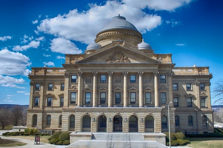
The Luzerne County Council is the governing body of the county. The council meets at the Luzerne County Courthouse. There are eleven members on the assembly. The Democrats control a majority of seats (with seven members). The council also consists of three Republicans and one Independent. The chairperson is the highest-ranking officer on the council. When the group is not in session, the officer's duties often include acting as its head, its representative to the outside world, and its spokesperson. The chairperson is appointed by his or her fellow council members. He or she sets the agenda for the council and administers the meetings. The current chairperson is Linda McClosky Houck. The following members have been duly elected to the county council by the voters of Luzerne County.
The following is a list of former and current chairpersons.
County Manager
The executive branch is headed by the Luzerne County Manager. He or she is appointed by the Luzerne County Council. The manager directs the county's organizational, operational, management, budget, and administrative operations and activities. The current manager is C. David Pedri.
Other county officials
Politics
As of November 2008, there are 187,849 registered voters in Luzerne County.
The county is a bellwether of the state having voted for the presidential candidate who carried Pennsylvania in every election since 1960. While the Democratic Party has been historically dominant in county-level politics, on the statewide and national levels Luzerne County leans toward the Democratic Party only slightly. In 2000, Democrat Al Gore won 52% of the vote and Republican George W. Bush won 44%. In 2004, it was much closer with Democrat John Kerry winning 51% to Republican George Bush's 48%. In 2006, both Democrats (Governor Ed Rendell and now Senator Bob Casey Jr.) won 67.5% and 60.6% of the vote in Luzerne County. In 2008, Barack Obama received 53% of the county vote to 45% for John McCain. Four years later, in 2012, Obama carried the county again.
In 2016, Donald Trump won the county with 58% of the vote, the largest margin since President Nixon in 1972. It was the first time a Republican presidential candidate carried the county since 1988.
United States Senate
United States House of Representatives
State Senate
State House of Representatives
Public school districts
Charter schools
Public vocational technical schools
Recreation
There are four Pennsylvania state parks in Luzerne County:
Other recreation
Local attractions
Communities
Luzerne County contains the second highest number of independently governing municipalities in the state of Pennsylvania, with 76; only Allegheny County has more. Under Pennsylvania law, there are four types of incorporated municipalities: cities, boroughs, townships, and, in the case of Bloomsburg, towns. The following cities, boroughs and townships are located in Luzerne County:
Cities
Census-designated places
Census-designated places are geographical areas designated by the U.S. Census Bureau for the purposes of compiling demographic data. They are not actual jurisdictions under Pennsylvania law.
Population ranking
The population ranking of the following table is based on the 2010 census of Luzerne County.
† county seat