
Named for Coal deposits Congressional districts 11th, 17th Website carboncounty.com Area 1,002 km² Population 64,786 (2013) | Designated June 13, 1982 Founded 13 March 1843 | |
 | ||
Rivers Bear Creek, Lizard Creek, Quakake Creek, Panther Creek Points of interest Asa Packer Mansion, Switchback Railroad Trail, Pocono Mountains, Jack Frost Ski Resort, H2Oooohh Indoor Waterpark Destinations | ||
Stoney ridge and fireline road carbon county pennsylvania
Carbon County is a county located in the U.S. state of Pennsylvania. As of the 2010 census, the population was 65,249. Its county seat is Jim Thorpe, founded in 1818 as Mauch Chunk, a company town of the Lehigh Coal & Navigation Company (LC&N) as it built a wagon road nine miles to their coal mine at today's) Summit Hill, and constructed the Lehigh Canal navigations. In 1827, that wagon road became the nation's second operating railroad, the Summit Hill & Mauch Chunk Railroad which is regarded as the world's first roller coaster, which became its main function between 1873-1931. The area around Mauch Chunk was known as the "Switzerland of America", the long wide slack water pool above the Lehigh's upper dam being surrounded by Mauch Chunk Ridge, Bear Mountain, Pisgah Ridge, Mount Pisgah, Nesquehoning Ridge, Broad Mountain and their various prominences and summits. Another railroad first, the first railway to operate steam locomotives as traction engines and prime movers in the United States was the Beaver Meadows Railroad, which connected from mines west of Beaver Meadows and Weatherly on the opposite side of Broad Mountain along a water path through the Lehigh Gorge at Penn Haven Junction (once supporting five railroads) to the Lehigh Canal opposite Lehighton, PA.
Contents
- Stoney ridge and fireline road carbon county pennsylvania
- Map of Carbon County PA USA
- Geography
- Adjacent counties
- Major Highways
- History
- Demographics
- Law and government
- County commissioners
- State Senate
- State House of Representatives
- United States House of Representatives
- United States Senate
- Community junior and technical colleges
- Public school districts
- Career Tech School
- Intermediate Unit
- Recreation
- Municipalities
- Census designated places
- Former communities
- Population ranking
- PennEast Pipeline
- References
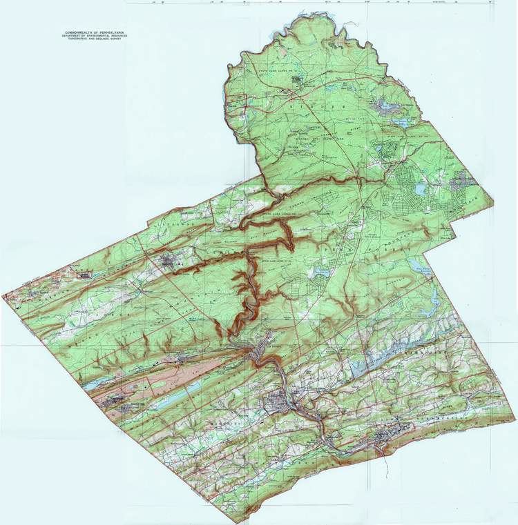
Map of Carbon County, PA, USA
The first blast furnaces in Northampton County were built by the LC&N in an attempt to make anthracite iron, the foundation of the early industrial revolution in America. The LC&N also built the first wire rope factory in the U.S. in Mauch Chunk
Carbon County is included in the Allentown-Bethlehem-Easton, PA-NJ Metropolitan Statistical Area, which is also included in the New York-Newark, NY-NJ-CT-PA Combined Statistical Area. It is considered part of the state's Coal Region, though the eastern and northeastern sections are considered part of the Pocono Mountains—since they are east of the Lehigh River, the demarcation arbitrarily separating very similar mountain ridge and valley systems.
Geography
According to the U.S. Census Bureau, the county has a total area of 387 square miles (1,000 km2), of which 381 square miles (990 km2) is land and 5.9 square miles (15 km2) (1.5%) is water. Blue Mountain forms the southern boundary of Carbon. The northeast area of the county is located in the Pocono Mountains and the northwest area includes portions of Broad Mountain and Spring Mountain. It is drained by the Lehigh River except for a small area in western Packer Township and the borough of Lansford that are drained by the Still Creek and Panther Creek, respectively, into the Little Schuylkill River and the Schuylkill River, and the Audenried area in the northwest corner that drains into the Susquehanna River via the Catawissa Creek. The Lehigh cuts a gorge between Jim Thorpe and White Haven which hosts the Lehigh Gorge State Park.
Adjacent counties
Major Highways
History
Carbon County was created on March 13, 1843 from parts of Northampton and Monroe Counties and was named for the extensive deposits of anthracite coal in the region, where it was first discovered (1791) and early attempts were made to exploit the deposits by the Lehigh Coal Mine Company (1792), whose expeditions broke trail and pioneered river bank sites using mule animal powered technology to log, saw, and build arks to carry bags of coal to Philadelphia, with only scant success.
The first settlement in Carbon County was the Moravian mission Gnadenhutten, established in 1745 in the Northampton County of the day. Deeply moved by the deplorable state of the Leni Lenape Indians in America, twelve Moravian missionaries left their home in Herrnhut Germany and traveled by sea to the wilderness of Pennsylvania, a place known for religious tolerance under the auspices of Count Zinzendorf. Located where Lehighton now stands, Gnadenhutten exemplified communal simplicity. Home to hundreds of Lenni Lenape (Delaware) and Mahican Indians displaced by white settlements, predation, bigotry and subjegation to the Iroquois, the Delaware peoples were being squeezed out of the southern counties and New Jersey westwards and against the Blue Ridge escarpment. The mission was a scene of quiet, humble and unobtrusive heroism and the Indians' shelter. Although the wilderness of Carbon County was quite treacherous, the Moravians traveled in the wilds of Carbon County undaunted. By 1752, increased hostility put Gnadenhutten at risk for attack, but the missionaries' pious good works did not go unnoticed. The frankness and earnestness of the simple Moravians had won respect with the many tribes of Pennsylvania Indians, and they lived without incident until 1755. At that point an Amerindian uprising drove settlements away from the Lehigh Gap, and whites didn't re-enter the area before the late 1780s according to Brenckman. In 1791, a homesteader, Phillip Ginter hunting on 'Sharp Mountain' along Pisgah Ridge found a black 'stone coal' outcropping, and conveyed a chunk of it to Weissport, PA. (For a more complete set of details & events, see Lehigh Canal and Lehigh Coal & Navigation Company articles.)
Lehigh Coal Mine Company (LCMC) operations had managed to fell many trees and open up the mouth area of the Nesquehoning Creek by 1800. This area became known as Lausanne, or Lausanne Landing, after the Inn & Tavern built there called the "Landing Tavern". An Amerindian trail, crossed the stream near the confluence with Jean's Run and the camp grounds of their boat builders, climbing northwestwards along a traverse to the next water gap west, eroded into the southern flank of Broad Mountain. Connecting across the barrier ridge it had just climbed to another valley whose waters originated in the saddle-pass in which Hazelton, Pennsylvania was built, the trail would become the 'Lausanne-Nescopeck road' (mule trail), then the Lehigh & Susquehanna Turnpike in 1804. Today, PA 93 follows this route in the main, save where modern road building capabilities allowed improved positioning. This road cut off 90–100 miles (140–160 km) from a trip from Philadelphia to the Wyoming Valley and the northern sections of the Coal Region.
Carbon County is the location of the trials and executions of the controversial Molly Maguires, an Irish secret society that had been accused of terrorizing the region.
Carbon County has a rich history. Some interesting people have passed through her mountains, including the Moravian mystic Count Zinzendorf, Benjamin Gilbert, John James Audubon, Benjamin Franklin, and many more.
Blessed with a unique geography, Carbon County dazzled the adventurous travelers of the Victorian era, just as it attracts adventurers today. Aesthetically not much has changed of this unique landscape; written in 1877, the following passage is still valid today: "Such rough and tumble experience, climbing mountains, falling over rocks, exploring wild ravines, diving into coal mines, and riding on every description of conveyance which it has entered into the mind of man to run on." Home of the Lehigh Gorge State Park, Carbon County is an ideal place for hikers, cyclists, history buffs and adventurers.
Demographics
As of the census of 2000, there were 58,802 people, 23,701 households, and 16,424 families residing in the county. The population density was 154 people per square mile (60/km²). There were 30,492 housing units at an average density of 80 per square mile (31/km²). The racial makeup of the county was 97.82% White, 0.60% Black or African American, 0.16% Native American, 0.31% Asian, 0.03% Pacific Islander, 0.32% from other races, and 0.76% from two or more races. 1.46% of the population were Hispanic or Latino of any race. 29.4% were of German, 10.1% Irish, 9.2% Italian, 7.9% American, 6.6% Slovak, 6.0% Polish and 5.8% Ukrainian ancestry according to Census 2000.
There were 23,701 households out of which 28.70% had children under the age of 18 living with them, 54.80% were married couples living together, 9.90% had a female householder with no husband present, and 30.70% were non-families. 26.00% of all households were made up of individuals and 13.50% had someone living alone who was 65 years of age or older. The average household size was 2.44 and the average family size was 2.93.
In the county, the population was spread out with 22.20% under the age of 18, 6.90% from 18 to 24, 28.30% from 25 to 44, 24.20% from 45 to 64, and 18.50% who were 65 years of age or older. The median age was 41 years. For every 100 females there were 94.90 males. For every 100 females age 18 and over, there were 92.30 males.
Carbon County's live birth rate was 646 births in 1990. Carbon County live birth rate in 2000 declined to 566 births, while in 2011 it rose to 586 babies. Over the past 50 years (1960 to 2010), rural Pennsylvania saw a steady decline in both the number and proportion of residents under 18 years old. In 1960, 1.06 million rural residents, or 35 percent of the rural population, were children. According to data from the Pennsylvania Department of Health, in 1990, the Commonwealth of Pennsylvania's birth rate was 171,053. In 2000, Pennsylvania's birth rate was 145,874. Finally in 2011, the State's birth rate declined further to 142,021. From 2000 to 2009, the number of babies born in rural counties declined 5 percent. Urban counties have also experienced a decline in the number of school aged children. From 2000-2010 urban Pennsylvania counties had a 3 percent decline in the number of residents under 18 years old. In 2010, there were 2.07 million residents, or 22 percent of the urban population, who were under age 18.
Law and government
Carbon County has long been considered a bellwether county for Pennsylvania statewide elections. In gubernatorial elections, it has been perfect since 1952. At the presidential level, Carbon County was also a bellwether for Pennsylvania (although not the nation) until recently, with only 1 miss (in 1960) from 1916 to 2000, and with a margin within 3.5 points of the statewide margin in every election from 1940 to 2000 except 1964 (5.3% more Democratic) and 1976 (6.9% more Democratic). However, since then the county has trended Republican relative to the state as a whole, with McCain outperforming in Carbon by 8.5% relative to the state and Romney outperforming by 12.9%. Republicans hold the commissioner majority while Democrats hold all county row offices. Al Gore carried it in 2000, and in 2004, Republican George W. Bush defeated Democrat John Kerry 49.99% to 48.81% or a margin of 296 votes.
County commissioners
State Senate
State House of Representatives
United States House of Representatives
United States Senate
Community, junior and technical colleges
Public school districts
Career Tech School
Carbon Career & Technical Institute public school located in Jim Thorpe
Intermediate Unit
The public and private k-12 schools in Carbon County are served by Carbon-Lehigh Intermediate Unit 21.
Recreation
Mauch Chunk Lake is a county-run park that offers swimming, camping, hiking and cross country skiing in the winter. There are three Pennsylvania state parks in Carbon County.
Municipalities
Under Pennsylvania law, there are four types of incorporated municipalities: cities, boroughs, townships, and, in the case of Bloomsburg, a town. The following boroughs and townships are located in Carbon County:
Census-designated places
Census-designated places are geographical areas designated by the U.S. Census Bureau for the purposes of compiling demographic data. They are not actual jurisdictions under Pennsylvania law. Other unincorporated communities, such as villages, may be listed here as well.
Former communities
Population ranking
The population ranking of the following table is based on the 2010 census of Carbon County.
† county seat
PennEast Pipeline
The proposed PennEast Pipeline will pass through the county adversely impacting many property owners and community tax revenues. Unlike other states, under Pennsylvania state tax policy, natural gas and oil pipelines are exempted from property taxes. Pipeline companies prohibit development within the 100 foot wide right-of-way, there by limiting future development options for the landowner. This limits future potential property tax revenues for the school district, by constraining future land development. Located in the marcellus shale region, Carbon County is adversely impacted this way.
The Carbon County Planning Commission and Carbon County Commissioners have stated opposition to the pipeline project. The pipeline adversely impacts: Penn Forest Township, Kidder Township, Towamensing Township and Lower Towamensing Township. The Township Supervisors in all four townships passed resolutions opposing the pipeline.