
Founded April 4, 1842 Area 1,049 km² Population 28,003 (2013) | Website www.wycopa.org Congressional district 11th | |
 | ||
Rivers Susquehanna River, Tunkhannock Creek | ||
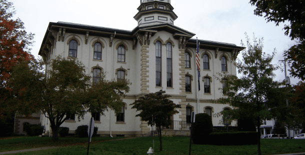
Wyoming County is a county located in the U.S. state of Pennsylvania. As of the 2010 census, the population was 28,276. Its county seat is Tunkhannock. It was created in 1842 from part of Luzerne County.
Contents
- Map of Wyoming County PA USA
- Geography
- Adjacent counties
- Demographics
- Politics
- County commissioners
- Other county offices
- State Representative
- State Senator
- United States House of Representatives
- United States Senator
- Public school districts
- Higher education
- Transportation
- Communities
- Boroughs
- Census designated places
- Population ranking
- References
Map of Wyoming County, PA, USA
Wyoming County is included in the Scranton—Wilkes-Barre—Hazleton, PA Metropolitan Statistical Area.
Geography
According to the U.S. Census Bureau, the county has a total area of 405 square miles (1,050 km2), of which 397 square miles (1,030 km2) is land and 7.7 square miles (20 km2) (1.9%) is water. The county is intersected by the North Branch of the Susquehanna River, and drained by Tunkhannock, Mehoopany, and other large creeks. The land surface is generally hilly or mountainous, Mehoopany, Tunkhannock, Knob, and Bowman's mountains occupying a portion. The soil is fertile. Timber, coal, and iron are very abundant.
Adjacent counties
Demographics
As of the census of 2000, there were 28,080 people, 10,762 households, and 7,705 families residing in the county. The population density was 71 people per square mile (27/km²). There were 12,713 housing units at an average density of 32 per square mile (12/km²). The racial makeup of the county was 98.28% White, 0.53% Black or African American, 0.27% Asian, 0.17% Native American, 0.01% Pacific Islander, 0.15% from other races, and 0.59% from two or more races. 0.67% of the population were Hispanic or Latino of any race. 20.3% were of German, 12.9% Irish, 11.9% English, 11.6% Polish, 9.6% American and 8.1% Italian ancestry according to Census 2000.
There were 10,762 households out of which 33.20% had children under the age of 18 living with them, 58.10% were married couples living together, 9.30% had a female householder with no husband present, and 28.40% were non-families. 24.10% of all households were made up of individuals and 9.90% had someone living alone who was 65 years of age or older. The average household size was 2.55 and the average family size was 3.02.
In the county, the population was spread out with 25.50% under the age of 18, 8.00% from 18 to 24, 28.10% from 25 to 44, 25.20% from 45 to 64, and 13.20% who were 65 years of age or older. The median age was 38 years. For every 100 females there were 98.60 males. For every 100 females age 18 and over, there were 95.80 males.
Politics
As of February 2015, there are 15,228 registered voters in Wyoming County.
County commissioners
Other county offices
State Representative
State Senator
United States House of Representatives
United States Senator
Public school districts
Higher education
Transportation
Skyhaven Airport is a public use airport located in Wyoming County, one nautical mile (1.85 km) south of the central business district of Tunkhannock.
With the town sited on the lower end of the upper third of the Susquehanna, busily wending its way south to the Chesapeake Bay, the river banks to either side the whole length of the Susquehanna were historically used as a rail transport corridor with competing railroads typically making their way on either side on the important NYC and Philadelphia to Buffalo, New York routes connecting the eastern seaboard to cities such as Chicago on the Great Lakes; towns like Tunkhannock played an important role in the highly competitive stakes for such high profit passenger expresses for steam locomotives had surprisingly short cruising ranges and passenger travel had higher earnings than freight. Today, except for select parts, the river bank rail transport infrastructures remaining are mainly left bank located assets of a single railroad's operations department, even shared roads (operated over by several lines) these days use the single corridor along the east/left river bank connecting the large Sayre Yard on the stateline in Sayre, Pennsylvania further upriver to the transitional Duryea yard. After the collapse of Conrail, trackage on the Northern Susquehanna is operated by Norfolk Southern, with some areas sublet to other road companies. The trackage running through Tunkhannock
Pennsylvania Route 29 ('PA-29', a continuation of US-309 from Philadelphia and Allentown) connects to the New York state line providing north-south road connections by secondary highway, whilst PA-92, and especially U.S. Route 6 (US-6) provide major east-west secondary highway access to the region.
Communities
Under Pennsylvania law, there are four types of incorporated municipalities: cities, boroughs, townships, and, in at most two cases, towns. The following boroughs and townships are located in Wyoming County:
Boroughs
Census-designated places
Population ranking
The population ranking of the following table is based on the 2010 census of Wyoming County.
† county seat