
Founded 15 March 1847 | Congressional district 10th Area 1,171 km² Population 6,351 (2013) Unemployment rate 5.5% (Apr 2015) | |
 | ||
Website www.sullivancounty-pa.us Points of interest Forksville Covered Bridge, Eagles Mere Museum, Events on the Green, Eagles Mere Tobogga, Eagles Mere Air Museum | ||
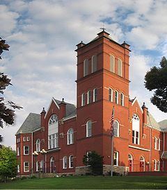
Lincoln falls sullivan county pennsylvania
Sullivan County is a county located in the U.S. state of Pennsylvania. As of the 2010 census, the population was 6,428, making it the second-least populous county in Pennsylvania. Its county seat is Laporte. The county was created on March 15, 1847, from part of Lycoming County and named for Charles C. Sullivan, leader of the Pennsylvania Senate at that time.
Contents
- Lincoln falls sullivan county pennsylvania
- Map of Sullivan County PA USA
- History
- Geography
- Adjacent counties
- Geology
- Demographics
- Politics and government
- County commissioners
- Other county offices
- State Representative
- State Senator
- United States House of Representatives
- United States Senator
- Public school districts
- Transportation
- Recreation
- Communities
- Boroughs
- Population ranking
- References
Map of Sullivan County, PA, USA
History
The land which became Sullivan County was originally purchased from the Iroquois by the Province of Pennsylvania in 1768, as part of the first Treaty of Fort Stanwix. It was then part of Northumberland County, then became part of Lycoming County when it was formed in 1795. Sullivan County itself was formed from the northeastern part of Lycoming County on March 15, 1847. It was the thirteenth and last county formed at least partly from Lycoming County (and the fifth entirely formed from it).
According to the official state publication Pennsylvania Local Government, Sullivan County was named for Pennsylvania state senator Charles C. Sullivan, who "took an active part in procuring passage of the bill" establishing the county. However, according to Frederic A. Godcharles (1933), the county is named for General John Sullivan, who led the Sullivan Expedition against the Iroquois in 1779.
Geography
According to the U.S. Census Bureau, the county has a total area of 452 square miles (1,170 km2), of which 450 square miles (1,200 km2) is land and 2.6 square miles (6.7 km2) (0.6%) is water.
Elevation ranges from 2593 ft at North Mountain in Davidson Township to 779 ft on Loyalsock Creek at the Lycoming County line. The county is served by Pennsylvania Route 87, Pennsylvania Route 487, and U.S. Route 220. The major rivers in the county are Loyalsock Creek, Little Loyalsock Creek, Muncy Creek, and Fishing Creek. The majority of the land in Sullivan County is forest, but there is some farmland, especially in the northern part of the county. There are numerous river valleys in the southern and western parts of Sullivan County.
Adjacent counties
Geology
Sullivan County lies predominantly within the Appalachian Plateau physiographic province, which is characterized by gently folded and faulted sedimentary rocks of middle to late Paleozoic age. The southern border of the county is approximately at the Allegheny Front, a geological boundary between the Ridge and Valley province and the plateau. (PA Geologic Survey Map 13). The mountains within the county are part of the Endless Mountains.
The stratigraphic record of sedimentary rocks within the county spans from the Devonian Lock Haven Formation (exposed only in Lick Creek valley) to the coal-bearing Pennsylvanian Allegheny Formation. Generally, the Catskill Formation underlies most of the lowlands, and sandstones of the Huntley Mountain, Burgoon, Mauch Chunk, or Pottsville Formations cap the mountains. No igneous or metamorphic rocks exist within the county, other than possible glacial erratics.
Structurally, the bedrock of Sullivan County is gently folded, with the axes of two major anticlines (including the Wilmot Anticline) and two major synclines (Bernice-Mehoopany Syncline and Noxen Syncline) each trending roughly east-west. There are three mapped faults in the Allegheny Formation between the towns of Murray and Ringdale.
Nearly all of Sullivan County was glaciated several times in the past, during the Pleistocene epoch, or "Ice Age." (PA Geologic Survey Map 59). Most of the county is covered by glacial till of Late Wisconsinan age. Late Illinoian Stage deposits may underlie the Late Wisconsinan deposits, and these are exposed in the south central part of the county (roughly western Davidson Township).
The major rivers in Sullivan County are Loyalsock Creek and Muncy Creek. Both flow into the West Branch of the Susquehanna River. Some streams along the eastern border of the county flow into the North Branch of the Susquehanna River. All of Sullivan county is thus within the Chesapeake Bay Watershed.
Several small coal fields exist within Sullivan County. The fields contain either bituminous coal or semi-anthracite, and all occur within Pennsylvanian strata.
Notable geologic features within Sullivan County include some of the following:
Demographics
As of the census of 2000, there were 6,556 people, 2,660 households, and 1,752 families residing in the county. The population density was 15 people per square mile (6/km²). There were 6,017 housing units at an average density of 13 per square mile (5/km²). The racial makeup of the county was 95.58% White, 2.20% Black or African American, 0.76% Native American, 0.15% Asian, 0.46% from other races, and 0.85% from two or more races. 1.10% of the population were Hispanic or Latino of any race. 33.8% were of German, 14.7% Irish, 9.5% English, 7.5% American, 5.9% Polish and 5.6% Italian ancestry according to Census 2000.
There were 2,660 households out of which 24.20% had children under the age of 18 living with them, 54.70% were married couples living together, 6.80% had a female householder with no husband present, and 34.10% were non-families. 29.30% of all households were made up of individuals and 15.20% had someone living alone who was 65 years of age or older. The average household size was 2.30 and the average family size was 2.81.
In the county, the population was spread out with 20.80% under the age of 18, 7.90% from 18 to 24, 24.10% from 25 to 44, 25.30% from 45 to 64, and 21.90% who were 65 years of age or older. The median age was 43 years. For every 100 females there were 102.10 males. For every 100 females age 18 and over, there were 100.40 males.
According to research by The Center for Rural Pennsylvania, which is a legislative Agency of the Pennsylvania General Assembly, the poverty rate for Sullivan County was 14.4% in 2014. The statewide poverty rate was 13.6% in 2014. The 2012 childhood poverty rate by school district was: Area School District - % living at 185% or below than the Federal Poverty Level and Area School District - .
Sullivan County's live birth rate was 55 births in 1990. The County's live birth rate in 2000 was 49 births, while in 2011 it was 55 babies. Over the past 50 years (1960 to 2010), rural Pennsylvania saw a steady decline in both the number and proportion of residents under 18 years old. In 1960, 1.06 million rural residents, or 35 percent of the rural population, were children.
Politics and government
As of October 2012, there are 4,243 registered voters in Sullivan County.
County commissioners
Other county offices
State Representative
State Senator
United States House of Representatives
United States Senator
Public school districts
Sullivan County School District has one high school, grades 7-12, and one elementary school, grades K-6. Sullivan County High School is located in Laporte, PA. Sullivan County Elementary School is located just behind the high school.
Transportation
Public transportation is provided by Endless Mountains Transportation Authority.
Sullivan County is one of only two counties in Pennsylvania with no known active railroad lines of any kind, the other being Fulton County.
Recreation
There are two Pennsylvania state parks in Sullivan County.
There are several festivities held in the county each year. Dushore Founder's Day- Held in August. Activities such as Outhouse Races, Roll-a-Keg Races, Arts and Crafts, and vendors. Dushore Dairy Parade- Held in Mid-June. Activities such as Milking a Cow. Laporte Fireman's Carnival- Held in August. Carnival rides and games. Sullivan County Fair- Held in Late August and Early September. Carnival rides and games, exhibitions, competitions, Demolition Derby, and vendors.
Sullivan County is also home to a large, private hunting club, Painter Den, Inc. This vast property is situated in Davidson, Laporte and Colley townships. Painter Den pond is also on the property and is stocked with Perch and Pike.
Communities
Under Pennsylvania law, there are four types of incorporated municipalities: cities, boroughs, townships, and, in at most two cases, towns. The following cities, boroughs and townships are located in Sullivan County:
Boroughs
Population ranking
The population ranking of the following table is based on the 2010 census of Sullivan County.
† county seat