
Country United States County Luzerne Incorporated 1842 Elevation 372 m Population 1,110 (2013) Local time Sunday 1:15 AM | State Pennsylvania Settled 1824 Time zone Eastern (EST) (UTC-5) Zip code 18661 Area code 443 (570 Exchange) | |
 | ||
Weather 3°C, Wind NW at 18 km/h, 86% Humidity Area 3.108 km² (3.108 km² Land / 10 ha Water) | ||
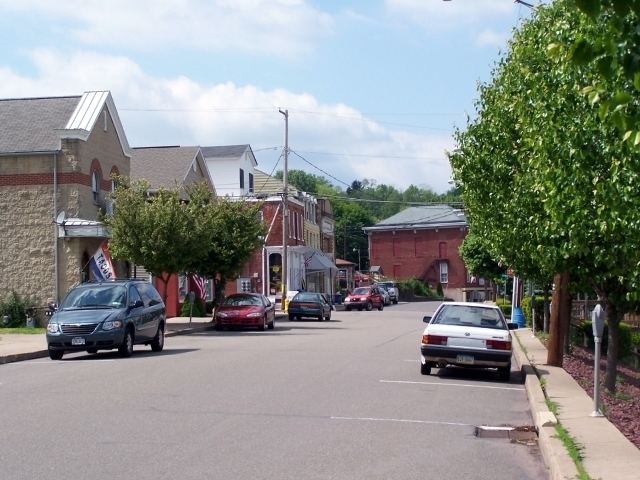
White Haven is a borough in Luzerne County, Pennsylvania, United States. White Haven was created in 1824 by industrialist Josiah White. It is located along the Lehigh River which connects White Haven to Jim Thorpe, Pennsylvania. The population was 1,097 at the 2010 census. White Haven is located 17 miles (27 km) south of Wilkes-Barre, Pennsylvania, and 4 miles (6 km) west of the I-476 and I-80 interchange. White Haven's elevation is 1,221 feet (372 m) above sea level.
Contents
Map of White Haven, PA 18661, USA
Geography
White Haven is located at 41°3′34″N 75°46′34″W (41.059532, -75.776123).
According to the United States Census Bureau, the borough has a total area of 1.2 square miles (3.2 km2), of which 1.2 square miles (3.2 km2) is land and 0.04 square miles (0.1 km2), or 2.12%, is water.
Demographics
As of the census of 2000, there were 1,182 people, 468 households, and 329 families residing in the borough. The population density was 982.1 people per square mile (380.3/km2). There were 515 housing units at an average density of 427.9 per square mile (165.7/km2). The racial makeup of the borough was 98.39% White, 0.08% Native American, 1.27% Asian, and 0.25% from two or more races. Hispanic or Latino of any race were 0.76% of the population.
The main ancestries reported by White Haven residents on the 2000 Census were Polish, with 17% of the population, Italian with 13%, Irish with 10%, Slovak with 8%, and German with 6%. However, Czechoslovakian, Carpatho Rusyn, Eastern European and Slavic were all reported by about one percent of the population, so the Slovak population might have come in second to Polish if the census had allowed reporting of more than two ancestries.
There were 468 households, out of which 34.0% had children under the age of 18 living with them, 52.6% were married couples living together, 12.8% had a female householder with no husband present, and 29.5% were non-families. 26.5% of all households were made up of individuals, and 14.1% had someone living alone who was 65 years of age or older. The average household size was 2.53 and the average family size was 3.06.
In the borough the population was spread out, with 27.3% under the age of 18, 7.3% from 18 to 24, 28.0% from 25 to 44, 20.9% from 45 to 64, and 16.5% who were 65 years of age or older. The median age was 37 years. For every 100 females there were 87.3 males. For every 100 females age 18 and over, there were 88.8 males.
The median income for a household in the borough was $37,438, and the median income for a family was $43,846. Males had a median income of $32,159 versus $27,386 for females. The per capita income for the borough was $18,768. About 4.5% of families and 6.4% of the population were below the poverty line, including 8.3% of those under age 18 and 8.8% of those age 65 or over.