
Airport type Public 7/25 3,375 1,029 Asphalt Elevation 166 m Phone +1 570-288-3257 | Elevation AMSL 543 ft / 166 m 3,375 1,029 9/27 2,191 Code WBW | |
 | ||
Address 2001 Wyoming Ave, Kingston, PA 18704, USA | ||
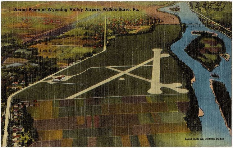
Wilkes-Barre Wyoming Valley Airport (IATA: WBW, ICAO: KWBW, FAA LID: WBW) is a county owned, public airport three miles north of Wilkes-Barre, in Luzerne County, Pennsylvania and 11 miles south of Scranton, in Lackawanna County, Pennsylvania The National Plan of Integrated Airport Systems for 2011–2015 categorized it as a general aviation facility. The primary airport of the Scranton/Wilkes-Barre metropolitan area is the Wilkes-Barre/Scranton International Airport (AVP)
Facilities
The airport covers 135 acres (55 ha) at an elevation of 543 feet (166 m). It has two runways: 7/25 is 3,375 by 75 feet (1,029 × 23 m) asphalt; 9/27 is 2,191 by 100 feet (668 × 30 m) asphalt and turf.
In the year ending October 4, 2011 the airport had 25,125 aircraft operations, average 68 per day: 99.5% general aviation, 0.3% military and 0.2% air taxi. 51 aircraft were then based at the airport: 98% single-engine and 2% multi-engine.