
Length 391.6 km | ||
 | ||
Existed: August 7, 1947 by FHWAJuly 1, 1964 by Caltrans – present | ||
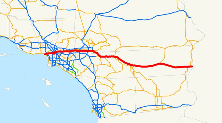
Interstate 10 (I-10, The 10), a major east–west Interstate Highway, runs in the U.S. state of California east from Santa Monica, on the Pacific Ocean, through Los Angeles and San Bernardino to the border with Arizona. In the greater Los Angeles area, it is known as the Santa Monica Freeway and the San Bernardino Freeway, linked by a short concurrency on Interstate 5 (the Golden State Freeway) at the East Los Angeles Interchange.
Contents
- Route description
- Santa Monica Freeway
- San Bernardino Freeway
- Riverside County
- History
- Juan Bautista de Anza National Historic Trail
- Future
- Spur to US 101
- References
Interstate 10 also has portions designated as either the Rosa Parks Freeway or the Redlands Freeway.
Route description
The California Streets and Highways Code defines Route 10 from "(a) Route 1 in Santa Monica to Route 5 near Seventh Street in Los Angeles. (b) Route 101 near Mission Road in Los Angeles to the Arizona state line at the Colorado River via the vicinity of Monterey Park, Pomona, Colton, Indio, and Chiriaco Summit and via Blythe.." Despite the legislative definition, Caltrans connects the two sections of the route by cosigning I-10 down Interstate 5 between the East LA Interchange and the Santa Monica Freeway, negating a section of the San Bernardino Freeway west of I-5. This short section of Route 10 between Route 5 and Route 101, which was formerly defined as Route 110 (signed as Interstate 110) until 1968, is signed overhead for I-10 eastbound and for U.S. 101 westbound. This I-5/I-10 cosigning is consistent with the Federal Highway Administration's Interstate Highway route logs that such an overlap exists for the segment of I-10 in California.
I-10 is part of the California Freeway and Expressway System and is eligible for the State Scenic Highway System. However, it is not actually a scenic highway as designated by Caltrans. The Santa Monica Freeway is Route 10 from Route 1 to Route 5, as named by the State Highway Commission on April 25, 1957.
The section between the Harbor (I-110) and San Diego (I-405) freeways is also signed as the Rosa Parks Freeway, after the African American civil rights activist. The I-10 freeway is signed as the Christopher Columbus Transcontinental Highway in Santa Monica.
Santa Monica Freeway
The Santa Monica Freeway is the westernmost segment of Interstate 10, beginning at the western terminus of I-10 at the Pacific Coast Highway in Santa Monica, California and ending southeast of downtown Los Angeles at the East Los Angeles Interchange.
Interstate 10 begins in the city of Santa Monica when State Route 1 turns into a freeway and heads east. SR 1 exits onto Lincoln Boulevard and heads south while I-10 continues east. Soon after it enters the city of Los Angeles, I-10 has a four-level interchange with Interstate 405. Interstate 10 then continues through Sawtelle, Rancho Park, Cheviot Hills, Beverlywood and Crestview in West Los Angeles, Lafayette Square and Wellington Square in Mid-City, Arlington Heights, West Adams and Jefferson Park into downtown Los Angeles. On the western edge of downtown, I-10 has an interchange with Interstate 110 to the south and State Route 110 to the north. I-10 then travels along the southern edge of downtown to the East Los Angeles Interchange.
At the East Los Angeles Interchange, State Route 60 diverges east towards Riverside and Pomona. I-10 then turns north, running concurrently with Interstate 5 for a few miles. Then, Interstate 10 heads east and merges with the traffic from the spur to US 101 onto the San Bernardino Freeway.
The freeway is 14 lanes wide (two local, five express in each direction) from the Harbor Freeway (Interstate 110) interchange to the Arlington Avenue off-ramp. Most of these lanes are full at peak travel times (even on Saturdays). The remainder of the freeway varies between eight and 10 lanes in width. The whole freeway (though a much smaller version) opened in 1965, with a formal dedication held in 1966.
While the construction of the Century Freeway several miles to the south reduced traffic congestion to a considerable amount by creating an alternate route from downtown to the Los Angeles International Airport, the Santa Monica Freeway is still one of the busiest freeways in the world. All three freeway-to-freeway interchanges along its length are notorious for their congestion, and are routinely ranked among the top 10 most congested spots in the United States.
Due to the high traffic volume, car accidents are so common that Caltrans has constructed special Accident Investigation Sites separated from the freeway by fences. These enable the California Highway Patrol to quickly clear accidents from the through traffic lanes, and the fences reduce congestion by preventing rubbernecking (in which vehicles slow down so their occupants can watch the accident investigation).
The Santa Monica Freeway is considered the border between West Los Angeles and South Los Angeles. Part of the freeway also skims the Byzantine-Latino quarter, which is home to many immigrants affiliated with the Eastern Orthodox Church.
San Bernardino Freeway
Interstate 10 heads east from Downtown Los Angeles the Eastside Los Angeles region, with two HOV lanes paralleling it on the north side called the El Monte Busway. These roadways extend to Alameda Street on US 101, following the spur west to where I-10 passes California State University Los Angeles. However, after the Interstate 710 interchange, these lanes merge back into the typical left lanes of each roadway.
East of Interstate 710, I-10 continues through Monterey Park, Alhambra, Rosemead, San Gabriel, El Monte, and Baldwin Park before intersecting with Interstate 605. It then travels through West Covina and Covina before heading up Kellogg Hill into San Dimas, where I-10 intersects with State Route 57 (formerly part of Interstate 210) and State Route 71 at the Kellogg Interchange. I-10 then heads east through Pomona and Claremont, and leaving L.A. County to enter San Bernardino County.
In San Bernardino County, Interstate 10 travels through Montclair, Upland, and Ontario, providing access to Ontario International Airport. I-10 then has a four-level interchange with Interstate 15 before traveling through Fontana, Rialto, and Colton. I-10 then intersects with Interstate 215 before briefly entering San Bernardino city proper and traveling through Loma Linda and Redlands. In Redlands, I-10 intersects with the State Route 210 freeway (future Interstate 210) and with State Route 38 before entering Yucaipa and eventually Riverside County.
Riverside County
In Riverside County, I-10 goes through Calimesa before entering Beaumont and merging with the eastern end of State Route 60 (itself formerly the California segment of US 60). In Banning, I-10 has a diamond intersection with State Route 243 before passing through San Gorgonio Pass between the San Bernardino Mountains and the San Jacinto Mountains and entering Palm Springs. I-10 intersects with the western end of State Route 111, whereas I-10 bypasses the town and connects to State Route 62, a major east–west route through the Mojave Desert. I-10 cuts through Cathedral City and passes just outside the city limits of Rancho Mirage, Palm Desert, and Indian Wells before entering Indio. I-10 then has an interchange in Coachella with the northern end of the State Route 86 freeway, which also leads to SR-111. Past Coachella, I-10 traverses the Mojave Desert, with few junctions and no cities. Several miles east and roughly halfway between Indio and Blythe, in the community of Desert Center, I-10 intersects with State Route 177, a turnoff that connects to SR-62. Near the Arizona state line, I-10 meets the terminus of State Route 78. In the city of Blythe, I-10 runs concurrently with U.S. Route 95 as both routes cross the Colorado River into Arizona.
I-10 westbound is usually signed as towards San Bernardino and/or Los Angeles in the Mojave Desert. Eastbound, in the San Gorgonio Pass, the signage indicates "Indio, Other Desert Cities", and indicates "Blythe" after Indio — the first sign for Phoenix does not occur until Indio.
History
What is now Interstate 10 east of Los Angeles was generally part of the Atlantic and Pacific Highway, one of many transcontinental national auto trails. By 1926, when the United States Numbered Highways were assigned, the road across the desert east of Indio was unimproved, while the road from Indio west to San Bernardino (as well as various roads west to Los Angeles) was paved. In late 1926, U.S. Route 99 was designated along the section of road from San Bernardino to Indio, where it turned south along present State Route 86 on the west side of the Salton Sea. West of San Bernardino, US 99 ran to Los Angeles concurrent with U.S. Route 66 (via Pasadena) before turning north; this route to Los Angeles is north of the later alignment of Interstate 10. The piece of this between San Bernardino and Indio was defined in 1915 as Legislative Route 26. (It continued south from Indio via El Centro to Heber; see U.S. Route 99 and State Route 86 for details. A 1931 extension took it south to Calexico on present State Route 111.)
The route from Indio via Mecca to the Arizona state line near Blythe was defined in 1919 as pre-1964 Legislative Route 64. (Later extensions took LR 64 west along present State Route 74; a 1931 cutoff bypassed Mecca to the north.) LR 26 was extended west from San Bernardino to Los Angeles in 1931, running along an alignment south of the existing US 66/US 99. Neither of these was a signed route until around 1932, when U.S. Route 60 was extended west from Arizona to Los Angeles, running along LR 64 to Indio, LR 26 (with US 99) to Beaumont, pre-1964 Legislative Route 19 to Pomona, and LR 26 to Los Angeles. (The original alignment of LR 26 ran roughly where State Route 60 now is west of Pomona, but an alignment close to present I-10 opened around 1934).
Thus, in 1931, what is now I-10 east of Los Angeles had been defined as LR 26 from Los Angeles to Indio and LR 64 from Indio to Arizona. It was signed as US 99 from San Bernardino to Indio, and US 60 came along around 1932 from Los Angeles to Pomona and from Beaumont to Arizona. U.S. Route 70 was extended west from Arizona ca. 1936 along the whole route to Los Angeles, and, between 1933 and 1942, US 99 moved from US 66 to present I-10 between San Bernardino and Los Angeles, forming a three-way concurrency between Pomona and Los Angeles. Old alignments and names include Valley Boulevard, Ramona Boulevard and Garvey Avenue.
I-10 holds the distinction of being the first freeway in Los Angeles. A four-mile section of today's freeway was built between 1933 and 1935 at a cost of $877,000. The "Ramona Boulevard" highway linked downtown Los Angeles to the communities of the southern San Gabriel Valley. The roadway, which opened on April 20, 1935, was dubbed the "Air Line route," and was seen as a major achievement in traffic design.
The route east from Los Angeles was added to the Interstate Highway System on August 7, 1957. It was assigned the I-10 number on August 14, 1957, and the short piece west of I-5 was approved as I-110 on November 10, 1958. By then, most if not all of the San Bernardino Freeway had been completed, and I-10 was signed along the existing freeway along with US 70, US 99, and part of US 60. Those three routes were all removed in the 1964 renumbering, leaving only I-10.
The part west of downtown Los Angeles was pre-1964 Legislative Route 173, defined in 1933 from Santa Monica to downtown Los Angeles. It was signed as State Route 26 by 1942, running primarily Olympic Boulevard. It was later replaced by the Santa Monica Freeway, and added to the Interstate Highway System on September 15, 1955. It too was assigned the I-10 number on August 14, 1957. It was completed ca. 1964, and became Route 10 in the 1964 renumbering.
Portions of the Santa Monica Freeway going over La Cienega Boulevard collapsed after the Northridge earthquake on January 17, 1994, and were rebuilt using new Seismic-Resistant bridge designs.
The El Monte Busway was converted to high occupancy toll (HOT) lanes in 2013 as part of the Metro ExpressLanes project.
On July 19, 2015, a bridge carrying the eastbound lanes of I-10 near Desert Center collapsed from floodwater from the remnants of Hurricane Dolores, trapping a vehicle.
On October 23, 2016 thirteen people died in a tour bus crash. The cause is under investigation.
Juan Bautista de Anza National Historic Trail
The I-10 is part of the auto tour route of the Juan Bautista de Anza National Historic Trail, a National Park Service unit in the United States National Historic Trail and National Millennium Trail programs. In 2005, Caltrans began posting signs on roads that overlap with the historic 1776 Juan Bautista de Anza trail route, so that California drivers can now follow the trail.
Future
With the increasing high traffic volume between Los Angeles and San Bernardino, Caltrans has a few projects on the books to relieve the traffic congestion:
Spur to US 101
The legislative definition of Route 10 includes a spur from Interstate 5 (the Golden State Freeway) west to U.S. Route 101 (the Santa Ana Freeway) near downtown Los Angeles. This section of roadway, the westernmost part of the San Bernardino Freeway, was in fact part of the original San Bernardino Freeway, carrying U.S. Route 60, U.S. Route 70 and U.S. Route 99 long before the Golden State Freeway opened. It was added to the Interstate Highway System by 1958 as Interstate 110, but in 1968 it was removed from the system, becoming a Route 10 spur.
This road is signed only for the roads it feeds into: US 101 northbound and I-10 eastbound. It has only two interchanges between its ends: a westbound exit off of the spur at Mission Road immediately before merging with U.S. Route 101 northbound, and the eastbound exit for State Street and Soto Street before it merges onto I-10 eastbound—this one is numbered (as exit 19). There is no access from the I-10 spur to I-5.
Exit list
The entire route is in Los Angeles, Los Angeles County.