
Country United States Elevation 716 m Zip code 92220 | State California Incorporated February 6, 1913 Area code 951 Local time Wednesday 6:02 PM Population 30,506 (2013) | |
 | ||
Weather 13°C, Wind E at 19 km/h, 26% Humidity | ||
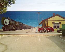
City of banning california proud history prosperous tomorrow
Banning is a city in Riverside County, California, United States. The population was 29,603 at the 2010 census. It is situated in the San Gorgonio Pass, also known as Banning Pass. It is named for Phineas Banning, stagecoach line owner and the "Father of the Port of Los Angeles."
Contents
- City of banning california proud history prosperous tomorrow
- Map of Banning CA USA
- Banning california 12 30 14
- Early history
- Indian School and cemetery
- World War II
- Geography
- Climate
- 2010
- 2000
- Government
- Safety
- Education
- Transportation
- Health care
- Cemetery
- Library
- In popular culture
- Notable residents
- References
Map of Banning, CA, USA
Banning has a western neighbor, the city of Beaumont, which shares geographic and regional features. Banning and Beaumont have been rapidly growing in size and population since the 1990s. Both cities are about 80 miles east of downtown Los Angeles and 30 miles west of Palm Springs, each connected by freeway and railroad.
Banning california 12 30 14
Early history
The area, up to the mid-19th century, was inhabited by the Cahuilla people, though the region around Banning was originally Maringayam (Serrano), and the Cahuilla expanded into the pass only in historic times. In 1824 it became part of the Mission San Gabriel Arcangel, and then the Rancho San Gorgonio. The first Anglo to settle in the area was Dr. Isaac Smith in 1853. In 1863 a smallpox epidemic further diminished the Cahuilla. The government created Indian reservations for the Cahuilla in 1877.
The development of the settlement that was to become Banning coincided with the start of the Colorado River Gold Rush. The Bradshaw Trail was a wagon road to the gold boomtowns of Arizona Territory that passed through the area in 1862. Gilman's Ranch north of downtown served as a station for the stagecoach lines on this road. The railroad followed passing through the town in 1876. The Southern Pacific (later purchased by Union Pacific) railroad, was a major contributor to the area's growth. U.S. Route 99 was built in 1923, followed by U.S. Route 60/70 in 1936, and subsequently Interstate 10.
Banning borders the Morongo Indian Reservation, home to the Morongo Band of Cahuilla (Mission) Indians. Relations with reservation residents have been stressed by such actions as disputes over water rights. See Dorothy Ramon's book (published 2000) "Always Believe" for a Maringayam's views on Banning and reservation life.
Prior to the name Banning, the settlement was called Moore City. Ransom B. Moore operated a large cattle ranch and was a member of the Los Angeles County Board of Supervisors, settling in the area and nearby San Gorgonio mountains in the early 1860s. Moore sold his holdings and relocated to central Arizona in 1883, establishing a large cattle ranch on the site of the former Camp Reno army outpost and later served in the Arizona Territorial Legislature.
The town of Banning was incorporated on February 6, 1913. Between the years 1880 and 1980, it was the largest city in year-round population between Redlands and the Colorado River.
Indian School and cemetery
The St. Boniface Indian Industrial School was opened in 1890, providing vocational education to Cahuilla, Serrano, Luiseño, Kumeyaay, and other American Indians. Bishop Francisco Mora y Borrell authorized the school and Mother Katharine Drexel provided funding to the Bureau of Catholic Indian Missions for purchase of the land, construction, and operations. Over its history, about 8,000 students attended the school which was demolished in 1974. A small abandoned cemetery remains.
World War II
During World War II, Banning was the site of the 1,000-bed Banning General Hospital. It supported training at the Desert Training Center and was later used as a naval convalescent hospital. The facilities were dismantled in 1948.
In 1942 the citizens of Banning raised funds for the purchase of an M3 Stuart tank to support the war effort. After the war the tank was given to the South African defense force; in turn, the tank was donated to a Memorable Order of Tin Hats Shellhole in Richmond, Natal Province, South Africa. The tank, named "City of Johannesburg", is now preserved at a local museum at Richmond.
Geography
Banning is located at 33°55′54″N 116°53′51″W (33.931729, -116.897557).
According to the United States Census Bureau, the city has a total area of 23.1 square miles (60 km2), all of it land.
Banning's elevation is approximately 2,300 feet (700 m) above sea level, which gives it a cooler climate in contrast to the county seat Riverside at 800 feet (240 m) above sea level and the Coachella Valley of the Colorado Desert to the east.
Banning is traversed by the San Andreas Fault which is responsible for the creation of the pass in which the city is situated.
Banning is 25 miles (40 km) west of Palm Springs and 100 miles (160 km) east of Los Angeles.
Climate
According to the Köppen Climate Classification system, Banning has a warm-summer Mediterranean climate, abbreviated "Csa" on climate maps.
2010
The 2010 United States Census reported that Banning had a population of 29,603. The population density was 1,281.6 people per square mile (494.8/km²). The racial makeup of Banning was 19,164 (64.7%) White (43.4% Non-Hispanic White), 2,165 (7.3%) African American, 641 (2.2%) Native American, 1,549 (5.2%) Asian, 39 (0.1%) Pacific Islander, 4,604 (15.6%) from other races, and 1,441 (4.9%) from two or more races. Hispanic or Latino of any race were 12,181 persons (41.1%).
The Census reported that 28,238 people (95.4% of the population) lived in households, 254 (0.9%) lived in non-institutionalized group quarters, and 1,111 (3.8%) were institutionalized.
There were 10,838 households, out of which 3,083 (28.4%) had children under the age of 18 living in them, 5,106 (47.1%) were opposite-sex married couples living together, 1,488 (13.7%) had a female householder with no husband present, 592 (5.5%) had a male householder with no wife present. There were 700 (6.5%) unmarried opposite-sex partnerships, and 75 (0.7%) same-sex married couples or partnerships. 3,092 households (28.5%) were made up of individuals and 2,085 (19.2%) had someone living alone who was 65 years of age or older. The average household size was 2.61. There were 7,186 families (66.3% of all households); the average family size was 3.19.
The population was spread out with 6,777 people (22.9%) under the age of 18, 2,730 people (9.2%) aged 18 to 24, 6,048 people (20.4%) aged 25 to 44, 6,387 people (21.6%) aged 45 to 64, and 7,661 people (25.9%) who were 65 years of age or older. The median age was 42.3 years. For every 100 females there were 93.4 males. For every 100 females age 18 and over, there were 90.7 males.
There were 12,144 housing units at an average density of 525.7 per square mile (203.0/km²), of which 7,412 (68.4%) were owner-occupied, and 3,426 (31.6%) were occupied by renters. The homeowner vacancy rate was 4.1%; the rental vacancy rate was 10.9%. 17,552 people (59.3% of the population) lived in owner-occupied housing units and 10,686 people (36.1%) lived in rental housing units.
According to the 2010 United States Census, Banning had a median household income of $38,919, with 19.4% of the population living below the federal poverty line.
2000
As of the census of 2000, there were 23,562 people, 8,923 households, and 6,237 families residing in the city. The population density was 1,022 people per square mile (395/km²). There were 9,761 housing units at an average density of 423/sq mi (164/km²). The racial makeup of the city was 64.2% White, 8.6% Black or African American, 2.5% Native American, 5.4% Asian, 0.1% Pacific Islander, 14.9% from other races, and 4.9% from two or more races. 30.2% of the population were Hispanic or Latino of any race.
There were 8,923 households out of which 26.3% had children under the age of 18 living with them, 53.2% were married couples living together, 12.5% had a female householder with no husband present, and 30.1% were non-families. 25.8% of all households were made up of individuals and 16.1% had someone living alone who was 65 years of age or older. The average household size was 2.60 and the average family size was 3.11.
In the city, the population was spread out with 26.4% under the age of 18, 7.4% from 18 to 24, 20.9% from 25 to 44, 18.4% from 45 to 64, and 26.8% who were 65 years of age or older. The median age was 41 years. For every 100 females there were 90.9 males. For every 100 females age 18 and over, there were 86.7 males.
The median income for a household in the city was $32,076, and the median income for a family was $38,995. Males had a median income of $31,300 versus $20,794 for females. The per capita income for the city was $16,231. About 14.8% of families and 19.9% of the population were below the poverty line, including 31.8% of those under age 18 and 6.5% of those age 65 or over.
Government
In the California State Legislature, Banning is in the 23rd Senate District, represented by Republican Mike Morrell, and in the 42nd Assembly District, represented by Republican Chad Mayes.
In the United States House of Representatives, Banning is in California's 36th congressional district, represented by Democrat Raul Ruiz.
Safety
Banning has had its own police force since shortly after its 1913 incorporation, and for many years also had a regional station of the Riverside County Sheriff's Department (which has moved eastward to neighboring Cabazon). The Beaumont, Palm Springs, Cathedral City, and Desert Hot Springs Police Departments also provide assistance in a major emergency, as well as the California Highway Patrol out of the Beaumont regional station.
The city of Banning contracts for fire and paramedic services with the Riverside County Fire Department through a cooperative agreement with CAL FIRE.
Education
The city is served by the Banning Unified School District and nearby Beaumont has the Beaumont Unified School District, both districts serve the area. Schools in the Banning USD:
Transportation
City-owned Banning Municipal Airport, FAA designator: BNG, has a 5,200-foot (1,600 m) runway.
Health care
San Gorgonio Memorial Hospital is a General Acute Care Hospital in Banning with Basic Emergency Services as of 2005.
Cemetery
The Summit Cemetery District operates the San Gorgonio Memorial Park, which was established in 1931 as the Banning-Cabazon Cemetery District. U.S. Geological Survey Geographic Names Information System: Sunnyslope Cemetery Notable burials include Medal of Honor recipient William Powers Morris.
Library
The Banning Library District operates the Banning Public Library, which was established in 1916 as the Banning Unified School District Library District and became an independent special district in 2005.