
Country United States Elevation 1,358 ft (414 m) Local time Sunday 8:26 AM | State California Incorporated December 3, 1888 Area code Area code 909 | |
 | ||
Weather 12°C, Wind E at 2 km/h, 74% Humidity Colleges and Universities University of Redlands, Community Christian College, Salon Success Academy‑Redlands, California Preparatory College | ||
Redlands /ˈrɛdlᵻndz/ is a city in San Bernardino County, California, United States. It is a part of the Greater Los Angeles area. As of the 2010 census, the city had a population of 68,747, up from 63,591 at the 2000 census. The population was estimated at 69,999 in 2013. The city is located approximately 10 miles (16 km) east of downtown San Bernardino.
Contents
- Map of Redlands CA USA
- History
- Railroads
- Citrus
- Geography
- Climate
- 2010
- 2000
- Federal
- State
- Municipal government
- Public education
- Transportation
- Airports
- Economy
- Historic structures
- Museums
- Theater and music
- Open spaces
- Cemetery
- Local attractions
- Local events
- Local references
- Religion
- Notable people
- Sister cities
- References
Map of Redlands, CA, USA
History
The area now occupied by Redlands was originally part of the territory of the Morongo and Aguas Calientes tribes of Cahuilla people. Explorations such as those of Pedro Fages and Francisco Garcés sought to extend Catholic influence to the indigenous people and the dominion of the Spanish crown into the area in the 1770s. The Serrano (Mountain-dwelling Cahuilla) village of Guachama, located just to the west of present-day Redlands, was visited by Fr. Francisco Dumetz in 1810, and was the reason the site was chosen for a mission outpost. Dumetz reached the village on May 20, the feast day of Saint Bernardino of Siena, and thus named the region the San Bernardino Valley. The Franciscan friars from Mission San Gabriel established the San Bernardino Asistencia in 1819 and embarked on the usual program of training the native tribes to raise crops and encouraging permanent settlements. By 1820, a ditch, known as a zanja, was dug by the natives for the friars from Mill Creek to the Asistencia. In 1822, word of the Mexican triumph in the War of Independence reached the inland area, and lands previously claimed by Spain passed to the custody of the Mexican government.
In 1842, the Lugo family bought the Rancho San Bernardino Mexican land grant and this became the first fixed settler civilization in the area. The area northwest of current Redlands, astride the Santa Ana River, would become known as Lugonia. In 1851, the area received its first Anglo inhabitants in the form of several hundred Mormon pioneers, who purchased the entire Rancho San Bernardino, founded nearby San Bernardino, and established a prosperous farming community watered by the many lakes and streams of the San Bernardino Mountains. The Mormon community left wholesale in 1857, recalled to Utah by Brigham Young during the tensions with the federal government that ultimately led to the brief Utah War. Benjamin Barton purchased 1,000 acres (4 km2) from the Latter-day Saints and planted extensive vineyards and built a winery.
"The first settler on the site of the present Redlands is recorded to have erected a hut at the corner of what is now Cajon St. and Cypress Ave.; he was a sheep herder, and the year, 1865," reported Ira L. Swett in "Tractions of the Orange Empire." Lugonia attracted settlers; in 1869, Barry Roberts, followed a year later by the Craw and Glover families. "The first school teacher in Lugonia, George W. Beattie, arrived in 1874—shortly followed by the town's first negro settler, Israel Beal."
The city has been visited by three U.S. Presidents: William McKinley was the first in 1901, followed by Theodore Roosevelt in 1903 and William Howard Taft in 1909. Local landmarks include the A.K. Smiley Public Library, a Moorish-style library built in 1898, and the Redlands Bowl, built in 1930 and home of the oldest continuously free outdoor concert series in the United States. Located behind the Smiley Library is the Lincoln Shrine, the only memorial honoring the "Great Emancipator", the sixteenth president, west of the Mississippi River. Famous homes include “America’s Favorite Victorian,” the Morey Mansion, on Terracina Boulevard, and the Kimberly Crest House and Gardens, a home museum featured on the PBS series “America’s Castles.” Named after the family that purchased the house, the owners of Kimberly-Clark (makers of paper goods and Kleenex), it is a beautiful mansion set high on a hill overlooking the whole valley. Redlands is still regarded as the "Jewel of the Inland Empire." In the mid-late 20th Century, Redlands was home to various light manufacturing firms, and became a bedroom community for the military personnel and contractor employees of the aerospace industry that supported missions at Norton Air Force Base as well as the Lockheed Propulsion Company plant in Mentone.
Railroads
In the 1880s, the arrival of the Southern Pacific and Atchison, Topeka and Santa Fe Railroads, connecting Southern California to San Francisco and Salt Lake triggered a land boom, with speculators such as John W. North flooding the area now known as the Inland Empire. North and others saw the area, with its hot, dry climate and ready access to water as an ideal center for citrus production. The city of Redlands was soon established by Frank E. Brown, a civil engineer, and E. G. Judson, a New York stock broker, to provide a center (along with North's nearby settlement at Riverside) for the burgeoning citrus industry. They named their city “Redlands” after the color of the adobe soil. So large had the area grown by 1888 that it was decided to incorporate. "A red-letter day in the Annals of Redlands," pronounced Scipio Craig, editor of The Citrograph newspaper, of the November 26 incorporation. The original community of Lugonia was absorbed at this time. The newspaper was first published in July 1887 by The Citrograph Printing Company, which remains in 2015 as both Redlands' oldest business and the longest-operating printing company in California.
The Redlands Street Railway Company was incorporated on March 22, 1888, acquiring on June 5 a franchise from the San Bernardino County Supervisors dating to December 1887, conveying the right to construct, operate and maintain for a term of 50 years a line of street railways in Redlands, Terracina and vicinity. The initial operations began in June 1889 with a single-track line operating two-mule-team cars, the first street railway company of several to provide service to the community. Electrification and new rails replaced mules in 1899. Most Redlands street railways would pass to the San Bernardino Valley Traction Company in a consolidation on June 3, 1903, and thence to the Pacific Electric in the "Great Merger" of Huntington properties under new ownership by the Southern Pacific Transportation Company on February 8, 1911. Henry E. Huntington, nephew of late Southern Pacific president Collis P. Huntington, had gained control of the four-mile (6 km)-long streetcar line of the Redlands Central Railway Company in 1908.
The Pacific Electric Railway completed an interurban connection between Los Angeles and San Bernardino in 1914, providing a convenient, speedy connection to the fast-growing city of Los Angeles and its new port at San Pedro, bringing greater prosperity to the town and a new role as a vacation destination for wealthy Angelenos. Redlands was the eastern terminus of the "Big Red Car" system. At its peak, PE operated five local routes in Redlands, with streetcars running to Smiley Heights, and on Orange, Olive, and Citrus Avenues. Pacific Electric interurban service to Redlands was abandoned on July 20, 1936, with 2.07 miles (3.33 km) of track into the city lifted, although PE and Southern Pacific (parent company of PE) provided freight service as far as the Sunkist packing plant at Redlands Heights on San Bernardino Avenue into at least the 1970s. The Smiley Heights line was abandoned at this time, as well. Bus service operated by the Motor Transit Company, a subsidiary of Pacific Electric, began on July 20. This also affected mail delivery in Redlands as "Approximately 80 percent of our mail from all directions arrives on the 5 a.m. electric car," explained Postmaster James B. Stone. "This dispatch is sorted and morning deliveries started by 8:30 a.m. on most routes. The post office department has temporarily arranged for this mail to be brought in by the Santa Fe train at 6:05 a.m. As this arrival is an hour later, our service will be one hour later." The abandoned Pacific Electric La Quinta trestle over the Santa Ana River stands today, immediately south of San Bernardino International Airport.
Citrus
In the spring of 1882, Mr. E. J. Waite of Wisconsin planted the first orange grove in the city. For almost 75 years, the city was the center of the largest navel orange producing region in the world. By the late 1930s, Redlands was a fruit-packing center surrounded by more than 15,000 acres (61 km2) of citrus groves. The city produced more than 4,200 railcars of navel oranges and 1,300 cars of Valencia oranges during the 1937–38 growing season. During the 1930s and 1940s, labor activists campaigned in the canneries and packing houses for union representation and higher wages. The United Cannery, Agricultural, Packing, and Allied Workers of America (UCAPAWA) won 13 National Labor Relations Board representation elections in the Riverside-Redlands area in 1943. In 1945, the first annual Orange Queen Ball at the Redlands City Auditorium was held to raise funds for the union.
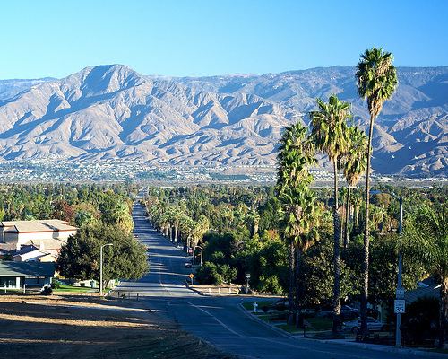
At the turn of the 20th century, Redlands was the "Palm Springs" of the next century, with roses being planted along many city thoroughfares. Some of these plantings would survive as wild thickets into the 1970s, especially adjacent to orange groves where property management was lax. Washingtonia palms (Washingtonia robusta) were planted along many main avenues. In fact, Redlands was the first city to have center medians with trees or gardens in between roads. So beautifully kept was the area, with the dramatic mountain backdrops, that for several years the Santa Fe Railroad operated excursion trains along the loop that passed through the orange groves of Redlands and Mentone, across the Santa Ana River, and back into San Bernardino via East Highlands, Highlands and Patton, and advertised as the "Kite Route" due to its multi-sided alignment. The trestle over "the Wash" north of Mentone was carried away during a flood in March 1938 and never replaced, the line being truncated there. The Southern Pacific branch line from the San Timoteo Canyon to Crafton was abandoned after the downtown packing house business died. A thru-truss bridge over the Zanja (locally pronounced "san-kee") exists today, abandoned in place. Burlington Northern Santa Fe, result of the AT&SF-Burlington Northern merger, applied to abandon its San Bernardino-connected branch line east of downtown Redlands in 2007, the last shippers at Crafton and Mentone having ceased operations. A move was made by transit activists to have this branch revitalized as part of the Southern California transit districts, but it came to nothing.
The citrus industry declined in the area as more agricultural areas were replaced by subdivisions, and all three citrus packing houses (two in downtown and one on San Bernardino Avenue) had closed by the end of the 1900s. Today only one packing house remains to serve the needs of approximately the 2,500 acres (10 km2) of citrus that remains in production in the area.
Geography
According to the United States Census Bureau, the city has a total area of 36.4 square miles (94 km2). 36.1 square miles (93 km2) of it is land and 0.3 square miles (0.78 km2) of it (0.83%) is water.
Climate
The climate in this area is described by the Köppen Climate Classification System as "dry-summer subtropical" often referred to as "Mediterranean" and abbreviated as Csa.
2010
The 2010 United States Census reported that Redlands had a population of 68,747. The population density was 1,887.3 people per square mile (728.7/km²). The racial makeup of Redlands was 47,452 (69.0%) White (54.0% Non-Hispanic White), 3,564 (5.2%) African American, 625 (0.9%) Native American, 5,216 (7.6%) Asian, 235 (0.3%) Pacific Islander, 8,266 (12.0%) from other races, and 3,389 (4.9%) from two or more races. Hispanic or Latino of any race were 20,810 persons (30.3%).
The Census reported that 66,379 people (96.6% of the population) lived in households, 1,856 (2.7%) lived in non-institutionalized group quarters, and 512 (0.7%) were institutionalized.
There were 24,764 households, out of which 8,598 (34.7%) had children under the age of 18 living in them, 12,374 (50.0%) were opposite-sex married couples living together, 3,397 (13.7%) had a female householder with no husband present, 1,291 (5.2%) had a male householder with no wife present. There were 1,255 (5.1%) unmarried opposite-sex partnerships, and 164 (0.7%) same-sex married couples or partnerships. 6,083 households (24.6%) were made up of individuals and 2,198 (8.9%) had someone living alone who was 65 years of age or older. The average household size was 2.68. There were 17,062 families (68.9% of all households); the average family size was 3.21.
The population was spread out with 16,273 people (23.7%) under the age of 18, 8,185 people (11.9%) aged 18 to 24, 17,381 people (25.3%) aged 25 to 44, 17,930 people (26.1%) aged 45 to 64, and 8,978 people (13.1%) who were 65 years of age or older. The median age was 36.2 years. For every 100 females there were 90.9 males. For every 100 females age 18 and over, there were 87.3 males.
There were 26,634 housing units at an average density of 731.2 per square mile (282.3/km²), of which 15,061 (60.8%) were owner-occupied, and 9,703 (39.2%) were occupied by renters. The homeowner vacancy rate was 2.2%; the rental vacancy rate was 7.9%. 41,102 people (59.8% of the population) lived in owner-occupied housing units and 25,277 people (36.8%) lived in rental housing units.
During 2009–2013, Redlands had a median household income of $66,835, with 12.5% of the population living below the federal poverty line.
2000
As of the census of 2000, there were 63,591 people, 23,593 households, and 16,019 families residing in the city. The population density was 1,793.1 inhabitants per square mile (692.2/km²). There were 24,790 housing units at an average density of 699.0 per square mile (269.8/km²). The racial makeup of the city was 73.7% White, 4.3% African American, 0.9% Native American, 5.1% Asian, 0.2% Pacific Islander, 11.3% from other races, and 4.4% from two or more races. Hispanic or Latino of any race were 24.1% of the population.
There were 23,593 households out of which 33.5% had children under the age of 18 living with them, 50.6% were married couples living together, 13.0% had a female householder with no husband present, and 32.1% were non-families. 26.0% of all households were made up of individuals and 9.2% had someone living alone who was 65 years of age or older. The average household size was 2.6 and the average family size was 3.2.
In the city, the population was spread out with 26.2% under the age of 18, 10.7% from 18 to 24, 27.9% from 25 to 44, 22.7% from 45 to 64, and 12.6% who were 65 years of age or older. The median age was 35 years. For every 100 females there were 89.4 males. For every 100 females age 18 and over, there were 85.4 males.
The median income for a household in the city was $58,155, and the median income for a family was $76,254. Males had a median income of $64,408 versus $52,122 for females. The per capita income for the city was $24,237. About 2.7% of families and 1.5% of the population were below the poverty line, including 8.5% of those under age 18 and 5.2% of those age 65 or over.
The 2008 population estimated by the California Department of Finance was 71,807.
Federal
Redlands is represented in the United States Senate by Democrats Barbara Boxer and Kamala Harris.
In the United States House of Representatives, Redlands is split between California's 8th congressional district, represented by Republican Paul Cook, and California's 31st congressional district, represented by Democrat Pete Aguilar.
State
In the California State Legislature, Redlands is in the 23rd Senate District, represented by Republican Mike Morrell, and in the 40th Assembly District, represented by Republican Marc Steinorth.
Municipal government
Redlands is a general law city with no charter of its own. The city uses the council-manager form of government. All five members of the city council are elected at-large. The mayor and vice-mayor are not directly elected, but are chosen by the council.
Public education
Redlands Unified School District
Gorman Learning Center (K-12 charter school)
Transportation
Coming east from Los Angeles and continuing toward Palm Springs, Interstate 10 bisects Redlands. A tempestuous political battle occurred in the 1950s when three routes for the new freeway were considered, one north of town through the Lugonia district - the Lugonia-Sand Canyon route, the center route through the city, and a southern alignment through San Timoteo Canyon, parallelling the Southern Pacific railroad tracks - the San Timoteo-Live Oak Canyon route. The central route was finalized in 1957 and Redlands Mayor Charles Parker cut the ceremonial ribbon to open the new interstate on August 28, 1962. The new State Route 210 or Foothill Freeway ends at Interstate 10 in Redlands, then heads west toward Pasadena and Los Angeles. The San Bernardino-based Omnitrans bus system which handles the bus service for the area serves Redlands. The San Bernardino line of the Greater Los Angeles regional transportation system called Metrolink has a stop in nearby San Bernardino. A passenger rail connection to San Bernardino is planned to open in the mid to late 2010s.
Airports
Economy
Historic structures
Museums
Theater and music
Open spaces
The city of Redlands owns and operates 14 public parks totaling more than 143 acres (0.58 km2):
The Redlands Conservancy has established 10 city-approved trails:
Cemetery
The Hillside Memorial Park Cemetery, established in 1886 as a private cemetery, was acquired by the city in 1918. Notable burial include actress Gloria Holden, television journalist Robert Pierpoint, and author Charles Nordhoff.
Local attractions
Local events
Local references
Religion
A variety of religions have a presence in Redlands, including a number of Christian faiths, Judaism, and Islam. There is a Redlands Area Interfaith Council.
The Redlands California Temple is the 116th operating temple of The Church of Jesus Christ of Latter-day Saints (LDS Church) and one of four LDS temples in Southern California. The LDS Church also has multiple chapels in Redlands.
Congregation Emanu El, formerly located in nearby San Bernardino, in 2013 dedicated its new building on Ford Street in Redlands. The Congregation claims to trace its history back to the 1850s.
Notable people
Sister cities
Redlands has two sister cities, as designated by Sister Cities International: