
Country United States County Los Angeles Elevation 1,168 ft (356 m) Local time Monday 5:31 AM | State California Incorporated October 3, 1907 Time zone PST (UTC-8) Zip code 91711 | |
 | ||
Weather 4°C, Wind N at 3 km/h, 80% Humidity Colleges and Universities | ||
Welcome to claremont california
Claremont is a city on the eastern edge of Los Angeles County, California, United States, 30.3 miles (48.8 km) east of downtown Los Angeles. It is located in the eastern San Gabriel Valley, at the foothills of the San Gabriel Mountains, and has a population, as of the 2015 United States Census estimate, of 36,283 people.
Contents
- Welcome to claremont california
- Map of Claremont CA USA
- History
- Geography
- Climate
- 2010
- 2000
- Top employers
- Points of interest
- Government
- Public schools
- Post secondary
- Extracurricular and summer camps
- Arts and culture
- Transportation
- Law enforcement
- Fire department
- References
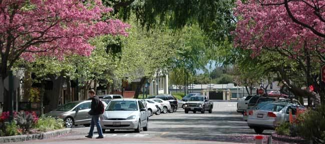
Map of Claremont, CA, USA
Claremont is known as the home of the Claremont Colleges and other educational institutions, and for its tree-lined streets with numerous historic buildings. In July 2007, it was rated by CNN/Money magazine as the fifth best place to live in the United States, and was the highest rated place in California on the list. Due to its large number of trees and residents with doctoral degrees, it is sometimes referred to as "The City of Trees and PhDs".
The city is primarily residential, with a significant portion of its commercial activity revolving around "The Village", a popular collection of street-front small stores, boutiques, art galleries, offices, and restaurants adjacent to and west of the Claremont Colleges. The Village was expanded in 2007, adding a controversial multi-use development that includes a cinema, a boutique hotel, retail space, offices, and a parking structure on the site of an old citrus packing plant just west of Indian Hill Boulevard. Some critics say that the expansion negatively altered the original, small-town feel of The Village.
Claremont has been a winner of the National Arbor Day Association's Tree City USA award for 22 consecutive years. When the city incorporated in 1907, local citizens started what has since become the city's tree-planting tradition. Claremont is one of the few remaining places in North America with American Elm trees that have not been exposed to Dutch elm disease. The stately trees line Indian Hill Boulevard in the vicinity of the city's Memorial Park.
The Claremont Institute, a conservative think tank, is located there. Several retirement communities, among them Pilgrim Place, the Claremont Manor and Mt. San Antonio Gardens, are also located in Claremont.
History
The citrus groves and open space which once dominated the northern portion of the city have been replaced by residential developments of large homes. Construction of Stone Canyon Preserve, one of the final residential tract developments in the north of the city, commenced in 2003 as part of a complicated agreement between Pomona College and the City of Claremont which resulted in the creation of the 1,740-acre (7.0 km2) Wilderness Park. The northern, foothill area also includes the Padua Hills Theatre, a historic site constructed in 1930.
Geography
According to the United States Census Bureau, the city has a total area of 13.35 square miles (34.6 km2), of which 13.3 square miles (34 km2) is land and 0.05 square miles (0.13 km2) (1.03%) is water. Claremont is located at the eastern end of Los Angeles County and borders the cities of Upland and Montclair in San Bernardino County, as well as the cities of Pomona and La Verne in Los Angeles County. Its geographic location puts it well within the region known as the San Gabriel Valley. Claremont is approximately 24 miles (39 km) east of Pasadena and 30 miles (48 km) east of downtown Los Angeles.
Climate
Claremont has a Mediterranean climate (Köppen climate classification Csa). In the summer months, temperatures can rise into the triple digits. In the autumn months, Claremont can receive gusty winds known as the "Santa Ana Winds", which can bring fire danger to nearby foothills. In the winter, most of its annual rainfall occurs. Snow is rare but can often be viewed in the nearby San Gabriel Mountains. In early summer, Claremont can receive overcast weather due to its strong onshore flow from the ocean known as "May Gray" or "June Gloom".
2010
The 2010 United States Census reported that Claremont had a population of 34,926. The population density was 2,589.7 people per square mile (999.9/km²). The racial makeup of Claremont was 24,666 (70.6%) White (58.9% Non-Hispanic White), 1,651 (4.7%) African American, 172 (0.5%) Native American, 4,564 (13.1%) Asian, 38 (0.1%) Pacific Islander, 2,015 (5.8%) from other races, and 1,820 (5.2%) from two or more races. Hispanic or Latino of any race were 6,919 persons (19.8%).
The Census reported that 29,802 people (85.3% of the population) lived in households, 4,926 (14.1%) lived in non-institutionalized group quarters, and 198 (0.6%) were institutionalized.
There were 11,608 households, out of which 3,576 (30.8%) had children under the age of 18 living in them, 6,305 (54.3%) were opposite-sex married couples living together, 1,223 (10.5%) had a female householder with no husband present, 397 (3.4%) had a male householder with no wife present. There were 429 (3.7%) unmarried opposite-sex partnerships, and 138 (1.2%) same-sex married couples or partnerships. 2,957 households (25.5%) were made up of individuals and 1,556 (13.4%) had someone living alone who was 65 years of age or older. The average household size was 2.57. There were 7,925 families (68.3% of all households); the average family size was 3.10.
The population was spread out with 6,459 people (18.5%) under the age of 18, 6,778 people (19.4%) aged 18 to 24, 6,940 people (19.9%) aged 25 to 44, 8,979 people (25.7%) aged 45 to 64, and 5,770 people (16.5%) who were 65 years of age or older. The median age was 38.6 years. For every 100 females there were 88.4 males. For every 100 females age 18 and over, there were 84.7 males.
There were 12,156 housing units at an average density of 901.3 per square mile (348.0/km²), of which 7,700 (66.3%) were owner-occupied, and 3,908 (33.7%) were occupied by renters. The homeowner vacancy rate was 0.9%; the rental vacancy rate was 5.5%. 21,209 people (60.7% of the population) lived in owner-occupied housing units and 8,593 people (24.6%) lived in rental housing units.
During 2009–13, Claremont had a median household income of $87,324, with 7.2% of the population living below the federal poverty line.
2000
As of the census of 2000, there were 33,998 people, 11,281 households, and 7,806 families residing in the city. The population density was 2,586.6 inhabitants per square mile (999.0/km2). There were 11,559 housing units at an average density of 879.4 per square mile (339.6/km2). The racial makeup of the city was 73.48% White, 15.36% of the population were Hispanic or Latino of any race, 11.51% Asian, 4.98% Black or African American, 0.56% Native American, 0.13% Pacific Islander, 5.20% from other races, and 4.14% from two or more races.
31.3% of households included children under the age of 18. 55.7% were married couples living together, 10.4% had a female householder with no husband present, and 30.8% were non-families. 24.9% of all households were made up of individuals and 10.6% had someone living alone who was 65 years of age or older. The average household size was 2.56 and the average family size was 3.08.
The population was widely distributed in age, with 20.7% under the age of 18, 18.6% from 18 to 24, 22.8% from 25 to 44, 23.3% from 45 to 64, and 14.6% 65 years of age or older. The median age was 36 years. For every 100 females, there were 88.6 males. For every 100 females age 18 and over, there were 85.1 males.
According to a 2009 estimate, the median household income was $83,342 and the median family income was $107,287. The per capita income for the city was $39,648. About 3.5% of families and 5.4% of individuals were below the poverty line.
Top employers
According to the City's 2009 Comprehensive Annual Financial Report, the top employers in the city are:
Points of interest
Government
In the California State Legislature, Claremont is in the 25th Senate District, represented by Democrat Anthony Portantino, and in the 41st Assembly District, represented by Democrat Chris Holden.
In the United States House of Representatives, Claremont is in California's 27th congressional district, represented by Democrat Judy Chu.
Public schools
Claremont's school district is known as the Claremont Unified School District (CUSD). It has 7 elementary schools, one intermediate school, and 1 high school. The high school is Claremont High School (CHS). The other high school in Claremont is The Webb Schools, a collective name for two private schools for grades 9-12, founded by Thompson Webb.
Post secondary
Private educational institutions host approximately 6,500 students every year from across the country and around the world. The Claremont Colleges — a consortium of seven schools of higher education — include Pomona College (founded in 1887), Claremont Graduate University (1925), Scripps College (1926), Claremont McKenna College (1946), Harvey Mudd College (1955), Pitzer College (1963), and the Keck Graduate Institute of Applied Life Sciences (1997). Many of these schools are consistently rated among the best in the nation.
Just north of Foothill Boulevard is the college-owned Robert J. Bernard Field Station, which preserves natural coastal sage scrub on its property. The Claremont School of Theology and Claremont Lincoln University, two other schools of higher education, share some resources with the Claremont Colleges, but are a separate entities.
Extracurricular and summer camps
Claremont is home to several extracurricular youth organizations and summer camps, including STEM Center USA, Kiddie Academy of Claremont, and Young Actors Camp.
Arts and culture
Each year, Claremont holds a springtime folk music festival, hosted by the Folk Music Center Store and Museum. The 34th event is set to take place in May 2017.
Local museums include Raymond M. Alf Museum of Paleontology, which is America's only paleontology museum located on a high school campus.
Each July, Ophelia's Jump Productions presents their annual Midsummer Shakespeare Festival at The Sontag Outdoor Theatre in Pomona College. Productions are performed in repertory with local community and civic events and festivities.
Transportation
Commuter train service to Claremont is provided by Metrolink from the Claremont Metrolink Station. The station is on the San Bernardino Line, with trains traveling to Los Angeles and San Bernardino several times each day. Claremont's train station is known as the Claremont Depot. It will also connect with the Metro Gold Line and with the Gold Line Foothill Extension.
Claremont has a bus transportation system that covers the Eastern San Gabriel Valley. This bus service is also known as Foothill Transit.
Law enforcement
The Claremont Police Department provides law enforcement services for the city of Claremont.
The Los Angeles County Sheriff's Department provides law enforcement services for the unincorporated communities of Claremont.
Fire department
The Los Angeles County Fire Department provides fire protection services for the city of Claremont and its unincorporated communities.