
Founded September 6, 1776 Area 1,210 km² Unemployment rate 5.6% (Apr 2015) | Population 149,588 (2013) | |
 | ||
Colleges and Universities Hagerstown Community College, Kaplan University ‑ Hagerstown, Award Beauty School Destinations Hagerstown, Antietam National Battlefield, Fort Frederick State Park, Hancock, Greenbrier State Park | ||
Washington County is a county located in the western part of the U.S. state of Maryland. As of the 2010 census, the population was 147,430. Its county seat is Hagerstown. Washington County was the first county in the United States to be named for the Revolutionary War general (and later President) George Washington. Washington County is one of three Maryland counties recognized by the Appalachian Regional Commission as being part of Appalachia.
Contents
- Map of Washington County MD USA
- History
- Geography
- Adjacent counties
- County government
- State representation
- Federal representation
- 2000 census
- 2010 census
- Economy
- National parks
- State parks
- Museums historic sites and other points of interest
- Education
- Colleges and universities
- City
- Census designated places
- Notable residents and natives
- References
Map of Washington County, MD, USA
The county borders southern Pennsylvania to the north, Northern Virginia to the south, and the Eastern Panhandle of West Virginia to the south and west.
Washington County is included in the Hagerstown-Martinsburg, MD-WV Metropolitan Statistical Area, which is also included in the Washington-Baltimore-Arlington, DC-MD-VA-WV-PA Combined Statistical Area.
History
The western portions of Maryland (including present Washington County) were incorporated into Prince George's County in 1696. This original county included six current counties. The first to be created was Frederick, separated from Prince George's County in 1748.
Washington County was formed on September 6, 1776, by the division of Frederick County. At the same time, a portion of Frederick County became part of the newly created Montgomery County along with portions from Prince George's County and Charles' County, and was named for General Richard Montgomery. Washington County as created included land later to become Allegany County (created in 1789) and Garrett County (included in Allegany County when it was created in 1789, but separated from Allegany County in 1872). Washington County thus originally included the entire western part of the state.
A number of properties in the county are listed on the National Register of Historic Places.
Geography
According to the U.S. Census Bureau, the county has a total area of 467 square miles (1,210 km2), of which 458 square miles (1,190 km2) is land and 9.6 square miles (25 km2) (2.0%) is water.
Washington County is located in the Appalachian Mountains, stretching from the Ridge-and-Valley Country in the west to South Mountain in the east, which is an extension of the Blue Ridge. Much of the county lies in the broad Hagerstown Valley between these two zones; the valley is part of the Great Appalachian Valley that continues southward into Virginia and West Virginia as the Shenandoah Valley and northward into Pennsylvania as the Cumberland Valley.
The county is bordered to the north by the Mason–Dixon line with Pennsylvania, to the south by the Potomac River and the states of Virginia and West Virginia, to the west by Sideling Hill Creek and Allegany County, Maryland, and to the east by Frederick County and South Mountain.
Adjacent counties
County government
Washington County's 'leader' is known as the County Administrator. Currently, Greg Murray serves as the Administrator. However, Washington County's County Commissioners exercise executive powers as they exist in the government of the county.
The County Commissioners in Washington County comprise the traditional form of county government in Maryland. Current members include: Terry Baker, President, John F. Barr, Vice-President and LeRoy E. Myers, Jeffrey A. Cline and William J. Wivell.
State representation
Washington County is represented by two senators in the Maryland State Senate. Member George C. Edwards (R), serves the 1st district in Maryland and Andrew A. Serafini (R), serves in the 2nd district. The county also is represented in Maryland General Assembly's other primary division, the Maryland House of Delegates. Delegates who stand for Washington County include: Mike McKay (R) for District 1C, Neil Parrot (R) and William Wivell (R) for District 2A and Brett Wilson (R) for District 2B.
Federal representation
The county is located within Maryland's 6th congressional district. The representative of the district currently is John Delaney (D).
2000 census
As of the census of 2010, there were 147,430 people, 49,726 households, and 34,112 families residing in the county. The population density was 315 people per square mile (111/km²). There were 52,972 housing units at an average density of 116 per square mile (45/km²). The racial makeup of the county was 89.71% White or Caucasian, 7.77% Black or African American, 0.18% Native American, 0.80% Asian, 0.04% Pacific Islander, 0.46% from other races, and 1.04% from two or more races. 1.19% of the population were Hispanic or Latino of any race. In the Census 2000, 32.1% identified as being of German ancestry, 21.4% American, 8.8% Irish, and 8.4% English ancestry.
There were 49,726 households out of which 31.30% had children under the age of 18 living with them, 54.00% were married couples living together, 10.70% had a female householder with no husband present, and 31.40% were non-families. 26.00% of all households were made up of individuals and 11.10% had someone living alone who was 65 years of age or older. The average household size was 2.46 and the average family size was 2.96.
In the county, the population was spread out with 23.40% under the age of 18, 8.10% from 18 to 24, 31.30% from 25 to 44, 23.00% from 45 to 64, and 14.20% who were 65 years of age or older. The median age was 37 years. For every 100 females there were 104.50 males. For every 100 females age 18 and over, there were 104.00 males.
2010 census
As of the 2010 United States Census, there were 147,430 people, 55,687 households, and 37,506 families residing in the county. The population density was 322.1 inhabitants per square mile (124.4/km2). There were 60,814 housing units at an average density of 132.8 per square mile (51.3/km2). The racial makeup of the county was 85.1% white, 9.6% black or African American, 1.4% Asian, 0.2% American Indian, 1.1% from other races, and 2.6% from two or more races. Those of Hispanic or Latino origin made up 3.5% of the population. In terms of ancestry, 31.7% were German, 14.1% were Irish, 9.8% were English, 8.5% were American, and 5.1% were Italian.
Of the 55,687 households, 32.4% had children under the age of 18 living with them, 50.6% were married couples living together, 12.0% had a female householder with no husband present, 32.6% were non-families, and 26.6% of all households were made up of individuals. The average household size was 2.50 and the average family size was 3.01. The median age was 39.7 years.
The median income for a household in the county was $52,994 and the median income for a family was $65,811. Males had a median income of $47,622 versus $34,225 for females. The per capita income for the county was $26,588. About 7.7% of families and 10.4% of the population were below the poverty line, including 14.1% of those under age 18 and 8.8% of those age 65 or over.
Economy
In 2000, the median income for a household in the county was $40,617, and the median income for a family was $48,962. Males had a median income of $34,917 versus $24,524 for females. The per capita income for the county was $20,062. About 7.00% of families and 9.50% of the population were below the poverty line, including 12.30% of those under age 18 and 9.50% of those age 65 or over.
According to the Maryland Department of Business and Economic Development, the following were the major employers in the county (excluding post offices, state government, and local governments, but including public institutions of higher education):
National parks
State parks
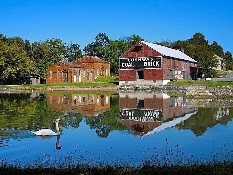
Museums, historic sites, and other points of interest
Education
Washington County Public Schools administers public schools in the county. See Washington County Public Schools – School Directory for a detailed listing of elementary, middle, high, and other schools.
Colleges and universities
City
Census-designated places
The Census Bureau recognizes the following census-designated places in the county: