
Congressional district 9th Website www.co.fulton.pa.us Founded 19 April 1851 | Area 1,134 km² Population 14,670 (2013) Unemployment rate 5.1% (Apr 2015) | |
 | ||
Rivers Tonoloway Creek, Sideling Hill Creek | ||
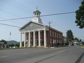
Fulton County is a county located in the U.S. state of Pennsylvania. As of the 2010 census, the population was 14,845, making it the fourth-least populous county in Pennsylvania. Its county seat is McConnellsburg. The county was created on April 19, 1850, from part of Bedford County and named for inventor Robert Fulton.
Contents
- Map of Fulton County PA USA
- Geography
- Adjacent counties
- Geology
- Demographics
- Politics
- Public school districts
- Major Highways
- Other
- Communities
- Boroughs
- Census designated places
- Population ranking
- References
Map of Fulton County, PA, USA
Geography
According to the U.S. Census Bureau, the county has a total area of 438 square miles (1,130 km2), of which 438 square miles (1,130 km2) is land and 0.5 square miles (1.3 km2) (0.1%) is water. It is in the watershed of the Chesapeake Bay and, although most of the county is drained by the Potomac River, some northern and northeastern areas are drained by the Juniata River into the Susquehanna River.
Adjacent counties
Geology
Fulton County is situated within the Ridge and Valley physiographic province, which is characterized by folded and faulted sedimentary rocks of early to middle Paleozoic age. (PA Geological Survey Map 13)
The stratigraphic record of sedimentary rocks within the county spans from the Cambrian Shadygrove Formation outcropping just south of McConnelsburg to the Pennsylvanian Allegheny Group at the northernmost tip of the county. No igneous or metamorphic rocks of any kind exist within Fulton county.
Mountain ridges within Fulton County include Rays Hill (along the western border with Bedford County), Town Hill, Sideling Hill, Scrub Ridge, and Meadow Grounds Mountain, and all these are held up by the Mississippian Pocono Formation, made of quartz sandstone and conglomerate. Rays Hill and Town Hill form a syncline, as do Scrub Ridge and Meadow Grounds Mountain, and Sideling Hill itself is a syncline. Dickeys Mountain and Tuscarora Mountain (along the eastern border with Franklin County) also form a syncline, but these ridges are held up by the Tuscarora Formation. Broad Top, located in the northeast corner of the county, is a plateau of relatively flat-lying rocks that are stratigraphically higher, and thus younger (Mississippian and Pennsylvanian), than most of the other rocks within the county. Broad Top extends into Huntingdon County to the north and Bedford County to the west.
All of Fulton County lies far to the south of the glacial boundary, and thus it was never glaciated (PA Geological Survey Map 59). However, during the Pleistocene epoch, or "Ice Age," periglacial (meaning "around glacier" or simply "cold") processes dominated. Most of the county was most likely a tundra during the Pleistocene.
The Broad Top Coal Field is located in Wells Township in the northwestern corner of the county (PA Geologic Survey Map 11). The field contains bituminous coal. There are a few abandoned mines in the area, although acid mine drainage is not as much of an environmental problem in Fulton County as it is in adjacent Bedford and Huntingdon Counties.
Interesting geologic features within Fulton County include some of the following:
Demographics
As of the census of 2000, there were 14,261 people, 5,660 households, and 4,097 families residing in the county. The population density was 33 people per square mile (13/km²). There were 6,790 housing units at an average density of 16 per square mile (6/km²). The racial makeup of the county was 98.25% White, 0.66% Black or African American, 0.20% Native American, 0.11% Asian, 0.01% Pacific Islander, 0.04% from other races, and 0.72% from two or more races. 0.36% of the population were Hispanic or Latino of any race. 40.8% were of German, 20.4% American, 8.3% Irish and 6.9% English ancestry according to Census 2000.
There were 5,660 households out of which 31.70% had children under the age of 18 living with them, 59.50% were married couples living together, 8.20% had a female householder with no husband present, and 27.60% were non-families. 24.00% of all households were made up of individuals and 10.60% had someone living alone who was 65 years of age or older. The average household size was 2.50 and the average family size was 2.95.
In the county, the population was spread out with 24.60% under the age of 18, 7.60% from 18 to 24, 28.40% from 25 to 44, 25.00% from 45 to 64, and 14.50% who were 65 years of age or older. The median age was 38 years. For every 100 females there were 100.10 males. For every 100 females age 18 and over, there were 98.60 males.
Almost everyone who lives in Fulton County speaks English as their first language. The dominant form of speech in Fulton County is the Central Pennsylvania accent.
Politics
Fulton County has displayed strong tendencies to vote for Republican candidates in past elections. In the 2004 U.S. Presidential election, George W. Bush carried the county by a massive 52.6% margin over John Kerry, making it Bush's strongest county in the slightly Democratic state, which Kerry won by a 2.5% margin over Bush. Furthermore, in 2008, John McCain carried Fulton by a 48.6% margin over Barack Obama, McCain's best showing in the Keystone State, which Obama won by a 10.3% margin over McCain. The country voted for Donald Trump in 2016 by a 70.8% margin, the highest in the state. The county has voted for the Republican in every presidential election since 1964. In 2006, Rick Santorum and Lynn Swann received more than 60% of the Fulton County vote despite their defeats statewide. In the 2012 U.S. Presidential election, Fulton County was the only county in Pennsylvania where Barack Obama won less than 20% of the white vote.
Public school districts
Major Highways
Other
Fulton County is one of only two counties in Pennsylvania with no known active railroad lines of any kind, the other being Sullivan County.
Communities
Under Pennsylvania law, there are four types of incorporated municipalities: cities, boroughs, townships, and, in at most two cases, towns. The following boroughs and townships are located in Fulton County:
Boroughs
Census-designated places
Population ranking
The population ranking of the following table is based on the 2010 census of Fulton County.
† county seat