
Highest point Elliott Knob Parent range Appalachian Mountains | Country United States of America | |
 | ||
Mountains Evitts Mountain, Fort Lewis Mountain, Elliott Knob, Signal Knob, Third Hill Mountain | ||
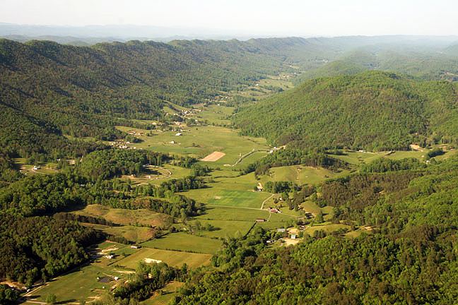
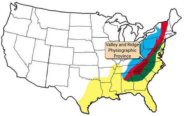
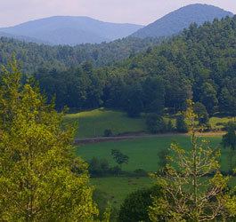
The Ridge-and-Valley Appalachians, also called the Ridge and Valley Province or the Valley and Ridge Appalachians, are a physiographic province of the larger Appalachian division and are also a belt within the Appalachian Mountains extending from southeastern New York through northwestern New Jersey, westward into Pennsylvania and southward into Maryland, West Virginia, Virginia, Kentucky, Tennessee, Georgia and Alabama. They form a broad arc between the Blue Ridge Mountains and the Appalachian Plateau physiographic province (the Allegheny and Cumberland Plateaus). They are characterized by long, even ridges, with long, continuous valleys in between.
Contents
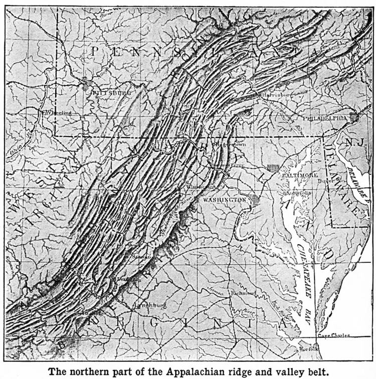
The ridge and valley system presents an important obstacle to east-west land travel even with today's technology. It was a nearly insurmountable barrier to railroads crossing the range as well as to walking or horse-riding migrants traveling west to settle the Ohio Country, Northwest Territory and Oregon Country, before the days of motorized transportation. In the era when animal power dominated transportation there was no safe way to cross east-west in the middle of the range; crossing was only possible nearer its extremes except for a few rough passages opened mid-range during the colonial era such as Braddock's Road and Forbes Road, later improved into America's first National Roads (respectively Cumberland Road, Lincoln Highway or designated U.S. 40 and U.S. 30 in later years).
Geography
The eastern head of the Ridge and Valley region is marked by the Great Appalachian Valley, which lies just west of the Blue Ridge. The western side of the Ridge and Valley region is marked by steep escarpments such as the Allegheny Front, the Cumberland Mountains, and Walden Ridge.
Geology
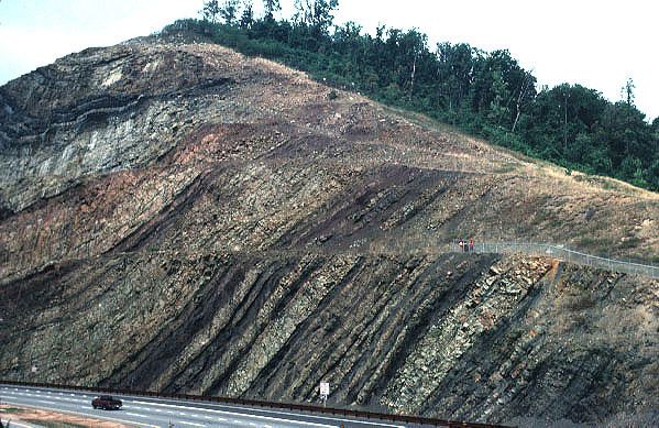
These curious formations are the remnants of an ancient fold-and-thrust belt, west of the mountain core that formed in the Alleghenian orogeny (Stanley, 421-2). Here, strata have been folded westward, and forced over massive thrust faults; there is little metamorphism, and no igneous intrusion.(Stanley, 421-2) The ridges represent the edges of the erosion-resistant strata, and the valleys portray the absence of the more erodible strata. Smaller streams have developed their valleys following the lines of the more easily eroded strata. But a few major rivers, such as the Delaware River, the Susquehanna River, the New River, and the Potomac River, are evidently older than the present mountains, having cut water gaps that are perpendicular to hard strata ridges. The evidence points to a wearing down of the entire region (the original mountains) to a low level with little relief, so that major rivers were flowing in unconsolidated sediments that were unaffected by the underlying rock structure. Then the region was uplifted slowly enough that the rivers were able to maintain their course, cutting through the ridges as they developed.
Valleys may be synclinal valleys or anticlinal valleys.
These mountains are at their highest development in central Pennsylvania, a phenomenon termed the Pennsylvania climax.