
 | ||
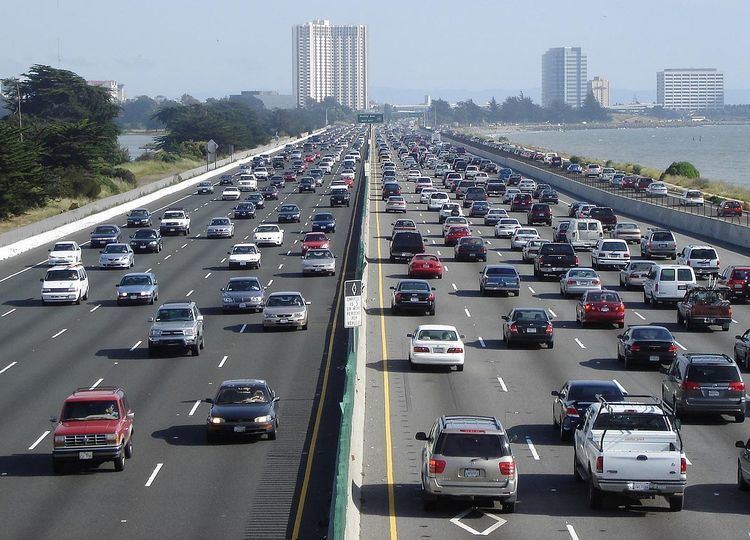
Transportation in the San Francisco Bay Area is reliant on a complex multimodal infrastructure consisting of roads, bridges, highways, rail, tunnels, airports, and bike and pedestrian paths. The development, maintenance, and operation of these different modes of transportation are overseen by various agencies, including the California Department of Transportation (Caltrans), the Association of Bay Area Governments, San Francisco Municipal Transportation Agency, and the Metropolitan Transportation Commission. These and other organizations collectively manage several interstate highways and state routes, two subway networks, two commuter rail agencies, eight trans-bay bridges, a ferry, local bus service, three international airports, and an extensive network of roads, tunnels, and bike paths. A 2011 Brookings Institution study ranked the San Francisco MSA and the San Jose MSA sixteenth and second, respectively, on transit coverage to job access. Another nationwide study, conducted by the University of Minnesota in 2014, ranked the San Francisco MSA second and San Jose MSA tenth. Despite this, the San Francisco Bay Area remains the second most traffic-congested region in the country with a declining per capita use of public transit.
Contents
Airports
The following airports are served by commercial airlines. In addition there are many general aviation airports in the region.
Another minor airport is Charles M. Schulz - Sonoma County Airport (STS) in Santa Rosa. It is served by two commercial airlines, Horizon Air and Allegiant Air.
Airport shuttle service
Airport shuttle buses and vans provide services from the three major San Francisco Bay Area airports, namely San Francisco International Airport (SFO), Oakland International Airport (OAK), and San Jose International Airport (SJC) — Flat Rate Airport Taxi Cab and Car Service; BayPorter Express Airport Shuttle; Marin Airporter; Marin County Airport Shuttle; Monterey Airport Shuttle; Non Stop Airport Shuttle; Sonoma County Airport Express; SuperShuttle; and Cook Limousine Services.
Public transportation
Public transportation in the San Francisco Bay Area is quite extensive, including one heavy rail/commuter rail system, one commuter rail line, two light rail systems, Amtrak inter-city rail service, and four major overlapping bus agencies, in addition to dozens of smaller ones. In addition to rail and bus systems, there are multiple public and private ferry services, such as Golden Gate Ferry, which are being expanded by the San Francisco Bay Water Transit Authority. Most of the larger agencies accept the Clipper Card, a reloadable contactless smart card, as a universal electronic payment system.
An extensive rail infrastructure that provides a mix of services exists within the nine Bay Area counties. Bay Area Rapid Transit, commonly known as BART, provides subway service in San Francisco and parts of Oakland and Berkeley, and commuter rail service to Contra Costa County, Alameda County, and San Mateo County. An expansion that is currently under construction will build an additional station in Alameda County and bring BART south into Santa Clara County by 2016. Caltrain, which runs on the right-of-way of the historic Southern Pacific Railroad, provides commuter rail service on the San Francisco Peninsula, linking the cities of San Francisco, San Jose, Gilroy, and numerous peninsula cities in between. The Millbrae Intermodal Terminal provides transfers between Caltrain and BART. The Altamont Commuter Express, commonly known as ACE, also provides commuter rail service, but from the Central Valley into Silicon Valley, terminating in the San Jose Diridon Station.
In addition, Amtrak has a presence throughout the Bay Area. Stations in Martinez and Emeryville feature Coast Starlight and California Zephyr service. The Capitol Corridor connects Bay Area cities to Sacramento, and features BART transfer stations at Richmond and the Oakland Coliseum. The Bay Area also has two light rail systems: one run by San Francisco Municipal Railway called Muni Metro, which operates within the city of San Francisco, and the other run by the Santa Clara Valley Transportation Authority, which operates within Santa Clara County.
A series of overlapping bus agencies provide additional public transit coverage to Bay Area regions both served and not served by rail transit. The four largest agencies, Muni, AC Transit, SamTrans, and VTA operate within the City of San Francisco, East Bay, the Peninsula, and South Bay respectively, although their service areas generally overlap with neighboring agencies and numerous smaller agencies. All of these agencies also provide limited night bus service, which are intended to "shadow" the rail routes that are closed during the nighttime hours for maintenance. In addition, the four bus agencies are each independently pursuing constructing bus rapid transit systems by developing separated right-of-ways and traffic signaling on busy corridors, including on Geary and Van Ness for Muni, El Camino Real for SamTrans and VTA, and International Boulevard for AC Transit.
Although BART and certain bus agencies provide travel over (or under) the San Francisco bay, Golden Gate Transit also runs the Golden Gate Ferry, which along with private operators Blue & Gold Fleet and Red & White Fleet provide ferry service across the bay. The ferry, along with all the major train and bus operators, allow bicycles onto their systems with no additional charge. In addition, Bay Area residents may rent bicycles from the Bay Area Bike Share in certain parts of San Francisco, San Mateo, and Santa Clara counties.
Until 1971 the Southern Pacific Railroad operated from its Third and Townsend Depot commuter trains to San Jose and long distance trains to Los Angeles.
Bus services
The Transbay Terminal serves as the terminus for long-range bus service (such as Greyhound and BoltBus) and as a hub for regional bus systems AC Transit (Alameda & Contra Costa counties), WestCAT, SamTrans (San Mateo County), and Golden Gate Transit (Marin and Sonoma Counties).
Megabus recently relaunched intercity bus service in California and Nevada. San Francisco riders can choose from three routes (SF-San Jose-LA, SF-Oakland-LA, & SF-Sacramento-Reno). The San Francisco stop is located in front of the Caltrain Station. Other intercity bus services include California Shuttle Bus, Hoang Transportation, and USAsia.
Bike Sharing
Bay Area Bike Share is a regional public bicycle sharing system that serves the cities of San Francisco, Redwood City, Palo Alto, Mountain View, and San Jose, along the Caltrain corridor.
The bicycles are available 24 hours a day, seven days a week to anyone who purchases a membership, with three options, annual fee of US$88, US$22 for three days or US$9 for 24 hours. Any rider may take unlimited trips of up to 30 minutes, as measured from the time the bike is withdrawn from a dock to the time it is returned. Bikes can be picked up at any of the stations using a key fob or electronic code, and dropping them off at any station. Longer trips incur additional fees starting at US$4 for the first additional half-hour, since the idea of bike sharing is to make bicycles available for short trips. A replacement fee of $1,200 is charged if a rented bike is lost.
Freeways and highways
The Bay Area possesses an extensive freeway and highway system.
The Peninsula to the South Bay
The freeway system in Santa Clara county is augmented by its expressway system of county routes.
Named interchanges
The Alemany Maze is the interchange between the James Lick Freeway (U.S. Route 101) and Interstate 280.
The MacArthur Maze is the interchange between the Eastshore Freeway, Nimitz Freeway, and MacArthur Freeway at the east end of the Bay Bridge.
The Joe Colla Interchange is the interchange between US 101, I-280, and I-680. Both I-280 and I-680's southern termini is located as this interchange.
San Francisco streets
Due to its unique geography, and the freeway revolts of the late 1950s, San Francisco is one of the few American cities with arterial thoroughfares instead of having numerous highways within the city.
Interstate 80 begins at the approach to the Bay Bridge and is the only direct automobile link to the East Bay. U.S. Route 101 connects to the western terminus of Interstate 80 and provides access to the south of the city along San Francisco Bay toward Silicon Valley. Northward, the routing for U.S. 101 uses arterial streets Mission Street (northbound) and South Van Ness Avenue (southbound), Van Ness Avenue, Lombard Street, Richardson Avenue, and Doyle Drive to connect to the Golden Gate Bridge, the only direct automobile link to Marin County and the North Bay.
State Route 1 also enters San Francisco from the north via the Golden Gate Bridge, but turns south away from the routing of U.S. 101, first onto Park Presidio Blvd through Golden Gate Park, and then bisecting the west side of the city as the 19th Avenue arterial thoroughfare, joining with Interstate 280 at the city's southern border. Interstate 280 continues south from San Francisco. Interstate 280 also turns to the east along the southern edge of the city, terminating just south of the Bay Bridge in the South of Market neighborhood. After the 1989 Loma Prieta earthquake, city leaders decided to demolish the Embarcadero Freeway, and a portion of the Central Freeway, converting them into street-level boulevards.
State Route 35 enters the city from the south as Skyline Boulevard, following city streets until it terminates at its intersection with Highway 1. State Route 82 enters San Francisco from the south as Mission Street, following the path of the historic El Camino Real and terminating shortly thereafter at its junction with 280. Major east–west thoroughfares include Geary Boulevard, the Lincoln Way/Fell Street corridor, and Market Street/Portola Drive.
The Western Terminus of the historic transcontinental Lincoln Highway, the first road across America, is in San Francisco's Lincoln Park.
Bridges
Due to the central location of the San Francisco Bay, eight toll bridges cross the Bay or Bay tributaries. Each of the bridges collect separate tolls, and all of them accept payment through FasTrak, an electronic toll collection system used in the state of California. Seven of these eight bridges are owned directly by the State of California, while the Golden Gate Bridge is owned and operated by the Golden Gate Bridge, Highway and Transportation District.
Seaports
The Port of San Francisco was once the largest and busiest seaport on the West Coast. It featured rows of piers perpendicular to the shore, where cargo from the moored ships was handled by cranes and manual labor and transported to nearby warehouses. The port handled cargo to and from trans-Pacific and Atlantic destinations, and was the West Coast center of the lumber trade. The 1934 West Coast Longshore Strike, an important episode in the history of the American labor movement, brought most ports to a standstill. The advent of container shipping made pier-based ports obsolete, and most commercial berths moved to the Port of Oakland and Port of Richmond. A few active berths specializing in break bulk cargo remain alongside the Islais Creek Channel.
The port currently uses Pier 35 to handle the 60–80 cruise ship calls and 200,000 passengers that come to San Francisco. Itineraries from San Francisco usually include round trip cruises to Alaska and Mexico. The new James R. Herman Cruise Terminal Project at Pier 27 is scheduled to open 2014 as a replacement. The existing primary terminal at Pier 35 has neither the sufficient capacity to allow for the increasing length and passenger capacity of new cruise ships nor the amenities needed for an international cruise terminal.
On March 16, 2013, Princess Cruises Grand Princess became the first ship to home port in San Francisco year round. The ship offers cruises to Alaska, California Coasts, Hawaii, and Mexico. Grand Princess will be stationed in San Francisco until April 2014. Princess will also operate other ships during the summer of 2014, making it the only cruise line home porting year round in San Francisco.