
Length 330 km | ||
 | ||
History: Proposed August 7, 1947 by FHWAFederally designated June 26, 1956Signed July 1, 1964 by Caltrans Restrictions: No flammable tank vehicles or explosives on the Bay Bridge West end: US 101 in San Francisco East end: I‑80 at Nevada state line | ||
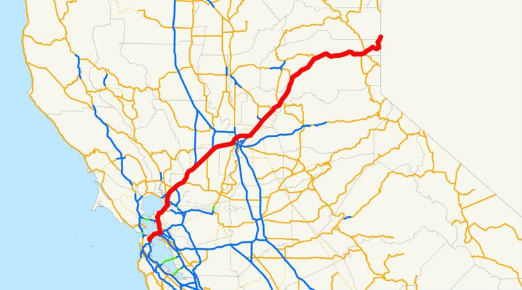
Interstate 80 (I-80) is a major east–west route of the Interstate Highway System, running between the U.S. states of California and New York. The highway has its western terminus in San Francisco. From there it heads east across the Bay Bridge to Oakland, where it turns north and crosses the Carquinez Bridge before turning back northeast through the Sacramento Valley. I-80 then traverses the Sierra Nevada, cresting at Donner Summit, before crossing into the state of Nevada within the Truckee River Canyon. The speed limit is at most 65 miles per hour (105 km/h) along the entire route instead of the state's maximum of 70 mph (110 km/h) and most of the route is in either urban areas or mountainous terrain. I-80 has portions designated as the Eastshore Freeway and Alan S. Hart Freeway.
Contents
- Route description
- San Francisco Bay Area
- Eastshore Freeway
- Central Valley
- Sierra Nevada
- Historic routing
- Original routing in San Francisco
- Legacy
- Truncation of US40
- Former alignments in Sacramento
- Bay Bridge replacement
- Future
- Related routes
- References
Throughout California, I-80 was built along the corridor of U.S. Route 40 (US 40), eventually replacing this designation entirely. The prior US 40 corridor itself was built along several historic corridors in California, notably the California Trail and Lincoln Highway. The route has changed from the original plans in San Francisco due to freeway revolts canceling segments of the originally planned alignment. Similarly in Sacramento, the freeway was re-routed around the city after plans to upgrade the original grandfathered route through the city to Interstate highway standards were cancelled.
Route description
I-80 is recognized as the Dwight D. Eisenhower Highway in the western United States and a Blue Star Memorial Highway for its entire length. In California, it follows the original corridor of the Lincoln Highway from Sacramento to Reno (with minor deviations near Donner Summit). I-80 is also known as the Kent D. Pursel Memorial Freeway from the Bay Bridge to the Alameda/Contra Costa County line (named after a former Alameda County Board of Supervisor), the Linus F. Claeys Freeway from State Route 4 (SR 4) to the Carquinez Bridge (after a Contra Costa County businessman and philanthropist), the Alan S. Hart Freeway from the Sacramento/Placer County line to the Nevada state line (named after a California Department of Transportation, Caltrans, engineer who oversaw the modernization of this segment of I-80), and the Dutch Flat and Donner Lake Wagon Road from Emigrant Gap to Donner Lake.
San Francisco Bay Area
According to the California State Highway system, I-80 begins at its intersection with U.S. Route 101 in San Francisco. However, the San Francisco Skyway (officially known to Caltrans as the Bayshore Viaduct), the elevated freeway that runs from this junction of the James Lick Freeway and the Central Freeway to the Western Approach of the San Francisco–Oakland Bay Bridge at 4th Street, may not be officially part of the Interstate Highway System, although it is consistently shown as I-80 on most maps of San Francisco. The Interstate designation is interpreted by some to actually beginning on the Bay Bridge approach itself, at the location of the Fremont Street off-ramp (previously known as the Terminal Separator Structure (TSS) that once connected it to the Embarcadero Freeway). Thus, the first 1.20 miles (1.93 km) of the signed Interstate may not be officially an actual Interstate, and is secretly defined as State Route 80.
Eastshore Freeway
The Eastshore Freeway is a segment of Interstates 80 and 580 along the northeast shoreline of San Francisco Bay in northern California. It begins at the Carquinez Bridge and ends at the MacArthur Maze interchange just east of the eastern end of the San Francisco–Oakland Bay Bridge. Interstate 580 joins the Eastshore Freeway at an interchange known locally as the "Hoffman Split" in Albany. The section of the Eastshore Freeway between the MacArthur Maze and the 580 (Hoffman) split between Albany is a wrong-way concurrency where the northbound direction is signed as I-80 East and I-580 West, while the southbound direction is signed as westbound I-80 and eastbound I-580.
The Eastshore Freeway was created in the mid 1950s (construction commenced in 1954) by re-engineering the Eastshore Highway, a thoroughfare constructed in the 1930s (1937–39) as one of the approaches to the Bay Bridge and designated as part of U.S. Route 40. The Eastshore Highway began in El Cerrito at an intersection with San Pablo Avenue at Hill Street between Potrero Avenue and Cutting Blvd., adjacent to the location today of the El Cerrito Del Norte station of BART. It was not a freeway in that access was at intersections with adjoining streets rather than by ramps. The Eastshore Highway ran from El Cerrito to the Bay Bridge along the same routing as today's freeway, although it was much narrower. A causeway was constructed for this purpose by filling in part of the mudflats along the bayshore. In the stretch from University to Ashby Avenues in Berkeley, this resulted in the creation of an artificial lagoon which was developed by the Works Progress Administration in the late 1930s as "Aquatic Park".
The frontage road along the east side of today's Eastshore Freeway between Buchanan Street in Albany and Hearst Avenue in Berkeley retains the name "Eastshore Highway". The terminal segment of the old Eastshore Highway in El Cerrito between Potrero and San Pablo Avenues is today named "Eastshore Boulevard".
Originally, the name "Eastshore Freeway" was also applied to what is today known as the "Nimitz Freeway" (I-880) upon its construction in 1947. This freeway was dedicated in 1958 to Admiral Nimitz, and so for a few years in the 1950s prior, the Eastshore Freeway stretched the entire length of the east shore of San Francisco Bay. Until the late 1960s, the Eastshore Freeway was also designated as part of State Route 17 (SR 17) together with the Nimitz Freeway.
The Eastshore Freeway was officially renamed the "Kent D. Pursel Memorial Freeway" in 1968, after a former member of the Alameda County Board of Supervisors. But this name is hardly recognized as such by the public, and most maps still show the name "Eastshore Freeway".
The interchange where I-580 joins I-80 is still known locally as the "Hoffman Split", an allusion to the time before the I-580 freeway replaced Hoffman Boulevard as the highway leading to the Richmond-San Rafael Bridge. The same interchange today also serves the Buchanan Street exit in Albany.
The section of the Eastshore Freeway between the MacArthur Maze and the I-80/I-580 split suffers from severe traffic congestion during rush hour due to the merger of three freeways (I-80, I-580, and I-880) at the MacArthur Maze.
Central Valley
This section of I-80 has a top speed of 65 miles per hour (105 km/h), unlike California's top speed limit of 70 mph (110 km/h), common in rural freeways. I-80 is a six- to eight-lane freeway with carpool lanes in Fairfield from exit 39A (Red Top Road) to exit 47 (Air Base Parkway).
I-80 has changed routing in the Sacramento area. Currently, the freeway runs on a northern bypass of the city, the Beltline Freeway, that was originally designated I-880. The I-80 routing alignment was moved from a route through Sacramento, now I-80 Business, after the proposed I-80 replacement of the North Sacramento Freeway was canceled. The Beltline Freeway runs northeast from the junction of I-80 and I-80 Business (U.S. Route 50 there) in West Sacramento across I-5 to its junction northeast of Sacramento with I-80 Business (which is SR 51). SR 244 heads east as a short freeway spur from that interchange.
Sierra Nevada
Crossing the Sierra Nevada, I-80 regularly gets snow at higher elevations from fall to spring. Caltrans sometimes requires vehicles to use snow tires, snow chains or other traction devices in the mountains during and after snowstorms. Checkpoints are often set up to enforce chain restrictions on vehicles bound for icy or snowy areas. When chain restrictions are in effect vehicles must have chains on the driving wheels, except 4WD vehicles with snow tires. Additionally, during the winter season, trucks are required to carry chains whether or not controls are in force.
I-80 crosses the Sierra Nevada crest at Donner Summit (also known as Euer Saddle) at an elevation of 7,239 feet (2,206 m) westbound and 7,227 feet (2,203 m) eastbound. The Donner Summit Rest Area is located at this point. The summit is located in Nevada County, California. The pass is generally open year-round; it is plowed in winter, but may temporarily close during the worst snowstorms. The older, original US 40/Lincoln Highway route over Donner Pass is about two miles (3 km) to the south. This highway was replaced as the official trans-Sierra route by I-80 in 1964. Although the current Donner Pass is lower, Euer Saddle was chosen for the interstate because of more gradual approaches.
Historic routing
In California, I-80 was built along the corridor of, and eventually replaced, U.S. Route 40. The US 40 designation was eliminated in the state as part of the 1964 state highway renumbering. US 40 was one of the original California routes designed in 1926, although its western terminus was in Berkeley, California with US 101E (then SR 17, then I-5W, now I-580/I-880) prior to the San Francisco–Oakland Bay Bridge construction in 1934. A ferry ran from there to San Francisco. After the Bay Bridge's construction, US 40, along with US 50, were extended along the bridge to connect with US 101.
US 40 and US 50 ran concurrently along the Bay Bridge and the routes split on what is the present day MacArthur Maze in Oakland, California. US 50 continued southwest on present-day I-580 to Stockton and US 40 closely followed the route of present-day I-80. When reaching Sacramento, California, US 40 and US 50 rejoined once again, US 50 running concurrently with former US 99 from Stockton to Sacramento. US 40 then again split with US 50 in Downtown Sacramento and closely followed the route of present-day Business I-80, which was I-80 from 1957 to 1981, when I-80 was realigned along former I-880, routing along what was then the outskirts of Sacramento. US 40 then closely followed I-80 through the Sierra Nevada Range into Nevada.
A portion of old US 40 near Donner Lake is still fully intact and is an alternate route of I-80. It begins near Soda Springs and ends at Truckee, California. At one point, it travels right by Donner Lake, unlike I-80, which ascends higher in the Sierra Nevada Range north of historic US 40.
Original routing in San Francisco
When I-80 was first approved, it was to begin at planned I-280 (SR 1) in Golden Gate Park, head east on the never-built Panhandle Freeway, then run south and southeast on the Central Freeway (US 101) to the San Francisco Skyway. The Panhandle Freeway was to be routed through Hayes Valley, passing through Golden Gate Park and terminating at proposed I-280, now SR 1. In 1964, community oppositions forced CalTrans to abandon the Panhandle Freeway project. A January 1968 amendment moved I-280 to its present alignment, degraded Interstate 480, to a state highway, and truncated the origin point of I-80 to the Embarcadero Freeway (then I-280, formerly I-480). Prior to that truncation, I-80 had been defined as from "Route 280 in San Francisco to the Nevada state line near Verdi, Nevada, passing near Division Street in San Francisco, passing near Oakland, via Albany, via Sacramento, passing near North Sacramento, passing near Roseville, via Auburn, via Emigrant Gap, via Truckee and via the Truckee River Canyon," and certain maps had been shown of I-80 running concurrently with US 101 to Fell Street. These changes were made on the state level later that year, but Route 80 was only truncated to US 101. (The Central Freeway remained part of US 101, and the Panhandle Freeway became State Route 241. The Panhandle Freeway was later cancelled in the wake of the Freeway Revolts, and the State Route 241 designation has since been reassigned to an unrelated stretch of highway in Orange County) The San Francisco Skyway, which had already been signed as part of I-80, has remained a de facto section of I-80 to the present day and remains listed as part of the Interstate in California.
In 2000, the San Francisco Chronicle published an article about the proposed construction of a new freeway through San Francisco. According to the article, the suggested 19th Avenue tunnel would run five miles (8.0 km), from Junipero Serra Boulevard through Golden Gate Park and up to Lake Street, with exits at Brotherhood Avenue, Ocean Avenue, Quintara Street, Lincoln Way, and Geary Boulevard. The Van Ness tunnel would run almost two miles (3.2 km), from about Fell Street to Lombard Street, with exits at Broadway and Geary Boulevard. Along Oak and Fell, the planners suggested an underground road running more than half a mile (0.8 km) from Laguna to Divisadero streets. However, the roads would violate the long-standing general plan for San Francisco, which calls for no new highway capacity. On March 2015, this proposed route was adopted by the CTC.
Legacy
Prior to the construction of I-80, the US 40 corridor had frequent car accidents. Reasons for this was of the many traffic lights and out-of-nowhere stop signs. Specifically, five intersections were listed with a high accident rate when CalTrans claimed that the construction of the I-80 freeway would reduce the accidents. According to a study done on I-80 in Vallejo from 1955 and 1956, prior to the freeway construction, and 1957 and 1958, after the freeway was constructed, the accident rate dropped 73% and there were 245 fewer accidents on the then-new I-80 freeway.
The new route also made traveling in the Sierra Nevada Range much easier. Before construction, US 40 was a two-lane road with winding turns. This route was often closed in the winter because of the high elevation of the Donner Pass (7239 feet), and drivers had to use a much longer route to the north, US 40 ALT, now SR 70 using the Beckwourth Pass, at an elevation of 5221 ft. After the construction, driving was easier through the Sierra Nevada Range via I-80 and the pass was only closed to intense snowstorms.
Truncation of US 40
In 1964, Caltrans desired to reduce the amount of routes in the California state highways system. The Interstate Highway system, designed and built starting in 1956, was adding on to the already increased number of U.S. Routes and state highways. In result, the 1964 renumbering truncated US 50 to West Sacramento. The entire route of US 40 was deleted in the western United States due to the completion of I-80. Also, the number "40" was duplicated along I-40, at that time, a newly built route in southeastern California. I-40 was to be numbered I-30, but the American Association of State Highway and Transportation Officials (AASHTO) rejected the numbering.
The state law authorizing the renumbering was passed on September 20, 1963. Signage changes took place by July 1, 1964, and US 40 was decommissioned. US 40 was one of the first US Routes to be decommissioned completely in California.
Former alignments in Sacramento
In the Sacramento area, I-80 has been realigned to many routes. In 1964, I-80 used the old US 40/99E freeway, the current I-80 BUS, while a year later, I-80 was proposed to be realigned along a new freeway that'll run south of the former I-80/I-880 northeast of Sacramento, run to south of the American River, and rejoin I-80. This was needed because the 1964 I-80 didn't meet Interstate standards.
In 1972, I-880 was completed, while a part of the new alignment of I-80 was completed but not open to traffic, where there was a long bridge to nowhere. From 1972 to 1980, Interstate 880 began in West Sacramento as a fork from the original I-80, continues northeast over the Sacramento River to its interchange with I-5, continues east through the communities of North Sacramento and Del Paso Heights and ends at an interchange with the Roseville Freeway (I-80). The now-designated Capital City Freeway was then the original I-80 routing, continuing southwest directly into downtown Sacramento. I-80 was then re-routed along the Beltline Freeway in 1983, while the Capital City Freeway became I-80 Business, also I-305 and SR 51. I-880 would have intersected SR 244 and then US 50, but in 1979, the Sacramento City Council voted to delete the proposed I-80 alignment for rail transit. The constructed 244/51/80 split is now used for three railroad stations. In 1980, the new I-80 alignment was deleted from the Interstate system. SR 244 was then truncated from its proposed alignment to the only freeway section of the abandoned project in 1994, which is about a mile long.
Bay Bridge replacement
In 1989, the 1989 Loma Prieta earthquake, with a magnitude of 6.9, was responsible for 63 deaths and 3,757 injuries. The San Francisco–Oakland Bay Bridge, which is part of I-80, suffered severe damage, as a 76-by-50-foot (23 m × 15 m) section of the upper deck on the eastern cantilever side fell onto the deck below. The quake caused the Oakland side of the bridge to shift 7 inches (18 cm) to the east, and caused the bolts of one section to shear off, sending the 250-short-ton (230 t) section of roadbed crashing down like a trapdoor. Caltrans removed and replaced the collapsed section, and re-opened the bridge on November 18.
Around the mid-2000s, due to the risk of a future large earthquake, Caltrans started building a new eastern span. The department advertised that the new span of the Bay Bridge used a new earthquake-resisting technique that would not collapse in an earthquake similar to the Loma Prieta earthquake. The new eastern span opened on September 2, 2013 at an estimated cost of $6.4B dollars.
Future
The "I-80 Across the Top" Project is a major reconstruction of an alignment of I-80 in Sacramento. The corridor starts from exit 85 (West El Camino Avenue) to exit 95 (I-80 Business) and features a 10-mile (16 km) extension of HOV lanes west along I-80, at a cost of about $133.3 million. Construction started in 2011 and is expected to finish in 2016.
Related routes
There are eight associated routes of I-80: seven auxiliary Interstate Highways and one business route; these routes are I-280, I-380, I-580, I-680, I-780, I-880, I-980, and I-80 Bus.. Three former routes exist: I-180, I-480, and I-880.