
Area 179.97 sq mi Founded November 29, 1777 | ||
 | ||
Recent posts on Google+ Colleges and Universities San Jose State University, San Jose City College, Evergreen Valley College, Silicon Valley University, International Technological University | ||
Map of San Jose, California
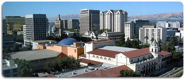
San Jose (, Spanish for "Saint Joseph"; [saŋ xoˈse]), officially the City of San José, is the economic, cultural, and political center of Silicon Valley and the largest city in Northern California. With an estimated 2015 population of 1,026,908, it is the third most populous city in California (after Los Angeles and San Diego) and the tenth most populous in United States. Located in the center of the Santa Clara Valley, on the southern shore of San Francisco Bay, San Jose covers an area of 179.97 square miles (466.1 km2). San Jose is the county seat of Santa Clara County, the most affluent county in California and one of the most affluent counties in the United States. San Jose is the largest city in both the San Francisco Bay Area and the San Jose-San Francisco-Oakland Combined Statistical Area, which contain 7.7 million and 8.7 million people respectively.
Contents
- Map of San Jose California
- Smart cities usa san jose ca
- Glassdoor san jose ca best city to work in 2014
- Early history
- Modern history
- Geography
- Cityscape
- Sprawl
- Landmarks
- Topography
- Climate
- Demographics
- 2010
- 2000
- Economy
- Technology
- Top employers
- City arts and architecture
- House architecture
- Sports
- Parks and recreation
- Habitat and wildlife
- Trails
- Museums libraries and other cultural collections
- Event venues
- Other structures
- Local
- State and federal
- Crime
- Colleges and universities
- Primary and secondary education
- Annexation issue
- Private education
- Library system
- Media
- Public transportation
- Air transportation
- Freeways and highways
- Major highways
- Walkability
- Utilities
- Public wireless access
- Twin towns sister cities
- References
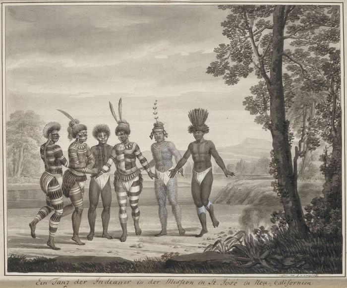
Before the arrival of the Spanish, the area around San Jose was inhabited by the Ohlone people. San Jose was founded on November 29, 1777, as the Pueblo of San José de Guadalupe, the first civilian town founded in Spanish Alta California. When California gained statehood in 1850, San Jose became the state's first capital. Following World War II, San Jose experienced an economic boom, with a rapid population growth and aggressive annexation of nearby cities and communities carried out in the 1950s and 60s. The rapid growth of the high-technology and electronics industries further accelerated the transition from an agricultural center to an urbanized metropolitan area. Results of the 1990 U.S. Census indicated that San Jose had officially surpassed San Francisco as the most populous city in Northern California. By the 1990s, San Jose and the rest of Silicon Valley had become the global center for the high tech and internet industries.
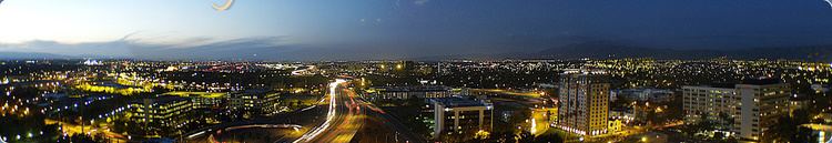
San Jose is a global city, notable as a center of innovation, for its affluence and high cost of living. San Jose's location within the booming high tech industry, as a cultural, political, and economic center has earned the city the nickname "Capital of Silicon Valley". San Jose is one of the wealthiest major cities in the United States and the world, and has the third highest GDP per capita in the world (after Zurich, Switzerland and Oslo, Norway), according to the Brookings Institution. With a median home price of $1,085,000, San Jose has the most expensive housing market in the country and the fifth most expensive housing market in the world, according to the 2017 Demographia International Housing Affordability Survey. Major global tech companies including Cisco Systems, eBay, Cadence Design Systems, Adobe Systems, PayPal, Brocade, Samsung, Acer, and Western Digital maintain their headquarters in San Jose, in the center of Silicon Valley.
Smart cities usa san jose ca
Glassdoor san jose ca best city to work in 2014
Early history
Prior to European settlement, the area was inhabited by several groups of Ohlone Native Americans.
The first lasting European presence began with a series of Franciscan missions established from 1769 by Junípero Serra.
On orders from Antonio María de Bucareli y Ursúa, Spanish Viceroy of New Spain, San Jose was founded by Lieutenant José Joaquín Moraga as Pueblo de San José de Guadalupe (in honor of Saint Joseph) on November 29, 1777, to establish a farming community. The town was the first civil settlement in Alta California
In 1797, the pueblo was moved from its original location, near the present-day intersection of Guadalupe Parkway and Taylor Street, to a location in what is now Downtown San Jose. San Jose came under Mexican rule in 1821 after Mexico broke with the Spanish crown. It then became part of the United States, after it capitulated in 1846 and California was annexed.
Modern history
On March 27, 1850, San Jose became the second incorporated city in the state (after Sacramento), with Josiah Belden its first mayor. San Jose was California's first state capital, and hosted the first and second sessions (1850–1851) of the California Legislature. Today the Circle of Palms Plaza in downtown is the historical marker for the first state capital. The city was a station on the Butterfield Overland Mail route.
In the period 1900 through 1910, San Jose served as a center for pioneering invention, innovation, and impact in both lighter-than-air and heavier-than-air flight. These activities were led principally by John Montgomery and his peers. The City of San Jose has established Montgomery Park, a Monument at San Felipe and Yerba Buena Roads, and John J. Montgomery Elementary School in his honor. During this period, San Jose also became a center of innovation for the mechanization/industrialization of agricultural and food processing equipment.
Though not affected as severely as San Francisco, San Jose also suffered significant damage from the 1906 San Francisco earthquake. Over 100 people died at the Agnews Asylum (later Agnews State Hospital) after its walls and roof collapsed, and San Jose High School's three-story stone-and-brick building was also destroyed. The period during World War II was a tumultuous time. Japanese Americans primarily from Japantown were sent to internment camps, including the future mayor Norman Mineta. Following the Los Angeles zoot suit riots, anti-Mexican violence took place during the summer of 1943. In 1940, the Census Bureau reported San Jose's population as 98% white.
As World War II started, the city's economy shifted from agriculture (the Del Monte cannery was the largest employer and closed in 1999) to industrial manufacturing with the contracting of the Food Machinery Corporation (later known as FMC Corporation) by the United States War Department to build 1,000 Landing Vehicle Tracked. After World War II, FMC (later United Defense, and currently BAE Systems) continued as a defense contractor, with the San Jose facilities designing and manufacturing military platforms such as the M113 Armored Personnel Carrier, the Bradley Fighting Vehicle, and various subsystems of the M1 Abrams battle tank.
IBM established its West Coast headquarters in San Jose in 1943 and opened a downtown research and development facility in 1952. Both would prove to be harbingers for the economy of San Jose, as Reynold Johnson and his team would later invent RAMAC, as well as the hard disk drive, and the technological side of San Jose's economy grew.
The Ford Motor Company relocated its factory in Richmond to a new location in the suburb of Milpitas, called the San Jose Assembly Plant, which was one of the primary locations for manufacturing the Ford Mustang.
During the 1950s and 1960s, City Manager A. P. "Dutch" Hamann led the city in a major growth campaign. The city annexed adjacent areas, such as Alviso and Cambrian Park, providing large areas for suburbs. An anti-growth reaction to the effects of rapid development emerged in the 1970s, championed by mayors Norman Mineta and Janet Gray Hayes. Despite establishing an urban growth boundary, development fees, and the incorporations of Campbell and Cupertino, development was not slowed, but rather directed into already-incorporated areas.
On April 3, 1979, the San Jose City Council adopted San José, with the diacritical mark on the "e", as the spelling of the city name on the city seal, official stationery, office titles and department names. Also, by city council convention, this spelling of San José is used when the name is stated in mixed upper- and lower-case letters, but not when the name is stated only in upper-case letters. The accent reflects the Spanish version of the name, and the dropping of accents in all-capital writing was typical in Spanish. While San José is commonly spelled both with and without the acute accent over the "e," the city's official guidelines indicate that it should be spelled with the accent most of the time and sets forth narrow exceptions, such as when the spelling is in URLs, when the name appears in all-capital letters, when the name is used on social media sites where the diacritical mark does not render properly, and where San Jose is part of the proper name of another organization or business, such as San Jose Silicon Valley Chamber of Commerce, that has chosen not to use the accent-marked name. The city's name without the accent can still be found in its 1965 Charter document, as amended, which formally chartered the municipality as City of San Jose. Similarly, the city's website appears to use a mixture of both; for example, the "City of San José" in the text uses the mark but the "City of San Jose" logo image does not.
San Jose's position in Silicon Valley triggered further economic and population growth. Results from the 1990 U.S. Census indicated that San Jose surpassed San Francisco as the most populous city in the Bay Area for the first time. This growth led to the highest housing-cost increase in the nation, 936% between 1976 and 2001. Efforts to increase density continued into the 1990s when an update of the 1974 urban plan kept the urban growth boundaries intact and voters rejected a ballot measure to ease development restrictions in the foothills. Sixty percent of the housing built in San Jose since 1980 and over three-quarters of the housing built since 2000 have been multifamily structures, reflecting a political propensity toward Smart Growth planning principles.
Geography
San Jose is located at 37°20′07″N 121°53′31″W. According to the United States Census Bureau, the city has a total area of 180.0 sq mi (466 km2), of which 3.4 sq mi (8.8 km2) (1.91%) is water.
San Jose lies between the San Andreas Fault, the source of the 1989 Loma Prieta earthquake, and the Calaveras Fault. San Jose is shaken by moderate earthquakes on average one or two times a year. These quakes originate just east of the city on the creeping section of the Calaveras Fault, which is a major source of earthquake activity in Northern California. On April 14, 1984, at 1:15 pm local time, a 6.2 magnitude earthquake struck the Calaveras Fault near San Jose's Mount Hamilton. The most serious earthquake, in 1906, damaged many buildings in San Jose as described earlier. Earlier significant quakes rocked the city in 1839, 1851, 1858, 1864, 1865, 1868, and 1891. The Daly City Earthquake of 1957 caused some damage. The Loma Prieta earthquake of 1989 also did some damage to parts of the city. The other faults near San Jose are the Monte Vista Fault and the Hayward Fault Zone.
Cityscape
The city is generally divided into the following areas: Downtown San Jose, Central, West San Jose, North San Jose, East San Jose, and South San Jose. Many of these regions were originally unincorporated communities or separate municipalities that were later annexed by the city.
Besides those mentioned above, some well-known communities within San Jose include Japantown, Rose Garden, Sunol-Midtown, Willow Glen, Naglee Park, Burbank, Winchester, Alviso, East Foothills, Alum Rock, Little Portugal, Blossom Valley, Cambrian, Almaden Valley, Silver Creek Valley, Evergreen Valley, Edenvale, Santa Teresa, Seven Trees, Coyote Valley, and Berryessa.
Sprawl
San Jose's urban sprawl was made by the design of "Dutch" Hamann, the City Manager from 1950 to 1969. During his administration, with his staff referred to as "Dutch's Panzer Division," the city annexed property 1,389 times, growing the city from 17 to 149 square miles (44 to 386 km2), absorbing the communities named above, changing their status to "neighborhoods."
They say San José is going to become another Los Angeles. Believe me, I'm going to do everything in my power to make that come true.
Sales taxes were a chief source of revenue. Hamann would determine where major shopping areas would be, and then annex narrow bands of land along major roadways leading to those locations, pushing tentacles across the Santa Clara Valley and, in turn, walling off the expansion of adjacent communities.
During his reign, it was said the City Council would vote according to Hamann's nod. In 1963, the State of California imposed Local Agency Formation Commissions statewide, but largely to try to maintain order with San Jose's aggressive growth. Eventually the political forces against growth grew as local neighborhoods bonded together to elect their own candidates, ending Hamann's influence and leading to his resignation. While the job was not complete, the trend was set. The city had defined its sphere of influence in all directions, sometimes chaotically leaving unincorporated pockets to be swallowed up by the behemoth, sometimes even at the objection of the residents.
Landmarks
Important landmarks in San Jose include Children's Discovery Museum of San Jose, History Park at Kelley Park, Cathedral Basilica of St. Joseph, Plaza de César Chávez, Dr. Martin Luther King, Jr. Library, Mexican Heritage Plaza, Rosicrucian Egyptian Museum, Lick Observatory, Hayes Mansion, SAP Center at San Jose, Hotel De Anza, San Jose Improv, San Jose Municipal Stadium, Spartan Stadium, Japantown San Jose, Winchester Mystery House, Raging Waters, Circle of Palms Plaza, San Jose City Hall, San Jose Flea Market, Oak Hill Memorial Park, and The Tech Museum of Innovation.
Topography
The Guadalupe River runs from the Santa Cruz Mountains (which separate the South Bay from the Pacific Coast) flowing north through San Jose, ending in the San Francisco Bay at Alviso. Along the southern part of the river is the neighborhood of Almaden Valley, originally named for the mercury mines which produced mercury needed for gold extraction from quartz during the California Gold Rush as well as mercury fulminate blasting caps and detonators for the U.S. military from 1870 to 1945. East of the Guadalupe River, Coyote Creek also flows to south San Francisco Bay and originates on Mount Sizer near Henry W. Coe State Park and the surrounding hills in the Diablo Range, northeast of Morgan Hill, California.
The lowest point in San Jose is 13 feet (4.0 m) below sea level at the San Francisco Bay in Alviso; the highest is 2,125 feet (648 m). Because of the proximity to Lick Observatory atop Mount Hamilton, San Jose has taken several steps to reduce light pollution, including replacing all street lamps and outdoor lighting in private developments with low pressure sodium lamps. To recognize the city's efforts, the asteroid 6216 San Jose was named after the city.
San Jose lies close to the Pacific Ocean and close to San Francisco Bay (a small portion of its northern border touches the bay). Santa Clara Valley is the population center of the Bay Area and, like the hub and spokes of a wheel, surrounding communities emanate outwards from the valley. This growth, in part, has shaped the greater Bay Area as it is today in terms of geographic population distribution and the trend of suburbanization away from the valley.
There are four distinct valleys in the city of San Jose: Almaden Valley, situated on the southwest fringe of the city; Evergreen Valley to the southeast, which is hilly all throughout its interior; Santa Clara Valley, which includes the flat, main urban expanse of the South Bay; and the rural Coyote Valley, to the city's extreme southern fringe.
Climate
San Jose, like most of the Bay Area, has a Mediterranean climate (Köppen Csb). San Jose has an average of 301 days of sunshine and an annual mean temperature of 60.5 °F (15.8 °C). It lies inland, surrounded on three sides by mountains, and does not front the Pacific Ocean like San Francisco. As a result, the city is somewhat more sheltered from rain, giving it a semiarid feel with a mean annual rainfall of 15.82 inches or 401.8 millimetres, compared to some other parts of the Bay Area, which can receive about three times that amount.
Like most of the Bay Area, San Jose is made up of dozens of microclimates. Because of a more prominent rain shadow from the Santa Cruz Mountains, Downtown San Jose experiences the lightest rainfall in the city, while South San Jose, only 10 mi (16 km) distant, experiences more rainfall, and somewhat more extreme temperatures.
The monthly daily average temperature ranges from around 50 °F (10 °C) in December and January to around 70 °F (21.1 °C) in July and August. The highest temperature ever recorded in San Jose was 109 °F (42.8 °C) on June 14, 2000; the lowest was 19 °F (−7.2 °C) on December 22–23, 1990. On average, there are 2.7 mornings annually where the temperature lowers to or below the freezing mark, and sixteen afternoons where the high reaches or exceeds 90 °F or 32.2 °C. Diurnal temperature variation is far wider than along the coast or in San Francisco but still a shadow of what is seen in the Central Valley.
With the light rainfall, San Jose and its suburbs experience about 300 fully or partly sunny days a year. Rain occurs primarily in the months from November through April or May. During the winter and spring, hillsides and fields turn green with grasses and vegetation, although deciduous trees are few. With the coming of the annual hot summer dry period, the vegetation dies and dries, giving the hills a golden cover which, unfortunately, also provides fuel for frequent grass fires.
Measurable precipitation falls in downtown San Jose on an average of 59 days a year. “Rain year” precipitation has ranged from 4.83 inches (122.7 mm) between July 1876 and June 1877 to 30.30 inches (769.6 mm) between July 1889 and June 1890, although at the current site since 1893 the range is from 5.77 inches (146.6 mm) in “rain year” 1975–76 to 30.25 inches (768.3 mm) in “rain year” 1982–83. The most precipitation in one month was 12.38 inches (314.5 mm) in January 1911. The maximum 24-hour rainfall was 3.60 inches (91.4 mm) on January 30, 1968. Although summer is normally quite dry in San Jose, a very heavy thunderstorm on August 21, 1968, brought 1.92 inches (48.8 mm) of rain, causing some flooding.
The snow level drops as low as 2,000 ft (610 m) above sea level, or lower, occasionally coating nearby Mount Hamilton and, less frequently, the Santa Cruz Mountains, with snow that normally lasts a few days. This sometimes snarls traffic traveling on State Route 17 towards Santa Cruz. Snow rarely falls in San Jose; the most recent snow to remain on the ground was on February 5, 1976, when many residents around the city saw as much as 3 inches (0.076 m) on car and roof tops. The official observation station measured only 0.5 inches (0.013 m) of snow.
Demographics
In 2014, the U.S. Census Bureau released its new population estimates. With a total population of 1,015,785, San Jose became the 11th U.S. city to hit the 1 million mark, even though it is currently the 10th most populous city. In 1930, Detroit had reached 1,568,662, but by 2000, it had dropped below 1,000,000.
2010
The 2010 United States Census reported that San Jose had a population of 945,942. The population density was 5,256.2 people per square mile (2,029.4/km²). The racial makeup of San Jose was 404,437 (42.8%) White, 303,138 (32.0%) Asian (10.4% Vietnamese, 6.7% Chinese, 5.6% Filipino, 4.6% Indian, 1.2% Korean, 1.2% Japanese, 0.3% Cambodian, 0.2% Thai, 0.2% Pakistani, 0.2% Laotian), 30,242 (3.2%) African American, 8,297 (0.9%) Native American, 4,017 (0.4%) Pacific Islander, 148,749 (15.7%) from other races, and 47,062 (5.0%) from two or more races. Hispanic or Latino of any race were 313,636 persons (33.2%). 28.2% of the city's population were of Mexican descent; the next largest Hispanic groups were those of Salvadoran (0.7%) and Puerto Rican (0.5%) heritage. Non-Hispanic Whites were 28.7% of the population in 2010, down from 75.7% in 1970.
The census reported that 932,620 people (98.6% of the population) lived in households, 9,542 (1.0%) lived in non-institutionalized group quarters, and 3,780 (0.4%) were institutionalized. There were 301,366 households, out of which 122,958 (40.8%) had children under the age of 18 living in them, 162,819 (54.0%) were opposite-sex married couples living together, 37,988 (12.6%) had a female householder with no husband present, 18,702 (6.2%) had a male householder with no wife present. There were 16,900 (5.6%) unmarried opposite-sex partnerships, and 2,458 (0.8%) same-sex married couples or partnerships. 59,385 households (19.7%) were made up of individuals and 18,305 (6.1%) had someone living alone who was 65 years of age or older. The average household size was 3.09. There were 219,509 families (72.8% of all households); the average family size was 3.54.
The age distribution of the city was as follows: 234,678 people (24.8%) were under the age of 18, 89,457 people (9.5%) aged 18 to 24, 294,399 people (31.1%) aged 25 to 44, 232,166 people (24.5%) aged 45 to 64, and 95,242 people (10.1%) who were 65 years of age or older. The median age was 35.2 years. For every 100 females there were 101.1 males. For every 100 females age 18 and over, there were 99.8 males.
There were 314,038 housing units at an average density of 1,745.0 per square mile (673.7/km²), of which 176,216 (58.5%) were owner-occupied, and 125,150 (41.5%) were occupied by renters. The homeowner vacancy rate was 1.6%; the rental vacancy rate was 4.3%. 553,436 people (58.5% of the population) lived in owner-occupied housing units and 379,184 people (40.1%) lived in rental housing units.
2000
As of the census of 2000, there were 894,943 people, 276,598 households, and 203,576 families residing in the city.
The population density was 5,117.9 people per square mile (1,976.1/km²). There were 281,841 housing units at an average density of 1,611.8 per square mile (622.3/km²). Of the 276,598 households, 38.3% had children under the age of 18 living with them, 56.0% were married couples living together, 11.7% had a female householder with no husband present, and 26.4% were non-families. 18.4% of all households were made up of individuals and 4.9% had someone living alone who was 65 years of age or older. The average household size was 3.20 and the average family size was 3.62.
In the city, the population was spread out with 26.4% under the age of 18, 9.9% from 18 to 24, 35.4% from 25 to 44, 20.0% from 45 to 64, and 8.3% who were 65 years of age or older. The median age was 33 years. For every 100 females there were 103.3 males. For every 100 females age 18 and over, there were 102.5 males.
According to a 2007 estimate, the median income for a household in the city was the highest in the U.S. for any city with more than a quarter million residents with $76,963 annually. The median income for a family was $86,822. Males had a median income of $49,347 versus $36,936 for females. The per capita income for the city was $26,697. About 6.0% of families and 8.8% of the population were below the poverty line, including 10.3% of those under age 18 and 7.4% of those age 65 or over.
San Jose and the rest of the Bay Area is home to many Christian congregations, including large Roman Catholic and Eastern Orthodox churches, Mormons, and Jehovah's Witnesses, alongside centers of Jewish, Hindu, Islamic, Buddhist and Sikh faiths, among numerous other religious communities.
A high percentage of foreign-born residents (39.0% of the population) live in the city. These include many high-tech workers from East and South Asia, Eastern European immigrants, as well as poorer immigrants from Latin America, many of whom can be found in the large, multi-generational barrio Alum Rock district. San Jose has the largest Vietnamese population of any city in the world outside of Vietnam. The people from these countries have settled in the city and across the Santa Clara Valley primarily during the last three or four decades.
Economy
The large concentration of high-technology engineering, computer, and microprocessor companies around San Jose has led the area to be known as Silicon Valley. As the largest city in the valley, San Jose has billed itself "the capital of Silicon Valley." Area schools such as the University of California, Berkeley, University of California, Santa Cruz, San Jose State University, San Francisco State University, California State University, East Bay, Santa Clara University, and Stanford University pump thousands of engineering and computer science graduates into the local economy every year.
High economic growth during the tech bubble caused employment, housing prices, and traffic congestion to peak in the late 1990s. As the economy slowed in the early 2000s, employment and traffic congestion diminished somewhat. In the mid-2000s, traffic along major highways again began to worsen as the economy improved. San Jose had 405,000 jobs within its city limits in 2006, and an unemployment rate of 4.6%. In 2000, San Jose residents had the highest median household income of any city in the United States with a population over 300,000, and currently has the highest median income of any U.S. city with over 280,000 people.
The cost of living in San Jose and the surrounding areas is among the highest in California and the nation, according to 2004 data. Housing costs are the primary reason for the high cost of living, although the costs in all areas tracked by the ACCRA Cost of Living Index are above the national average. Households in the city limits have the highest disposable income of any city in the U.S. with over 500,000 residents.
San Jose lists many companies with 1,000 employees or more, including the headquarters of Adobe, Altera, Brocade Communications Systems, Cadence Design Systems, Cisco Systems, eBay, Lee's Sandwiches, Lumileds, PayPal, Rosendin Electric, Sanmina-SCI, and Xilinx, as well as major facilities for Becton Dickinson, Ericsson, Hewlett-Packard, Hitachi, IBM, Kaiser Permanente, KLA Tencor, Lockheed Martin, Nippon Sheet Glass, Qualcomm, and AF Media Group. The North American headquarters of Samsung Semiconductor are located in San Jose. Approximately 2000 employees will work at the new Samsung campus which opened in 2015. Other large companies based in San Jose include Altera, Atmel, CEVA, Cypress Semiconductor, Echelon, Extreme Networks, Harmonic, Integrated Device Technology, Maxim Integrated, Micrel, Move, Netgear, Novellus Systems, Oclaro, OCZ, Online Trading Academy, Quantum, SunPower, Sharks Sports and Entertainment, Supermicro, Tessera Technologies, TiVo, Ultratech, and VeriFone. Sizable government employers include the city government, Santa Clara County, and San Jose State University. Acer's United States division has its offices in San Jose. Prior to its closing, Netcom had its headquarters in San Jose.
In January 2014 Forbes Magazine reported that Careerbliss.com had ranked San Jose-Sunnyvale-Santa Clara metro area as the happiest place to work in the USA. The report cited a large concentration of technology jobs that typically offer a high salary and opportunity for growth, in addition to companies providing "fun and innovative work environments" as some of the reasons for the ranking.
Technology
San Jose residents produce more U.S. patents than any other city. On October 15, 2015, the United States Patent and Trademark Office opened a satellite office in San Jose to serve Silicon Valley and the Western U.S. States. Thirty-five percent of all venture capital funds in the U.S. are invested in San Jose and Silicon Valley companies.
On July 31, 2015, Cupertino-based Apple Inc. purchased a 40-acre site in San Jose. The site, which is bare land, will be the site of an office and research campus where it is estimated that up to 16,000 employees will be located. Apple paid $138.2 million in cash for the site. The seller, Connecticut-based Five Mile Capital Partners, paid $40 million for the site in 2010. Real estate experts expect that other tech companies currently located in Silicon Valley will also follow in Apple's path by purchasing land or property in San Jose.
Top employers
As of June 30, 2015, the top employers in the city are:
City arts and architecture
Because the downtown area is in the flight path to nearby Mineta San Jose International Airport (also evidenced in the above panoramic), there is a height limit for buildings in the downtown area, which is underneath the final approach corridor to the airport. The height limit is dictated by local ordinances, driven by the distance from the runway and a slope defined by Federal Aviation Administration regulations. Core downtown buildings are limited to approximately 300 feet (91 m) but can get taller farther from the airport.
There has been broad criticism over the past few decades of the city's architecture. Citizens have complained that San Jose is lacking in aesthetically pleasing architectural styles. Blame for this lack of architectural "beauty" can be assigned to the re-development of the downtown area from the 1950s onward, in which whole blocks of historic commercial and residential structures were demolished. Exceptions to this include the Downtown Historic District, the Hotel De Anza, and the Hotel Sainte Claire, both of which are listed in the National Register of Historic Places for their architectural and historical significance.
Municipal building projects have experimented more with architectural styles than have most private enterprises. The Children's Discovery Museum, Tech Museum of Innovation, and the San Jose Repertory Theater building have experimented with bold colors and unusual exteriors. The new City Hall, designed by Richard Meier & Partners, opened in 2005 and is a notable addition to the growing collection of municipal building projects.
Public art is an evolving attraction in the city. The city was one of the first to adopt a public art ordinance at 2% of capital improvement building project budgets, and the results of this commitment are beginning to affect the visual landscape of the city. There are a considerable number of public art projects throughout the downtown area, and a growing collection in the newer civic locations in neighborhoods including libraries, parks, and fire stations. Of particular note, the Mineta Airport expansion is incorporating a program of Art & Technology into its development.
Within the early efforts at public art, there are notable controversies. Two examples include the statue of Quetzalcoatl (the plumed serpent) in downtown which was controversial in its planning because some religious groups felt that it was pagan, and controversial in its implementation because many felt that the final statue by Robert Graham did not closely resemble a winged serpent, and was more noted for its expense than its aesthetics. This has resulted in locals joking that the statue resembles a pile of feces.
The statue of Thomas Fallon also met strong resistance from those who felt that people like him were largely responsible for the decimation of early native populations and Chicano/Latino activists protested he captured San Jose by violent force in the Mexican-American war (1846) as well "repressed" historic documents of Fallon ordered the expulsion of most of the city's Californio (early Spanish or Mexican) residents. In October 1991 after protests in part of Columbus Day and Dia de la Raza celebrations, the Fallon statue plan was scrapped and the statue was stored in a warehouse in Oakland for more than a decade. The statue was returned to public display in 2002, albeit in a less conspicuous location: Pellier Park, a small triangular patch formed by the merge of West Julian and West St. James streets.
In 2001, the city sponsored SharkByte, an exhibit of decorated sharks, based on the mascot of the hockey team, the San Jose Sharks, and modeled after Chicago's display of decorated cows. Large models of sharks were decorated in a variety of clever, colorful, or creative ways by local artists and were then displayed for months at dozens of locations around the city. Many displays were removed early because of vandalism. After the exhibition, the sharks were auctioned off and the proceeds donated to charity. The sharks can still be found in their new owners' homes and businesses.
In 2006, Adobe Systems commissioned an art installation titled San Jose Semaphore by Ben Rubin, which is located at the top of its headquarters building. Semaphore is composed of four LED discs which "rotate" to transmit a message. The content of the San Jose Semaphore's message remained a mystery until it was deciphered in August 2007. The visual art installation is supplemented with an audio track, transmitted from the building on a low-power AM station. The audio track provides clues to decode the message being transmitted.
The city is home to many performing arts companies, including Opera San Jose, Symphony Silicon Valley, Ballet San Jose Silicon Valley, sjDANCEco, Children's Musical Theater of San Jose (45 years old in 2013), the San Jose Youth Symphony, the San Jose Repertory Theatre, City Lights Theatre Company, The Tabard Theatre Company, San Jose Stage Company, and the now-defunct American Musical Theatre of San Jose which was replaced by Broadway San Jose in partnership with Team San Jose. San Jose also is home to the San Jose Museum of Art, one of the nation's premiere Modern Art museums. The annual Cinequest Film Festival in downtown has grown to over 60,000 attendees per year, becoming an important festival for independent films. The San Francisco Asian American Film Festival is an annual event, which is hosted in San Francisco, Berkeley, and Downtown San Jose. Approximately 30 to 40 films are screened in San Jose each year at the Camera 12 Downtown Cinemas. The San Jose Jazz Festival is another of many great events hosted throughout the year.
The SAP Center at San Jose is one of the most active venues for events in the world. According to Billboard Magazine and Pollstar, the arena sold the most tickets to non-sporting events of any venue in the United States, and third in the world after the Manchester Evening News Arena in Manchester, England, and the Bell Centre in Montreal, Quebec, Canada, for the period from January 1 – September 30, 2004. Including sporting events, the SAP Center averages 184 events a year, or roughly one event for every two days, which is significantly higher than the average for NHL arenas.
House architecture
San Jose has many examples of houses with fine architecture. Late 19th century and early 20th century styles exist in neighborhoods such as Hanchett Park, Naglee Park, Rose Garden, and Willow Glen (including Palm Haven).
Styles include Craftsman, Mission Revival, Prairie style, and Queen Anne style Victorian.
Notable architects include Frank Delos Wolfe, Theodore Lenzen, Charles McKenzie. and Julia Morgan
Sports
San Jose is home to the San Jose Sharks of the NHL, the San Jose Barracuda of the AHL, and the San Jose Earthquakes of Major League Soccer. The Sharks and the Barracuda play in the SAP Center at San Jose. The Earthquakes built an 18,000 seat new stadium that opened in March 2015. San Jose was a founding member of both the California League and Pacific Coast League in minor league baseball. San Jose currently fields the San Jose Giants, a High-A affiliate of the San Francisco Giants. The NFL's San Francisco 49ers call neighboring Santa Clara, California home.
San Jose has "aggressively wooed" the Oakland Athletics to relocate to San Jose from nearby Oakland, and the Athletics in turn have said that San Jose is their "best option," but the San Francisco Giants have thus far exercised a veto against this proposal. In 2013, the city of San Jose sued Major League Baseball for not allowing the Athletics to relocate to San Jose. On October 5, 2015 the United States Supreme Court rejected San Jose's bid on the Athletics.
From 2005 to 2007, the San Jose Grand Prix, an annual street circuit race in the Champ Car World Series, was held in the downtown area. Other races included the Trans-Am Series, the Toyota Atlantic Championship, the United States Touring Car Championship, the Historic Stock Car Racing Series, and the Formula D Drift racing competition.
In 2004, the San Jose Sports Authority hosted the U.S. Olympic team trials for judo, taekwondo, trampolining and rhythmic gymnastics at the San Jose State Event Center. In 2008, around 90 percent of the members of the United States Olympic team were processed at San Jose State University prior to traveling to the 2008 Summer Olympics in Beijing. The 2009 Junior Olympics for trampoline were also held here.
In August 2004, the San Jose Seahawk Rugby Football Club hosted the USA All-Star Rugby Sevens Championships at Watson Bowl, east of Downtown. San Jose State hosted the 2011 American Collegiate Hockey Association (ACHA) national tournament. The NCAA Men's Division I Basketball Tournament is also frequently held in San Jose.
Parks and recreation
San Jose possesses about 15,950 acres (6,455 ha) of parkland in its city limits, including a part of the expansive Don Edwards San Francisco Bay National Wildlife Refuge. The city's oldest park is Alum Rock Park, established in 1872. In its 2013 ParkScore ranking, The Trust for Public Land, a national land conservation organization, reported that San Jose was tied with Albuquerque and Omaha for having the 11th best park system among the 50 most populous U.S. cities.
Habitat and wildlife
Early written documents record the local presence of migrating salmon in the Rio Guadalupe dating as far back as the 18th century. Both steelhead (Oncorhynchus mykiss) and King salmon are extant in the Guadalupe River, making San Jose the southernmost major U. S. city with known salmon spawning runs, the other cities being Anchorage, Alaska; Seattle, Washington; Portland, Oregon and Sacramento, California. Runs of up to 1,000 Chinook or King Salmon (Oncorhynchus tshawytscha) swam up the Guadalupe River each fall in the 1990s, but have all but vanished in the current decade apparently blocked from access to breeding grounds by impassable culverts, weirs and wide, exposed and flat concrete paved channels installed by the Santa Clara Valley Water District. In 2011 a small number of Chinook salmon were filmed spawning under the Julian Street bridge.
Trails
San Jose's trail network of 60 miles (100 km) of recreational and active transportation trails throughout the city. The major trails in the network include:
This large urban trail network, recognized by Prevention Magazine as the nation's largest, is linked to trails in surrounding jurisdictions and many rural trails in surrounding open space and foothills. Several trail systems within the network are designated as part of the National Recreation Trail, as well as regional trails such as the San Francisco Bay Trail and Bay Area Ridge Trail.
Museums, libraries, and other cultural collections
Event venues
Other structures
Local
San Jose is a charter city under California law, giving it the power to enact local ordinances that may conflict with state law, within the limits provided by the charter. The city has a council-manager government with a city manager nominated by the mayor and elected by the city council.
The San Jose City Council is made up of ten council members elected by district, and a mayor elected by the entire city. During city council meetings, the mayor presides, and all eleven members can vote on any issue. The mayor has no veto powers. Council members and the mayor are elected to four-year terms; the even-numbered district council members beginning in 1994; the mayor and the odd-numbered district council members beginning in 1996. Each council member represents approximately 100,000 constituents.
Council members and the mayor are limited to two successive terms in office, although a council member that has reached the term limit can be elected mayor, and vice versa. The council elects a vice-mayor from the members of the council at the second meeting of the year following a council election. This council member acts as mayor during the temporary absence of the mayor, but does not succeed to the mayor's office upon a vacancy.
The City Manager is the chief administrative officer of the city, and must present an annual budget for approval by the city council. When the office is vacant, the Mayor proposes a candidate for City Manager, subject to council approval. The council appoints the Manager for an indefinite term, and may at any time remove the manager, or the electorate may remove the manager through a recall election. Other city officers directly appointed by the council include the City Attorney, City Auditor, City Clerk, and Independent Police Auditor.
Like all cities and counties in the state, San Jose has representation in the state legislature.
Like all California cities except San Francisco, both the levels and the boundaries of what the city government controls are determined by the Local Agency Formation Commission (LAFCO). The goal of a LAFCO is to try to avoid uncontrolled urban sprawl. The Santa Clara County LAFCO has set boundaries of San Jose's "Sphere of Influence" (indicated by the blue line in the map near the top of the page) as a superset of the actual city limits (the yellow area in the map), plus parts of the surrounding unincorporated county land, where San Jose can, for example, prevent development of fringe areas to concentrate city growth closer to the city's core. The LAFCO also defines a subset of the Sphere as an 'Urban Service Area' (indicated by the red line in the map), effectively limiting development to areas where urban infrastructure (sewers, electrical service, etc.) already exists.
San Jose is the county seat of Santa Clara County. Accordingly, many county government facilities are located in the city, including the office of the County Executive, the Board of Supervisors, the District Attorney's Office, eight courthouses of the Superior Court, the Sheriff's Office, and the County Clerk.
State and federal
In the California State Senate, San Jose is split between the 10th, 15th, and 17th districts, represented by Democrat Bob Wieckowski, Democrat Jim Beall, and Democrat Bill Monning respectively.
In the California State Assembly, San Jose is split between the 25th, 27th, 28th, and 29th districts, represented by Democrat Kansen Chu, Democrat Ash Kalra, Democrat Evan Low, and Democrat Mark Stone, respectively.
Federally, San Jose is split between California's 17th, 18th, and 19th congressional districts, represented by Democrat Ro Khanna, Democrat Anna Eshoo, and Democrat Zoe Lofgren, respectively.
Several state and federal agencies maintain offices in San Jose. The city is the location of the Sixth District of the California Courts of Appeal. It is also home to one of three courthouses of the United States District Court for the Northern District of California, the other two being in Oakland and San Francisco.
Crime
Crime in San Jose had been lower than in other large American cities until 2013, when crime rates in San Jose climbed above California and U.S. averages. Like most large cities, crime levels had fallen significantly after rising in the 1980s. Today it is no longer ranked as one of the safest cities in the country with a population over 1,000,000 people. The designation is based on crime statistics reported to the Federal Bureau of Investigation in six categories: murder, rape, robbery, aggravated assault, burglary, and auto theft. Recently, the city had the second lowest violent crime rate of any city with 500,000 or more residents, only behind Honolulu. However, homicides since 2011 have surged; there were 20 homicides in 2010, 42 in 2011, 46 in 2012, and 44 in 2013.
Colleges and universities
San Jose is home to several colleges and universities. The largest is San Jose State University, which was founded by the California legislature in 1862 as the California State Normal School, and is the founding campus of the California State University (CSU) system. Located in downtown San Jose since 1870, the university enrolls approximately 30,000 students in over 130 different bachelor's and master's degree programs. The school enjoys a good academic reputation, especially in the fields of engineering, business, art and design, and journalism, and consistently ranks among the top public universities in the western region of the United States. San Jose State is one of only three Bay Area schools that fields a Football Bowl Subdivision (FBS) Division I college football team; Stanford University and U.C. Berkeley are the other two.
California University of Management and Technology (CALMAT) offers many degree programs, including MBA, Computer Science, Information Technology. Most classes are offered both online and in the downtown campus. Many of the students are working professionals in the Silicon Valley.
Lincoln Law School of San Jose and University of Silicon Valley Law School offer law degrees, catering to working professionals.
National University maintains a campus in San Jose.
The San Jose campus of Golden Gate University offers business bachelor and MBA degrees.
San Jose's community colleges, San Jose City College, West Valley College, Mission College and Evergreen Valley College, offer associate degrees, general education units to transfer to CSU and UC schools, and adult and continuing education programs. The West campus of Palmer College of Chiropractic is also located in San Jose.
WestMed College is headquartered in San Jose and offers paramedic training, emergency medical technician training, and licensed vocational nursing programs.
The University of California, Santa Cruz operates Lick Observatory atop Mount Hamilton.
Western Seminary has one of its four campuses in San Jose, which opened on the campus of Calvary Church of Los Gatos in 1985. The campus relocated in 2010 to Santa Clara. Western is an evangelical, Christian graduate school that provides theological training for students who hope to serve in a variety of ministry roles including pastors, marriage and family therapists, educators, missionaries and lay leadership. The San Jose campus offers four master's degrees, and a variety of other graduate-level programs.
National Hispanic University offered associate and bachelor's degrees and teaching credentials to its students, focusing on Hispanic students, until its closing in 2015.
Primary and secondary education
Up until the opening of Lincoln High School in 1943, San Jose students only attended San Jose High School. Some of the city's history is embedded within these two high schools, which hold a Thanksgiving Day high school football game, called the "Big Bone." As of 2010, there are 127 elementary, 47 middle, and 44 high schools, of which are all public. Public education in the city is provided by four high school districts, fourteen elementary districts, and four unified school districts (which provide both elementary and high schools).
In addition to the main San Jose Unified School District (SJUSD), other nearby unified school districts of nearby cities are Milpitas Unified School District, Morgan Hill Unified School District, and Santa Clara Unified School District.
Districts using the "feeder" system:
Annexation issue
Prior to 1954, California law required cities and school districts to have the same boundaries. When San Jose began expanding, rural school districts became one of the major opponents, as their territory and tax base was taken by the city. The city's legislators pushed a bill through the California Legislature, removing that requirement, and ending much of the opposition. The result is a patchwork of local school districts in the areas annexed after 1954.
Private education
Private schools in San Jose are primarily run by religious groups. The Catholic Diocese of San Jose has the second largest student population in the Santa Clara County, behind only SJUSD; the diocese and its parishes operate several schools in the city, including six high schools: Archbishop Mitty High School, Bellarmine College Preparatory, Notre Dame High School, Saint Francis High School, St. Lawrence High School, and Presentation High School. Other private high schools not run by the Diocese include two Baptist high schools, Liberty Baptist School and White Road Baptist Academy, one Non-Denominational Protestant high school, Valley Christian High School (San Jose, California), one University-preparatory school, Cambrian Academy, and a nonsectarian K-12 Harker School west of the city in the Blackford neighborhood.
Library system
The San Jose Public Library system is unique in that the Dr. Martin Luther King Jr. Library combines the collections of the city's system with the San Jose State University main library. In 2003, construction of the library, which now holds more than 1.6 million items, was the largest single library construction project west of the Mississippi, with eight floors that result in more than 475,000 square feet (44,100 m2) of space with a capacity for 2 million volumes.
The city has 23 neighborhood branches including the Biblioteca Latinoamericana which specializes in Spanish language works. The East San Jose Carnegie Branch Library, a Carnegie library opened in 1908, is the last Carnegie library in Santa Clara County still operating as a public library and is listed in the National Register of Historic Places. As the result of a bond measure passed in November 2000, a number of brand new or completely reconstructed branches have been completed and opened. The yet-to-be-named brand new Southeast Branch is also planned, bringing the bond library project to its completion.
The San Jose system (along with the University system) were jointly named as "Library of the Year" by the Library Journal in 2004.
Media
San Jose is served by Greater Bay Area media. Print media outlets in San Jose include the San Jose Mercury News, the weekly Metro Silicon Valley, El Observador and the Silicon Valley / San Jose Business Journal. The Bay Area's NBC O&O, KNTV 11, is based in San Jose. In total, broadcasters in the Bay Area include 34 television stations, 25 AM radio stations, and 55 FM radio stations.
In April 1909, Charles David Herrold, an electronics instructor in San Jose, constructed a radio station to broadcast the human voice. The station, "San Jose Calling" (call letters FN, later FQW), was the world's first radio station with scheduled programming targeted at a general audience. The station became the first to broadcast music in 1910. Herrold's wife Sybil became the first female "disk jockey" in 1912. The station changed hands a number of times before eventually becoming today's KCBS in San Francisco. Therefore, KCBS technically is the oldest radio station in the United States, and celebrated its 100th anniversary in 2009 with much fanfare.
Public transportation
Rail service to and from San Jose is provided by Amtrak (the Sacramento–San-Jose Capitol Corridor and the Seattle–Los-Angeles Coast Starlight), Caltrain (commuter rail service between San Francisco and Gilroy), ACE (commuter rail service to Pleasanton and Stockton), and a local light-rail system connecting downtown to Mountain View, Milpitas, Campbell, and Almaden Valley, operated by the Santa Clara Valley Transportation Authority (VTA). Historic streetcars from History Park operate on the light rail lines in downtown during holidays. Long-term plans call for BART to be expanded to Santa Clara through Milpitas and San Jose from the current terminal in Fremont. Originally, the extension was to be built all at once, but due to the recession, sales tax revenue has dramatically decreased. Because of this, the extension will be built in two phases. Phase 1 will extend service to a temporary terminal in north-eastern San Jose in late 2017 at Berryessa station. Construction has been approved and funded and began in Summer 2012 and will connect with the Warm Springs extension to southern Fremont. In addition, San Jose will be a major stop on the future California High Speed Rail route between Los Angeles and San Francisco. Diridon Station (formerly Cahill Depot, 65 Cahill Street) is the meeting point of all regional commuter rail service in the area. It was built in 1935 by the Southern Pacific Railroad, and was refurbished in 1994.
VTA also operates many bus routes in San Jose and the surrounding communities, as well as offering paratransit services to local residents. Additionally, the Highway 17 Express bus line connects central San Jose with Santa Cruz. Intercity bus providers include Greyhound, BoltBus, Megabus, California Shuttle Bus, TUFESA, Intercalifornias, Hoang, and USAsia.
Air transportation
San Jose is served by Norman Y. Mineta San Jose International Airport (IATA: SJC, ICAO: KSJC, FAA LID: SJC), two miles (3.2 km) northwest of downtown, and by Reid-Hillview Airport of Santa Clara County (ICAO: KRHV, FAA LID: RHV) a general aviation airport located in the eastern part of San Jose. San Jose residents also use San Francisco International Airport (IATA: SFO, ICAO: KSFO, FAA LID: SFO), a major international hub located 35 miles (56 km) to the northwest, and Oakland International Airport (IATA: OAK, ICAO: KOAK, FAA LID: OAK), another major international airport located 35 miles (56 km) to the north. The airport is also near the intersections of three major freeways, U.S. Route 101, Interstate 880, and State Route 87.
Freeways and highways
The San Jose area has a large freeway system, including three Interstate freeways and one U.S. Route. It is, however, the largest city in the country not served by a primary Interstate; most of the Interstate Highway Network was planned by the early 1950s well before San Jose's rapid growth decades later.
U.S. 101 runs south to the California Central Coast and Los Angeles, and then runs north up near the eastern shore of the San Francisco Peninsula to San Francisco. I-280 also heads to San Francisco, but goes along just to the west of the cities of San Francisco Peninsula. I-880 heads north to Oakland, running parallel to the southeastern shore of San Francisco Bay. I-680 parallels I-880 to Fremont, but then cuts northeast to the eastern cities of the San Francisco Bay Area.
Several state highways also serve San Jose: SR 17, SR 85, SR 87 and SR 237. Additionally, San Jose is served by a system of county-wide expressways, which includes the Almaden Expressway, Capitol Expressway, San Tomas Expressway, and Lawrence Expressway.
Several regional transportation projects have been undertaken in recent years to deal with congestion on San Jose freeways. This includes expansion of State Route 87 including more lanes near the downtown San Jose area. The interchange for I-280 connecting with I-680 and US 101, a rush-hour spot where the three freeways meet has been known to have high-density traffic similar to Los Angeles County interchanges.
Major highways
The interchange at the beginning of I-280 and I-680 was constructed years before its completion. The two bridges, with no on ramps or off ramps stood over U.S. Route 101 as a 110-foot tall monument to inefficiency for years in the 1970s. It became the butt of many local jokes. The highlight prank occurred in January 1976, when a 1960 Chevrolet Impala was placed on the highest bridge overnight, where it obviously would be impossible to drive. The following day, San Jose City Councilman Joe Colla was photographed standing next to the car, a photo which was circulated across many newspapers. It has been suggested this stunt nudged the wheels of progress to find the funds to complete the freeway. In 2010, the interchange was named the Joe Colla Interchange.
Walkability
A 2011 study by Walk Score ranked San Jose the nineteenth most walkable of fifty largest cities in the United States.
Utilities
Potable water is provided primarily by the private-sector San Jose Water Company, with some by the Great Oaks Water Company, and ten percent by the public-sector San Jose Municipal Water System. Great Oaks provides exclusively well water, while the other two provide water from multiple sources, including well water, and surface water from the Los Gatos Creek watershed, Santa Clara Valley Water District, and the San Francisco Public Utilities Commission's Hetch Hetchy Reservoir.
The city recycles over 50% of its solid waste. It accepts textiles and "small metal appliances" for recycling, but not polystyrene foam.
Wastewater treatment happens at the San Jose-Santa Clara Regional Wastewater Facility (RWF), which treats and cleans the wastewater of more than 1,500,000 people that live and work in the 300+ square mile (780 km²) area encompassing San Jose, Santa Clara, Milpitas, Campbell, Cupertino, Los Gatos, Saratoga, and Monte Sereno.
About 18% of the treated wastewater is sold for irrigation ("water recycling") in San Jose, Santa Clara, and Milpitas, through local water providers San Jose Municipal Water System, City of Milpitas Municipal Services, City of Santa Clara Water & Sewer Utility, and San Jose Water Company.
PG&E provides residents natural gas and electricity service. Telephone communications are provided primarily by AT&T, and cable television is provided by Comcast. Internet services are provided by several companies, but primarily by Comcast and AT&T.
Public wireless access
On March 14, 2013, San Jose implemented a public wireless connection in the downtown area. Wireless access points were placed on outdoor light posts throughout the city.
Twin towns – sister cities
San Jose has one of the oldest Sister City programs in the nation. In 1957, when the city established a relationship with Okayama, Japan, it was only the third Sister City relationship in the nation, which had begun the prior year. The Office of Economic Development coordinates the San Jose Sister City Program which is part of Sister Cities International. As of 2014, there are eight sister cities: