
Founded February 21, 1810 Congressional district 10th Area 3,007 km² | Designated July 10, 1982 Population 62,316 (2013) | |
 | ||
Website www.bradfordcountypa.org University Northern Tier Career Center Points of interest Bradford County Museum, Tioga Downs, Mt Pisgah State Park, Sayre Historical Society, Endless Mountains Heritage Destinations | ||
Bradford County is a county located in the U.S. state of Pennsylvania. As of the 2010 census, the population was 62,622. Its county seat is Towanda. The county was created on February 21, 1810, from parts of Lycoming and Luzerne counties. Originally called Ontario County, it was reorganized and separated from Lycoming County on October 13, 1812, and renamed Bradford County for William Bradford, who had been a chief justice of the Pennsylvania Supreme Court and United States Attorney General.
Contents
- Map of Bradford County PA USA
- History
- Geography
- Adjacent counties
- Demographics
- Micropolitan Statistical Area
- County commissioners
- Other county officials
- State Senate
- State House of Representatives
- United States House of Representatives
- United States Senate
- Economy
- Public school districts
- Other public school entities
- Private schools
- Libraries
- Transportation
- Major Highways
- Recreation
- Communities
- Census designated place
- Unincorporated communities
- Population ranking
- References
Map of Bradford County, PA, USA
Bradford County comprises the Sayre, PA Micropolitan Statistical Area.
The county is not to be confused with the city of Bradford, which is in McKean County, 141 miles to the west via U.S. Route 6.
History
As noted above, Bradford County was originally named Ontario County. The county was reorganized and renamed in 1812. However, a section of north Philadelphia in which major east-west streets are named after Pennsylvania counties retains an Ontario Street, between Westmoreland and Tioga Streets. There are two short Bradford Streets in northeast Philadelphia, approximately four miles from Ontario Street.
Geography
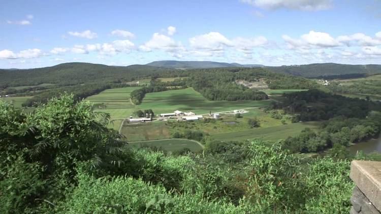
According to the U.S. Census Bureau, the county has a total area of 1,161 square miles (3,010 km2), of which 1,147 square miles (2,970 km2) is land and 14 square miles (36 km2) (1.2%) is water. It is the second-largest county in Pennsylvania by land area and third-largest by total area.
Adjacent counties
Demographics
As of the census of 2000, there were 62,761 people, 24,453 households, and 17,312 families residing in the county. The population density was 54 people per square mile (21/km²). There were 28,664 housing units at an average density of 25 per square mile (10/km²). The racial makeup of the county was 97.94% White, 0.40% Black or African American, 0.31% Native American, 0.45% Asian, 0.01% Pacific Islander, 0.19% from other races, and 0.69% from two or more races. 0.63% of the population were Hispanic or Latino of any race. 32.4% were of English, 19% German, 12.6% Irish and 6.4% Italian ancestry according to the 2012 American Community Survey.
There were 24,453 households out of which 31.80% had children under the age of 18 living with them, 57.40% were married couples living together, 8.90% had a female householder with no husband present, and 29.20% were non-families. 24.70% of all households were made up of individuals and 11.50% had someone living alone who was 65 years of age or older. The average household size was 2.52 and the average family size was 2.99.
In the county, the population was spread out with 25.50% under the age of 18, 6.80% from 18 to 24, 27.20% from 25 to 44, 24.70% from 45 to 64, and 15.70% who were 65 years of age or older. The median age was 39 years. For every 100 females there were 95.10 males. For every 100 females age 18 and over, there were 92.10 males.
The Bradford County live birth rate was 901 births in 1990. The County's live birth rate in 2000 was 710 births, while in 2011 it was 740 babies. From 1960 to 2010, rural Pennsylvania has experienced a decline in the number of residents under 18 years old.
Bradford County had a 511 babies born to teens (age15-19) in 2011. In 2015, the number of teen births in Bradford County declined to 490.
According to research by The Center for Rural Pennsylvania, which is a legislative agency of the Pennsylvania General Assembly, the poverty rate for Bradford County was 12.9% in 2014. The statewide poverty rate was 13.6% in 2014. The 2012 childhood poverty rate by school district was: Athens Area School District - 40.3% living at 185% or below than the Federal Poverty Level; Canton Area School District - 45.4%; Northeast Bradford School District - 41.2%; Sayre Area School District - 42.7%; Troy Area School District - 39.9%; Towanda Area School District - 44.7% and Wyalusing Area School District - 35.7%. The child poverty rate is collected by the school districts as part of the federal free school lunch program.
Micropolitan Statistical Area
The United States Office of Management and Budget has designated Bradford County as the Sayre, PA Micropolitan Statistical Area (µSA). As of the 2010 U.S. Census the micropolitan area ranked 8th most populous in the State of Pennsylvania and the 131st most populous in the United States with a population of 62,622.
County commissioners
Other county officials
State Senate
State House of Representatives
United States House of Representatives
United States Senate
Economy
Major employers are the natural gas industry, DuPont, Global-Tungsten and Powders (former Sylvania), Jeld-Wen, and Cargill Regional Beef, Wyalusing.
Public school districts
Other public school entities
Private schools
Data from EdNA database maintained by Pennsylvania Department of Education 2012
Libraries
Transportation
Public transportation is provided by Endless Mountains Transportation Authority.
Major Highways
Recreation
There is one Pennsylvania state park in Bradford County.
Communities
Under Pennsylvania law, there are four types of incorporated municipalities: cities, boroughs, townships, and, in only one case (Bloomsburg, Columbia County), towns. The following boroughs and townships are located in Bradford County:
Census-designated place
Unincorporated communities
Population ranking
The population ranking of the following table is based on the 2010 census of Bradford County.
† county seat