
Country United Kingdom | ||
 | ||
Mountains White Coomb, Cairns of Fleet, Culter Fell, Broad Law, Criffel | ||
The Southern Uplands are the southernmost and least populous of mainland Scotland's three major geographic areas (the others being the Central Lowlands and the Highlands). The term is used both to describe the geographical region and to collectively denote the various ranges of hills and mountains within this region.
Contents
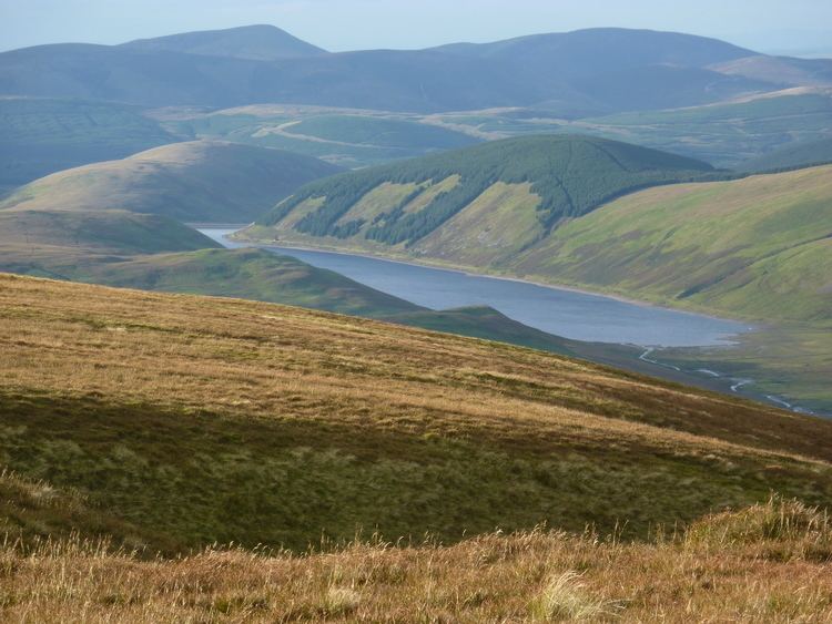
- Map of Southern Uplands Moffat UK
- Geology
- Geography
- Hill ranges
- Peaks
- Rivers and lochs
- Wildlife
- Local government
- Economy
- Agriculture
- Forestry
- Transport
- Road
- Rail
- Air and sea
- Walking
- Climbing
- Mountain biking
- Culture
- References
Map of Southern Uplands, Moffat, UK
An overwhelmingly rural and mainly agricultural region, the Southern Uplands are partly forested and contain many areas of open moorland.
Geology
The Southern Uplands consist mainly of Silurian sedimentary deposits deposited in the Iapetus Ocean from 400–500 million years ago. These rocks were pushed up from the sea bed into an accretionary wedge during the Caledonian orogeny, roughly 400 million years ago (Ma), when the continents and terranes of Laurentia, Baltica and Avalonia collided. The Caledonian orogeny is named for Caledonia, a Latin name for Scotland. The majority of the rocks are weakly metamorphosed coarse greywacke.
The tectonic processes involved in the formation of the accretionary wedge, where sediment is scraped off the seafloor as a tectonic plate is subducted, has led to the formation of multiple, major, east-west faults that are now exploited by rivers and define valleys across the Southern Uplands. Levels of deformation associated with these faults is highly variable, but is pervasive in the finer-grained sediments. Secondary mineralisation has further altered these Lower Palaeozoic rocks which are hosts for some distinctive springs, some of which have been exploited for tourism, such as those around Moffat.
Geography
The Southern Uplands lie south of the Southern Uplands Fault line that runs from Ballantrae on the Ayrshire coast northeastwards to Dunbar in East Lothian on the North Sea coast, a distance of some 220 km (140 mi).
Hill ranges
There are several ranges of hills and mountains within the Southern Uplands. From east to west these are:
Peaks
Although the summits are not as high as many in the Scottish Highlands nor other famous mountain regions, parts of the Southern Uplands are remote and mountainous, containing about 120 Marilyns.
Some of the more notable peaks in the Southern Uplands are:
The Southern Uplands are home to the UK's highest village, Wanlockhead, 430 m (1,410 ft) above sea level.
Rivers and lochs
The region is drained by numerous rivers, the most important of which are Scotland's third and fourth longest, the River Clyde at 106 mi (171 km) and the River Tweed at 97 mi (156 km) respectively. Several significant rivers drain southwards into the Solway Firth and Irish Sea including (from west to east) the River Cree, River Dee, River Nith, River Annan and the River Esk.
There are numerous lochs in the Southern Uplands, particularly in the west. The largest is Loch Ken which arises from the damming of the Water of Ken. Several other lochs in Galloway are dammed such as Loch Doon, Loch Bradan and Clatteringshaws Loch though many smaller ones remain in a more natural state such as Loch Dee, Loch Enoch, Loch Grannoch and Loch Trool.
To the east of Moffat is the largest natural body of water in the Southern Uplands, St. Mary's Loch together with the adjacent Loch of the Lowes and nearby Loch Skeen. There are several other reservoirs in the vicinity including Megget Reservoir, Talla Reservoir and Fruid Reservoir whilst Daer Reservoir lies among the Lowther Hills.
Wildlife
The area has a wide diversity of species and habitats. The uplands support black and red grouse, mountain hares, raptors such as golden eagles and hen harriers, and some unusual plant species. The western hills are home to red deer, roe deer and feral goats. The western forests have one fifth of the Scottish population of red squirrels. Ospreys are present at St Mary's Loch and along the River Tweed. Brown trout are common in many burns and a number of the rivers in the area have populations of sea trout, salmon and otters.
Local government
The two unitary authorities of Dumfries and Galloway in the west and the Scottish Borders in the east cover almost all of the Southern Uplands. Along its northern margins, the councils of South Ayrshire, East Ayrshire, South Lanarkshire and East Lothian extend into the region. After local government reorganisation in 1974 and prior to further reorganisation in 1996, the Southern Uplands were administered by the two 'regions' of Dumfries & Galloway and Borders along with the southern margins of the regions of Strathclyde and Lothian. Within each of these regions were districts with their own district councils. Historically, i.e. prior to 1974, the region comprised the counties of Wigtown, Kirkcudbright, Dumfries, Roxburgh, Peebles, Selkirk and Berwick together with parts of Ayrshire, Lanarkshire, Midlothian and East Lothian.
Economy
Agriculture and forestry are the main forms of land use in the Southern Uplands. Sustainable power has been in production for several decades: the Galloway hydro-electric power scheme was built between 1930 and 1936. More recently a number of wind farms have been developed on upland sites. Tourism and recreation are of increasing importance: walking, fishing and grouse shooting are traditional pursuits and mountain biking has become popular in recent years.
The textile industry employed large numbers in many of the towns of the Scottish Borders in the 19th and 20th centuries. Stocking frames were introduced in Hawick in 1771 and Galashiels' first woollen mill was built in 1800, but textile manufacture had a long history in the area: linen production had been a major industry since the Middle Ages. The textile industry declined in the late 20th century, with 7,800 people employed in 1981 and only 4,400 by 1998. However, it continues to be significant both to the local economy and to that of Scotland in general.
Agriculture
Generally, sheep and arable farming are more predominant in the Scottish Borders to the east, while dairy farming is traditionally more important in Dumfries and Galloway, although recent years here have seen a move away from cattle grazing towards sheep farming. Several breeds of livestock have originated in the Southern Uplands, including Galloway cattle, Ayrshire dairy cattle and Cheviot sheep.
Forestry
Large areas of the Southern Uplands are covered with forests such as:-
The amount of forested land cover in the western Southern Uplands increased greatly between the 1940s and the 1980s, from 1% to 23%.
Transport
The Southern Uplands have always formed a major obstacle to travel between the more heavily populated and industrialised Central Belt of Scotland and England to the south. Major roads and railways follow the east coast route and various valley routes radiating northwards from the Carlisle area.
Road
Several primary roads run through the Southern Uplands, most of which run north-south, with the most notable exception being the A75. The most significant of these roads is the M74 motorway connecting Scotland and England. These roads include
Rail
Four railway lines pass through the Southern Uplands all in a roughly north-south direction. These are the:
Air and sea
There are no major airports within the area. The nearest international passenger airports are Glasgow Prestwick International Airport, Glasgow International Airport and Edinburgh Airport. Vehicle ferries operate between Stranraer and Cairnryan in Scotland and Belfast and Larne in Northern Ireland respectively.
Walking
There are numerous walks through the Southern Uplands. These include the Southern Upland Way, a 212-mile (341 km) coast to coast walk between Portpatrick in the west and Cockburnspath in the east.
Climbing
There is some good rock climbing in the Southern Uplands, particularly in the western portion, the Galloway Hills. The majority of the climbing is on good quality granite, often slabby and sometimes a bit broken in nature. In cold winters there is good ice climbing on the hills of Craignaw, Merrick and Cairnsmore of Fleet.
Mountain-biking
The 7stanes are seven mountain biking centres spanning the south of Scotland, from the heart of the Scottish Borders to Dumfries and Galloway. They are on Forestry Commission land and along with schemes in Wales are regarded as the benchmark by which further trails in the UK should be developed. They are known as the 7stanes because each venue features a 'stane' (Scots for stone) somewhere along the forest trails.
The Seven Stanes:
Culture
The Southern Uplands and especially those areas adjacent to the Anglo-Scottish border have a troubled and bloody history. They were the scene of many raids, campaigns and battles, including the Battle of Ancrum Moor, the Battle of Nesbit Moor and the Battle of Philiphaugh. The Common Riding festivals of many Southern Upland towns such as Jedburgh, Kelso, Hawick, Peebles, Selkirk and Langholm recall this history, re-enacting the practice of riding the boundaries of the town to enable warning to be given of raids from the south.
This violent history is also commemorated in many Border ballads, another common theme of which is the supernatural, as in the ballads of Thomas the Rhymer and Tam Lin. Many Border ballads were collected by Sir Walter Scott in his Minstrelsy of the Scottish Border. Scott also portrayed the social history, folklore and traditions of the Southern Uplands in several of his prose and verse works (such as The Lay of the Last Minstrel), as did James Hogg, known as the Ettrick Shepherd.