
OS grid reference NX405655 Post town NEWTON STEWART Population 3,573 (2001) Dialling code 01671 | Sovereign state United Kingdom Postcode district DG8 Local time Sunday 1:33 PM | |
 | ||
Weather 14°C, Wind E at 11 km/h, 45% Humidity | ||
The blackhorse hotel newton stewart
Newton Stewart (Gd: Baile Ùr nan Stiùbhartach) is a former burgh town in Dumfries and Galloway, southwest Scotland. The town is on the River Cree with most of the town to the west of the river, and is sometimes referred to as the "Gateway to the Galloway Hills". Newton Stewart has also recently been twinned with the French town of Marcoussis.
Contents
- The blackhorse hotel newton stewart
- Map of Newton Stewart UK
- Tourism
- History
- Transport
- Education
- Media
- Notable people
- References
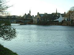
Map of Newton Stewart, UK
The main local industries are agriculture, forestry and tourism. The town hosts a local market, and a number of services to support the farming industry. There are many mountain biking trails in the area. Newton Stewart lies on the southern edge of the Galloway Forest Park, which supplies a large amount of jobs to the town. Newton Stewart F. C , nicknamed the "Creesiders" play in the South of Scotland league, their ground is called Blairmount Park.
Tourism
There are numerous nature trails nearby as part of Galloway Forest Park, managed on behalf of the state by Forest Enterprise. There is a local museum at St. John's Church, and a doll's house exhibition and a butterfly and tropical plant house nearby. The last two are no longer open for visitors. Newton Stewart is seven miles from Scotland's book town Wigtown.
History
The town was founded in the mid 17th century by William Stewart, fourth and youngest son of the 2nd Earl of Galloway. The "New Town of Stewart" was granted burgh status by charter from King Charles II, allowing a weekly market and two annual fairs to be held.
It was on a pilgrimage to the shrine of St Ninian at Whithorn in 1329 that Robert the Bruce forded the river where the present bridge stands. Designed by John Rennie the Elder and built in 1813 the present bridge replaced the old bridge of 1745 which was destroyed by floods in 1806.
The industrialist Sir William Douglas (died 1809), best known for founding the planned town of Castle Douglas, also established cotton mills in Newton Stewart, which was temporarily renamed "Newton Douglas" in his honour.
Granite from the area was used in the construction of most major docksides in Britain.
Transport
The A75 road runs along the southern edge of the town, and connects the town to Stranraer in the west and Dumfries in the east. Public transport in and around the town and to places in South Ayrshire and Dumfries & Galloway is mainly provided by Stagecoach Western, and locally based company James King Coaches.
Newton Stewart's railway station closed in 1965, as a result of the Beeching Axe. The nearest railway stations are at Stranraer and Barrhill which are respectively 25 miles and 18.5 miles away from Newton Stewart.
Education
Newton Stewart has three primary schools:
The town has one secondary school, the Douglas Ewart High School.
Media
The horror film The Wicker Man, set on the fictional privately-owned Scottish island of Summerisle, was filmed almost entirely on location around Newton Stewart, and had its premiere at its cinema in 1972.
Notable people
The artist and musician Bill Drummond of the KLF and K Foundation grew up in the town.
Scottish Under 23 International Footballer Ian Gibson 30 March 1943 – 25 May 2016. Who Played For Middlesbrough, Coventry City & Cardiff City amongst others.